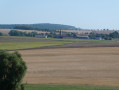
Between Athienville and Arracourt, passing through the Bois de Bénémont

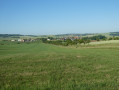
Circular route between the villages of Athienville and Arracourt, returning via the Bois de Bénamont. Beautiful views at the start along the path on the edge of the Bois les Jumelles. A shaded walk through the Bois de Bénamont. Best undertaken with a GPS as, at the start in the Bois de Bénamont, the paths are difficult to see in places and the IGN map is out of date.

Details

97194209
Creation:
Last update:
Last review:
  • Walking
    Activity: Walking
  • ↔
    Distance: 7.48 mi
  • ◔
    Average duration: 3h 55 
  • ▲
    Difficulty: Moderate

  • ⚐
    Back to start: Yes
  • ↗
    Ascent: + 515 ft
  • ↘
    Descent: - 531 ft

  • ▲
    Highest point: 1,089 ft
  • ▼
    Lowest point: 738 ft

Photos

Description of the walk

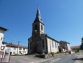
The walk starts at Athienville Church, Grande Rue. Parking is available opposite the church.

(S/E) Opposite the church, set off along the Grande Rue, keeping to the right-hand side of the church.

(1) At the cemetery, continue left onto Route d'Arracourt.

(2) At the Y-junction, turn right onto the D23b towards Arracourt until you reach the first path on the right.

(3) Follow this track to the right, which goes round Bois les Jumelles and joins the D23.

(4) Turn right to reach the village of Arracourt. Continue straight on along the Grande Rue.

(5) At the chapel, cross the D914 carefully at the pedestrian crossing and turn right onto the first street, Rue de la Chapelle, which turns into a track.

(6) At the Y-junction where two tracks meet, continue to the right until you reach the first forest path on the right.

(7) Enter the woods and arrive at a T-junction.

(8) Turn right onto a wide woodland path.

(9) Continue to the left.

(10) At the multi-path junction, continue along the wide path on the left and straight on through the Bois de Bénamont until you reach a stony track.

(11) Turn right and, at the next T-junction by the fence, continue straight on along the track until you reach the D914 near the pumping station.

(12) Cross the main road with care and follow it to the right until you reach a road on the left.

(13) Take this road towards Athienille, following the D123 until the junction for Hincourt.

(14) Leave the main road, turn left then right. Pass through the hamlet of Hincourt and join the D72.

(15) Follow it to the right until you reach the junction with the D123.

(16) Follow it to the right and continue along the Grande Rue to reach the church (S/E).

Waypoints

  1. S/E : mi 0 - alt. 755 ft - Car park opposite the church
  2. 1 : mi 0.14 - alt. 774 ft - Cemetery. D123
  3. 2 : mi 0.45 - alt. 758 ft - D23b
  4. 3 : mi 0.77 - alt. 837 ft - Le Giro
  5. 4 : mi 1.88 - alt. 817 ft - Les Charettes. D23
  6. 5 : mi 2.29 - alt. 758 ft - The chapel
  7. 6 : mi 2.67 - alt. 794 ft - Vaudrécourt
  8. 7 : mi 3.25 - alt. 843 ft - Entrance to the woods
  9. 8 : mi 3.54 - alt. 938 ft - Vassimont Communal Wood
  10. 9 : mi 3.69 - alt. 965 ft - Elvin Wood
  11. 10 : mi 3.87 - alt. 1,007 ft - Hill 303
  12. 11 : mi 4.65 - alt. 1,089 ft - Gravel track
  13. 12 : mi 5.35 - alt. 837 ft - Pumping station. D914
  14. 13 : mi 5.49 - alt. 863 ft - Towards Arracourt. D123
  15. 14 : mi 6.26 - alt. 860 ft - Route to Hincourt
  16. 15 : mi 7.07 - alt. 761 ft - D72
  17. 16 : mi 7.2 - alt. 768 ft - Grande Rue. D123
  18. S/E : mi 7.48 - alt. 751 ft - Car park opposite the church

Worth a visit

Other walks in the area

For more walks, use our search engine .

The GPS track and description are the property of this route's author. Please do not copy them without permission.