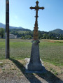
A circular route through the mountains above Asté

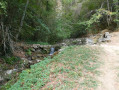
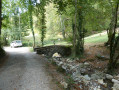
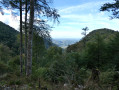
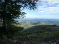
A circular walk starting from Asté, heading towards the mountains via Bernadaus with a view of the Baronnies de Bigorre, then a climb to Cap de Picadés, a traverse of the Izard plateau before descending alongside the Ruisseau du Lhéris. Before reaching Asté, take a short break at the picnic table by the Fontaine de Crastes. The walk takes place largely through woodland.

Details

n°108949154
Creation:
Last update:
Last review:
–
  • Walking
    Activity: Walking
  • ↔
    Distance: 7.54 mi
  • ◔
    Average duration: 6h 00 
  • ▲
    Difficulty: Difficult

  • ⚐
    Back to start: Yes
  • ↗
    Ascent: + 2,904 ft
  • ↘
    Descent: - 2,736 ft

  • ▲
    Highest point: 4,042 ft
  • ▼
    Lowest point: 2,001 ft
  • ⚐ Country: France
  • ⚐
    Area: Pyrenees
  • ⚐ City: Asté (65200)
  • ⚑
    Start/End: N 43.041665° / E 0.169768°
  • ❏
    IGN map(s): Ref. 1746SB, 1747ET
  • Hour-by-hour weather

Photos

Description of the walk

The walk starts at Place de Gramont in Asté; parking is available on the square (town hall, village hall).

(S/E) Opposite the town hall, turn left, then take the first road on the right, Chemin de Nabias.

(1) At the bend in the road, carry straight on along the ascending track.

(2) At a Y-junction at an elevation of 829, continue left until you reach the Bernadaus junction at an elevation of 961.

(3) Head up the track on the right, taking the four hairpin bends, then continue straight on across the Plateau de l’Izard until you reach an X-shaped junction of tracks.

(4) Continue to the right along thefirst track leading down into the Bois de Labouche until you reach a hairpin junction.

(5) Before the clearing, at the wooden post, take the hairpin bend onto the small path on the right and head down to the Fontaine de Crastes.

(6) Continue along the path, which turns into a track, following the Ruisseau du Lhéris. You’ll reach a Fork in the road at the entrance to Asté.

(7) Keep to the right onto Rue Crastes and carry on straight ahead to reach Place de Gramont (S/E).

Waypoints

  1. S/E : mi 0 - alt. 2,011 ft - Place de Gramont in Asté
  2. 1 : mi 0.44 - alt. 2,251 ft - Bend in the road
  3. 2 : mi 0.98 - alt. 2,894 ft - Crossroads
  4. 3 : mi 1.84 - alt. 3,327 ft - Bernadaus crossroads
  5. 4 : mi 4.11 - alt. 3,973 ft - Labouche Wood
  6. 5 : mi 4.53 - alt. 3,819 ft - Hairpin bend
  7. 6 : mi 6.43 - alt. 2,267 ft - Fontaine de Crastes
  8. 7 : mi 7.38 - alt. 2,215 ft - Rue Crastes
  9. S/E : mi 7.54 - alt. 2,159 ft - Place de Gramont in Asté

Notes

Very cool water at the Fontaine de Crastes.

Worth a visit

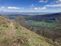
A stunning view of the Baronnies de Bigorre from the hamlet of Bernadaus.

The Fontaine de Crastes is a lovely spot with a picnic table and fresh water.

Other walks in the area

For more walks, use our search engine .

The GPS track and description are the property of this route's author. Please do not copy them without permission.