Country:
 City:
City:


The walk starts at the junction of the D994 and Route Nanquette, at the Maison Forestière. Parking is available immediately after the junction or a little further on at the information board.
(S/E) Continue along Route Nanquette and, at the information sign, turn right onto the gravel track, following the yellow and red markings ofthe GRP® Autour du Grand Nancy. Cross the track known as Route Charlemagne and continue straight on.
(1) At the junction with the track known as Route Henri Barré, leave the yellow and red markings, turn left and follow the Yellow Circles. Join a gravel track called Chemin de la Haute Borne and follow it to the left for a few metres.
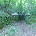
(2) At the multi-path junction, at the Vierge de Chaligny, leave the Yellow Circles and continue straight ahead along the descending stony track. Pass the entrance to a former iron mine.
(3) At the junction by the tennis courts, turn right onto the ascending stony track towards Maron. At the top of the hill, at the T-junction, continue straight ahead.
(4) At the 387-metre mark, reach the end of a stony track; take the track on the left, pass a stone marker, then take a dirt track on the right, between numbers 5 and 6, and follow the Yellow Circles again. You will come to a road.
(5) Turn right onto it, then turn left immediately at elevation 394, go through the barrier to stop cars, walk along the edge of the woodland, then into the woodland.
(6) At the multi-path junction at elevation 369, continue straight on along the descending stony track.
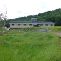
(7) On leaving the woods, at elevation 330, turn left onto the ascending stony track, passing in front of the Mazagrand buildings. Join a road.
(8) Turn right onto it, passing the statue of the Virgin Mary, then the wayside cross. Enter the village of Chaligny via the sloping Grande Rue, passing the two wash houses.
(9) At the roundabout, turn left onto Rue Edmond Pinter, passing the church and the town hall.
(10) Take the first street on the left, Rue du Val Fleurion, and, between houses nos. 288 and 316, take a small path leading downhill to the right. Turn right onto Route de la Mine, then take the first street on the left, Rue des Thuyas, and then turn right onto Rue de la Carte.
(11) Between houses nos. 18 and 19, take a small path leading uphill between the walls, follow the bends to the left and right and continue uphill. At the T-junction with the signpost, go straight on, following the signs for ‘Mine à l’Usine’. Pass marker 306 and continue straight on.
(12) After marker 306, take the first path on the right at a Y-junction. At the next Y-junction, turn right onto the descending path. At the first crossroads (X-junction), continue straight ahead and, at the T-junction 10 metres further on, by the ‘Mine Collapse’ sign, turn right onto the grassy path leading downhill. You will reach Rue Salvador Alliende.
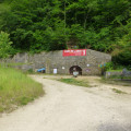
(13) Carry on straight ahead. At the multi-road junction, turn left to find the entrance to the mine site.
(14) If the site is open, continue up the track; then, at the top, turn right towards the mine (which is open to visitors), turn right again to pass the reception area and continue along the track.
If the site is closed, don’t panic – carry on down the road and take the first path on the left, go up the steps and you’ll reach the car park. Then continue along the route.
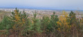
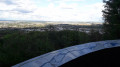
(15) At the Y-junction, take the path leading downhill on the right. At the end of the path, turn left, cross the car park to reach the observation point. Retrace your steps and take the path that leads into the woods. At the Y-junction shortly afterwards, take the uphill path through the woods on the left, then carry on straight ahead.
(16) At the crossroads (X-junction), at elevation 357, take the track leading uphill to the left. At the T-junction, turn right and stay on this wide track through the woods. Join a wide track.
(17) Carry on straight ahead. At the next junction with a small path, stay on the track to the right and follow it to Route Nanquette and the car park (S/E).


 Visorando Member

 Easy
Easy