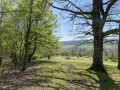
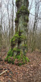
Greater Nancy – Haye State Forest

On the ‘Tour du Grand Nancy’ route, a circular stage through the Haye State Forest, starting from Clairlieu and heading towards Les Baraques.
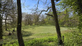
The walk is mainly through woodland on wide tracks and narrow forest paths.
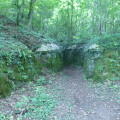
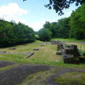
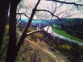
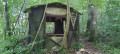
Visit to two blockhouses dating from the First World War and what remains of the Cistercian Abbey of Clairlieu.
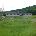
On the IGN map, near the coordinates (6), there is a symbol for a cave; in fact, it is enclosed within a building and therefore of no interest.

Details

50083282
Creation:
Last update:
Last review:
  • Walking
    Activity: Walking
  • ↔
    Distance: 9.56 mi
  • ◔
    Average duration: 4h 50 
  • ▲
    Difficulty: Moderate

  • ⚐
    Back to start: Yes
  • ↗
    Ascent: + 535 ft
  • ↘
    Descent: - 538 ft

  • ▲
    Highest point: 1,247 ft
  • ▼
    Lowest point: 889 ft

Photos

Description of the walk

The walk starts at the car park of the Clairlieu sports ground, Avenue de Maron.

(S/E) Leave the car park, cross Avenue de Maron and turn left onto the cycle path.

(1) Take the first path on the right to visit a former 1914–18 blockhouse 20 metres from the cycle path, then return to the cycle path and continue downhill towards the village.

(2) Take the second street on the right, Rue de la Sance. Carry on straight ahead to take a tarmac path between the woods and the green space to reach the abbey ruins.

(3) After your visit, turn back to the previous junction.

(2) Continue to the right, along the cycle path

(4) At the junction with Rue Boulevard Valonniere, turn right; at the T-junction, continue right onto Chemin de la Route Henri, then turn left onto the ascending stony track. Stay on the track and pass through a barrier to keep cars out.

(5) After the barrier, take a wide woodland path on the right and follow the signposts.

(6) At a Y-junction, turn left onto Chemin Bois de Saint-Georges and carry straight on along this track, crossing the Route Forestière de Villers to reach an X-junction (elevation 320).

(7) Continue to the left and, at the next Y-junction, turn right and carry on straight ahead.

(8) At the T-junction, at no. 225, carry on straight ahead along the flat path and leave the signposted route. You’ll arrive at a hillock (elevation 307).

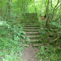
(9) Turn left and carry on straight ahead again. Pass the stone staircase, then the 14/18 blockhouse, and continue along the Chemin du Fond de Clairlieu. Join a stony track and follow it.

(10) At the end of the track (elevation 271), reach a small clearing and continue along the stony track leading uphill to the left. Join the small road.

(11) Turn left and follow the signposting for the Grand Nancy. Walk a few metres and take the first forest track on the right between nos. 295 and 287, then head straight on until you almost reach the bottom of the valley (elevation 287).

(12) Turn left onto the forest track, Chemin du Fond de la Crédence.

(13) Cross Route Jean Lebrun and carry on straight ahead along the Chemin de la Crédence.

(14) Cross a track, Route de Villers, and continue straight on along the stony track, Chemin de la Crédence.

(15) When you reach a cleared area on the right, take the first path on the left, enter the woods and continue straight on until you reach Route de Maron, at the Carrefour de la Haute Borne.

(16) Cross it carefully, and continue along the small road, Ligne Historique, passing through the barrier to keep cars out.

(17) At the junction with the Route Henri Barrée, turn left onto the stony track and leave the signposted route.

(18) At the end of the track, go through the barrier to prevent cars from entering and continue straight on along the small Chemin de la Route Henri. Walk alongside the motorway and return to the starting car park (S/E).

Waypoints

  1. S/E : mi 0 - alt. 1,191 ft - Clairlieu sports ground
  2. 1 : mi 0.07 - alt. 1,181 ft - Cycle path
  3. 2 : mi 0.4 - alt. 1,106 ft - Junction. Return to the abbey
  4. 3 : mi 0.49 - alt. 1,093 ft - Abbaye Cistersienne de Clairlieu
  5. 4 : mi 0.7 - alt. 1,132 ft - Boulevard de la Valonnière
  6. 5 : mi 1.12 - alt. 1,135 ft - Clairlieu North
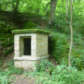
  7. 6 : mi 1.3 - alt. 1,083 ft - Water intake
  8. 7 : mi 1.54 - alt. 1,060 ft - Bois Mengin
  9. 8 : mi 1.97 - alt. 1,027 ft - Chemin du Fond de Clairlieu
  10. 9 : mi 2.15 - alt. 1,014 ft - In front of the hill
  11. 10 : mi 3.54 - alt. 889 ft - A small clearing
  12. 11 : mi 3.95 - alt. 1,027 ft - Route Jean Lebrun
  13. 12 : mi 4.83 - alt. 945 ft - Fond de la Crédence
  14. 13 : mi 5.93 - alt. 1,047 ft - La Petite Haye
  15. 14 : mi 6.47 - alt. 1,112 ft - Route de Villers
  16. 15 : mi 7.28 - alt. 1,240 ft - Grand Colas Cross
  17. 16 : mi 7.64 - alt. 1,214 ft - Carrefour de la Haute Borne (Clairieu)
  18. 17 : mi 8.21 - alt. 1,243 ft - Route Henri Barré
  19. 18 : mi 9.22 - alt. 1,125 ft - The Five Fountains
  20. S/E : mi 9.56 - alt. 1,191 ft - Clairlieu sports ground

Worth a visit

Visit the ruins of Clairlieu Cistercian Abbey.

Visit the two blockhouses from the 1914–1918 war.

Reviews and comments

5 / 5
Based on 2 reviews

Reliability of the description
5 / 5
Ease of following the route
5 / 5
Route interest
5 / 5
labouv
labouv

Overall rating : 5 / 5

Date of your route : Oct 14, 2024
Reliability of the description : ★★★★★ Very good
Ease of following the route : ★★★★★ Very good
Route interest : ★★★★★ Very good
Very busy route : No

Hello,

Very pleasant route in the Haye forest. We parked at the boulodrome de clairlieu car park.
Magnificent forest. Don't forget good shoes as many of the paths are dirty at this time of year. More often than not, there are "variants" on hard paths parallel to the track for those who want to keep their feet dry.
Please note that a section at the very start of the route passes through a private site (garage) surrounded by a fence. It is possible to bypass this via the cycle path that runs alongside the road and pick up the track further on.
We did this walk at the end of the day and were able to enjoy the colours of the sunset in the sparse areas of the forest.
Finally, this beautiful walk can be shortened or even lengthened thanks to the many paths in the forest, making it suitable for everyone.

Machine-translated

labouv
labouv

Overall rating : 5 / 5

Date of your route : Oct 14, 2024
Reliability of the description : ★★★★★ Very good
Ease of following the route : ★★★★★ Very good
Route interest : ★★★★★ Very good
Very busy route : No

Hello,

Very pleasant route in the Haye forest. We parked at the boulodrome in Clairlieu.
Magnificent forest. Don't forget good shoes as many of the paths are dirty at this time of year. More often than not, there are "variants" on hard paths parallel to the track for those who want to keep their feet dry.
Please note that a section at the very start of the route passes through a private site (garage) surrounded by a fence. It is possible to bypass this via the cycle path that runs alongside the road and pick up the track further on.
We did this walk at the end of the day and enjoyed the colours of the sunset in the sparse areas of the forest.
Finally, this beautiful walk can be shortened or even lengthened, perhaps thanks to the many paths in the forest, to suit everyone.

Machine-translated

Other walks in the area

For more walks, use our search engine .

The GPS track and description are the property of this route's author. Please do not copy them without permission.