The Greater Nancy area from Liverdun to the Bois des Hospices de Pompey

On the ‘Tour du Grand Nancy’ route, a circular stage between Liverdun and the Bois des Hospices de Pompey, passing through the village of Saizerais.
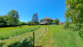
The walk is mainly through woodland, along wide paths.
Visit to the village of Saizerais.
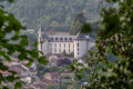
A tour of part of the town of Liverdun, passing, at the entrance, by the old canal which flows beneath the town, then through a cave and back via the old town and its significant heritage.

Details

48654193
Creation:
Last update:
Last review:
  • Walking
    Activity: Walking
  • ↔
    Distance: 10.29 mi
  • ◔
    Average duration: 5h 35 
  • ▲
    Difficulty: Moderate

  • ⚐
    Back to start: Yes
  • ↗
    Ascent: + 945 ft
  • ↘
    Descent: - 928 ft

  • ▲
    Highest point: 1,158 ft
  • ▼
    Lowest point: 659 ft
  • ⚐ Country: France
  • ⚐ City: Liverdun (54460)
  • ⚑
    Start/End: N 48.749303° / E 6.067854°
  • Accessible from the train station Gare de Liverdun.
  • ❏
    IGN map(s): Ref. 3315ET
  • Hour-by-hour weather

Photos

Description of the walk

Start of the walk: Rue du Port, in Liverdun; car park at the old port of the Marne–Rhine Canal.

(S/E) Head uphill towards Route de Pompey. Cross the road, taking care, and turn onto Rue du Tir opposite, which becomes an uphill gravel track.

(1) Take the first small path on the left, then turn left to go down the steps and arrive in front of the tunnel of the old Marne–Rhine Canal. Return to the track and continue the climb.

(2) Take the second small path on the left, at the information sign, to climb up to the Barbotte Rock Cave. After your visit, return to the track and continue uphill.

(3) Join a track and carry on straight ahead. At the next T-junction, turn right to continue along the path from Liverdun to Marbach, following the red-and-white markings forthe GR®5andGR®5F. At the next Y-junction, turn left, then enter the woods and pass by the Haras farm.

(4) In the Avant Garde forest, at the junction of two stony tracks, turn left and follow theGR®5F.

(5) At a bend in the track, continue straight on, as per theGR®5F, along a wide woodland path known as la Grande Tranchée. Enter the village of Saizerais by following the path.

(6) At the end of the path, turn left onto Rue des Cornouillers. Take the first street on the right, Rue des Charmilles, and then turn right again to join the A-road.

(7) Cross the A-road at the pedestrian crossing and carry on straight ahead along Rue des Coteaux.

(8) Immediately take the first street down to the left and continue along the stony track.

(9) Join Rue Saint-Georges and turn left, leaving theGR®5Fsignposting to follow the Camino de Santiago signposting again. At the Y-junction, carry straight on past the church. Join the main road and cross it at the pedestrian crossing, then carry straight on along Rue des Pétunias.

(10) Take the first street on the right, Rue Saint Amand, and carry on straight ahead.

(11) Cross Rue de Liverdun with care and continue straight on along Chemin de Jaillon. The road turns into a stony track. At the T-junction, at No. 35, continue straight on.

(12) At the bottom of the valley, at the sign marking the entrance to the Natrou Forest, take the track on the left, leaving the Compostela signposting to follow theGR®5signposting. Walk straight on along the rutted dirt track, occasionally taking the small bypass paths on the left.

(13) Below the power line, at the junction where several paths meet, carry on straight ahead along the small path rising to the left. At the top of the hill, continue along the wire fence. You’ll come to a track, then a road running alongside the sports ground.

(14) At the bend in the road, carry on straight ahead along the track, Chemin des Récompenses, then Rue des Miternes.

(15) Join the Route de Saizerais at the wayside cross and carry on straight ahead, passing the 1944 war memorial, then the Croix Saint Euchaire (16), and finally the Notre-Dame de Bel Amour chapel (17), before entering Liverdun via the Porte Haute.

(18) After the gate, take the first street on the left, Place d’Armes, and continue straight on to Place de la Fontaine.

(19) At Place de la Fontaine, turn right onto Grande Rue.

(20) At the end of the street, turn right onto Rue du Couchant.

(21) After the washhouse, continue left onto Grande Rue.

(22) Go down the stairs and continue straight on.

(23) At the end of the street, turn left onto Rue de la Gare. At the junction with Rue Nicole Noël, leave theGR® signposting and continue straight ahead, then turn right to reach the car park (S/E).


Waypoints

  1. S/E : mi 0 - alt. 669 ft - Rue du Port
  2. 1 : mi 0.3 - alt. 715 ft - Entrance to the - Canal de la Marne au Rhin
  3. 2 : mi 0.63 - alt. 755 ft - Grotte de la Roche Barbotte
  4. 3 : mi 1.15 - alt. 850 ft - Chemin des Vaux
  5. 4 : mi 2.71 - alt. 1,158 ft - The Grande Tranchée Trail
  6. 5 : mi 3.58 - alt. 948 ft - Les Cornouillers
  7. 6 : mi 4.52 - alt. 837 ft - Rue des Cornouillers
  8. 7 : mi 4.78 - alt. 807 ft - National Road
  9. 8 : mi 4.81 - alt. 804 ft - Rue des Coteaux
  10. 9 : mi 5.06 - alt. 804 ft - Rue Saint Georges
  11. 10 : mi 5.36 - alt. 830 ft - Rue Saint Amand
  12. 11 : mi 5.6 - alt. 853 ft - Jaillon Trail
  13. 12 : mi 6.9 - alt. 745 ft - Natrou Forest
  14. 13 : mi 7.8 - alt. 682 ft - Neyette Wood
  15. 14 : mi 8.57 - alt. 912 ft - Chemin des Récompenses
  16. 15 : mi 9.07 - alt. 935 ft - Road to Saizerais
  17. 16 : mi 9.27 - alt. 906 ft - Croix Sainte-Euchères (Liverdun)
  18. 17 : mi 9.51 - alt. 823 ft - Chapelle Notre-Dame de Bel Amour (Liverdun)
  19. 18 : mi 9.69 - alt. 830 ft - Place d’Armes. View of the - Moselle (la)
  20. 19 : mi 9.74 - alt. 833 ft - Grande Rue
  21. 20 : mi 9.82 - alt. 804 ft - Rue du Couchant
  22. 21 : mi 9.86 - alt. 774 ft - After the washhouse
  23. 22 : mi 9.89 - alt. 751 ft - The staircases
  24. 23 : mi 10 - alt. 666 ft - Rue de la Gare - Gare de Liverdun
  25. S/E : mi 10.29 - alt. 663 ft - Rue du Port

Worth a visit

South-eastern entrance to the Marne–Rhine Canal; the 400-metre-long canal runs beneath Liverdun.
Roche Barbotte Cave.
Walk through the Avant Garde State Forest.
Visit to the village of Saizerais.
Walk through the Natrou State Forest.
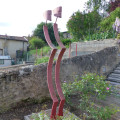
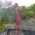
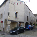
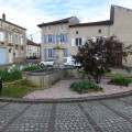
Tour of Liverdun: Croix de Chemins, Croix Saint Euchaire, Notre Dame de Bel Amour Chapel, Porte Haute with a view of the channelled Moselle, fountain, old houses with arcades, staircases featuring contemporary metal sculptures, etc.

Always be cautious and plan ahead when you're outdoors. Visorando and the author of this route cannot be held responsible for any accidents occurring on this route.

The GR® and PR® markings are the intellectual property of the Fédération Française de Randonnée Pédestre.

Reviews and comments

4.5 / 5
Based on 2 reviews

Reliability of the description
5 / 5
Ease of following the route
4.5 / 5
Route interest
4 / 5
biache.pascal@orange .fr

Overall rating : 4.3 / 5

Date of your route : Aug 24, 2026
Reliability of the description : ★★★★★ Very good
Ease of following the route : ★★★★★ Very good
Route interest : ★★★☆☆ Average
Very busy route : No

The main attraction of this route is the walk through the old town of Liverdun.
It is a pity that the route follows only forest tracks, farm tracks or woodland paths.
At the start of the route, it is better to head straight for the old canal, then climb the steps on the right in front of the tunnel gate and continue as normal. This avoids having to go down and then back up the steps and allows you to see the canal from the inside.

Machine-translated

reidid54
reidid54

Overall rating : 4.7 / 5

Date of your route : May 27, 2024
Reliability of the description : ★★★★★ Very good
Ease of following the route : ★★★★☆ Good
Route interest : ★★★★★ Very good
Very busy route : No

It’s a lovely walk that I’ve just completed for the second time. A beautiful medieval town that I hadn’t visited before. I’ve just one piece of advice: take care on stage 1 when going down the stone steps – hold onto the handrail, as the steps can be slippery if it’s been raining.

Machine-translated

Other walks in the area

For more walks, use our search engine .

The GPS track and description are the property of this route's author. Please do not copy them without permission.