Country:

 City:
City:


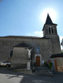
The walk starts at the car parks on Allée Jean Jaurès in Bagnères-de-Bigorre.
(S/E) Facing the Adour, head left and take the first bridge on the right to cross the Place du Docteur Charles Lacoste. At the end of the square, turn right and then immediately left onto Avenue du Groupe Bernard.
(1) At the end of the street, turn right onto Rue François Azens and cross the Adourette. At the next junction, turn right onto Avenue Philadelphe de Gerde.
(2) At the Y-junction, keep left and, at the small sports ground, turn left onto Impasse Pé de Castet.
(3) At the end of the street, take the small path on the left, continue to the right along the small path beside the Riou Arrouy and join a small road.
(4) Turn right to continue along Chemin de Cabarrou.
(5) At the end of the street, in Gerde, turn left onto Rue de l’Estantère and, at the church, turn left again onto Rue de l’Église, then immediately left onto Rue de la Caoue. Continue along the uphill track until you reach the D84.
(6) Cross it carefully and carry on straight ahead. At the bend in the road, take the track on the right.
(7) Return to the D84 and carry on straight ahead.
(8) At the junction, take the track on the right, go 10 metres and keep to the track furthest to the left.
(9) At the track junction, continue along the wide track on the right until you reach the top of the hill.
(10) Cross the stony track and carry on straight ahead across the grass, joining the GRP® Tour des Baronnies de Bigorre trail and continuing to the right
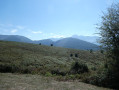
(11) You’ll come out onto a grassy stretch with a lovely view; continue along the field track to the left. At the next junction of two tracks, keep to the right.
(12) At the T-junction with a small rock, leave the GRP® and head down the grassy slope to the right, join a track at the wooden post and continue to the right to reach Asté.
(13) At the end of the street, turn right onto Rue Arteilh and, at the cemetery, continue along the field track to the left until you reach the D208.
(14) Follow it to the left and, at the next road junction, continue to the right along Avenue des Pyrénées (D8) until you reach Rue du Bédat.
(15) Turn left, take the 90° right-hand bend and you’ll arrive at the Pic du Midi Primary School.
(16) Turn left onto Place René Escoula and cross the River Adour. After the bridge, continue right along Allée Jean Jaurès to reach the car park (S/E).
 Visorando Member

 Easy
Easy 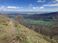
 Difficult