Country:

 City:
City:


The walk starts at the Tourist Office, 43 Avenue Emmanuel Brousse in Font Romeu.
(S/E) Leave the Tourist Office, cross the road and turn left. Then, after 50 metres, go up the steps on the right and follow the concrete track to reach Avenue Jean Paul.
(1) Turn left and walk past the Grand Hôtel.
(2) At the end of the car park, take a small path to the right at the signpost and follow the yellow markings.
(3) At the second signpost, follow the small path towards Egat. At the end of the path, turn right and cross over the Rec des Canaletes; at the signpost, continue towards Egat.
(4) At the T-junction, turn right.
(5) At this other T-junction, with a signpost, follow the signs for Egat by turning right.
(6) At the crossroads with two signposts, leave the yellowPR® markings and follow the red-and-yellowGRP® Tour de Cerdagne markings. Turn right onto the path leading downhill.
(7) When you reach the gate of the Training Centre, take the track leading uphill to the left (PR®).
(8) At the fork, turn right towards Les Airelles and join the Route de la Calme at the top of the Les Airelles cable car.
(9) Turn left onto this road and follow it for 200 m.
(10) Once you’ve passed the end of the car park, take a grassy track on the right, which turns into a small uphill path and then back into a track.
(11) Join the Route de la Calme, turn right and continue along the road to reach the car park; cross it diagonally to the left towards the restaurant.
(12) Take the track leading uphill which passes in front of the restaurant.
(13) At the junction with a signpost, turn right. At the second junction, turn left.
(14) At the next Y-junction, turn right.
(15) At the next fork, marked by a signpost, turn right towards the Roc de la Calma and its orientation table atop the rock.
(16) After your visit, turn back.
(15) Turn right towards Les Bouillouses and join a stony track.
(17) Turn left onto the track as it descends. At the end of the track, cross the small wooden bridge.
(18) Join a wide, ascending stony track; turn left and, as you approach the fence, veer slightly left towards the footpath gate and continue straight on along the stony track towards the dam.
(19) Turn right at the dam. At the end, turn right, cross the small bridge and continue to the right along the road. Follow the yellow or white-and-red markings forthe GR®10.
(20) Before the junction, at the last building, take a small path on the left (GRP®) and walk past the signpost.
(21) At the junction ofthe GR®10and theGRP® routes, head down to the right along theGR®10(red-and-white markings). You’ll reach the access road to Lac des Bouillouses.
(22) Cross it carefully and head for the track opposite. Cross the bridge, then go through the metal gate and continue along the track.
(23) Leave theGR®10. Take the small path on the left and follow the yellow markings (PR®). Pass Estany Llar and arrive at Estany Negre. Continue until you reach a fork in the path.
(14) Turn right and follow the small path to the end, skirting the Estany de la Pradella, until you reach a stony track.
(25) Turn left and follow this track (GR®10) until you reach a fork (elevation 1900).
(26) Leave theGR®10. Take the first path on the right (PR®) at the signpost for Coll del Pam and follow the yellow markings.
(27) As you come out of the woods, turn right onto the track leading uphill.
(28) At the Y-junction where two tracks meet, turn left. You’ll come out at the Coll del Pam car park; cross it diagonally towards a stony track to the left of the bridge. Follow the stony track for a few metres.
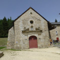
(29) Follow another track to the right (PR®), pass a signpost and follow the sign for: Ermitage.
(30) At the Y-junction where two tracks meet, turn right and follow this track. When you reach the access road to the pass, cross it carefully, then turn left and continue for 50 metres.
(31) At the start of the car park, turn right, go through the barrier to prevent cars from entering and continue southwards down the track. Just before you reach the Route Pierre de Coubertin, at the Y-junction, turn left.
(32) Continue to the left, and before you reach the buildings, turn right, cross the road and join a wide, ascending track.
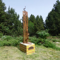
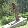
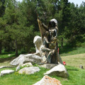
(33) At the bend in the track, by the signpost, take the track on the left towards Font Romeu. Stay on this wide path, known as the ‘Musée sans Mur’, to pass in front of the artworks. Join Avenue Jean Paul.
(34) Turn right, then take the first road on the left. Return to the original fork in the road.
(1) Turn left and follow the route back in the opposite direction to the outward journey to reach the (S/E).

 Visorando Member
 Easy
Easy 
 Moderate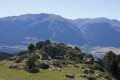
 Difficult