Circular walk starting from Valhey via Bathelémont

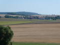
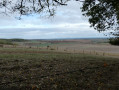
A circular walk starting from Valhey towards the top of Bauzemont, then on to Bathelémont and the Bois de Bénamont with its remains from the First World War. At the edge of the woods, there is a picnic table with an orientation board offering a distant view towards the Lunéville plain, with the Vosges mountains and the Donon visible in the distance.

Details

n°105178676
Creation:
Last update:
Last review:
–
  • Walking
    Activity: Walking
  • ↔
    Distance: 9.26 mi
  • ◔
    Average duration: 4h 50 
  • ▲
    Difficulty: Moderate

  • ⚐
    Back to start: Yes
  • ↗
    Ascent: + 666 ft
  • ↘
    Descent: - 643 ft

  • ▲
    Highest point: 1,106 ft
  • ▼
    Lowest point: 745 ft

Photos

Description of the walk

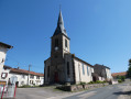
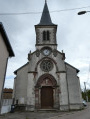
The walk starts at Valhey church; parking is available on the outskirts of the church.

(S/E) Facing the church, head to the right of the building, then turn left and immediately right.

(1) At the end of the street, turn right onto Rue Hargal and continue straight on along the track (Chemin de la Plaine). Join another field path and turn right. You’ll come to a small road.

(2) Follow it to the left until you reach the D2.

(3) Turn left and carry on until you reach the first road on the left, Route Thiriet.

(4) Follow it to a crossroads.

(5) Turn left onto the stony track and head towards the Bathelémont cemetery.

(6) Turn right onto the D123 towards the village.

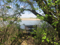
(7) In the village, at the T-junction, turn left onto Chemin Derrière la Cour and continue to a stream.

(8) Turn left onto the tarmac track leading uphill; this leads to a small clearing, then carry on straight ahead along the narrow path climbing into the woods.

(9) At the top of the hill, turn left onto the small path, which widens into a forest track. You’ll come to a Fork in the road.

(10) Carry on to the left, following the yellow arrow markings, and you’ll reach the edge of the Bois de Bénamont.

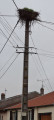
(11) Carry on to the left along the narrow path running alongside the fence. At the ‘Haut de Grabois’ sign, near an aerial, carry on to the left. Leave the woods at the orientation table (picnic table), carry on to the right along the field path and join a small road leading downhill.

(12) Follow it straight on until you reach the D23.

(13) Turn right onto this quiet departmental road, which leads onto the D914.

(14) Cross it carefully and continue along the gravel track to the left until you reach the Grande Rue.

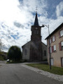
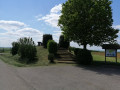
(15) At the second junction, turn left to reach the church (S/E). At the junction, look to your right for the monument commemorating American soldiers.

Waypoints

  1. S/E : mi 0 - alt. 784 ft - Church of Sainte-Madeleine
  2. 1 : mi 0.09 - alt. 797 ft - Rue Hargal
  3. 2 : mi 1.52 - alt. 745 ft - Road junction
  4. 3 : mi 1.65 - alt. 758 ft - D2
  5. 4 : mi 2 - alt. 778 ft - Route Thiriet
  6. 5 : mi 2.57 - alt. 840 ft - Crossroads
  7. 6 : mi 3.63 - alt. 869 ft - Bathelémont Cemetery
  8. 7 : mi 3.86 - alt. 892 ft - Bathelémont
  9. 8 : mi 4.56 - alt. 833 ft - Fork in the path at the stream
  10. 9 : mi 5.08 - alt. 1,001 ft - Vassimont Communal Wood
  11. 10 : mi 5.55 - alt. 1,079 ft - Bois du Sentier de la Vie
  12. 11 : mi 5.97 - alt. 1,102 ft - Edge of the Bois de Bénamont
  13. 12 : mi 6.39 - alt. 1,020 ft - Narrow road
  14. 13 : mi 6.89 - alt. 866 ft - D123
  15. 14 : mi 8.09 - alt. 837 ft - D 914
  16. 15 : mi 9.15 - alt. 807 ft - Grande Rue
  17. S/E : mi 9.26 - alt. 787 ft - Church of Sainte-Madeleine

Notes

Picnic table between (11) and (12).

Worth a visit

The villages of Valhey and Bathelémont.

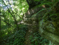
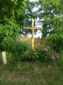
Remains from the First World War, including old trenches and the sites of earthen bunkers, in the Bois de Bénamont along the path

A lovely view at point (12).

Other walks in the area

For more walks, use our search engine .

The GPS track and description are the property of this route's author. Please do not copy them without permission.