


MCTOUL

 Visorando Member
 Premium user
 - Location: Saint-Pé-de-Bigorre (65270)
- Gender: man
Sign up:
Published route(s)
 La Galaisière – Le Gris Caillou via La Quinarderie
 2.61 mi
 +213 ft
 -200 ft
 1h 25
1h 25
 Easy
Easy
 Departure from Saint-Pierre-de-Coutances (Manche)
A lovely walk around Coutances and the La Soulles stream.
Le Pé de la Colle and the Vallon de Trébuquet from Riboux
 6.59 mi
+479 ft
-449 ft
3h 25
Easy
Departure from Riboux (Var)
6.59 mi
+479 ft
-449 ft
3h 25
Easy
Departure from Riboux (Var)
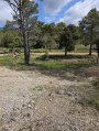
This walk is very pleasant in Pagnol's Provence, in the foothills of the Sainte-Baume massif, passing through the charmingly named "Pé de la Colle".
Even though much of it is on tarmac roads, there are no visitors as it is a dead end. This in no way spoils the feeling of solitude and being surrounded by nature!
Tour of Grande-Île in Chausey
3.44 mi
+105 ft
-102 ft
1h 40
Easy
Departure from Granville (Manche)
Chausey Island (more specifically La Grande Île) is a must-see for tourists visiting La Manche and the surrounding area. This route allows you to explore the island on a pleasant and comprehensive walk.The island itself is exceptionally beautiful and wild. The surrounding seascapes are also stunning. It is said that at high tide there are as many islands visible as there are weeks in the year (52) and at low tide as many as there are days in the year (365).
Chapel of Our Lady of Life and caves
 1.33 mi
+1,086 ft
-1,086 ft
1h 35
1.33 mi
+1,086 ft
-1,086 ft
1h 35
 Moderate
Departure from Fuilla (Pyrénées-Orientales)
Moderate
Departure from Fuilla (Pyrénées-Orientales)
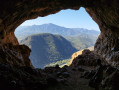
What could be more surprising than visiting a chapel built by human hands, completely isolated on a seemingly impassable rock face, with a huge cave overlooking it, also equipped with an altar forming another chapel, this one natural and even larger than the previous one!On the way up, there is a smaller cave. Both caves are completely safe. With a torch, you can explore them more fully...From up there, you'll get a breathtaking view of the Têt Valley, the surrounding valleys and the Canigou.
From Lastourg to the Jando Canal
 3.20 mi
+669 ft
-640 ft
2h 05
Moderate
Departure from Fuilla (Pyrénées-Orientales)
3.20 mi
+669 ft
-640 ft
2h 05
Moderate
Departure from Fuilla (Pyrénées-Orientales)
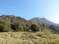
This short hike of just over 7 km takes you along the banks of the Canal de Jando (or "Rec Nou"), an abandoned irrigation canal that now serves as a footpath.The unmarked trail is located on the south side of the Têt valley and offers a sunny 2.5-hour walk or 1.5-hour run on suitable sections, close to the campsite, providing hikers with an alternative to longer hikes that require a car.
Pic des Coves and Garrigas from Serdinya
 4.79 mi
+2,920 ft
-2,907 ft
4h 45
4.79 mi
+2,920 ft
-2,907 ft
4h 45
 Difficult
Departure from Serdinya (Pyrénées-Orientales)
Difficult
Departure from Serdinya (Pyrénées-Orientales)
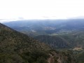
This half-day hike, far from the beaten track of Catalonia and the marked trails, takes you to the heights of Serdinya in the secret territory of wild boars and chamois. You will pass through the abandoned village of Les Horts. Magnificent landscapes, superb views and tranquillity guaranteed!
De Lastourg à Villefranche-de-Conflent
1.50 mi
+69 ft
-138 ft
0h 45
Easy
Departure from Fuilla (Pyrénées-Orientales)
Comment gagner Villefranche-de-Conflent depuis Lastourg sans emprunter la dangereuse N116, qui n'a aucune circulation piétonne de prévue ?Petite découverte d'un circuit alternatif le long de la Têt !Attention, cette randonnée qui emprunte un itinéraire partiellement sur le terrain d'ERDF (non clôturé), se fait à vos risques et périls !
Roc Campanyà from Mas de Lastourg
 3.05 mi
+2,644 ft
-2,644 ft
3h 40
Difficult
Departure from Serdinya (Pyrénées-Orientales)
3.05 mi
+2,644 ft
-2,644 ft
3h 40
Difficult
Departure from Serdinya (Pyrénées-Orientales)
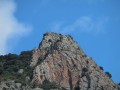
Roc Campanyà rises to an altitude of 1,134 metres, just above the Mas de Lastourg campsite in the Têt Valley, very close to Villefranche-de-Conflent. Breathtaking views of the Têt Valley, the Rotja Valley, the Fillols Valley and the Catalan giant, the Canigou. With a sheer drop of 834 metres, it seems inaccessible... yet it is!
From Mas de Lastourg to Serdinya along the banks of the River Têt
2.15 mi
+197 ft
-0 ft
1h 10
Easy
Departure from Fuilla (Pyrénées-Orientales)
To get from the outskirts of the Mas de Lastourg campsite to Serdinya without taking the main road, there is a lovely path that runs alongside the River Têt.Please note: you are not permitted to cross the campsite – it is private property!
 Condé-sur-Vire - Pont-Farcy via the greenway
 23.78 mi
+417 ft
-394 ft
4 hrs
Easy
Departure from Condé-sur-Vire (Manche)
23.78 mi
+417 ft
-394 ft
4 hrs
Easy
Departure from Condé-sur-Vire (Manche)
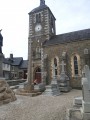
A beautiful route in the heart of nature, along the Vire river, very quiet and very pleasant.
From Serdinya to the village of Les Horts (ruins) (857 m)
 2.71 mi
+1,234 ft
-1,237 ft
2h 20
Easy
Departure from Serdinya (Pyrénées-Orientales)
2.71 mi
+1,234 ft
-1,237 ft
2h 20
Easy
Departure from Serdinya (Pyrénées-Orientales)
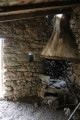
A short hike in the mountains above Serdinya to the abandoned village of Les Horts.This is a typical landscape of the Catalan Pyrenees: mountains, yet with Mediterranean buildings and vegetation.
Galaisière-La Cognerie-Les Ponts-Nicorps-Aquascole
 6.36 mi
+486 ft
-492 ft
3h 20
Easy
Departure from Saint-Pierre-de-Coutances (Manche)
6.36 mi
+486 ft
-492 ft
3h 20
Easy
Departure from Saint-Pierre-de-Coutances (Manche)
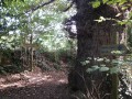
Hiking around Coutances No. 10.A lovely walk around the River La Soulles.This short walk takes us along paths and small local or district roads on a journey through the valley and hillsides of one of Coutances’ three rivers, the Soulles, in the villages to the south-east of Coutances.The route passes by some very pretty local stone houses (or outbuildings from old farms).
 Granges d'Espoune and d'Artigue Bourg on the slopes of Cabaliros
 4.04 mi
+1,585 ft
-1,591 ft
4 hrs
Moderate
Departure from Cauterets (Hautes-Pyrénées)
4.04 mi
+1,585 ft
-1,591 ft
4 hrs
Moderate
Departure from Cauterets (Hautes-Pyrénées)
A short, family-friendly and easy hike in summer, but a challenging trek in winter under the snow. You’re in the heart of the Hautes-Pyrénées, amidst the highest peaks, on the route to the Pic du Cabaliros and Lake Anapéou.In both summer and winter, it offers a complete change of scenery in these traditional pastoral areas.
Tour and ascent of Gros Cerveau Ollioules
 5.75 mi
+1,191 ft
-1,178 ft
3h 40
Moderate
Departure from Ollioules (Var)
5.75 mi
+1,191 ft
-1,178 ft
3h 40
Moderate
Departure from Ollioules (Var)
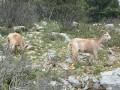
A beautiful hike in the hills above Ollioules and Sanary, off the beaten track. Exceptional views of the coastline from La Ciotat to Porquerolles, and inland from La Cadière-d'Azur to Le Revest, the Sainte-Baume mountain range and the Ollioules gorges.The hike alternates between shaded sections in the Mediterranean scrub and sunny sections on the limestone rocks of the La Colle massif.See important notes in Practical Information.
Walk in Porquerolles
 7.81 mi
+1,024 ft
-997 ft
4h 30
Moderate
Departure from Hyères (Var)
7.81 mi
+1,024 ft
-997 ft
4h 30
Moderate
Departure from Hyères (Var)
This paradise island is criss-crossed by numerous trails from north to south and east to west.
The proposed hike takes you through the village and then on to a beautiful day of walking and swimming in the western part of the island.
Magnificent panoramas, turquoise waters, oak forests, olive groves and vineyards on all sides.
You'll be able to say, "I was there!" and feel like you're playing Robinson Crusoe, without spending the day roasting on a beach...
Notre-Dame du Mai
 1.48 mi
+446 ft
-446 ft
1h 05
Easy
Departure from Six-Fours-les-Plages (Var)
1.48 mi
+446 ft
-446 ft
1h 05
Easy
Departure from Six-Fours-les-Plages (Var)
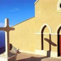
Short walk to reach the summit of Notre-Dame du Mai facing the Mediterranean. The 360° view is one of the most beautiful on the French Riviera. Best done early in the morning or in the evening at sunset to see the amber colours that the sun casts on the surrounding mountains, or in the middle of the day when the weather is very nice to see the azure sky and sea.
Unforgettable photos and memories!
From Villefranche-de-Conflent to the village of Les Horts (ruins)
 3.62 mi
+1,535 ft
-1,509 ft
3h 00
Moderate
Departure from Fuilla (Pyrénées-Orientales)
3.62 mi
+1,535 ft
-1,509 ft
3h 00
Moderate
Departure from Fuilla (Pyrénées-Orientales)
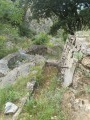
This is a short hike in the mountains above Serdinya, starting from Villefranche-de-Conflent and ending at the fountains of Les Horts, an abandoned village in ruins. The hike follows the old village access path, known as the "Chemin des Horts à Villefranche" in the Napoleonic land registry, although it is in very poor condition. The landscape is typical of the Catalan Pyrenees: mountains, yet with Mediterranean buildings and vegetation.
Haugarou refuge from the Col de Couraduque (1367m)
 4.38 mi
+502 ft
-525 ft
2.5 hrs
Easy
Departure from Aucun (Hautes-Pyrénées)
4.38 mi
+502 ft
-525 ft
2.5 hrs
Easy
Departure from Aucun (Hautes-Pyrénées)
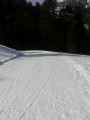
Short, easy winter hike. This is a standard hike in the Argelès-Gazost region.
A wide, well-marked trail leads hikers from the mini winter sports resort of Col de Couraduque to the Refuge du Haugarou, which is actually a beautiful mountain hotel.
In winter, this route is best done on snowshoes (even though it is generally well groomed and possibly passable in shoes)!
In summer, as the route follows a road, you may encounter cars...
Capeu Gros via the Destel Gorges and west of Croupatier
 4.03 mi
+1,598 ft
-1,578 ft
3h 15
Difficult
Departure from Ollioules (Var)
4.03 mi
+1,598 ft
-1,578 ft
3h 15
Difficult
Departure from Ollioules (Var)
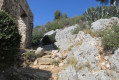
Capeu Gros is one of the peaks of the Croupatier massif, whose ridge leads to Baou des Quatre Ouro. The route, an extended version of the Rinckenbach route (Cuves du Destel), first follows the bed of the Destel with handrail climbing, chains and passage through the vats. It then passes along the Croupatier ridge. On the way back, you will see the Chappe telegraph and the boundary markers of the municipalities of Ollioules and Évenos. Breathtaking views from La Ciotat to Giens, via the bay of Toulon.
25/03/2024: the route ofthe GR® 51, which passes north between the Col du Taillan and the summit of Cape Gros, has been modified and now passes between the Col de Taillan, the telegraph and the summit of Capeu Gros. The IGN map has not been updated.
Baou de Quatre Ouro (576 m) and Croupatier via the caves path
 8.84 mi
+3,199 ft
-3,169 ft
6h 50
Difficult
Departure from Ollioules (Var)
8.84 mi
+3,199 ft
-3,169 ft
6h 50
Difficult
Departure from Ollioules (Var)
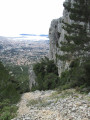
This active route will take you through the Croupatier to the Baou de Quatre Ouro, one of the four "Toulonais brothers". Paths and ledges where you have to use your hands, passages with ropes, discover the main caves of the massif, where the famous caves of the Château du Diable make the route more interesting.
Château du Diable and the Destel Gorges in Ollioules
 3.09 mi
+1,230 ft
-1,237 ft
2.5 hrs
3.09 mi
+1,230 ft
-1,237 ft
2.5 hrs
 Very difficult
Departure from Ollioules (Var)
Very difficult
Departure from Ollioules (Var)
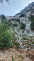
This very challenging route takes the hiker to the site of the Château du Diable and its remarkable caves and the Destel gorges, with their astonishing giant's kettles or cauldrons.
Nice sections with chains or ropes.
Lac de Gaube via Pont d'Espagne
 3.41 mi
+889 ft
-889 ft
2h 20
Moderate
Departure from Cauterets (Hautes-Pyrénées)
3.41 mi
+889 ft
-889 ft
2h 20
Moderate
Departure from Cauterets (Hautes-Pyrénées)
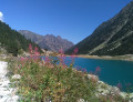
This pretty mid-mountain lake (1,731 m) on the GR®10 is easy to access and overlooked by peaks over 2,500 m high. It makes for a pleasant hike of a few hours. It is also accessible in winter, under the snow, on foot or with snowshoes. The long walk through the magnificent forest along the Gave de Gaube, on the side of the Gaube coast, makes the discovery of the mountains even more beautiful when you arrive at the first Huats lake with the north face of the Vignemale as a backdrop.
Les Encanaux via the Coutronne and Infernets ravines
 4.83 mi
+1,270 ft
-1,289 ft
3h 20
Moderate
Departure from Auriol (Bouches-du-Rhône)
4.83 mi
+1,270 ft
-1,289 ft
3h 20
Moderate
Departure from Auriol (Bouches-du-Rhône)
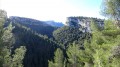
This is a short, challenging hike, which could be described as "ravine hiking", in the steep, arid ravines of the Coutronne (now a dry river) and the Infernets to the Encanaux. There, the latter flows into the Vède in a charming, shady and fairly wide spot, which is popular with walkers at the weekend.
The hike takes you through the potholes (giant's kettles) of the two rivers, in truly wild surroundings.
The first ravine is very rarely visited.
Sainte-Croix Chapel in Auriol
 0.79 mi
+217 ft
-217 ft
0h 35
Easy
Departure from Auriol (Bouches-du-Rhône)
0.79 mi
+217 ft
-217 ft
0h 35
Easy
Departure from Auriol (Bouches-du-Rhône)
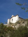
This short walk on the heights of Auriol was discovered by chance while trying to get as close as possible to the chapel, which stands out immaculately against the blue sky. It's a great way to spend a Sunday afternoon with the family, climbing just 37 metres. From the top, there is a remarkable view of the village and the entire surrounding area, from the northern slopes of the Sainte-Baume mountain range to the east to the Étoile mountain range to the west.
Baou Quatre Ouro via the Vallons des Bonnes Herbes and Vallons des Bagnards
 4.33 mi
+1,535 ft
-1,526 ft
3h 20
Difficult
Departure from Toulon (Var)
4.33 mi
+1,535 ft
-1,526 ft
3h 20
Difficult
Departure from Toulon (Var)
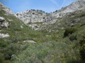
A lovely, challenging circular route along goat paths to the heights of the Baou de Quatre Ouro massif and Cap Gros.Go through two steep valleys.Return via the southern ridge of Baou and the Madema breach, partially descending to the cliff path, then the ups and downs of Hautes Pavègnes and finally the old quarry and the old Bonnes Herbes shooting range.
Soum de la Génie Braque via the Tres-Croutz forest
 6.27 mi
+3,698 ft
-3,698 ft
6h 05
Difficult
Departure from Saint-Pé-de-Bigorre (Hautes-Pyrénées)
6.27 mi
+3,698 ft
-3,698 ft
6h 05
Difficult
Departure from Saint-Pé-de-Bigorre (Hautes-Pyrénées)
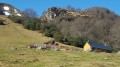
A lovely mid-mountain hike through the lush forest of Saint-Pé-de-Bigorre (or Tres-Croutz or Crouts = Three Crosses in Bigourdan). The first quarter of the hike is a bit challenging, as it is steep. You then pass through the Aülhet and Artigue mountain pastures, before following the ridge westwards to the summit of Soum de la Génie Braque. Well known to locals, this route offers a guaranteed change of scenery!
Pic du Cabaliros and Lac d'Anapéou from Cauterets
 11.58 mi
+4,478 ft
-4,478 ft
9h 15
Difficult
Departure from Cauterets (Hautes-Pyrénées)
11.58 mi
+4,478 ft
-4,478 ft
9h 15
Difficult
Departure from Cauterets (Hautes-Pyrénées)
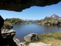
Le Cabaliros is a classic Pyrenean peak above Cauterets. Take the southern route, which is the longest, through woods, lush summer pastures and abundant mountain streams, rather than the Val d'Azun route. The length of the route and the significant elevation gain make this a challenging route reserved for experienced hikers. Enjoy a 360° view from the summit over the main Pyrenean range, the Saint-Pé-de-Bigorre massif and all the surrounding valleys.
Le Béout in the hills above Lourdes
 3.37 mi
+1,263 ft
-1,247 ft
2h 40
Moderate
Departure from Lourdes (Hautes-Pyrénées)
3.37 mi
+1,263 ft
-1,247 ft
2h 40
Moderate
Departure from Lourdes (Hautes-Pyrénées)
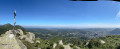
Short hike in the hills above Lourdes. The route is very quiet but well worth a look. It follows the northern ridge, which is the longest and has the greatest elevation gain.
From the main summit at 791m, where a cross has been erected, there is a 360° view of the Lourdes region.
From the second summit at 719m, there is a viewpoint with the old Béout cable car installation. A little further on is the entrance to the cave known as the "Gouffre de Lourdes", which is 82m deep.
Prairie de la Cantilerie or Prairie du Lapin Qui Tricote
 2.38 mi
+200 ft
-217 ft
1h 15
Easy
Departure from Saint-Pé-de-Bigorre (Hautes-Pyrénées)
2.38 mi
+200 ft
-217 ft
1h 15
Easy
Departure from Saint-Pé-de-Bigorre (Hautes-Pyrénées)
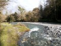
A few kilometres from the centre of Saint-Pé, a small pebble beach is the perfect spot for a refreshing dip in summer and a peaceful picnic break.
The knitting rabbit is hiding in the tall grass on the neighbouring property!
The Montagnou de la Pâle caves in the Très-Croutz Forest
 2.26 mi
+919 ft
-919 ft
1h 50
Easy
Departure from Saint-Pé-de-Bigorre (Hautes-Pyrénées)
2.26 mi
+919 ft
-919 ft
1h 50
Easy
Departure from Saint-Pé-de-Bigorre (Hautes-Pyrénées)
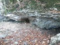
Just a stone’s throw from the village of Saint-Pé-de-Bigorre, this walk takes us along the trail of the massif’s caves, particularly those on a large hilltop, the Mountagnou de la Pale. The caves are dotted along this route as if laid out especially for the walker. We approach the gaping hole of the Gouffre du Hayau, whose unusual size and the draught of air coming in would surely draw you into its dark abyss, were you not careful...
This route was significantly altered in May 2024 by the creation of a new ‘karst trail’.
Montné Ridges and Col du Prat d’Aürelh circular loop via Le Pladi
 9.32 mi
+3,688 ft
-3,684 ft
7h 30
Difficult
Departure from Saint-Pé-de-Bigorre (Hautes-Pyrénées)
9.32 mi
+3,688 ft
-3,684 ft
7h 30
Difficult
Departure from Saint-Pé-de-Bigorre (Hautes-Pyrénées)
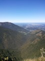
A beautiful, physically demanding day’s hike with several exposed sections along the ridges, taking you to the heights of the Saint-Pé-de-Bigorre massif, first to the east and then north-east, above the Génie Longue torrent.
Final stop at the Refuge du Col du Prat d’Aürelh (du Rey) and its summer pastures.
Magnificent scenery! Solitude guaranteed!
Soum de la Génie Braque circular loop via Cabanes d'Isarce and d'Aülhet
 9.88 mi
+4,364 ft
-4,364 ft
8 hrs
Difficult
Departure from Saint-Pé-de-Bigorre (Hautes-Pyrénées)
9.88 mi
+4,364 ft
-4,364 ft
8 hrs
Difficult
Departure from Saint-Pé-de-Bigorre (Hautes-Pyrénées)
An exceptional and magnificent circular route on the heights of Saint-Pé-de-Bigorre, in the Tres-Croutz forest, then along the ridge of the Soums de Maletaule. This route circles the Génie Braque torrent, which supplies water to the village below. On the mountain pastures, the landscapes are magical in both summer and winter, on the northern side (St-Pé) and the southern side (the main Pyrenees range).
Col d'Ech from Omex
 1.73 mi
+413 ft
-417 ft
1h 10
Easy
Departure from Omex (Hautes-Pyrénées)
1.73 mi
+413 ft
-417 ft
1h 10
Easy
Departure from Omex (Hautes-Pyrénées)
Short hike on the outskirts of Lourdes, in the Batsurguère valley. Above the charming village of Omex, there are isolated pastures in a natural basin, the source of the Moules stream. The pass is topped by the Soum of the same name and the Mail des Portes, the start of the beautiful Pernes ridge, towards the Soum du Montné, gateway to the Saint-Pé-de-Bigorre massif and the Très-Crouts forest.
The Génie Braque torrent and return via the Aülhet
 6.85 mi
+3,360 ft
-3,360 ft
6h 05
Difficult
Departure from Saint-Pé-de-Bigorre (Hautes-Pyrénées)
6.85 mi
+3,360 ft
-3,360 ft
6h 05
Difficult
Departure from Saint-Pé-de-Bigorre (Hautes-Pyrénées)
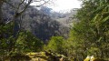
A lovely, challenging and demanding route through the Très-Croutz forest, passing along the bed of the La Génie Braque torrent.The circular route returns via the Aülhet ridge (and its hut, open all year round) after passing through the mountain pastures of the Bat de Haü cirque, clearly visible from the Gave de Pau valley and Saint-Pé-de-Bigorre.
Montagnou de la Lit to Saint-Pé-de-Bigorre
 2.56 mi
+659 ft
-659 ft
1h 45
Moderate
Departure from Saint-Pé-de-Bigorre (Hautes-Pyrénées)
2.56 mi
+659 ft
-659 ft
1h 45
Moderate
Departure from Saint-Pé-de-Bigorre (Hautes-Pyrénées)
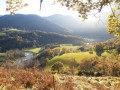
Starting from the Place des Arcades in Saint-Pé-de-Bigorre, enjoy a pleasant, peaceful walk to reach one of the hills sheltering the village, the “Montagnou de la Lit”, to the east. From up there, you can easily reach the entrance to the Grotte de la Résistance and, for the more adventurous, that of the Tute Faiouias.Magnificent views over the Gave de Pau valley and the ridges of the neighbouring peaks of the Saint-Pé massif.Return via the “Montagnou”, another hill above the village.
Hautacam Ridge and Pic du Mont towards Montaigu
 6.70 mi
+1,788 ft
-1,788 ft
6 hrs
Very difficult
Departure from Beaucens (Hautes-Pyrénées)
6.70 mi
+1,788 ft
-1,788 ft
6 hrs
Very difficult
Departure from Beaucens (Hautes-Pyrénées)
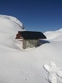
A magnificent, challenging hike along the ridges at 2,000 m facing the Pic du Midi de Bigorre.
Although off the marked trails, it is quite busy in summer. In winter, it is completely off the beaten track for hikers, particularly in the final section (see note in Practical Information below).
In winter, as in summer, save this route for a perfectly clear, sunny day, as the views are remarkable and you won’t regret the effort.
Cabane du Col du Prat d'Aürelh (Prat du Rey)
 6.08 mi
+1,617 ft
-1,627 ft
4h 10
Moderate
Departure from Ségus (Hautes-Pyrénées)
6.08 mi
+1,617 ft
-1,627 ft
4h 10
Moderate
Departure from Ségus (Hautes-Pyrénées)
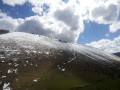
This hike is not technically difficult but goes beyond the scope of a "Sunday stroll". Its appeal lies in reaching the pastoral summer pastures above the magnificent Batsurguère valley, at the gateway to Lourdes, and taking a break in a perfectly maintained refuge hut. To the west, you can see the Aguée valley, towards the Col d'Espadres. The place is quiet and superb. With a bit of luck, you will be in the company of horses roaming free on the grassy slopes of the pass.
Long circular loop of the Pibeste-Aoulhet Reserve
 15.30 mi
+5,512 ft
-5,512 ft
10 hrs
Very difficult
Departure from Saint-Pé-de-Bigorre (Hautes-Pyrénées)
15.30 mi
+5,512 ft
-5,512 ft
10 hrs
Very difficult
Departure from Saint-Pé-de-Bigorre (Hautes-Pyrénées)
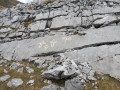
An exceptional, challenging and demanding route through the Très-Croutz forest, first on the Gave de Pau side, with a brief detour to the Val d'Azun side at the Col d'Andorre, then on the plateau at 1,400 m, between the Col d'Espadres and the Saint-Pé ridge (Maletaule or Soums).Summer pastures with centuries of pastoral activity, at the crossroads of important local historical sites, including the famous Très Croutz (the Three Crosses of the Bigourdan bishoprics).
Long circular from Le Mousqué to Saint-Pé-de-Bigorre
 4.68 mi
+896 ft
-902 ft
2h 55
Moderate
Departure from Saint-Pé-de-Bigorre (Hautes-Pyrénées)
4.68 mi
+896 ft
-902 ft
2h 55
Moderate
Departure from Saint-Pé-de-Bigorre (Hautes-Pyrénées)
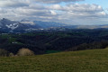
A must-visit spot for the locals of Saint-Pé and their friends, the peaks of Le Mousqué and La Tourette offer a change of scenery and magnificent panoramic views of the surroundings of Saint-Pé-de-Bigorre.Ideal at sunset in summer.
Pic de Montaigu via the Hautacam ridges
 9.11 mi
+2,913 ft
-2,917 ft
6h 45
Difficult
Departure from Beaucens (Hautes-Pyrénées)
9.11 mi
+2,913 ft
-2,917 ft
6h 45
Difficult
Departure from Beaucens (Hautes-Pyrénées)
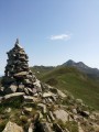
Montaigu is a beautiful peak in the Hautes-Pyrénées, facing the Pic du Midi de Bigorre and set back far enough from the main border range to offer a beautiful 360° view. This slope via the Hautacam ridges is the longest, but it is also the most beautiful and wildest. It offers a few aerial sections that add a certain interest! Only to be attempted if the weather is perfectly clear!
Tour and ascent of Roc Campanyà via the Vauban trails
 6.30 mi
+3,163 ft
-3,153 ft
4 hrs
6.30 mi
+3,163 ft
-3,153 ft
4 hrs
 Extremely difficult
Departure from Fuilla (Pyrénées-Orientales)
Extremely difficult
Departure from Fuilla (Pyrénées-Orientales)
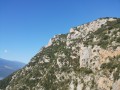
Roc Campanyà or Campagnia rises to an altitude of 1,134 metres, just above the Mas de Lastourg campsite in the Têt Valley, very close to Villefranche-de-Conflent. Its pointed, aggressive silhouette and the chaos of the Sant-Pere massif on which it is perched suggest that it is inaccessible without climbing equipment... But it's not. With a good pace and a good sense of direction, hikers can reach the summit in just 3 hours.Read the comments carefully before setting off on this route. Don't hesitate to turn back. There is a way out of the route between (10) and (5): return via the Vallon des Horts, a hike described here on visorando. The point (10) on this route corresponds to the point (4) on the other route.
Loop on the steep slopes of Sant-Pere, at the foot of Roc Campanya
 4.62 mi
+2,159 ft
-2,146 ft
4h 00
Difficult
Departure from Fuilla (Pyrénées-Orientales)
4.62 mi
+2,159 ft
-2,146 ft
4h 00
Difficult
Departure from Fuilla (Pyrénées-Orientales)
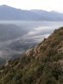
This is a good, challenging hike, mostly off the beaten track, along ancient paths in the Sant-Pere massif. At the foot of Roc Campanya/Campagna, you will discover an incredible view of the Têt and Rotja valleys. There is a 180° view with the 2,784-metre-high Canigou in the south.
Cap des Litas via Coumo Rédo and Col d’Espadres
 9.39 mi
+4,229 ft
-4,209 ft
8h 00
Difficult
Departure from Saint-Pé-de-Bigorre (Hautes-Pyrénées)
9.39 mi
+4,229 ft
-4,209 ft
8h 00
Difficult
Departure from Saint-Pé-de-Bigorre (Hautes-Pyrénées)
On the forgotten trails of Saint-Pé-de-Bigorre No. 3
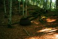
A challenging and demanding circular route above Serre Pourcou, across the mountainous plateaus and summer pastures of the Pyrenean foothills, and through the vast and impenetrable forest of Très Croutz, or the state-owned forest of Saint-Pé-de-Bigorre.
The diversity of the landscapes encountered never fails to impress the hiker...
La Crèque Noèle in Rieulhès
 0.71 mi
+161 ft
-167 ft
0h 30
Easy
Departure from Saint-Pé-de-Bigorre (Hautes-Pyrénées)
0.71 mi
+161 ft
-167 ft
0h 30
Easy
Departure from Saint-Pé-de-Bigorre (Hautes-Pyrénées)
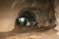
This short family walk takes you to a charming little cave that’s very easy to reach. Over the millennia, it has been home to all sorts of creatures, as well as humans. All have left traces, few of which are visible to the naked eye, apart from the bear droppings and the markings from palaeontological excavations.What remains is the cave’s impressive size – surprising and rare in the region – and its location in the ever-mysterious Très-Croutz Forest.
The valleys of Yerse and Aguée via Arriousec to Peyras
 10.62 mi
+4,695 ft
-4,678 ft
8 hrs
Very difficult
Departure from Asson (Pyrénées-Atlantiques)
10.62 mi
+4,695 ft
-4,678 ft
8 hrs
Very difficult
Departure from Asson (Pyrénées-Atlantiques)
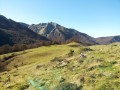
On the forgotten trails of Saint-Pé-de-Bigorre No. 5A long journey from the Ouzom Valley, through Les Aoules, to the Génies Valley, in the unfathomable Saint-Pé massif.In all seasons, the landscapes and forests are impressive and majestic.Its main attraction lies in the beauty of the two valleys crossed from end to end: the Yerse and the Aguée, sites of ancestral pastoralism where shepherds and their flocks lived from June to October. There are still many traces of this to be found.
Bédeille and Les Picharrots via the rangers’ path
 6.67 mi
+1,991 ft
-1,988 ft
4h 50
Difficult
Departure from Saint-Pé-de-Bigorre (Hautes-Pyrénées)
6.67 mi
+1,991 ft
-1,988 ft
4h 50
Difficult
Departure from Saint-Pé-de-Bigorre (Hautes-Pyrénées)
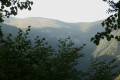
The Picharrots waterfall is a classic spot for lovers of the Saint-Pé Massif who aren’t afraid to tackle the challenges of navigating the Integral Biological Reserve, which is deliberately left completely untouched by human intervention.
This route offers an alternative, allowing you to take the Sentier des Gardes on the way there – a trail somewhat forgotten within the massif, but a truly epic one.
The final section of the route, between the Bédeille ravine and the waterfall, is more challenging and at times more exposed.
Return via the Génie Longue.
Boucle du Béout
 2.65 mi
+1,280 ft
-1,276 ft
2h 20
Difficult
Departure from Lourdes (Hautes-Pyrénées)
2.65 mi
+1,280 ft
-1,276 ft
2h 20
Difficult
Departure from Lourdes (Hautes-Pyrénées)
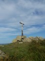
Tour of the Cité Saint-Pierre via the Béout ridge, passing by the summit cross and the old cable car station with views of Lourdes, the Gave de Pau and the start of the Vallée des Gaves.This hike in a wild area, with little or no signposting and trails that are difficult to see in summer and overgrown with ferns (especially on the descent), makes it accessible only to "adventurers" over the age of 10 who are not afraid of discovering this little summit!
Pic de Miquéu circular route via Coumo Redo and Calihourc
 6.98 mi
+3,586 ft
-3,570 ft
6h 20
Difficult
Departure from Saint-Pé-de-Bigorre (Hautes-Pyrénées)
6.98 mi
+3,586 ft
-3,570 ft
6h 20
Difficult
Departure from Saint-Pé-de-Bigorre (Hautes-Pyrénées)
On the forgotten paths of Saint-Pé-de-Bigorre No. 4
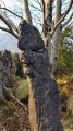
A beautiful view from the Pic de Miquéu (1,452 m) over the Saint-Pé Massif and the summer pastures, stretching as far as the peaks of the border range.
The route takes in several ancient paths not marked on maps, which adds to its appeal. On the way back, you’ll discover the remarkable site of Calihourc, with its sharp limestone pavement shaped like confessionals, celebrated and photographed by Abbé Abadie in his book *Le Sanglier du Picharrot*.
Refuge des Espuguettes, Plateau des Cardous and Plateau d'Alans
 4.68 mi
+2,362 ft
-2,352 ft
4h 10
Moderate
Departure from Gavarnie (Hautes-Pyrénées)
4.68 mi
+2,362 ft
-2,352 ft
4h 10
Moderate
Departure from Gavarnie (Hautes-Pyrénées)
Starting from Gavarnie, enjoy a change of scenery by escaping to the wild plateaus at the foot of the Grand and Petit Piméné (2,801m and 2,667m).
The Refuge des Espuguettes is a beautiful stop along the way. If you push on a little further to the Plateau des Cardous, you can admire the entire border range, the peaks of the Cirque, just for you, from the Tour du Marboré (3009m) to the Mailh Arrouy (2965m), passing by the majestic Vignemale (3,298 m).
A change of scenery and tranquillity guaranteed!
Le Montagnou de Saint-Pé
 1.03 mi
+236 ft
-213 ft
0h 40
Easy
Departure from Saint-Pé-de-Bigorre (Hautes-Pyrénées)
1.03 mi
+236 ft
-213 ft
0h 40
Easy
Departure from Saint-Pé-de-Bigorre (Hautes-Pyrénées)
A short walk in the hills above Saint-Pé-de-Bigorre offering breathtaking views of the village and its exceptional heritage: its 11th-century church, the former seminary and Catholic school, and the remarkable streets and houses dating from the 15th to the 18th centuries.There are also beautiful views of the mountain range to the south, including the Très-Croutz forest and the ridge of the Cirque de Bat dé Haü, stretching from the Toupiettes in the west to the Aülhet in the east.