The four “3,000-metre peaks” of West Gavarnie via the Crête des Gabiétous and Taillon

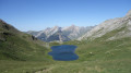
The ridge bordering the Cirque de Gavarnie and its immediate surroundings feature several legendary ‘3,000-metre’ peaks. This route to the west of the Cirque allows you to tackle four of them in a single day whilst following a stunning ridge! The ascent to the Taillon via the south-western ridge of the Gabiétous – a climb requiring no equipment other than your hands – is fun and exposed, but presents no major difficulties. The route remains at PD level (slightly difficult), making it accessible to many experienced mountaineers. The entire hike takes place in the high mountains in a marvellous setting, on both the French and Spanish sides, and is sure to leave you with memories to last a lifetime!

Details

86499033
Creation:
Last update:
Last review:
  • Walking
    Activity: Walking
  • ↔
    Distance: 9.02 mi
  • ◔
    Average duration: 7h 35 
  • ▲
    Difficulty: Very difficult

  • ⚐
    Back to start: Yes
  • ↗
    Ascent: + 3,986 ft
  • ↘
    Descent: - 3,973 ft

  • ▲
    Highest point: 10,308 ft
  • ▼
    Lowest point: 7,238 ft

Photos

Description of the walk

Drive up from Gavarnie and park at Col de Tentes, 2,207 m.

The summer starting point is the large car park at Col de Tentes, in the commune of Gavarnie, at the end of the D923 road, at an altitude of 2,207 m, which is very high for a hiking start point.

Please note: this is within the “Heart of the Pyrenees National Park” zone,where camping – whether in a tent, a vehicle (including a campervan) or any other shelter – is prohibited, even in the car parks. Park rangers frequently issue fines.

(S/E) The route starts at the western end of the car park. Take the footpath leading to the Port de Boucharo (Puerto de Bujaruelo), at 2,271 metres, the mountain pass marking the border between France and Spain. Cross the pass heading west and head south-west.

(1) A well-defined, unmarked path starts on the slope of the Eastern (Gabieto Norte) and Western (Gabieto Sur) Gabiétous. It lies between the path that heads sharply back to the left (leading to the Brèche de Roland) and the one that descends slightly to the left (leading to Bujarelo).

The path runs easily over a comfortable scree slope, up to just before the Pinarroya valley floor. After that, the path becomes a little more challenging, without being (yet) exposed. You head straight south-south-west towards the Gabiétous wall, wondering where the path will go. At 2,475 m, it turns sharply 90° to the left, towards the west, and climbs in short switchbacks to the Hourquette des Gabiétous.

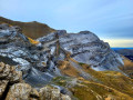
(2) Hourquette des Gabiétous (Forqueta de Gabieto) at 2,515 m. Looking back, on the left, you can make out a cairn situated to the right of a rocky spur, which marks the way forward. The path continues slightly below, to the right of the ridge (which remains a good distance away on the left-hand side). The landscape is dotted with small mountain pines. Head straight ahead, east-southeast, towards the scree slope at the foot of the gully leading up to the unnamed pass at 2,861 m. This route runs slightly to the left of other tracks, as close as possible to a very smooth cliff face. At its foot, you’ll find a carpet of edelweiss and golden thistles.

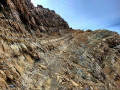
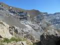
You’ll soon reach this gully; it’s very distinctive with its two-tone yellow and grey colouring. The ascent begins on a moderate slope, but the ground is very loose and unstable, consisting of crumbling scree. This route follows a path that winds upwards in several switchbacks through the grey (right-hand) section of the scree slope. In its final section, the gradient steepens considerably. Continue the ascent keeping to the right, at the far end of the gully, right up against the rock face (which is sometimes overhanging), to stay on the least crumbly rock possible. However, progress is hampered by the instability of the terrain; you’ll often need to use your hands, or even crawl on all fours! It’s hardly surprising, then, that it takes over an hour to get from one pass to the other. Reach the unnamed pass at 2,861 m.

NB: at the end of the winter season and well into the season, it may be necessary to navigate between the snowfields in this gully.

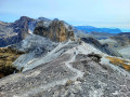
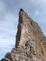
(3) Head north of the pass and pass through a small, sheltered gorge (which is easy when there is no snow) slightly below and to the left of the ridge. The ascent of the ridge begins in earnest here. Head due north, over very solid, large boulders. This involves 20 to 30 minutes ofeasy and enjoyablevertical climbing. There are several cairns clearly marking the route to follow.

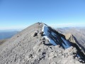
You’ll reach the more horizontal section of the ridge just before 3,000 metres. The route turns north-east. The next three summits are clearly visible. Reach thefirst summit , the Gabiétous Occidental at 3,034 metres (Gabieto Sur, 3,031 metres, according to the Spanish IGN).

(4) From its summit, continue north-east, staying firmly on the ridge. Pass one of the many gendarmes – this one at 3,035 m (higher than the Western Gabiétous, the Punda dero Cabieto) – and a few rocky outcrops. You’ll soon reach the Eastern Gabiétous at 3,033 m (Gabieto Norte, 3,031 m, according to the Spanish IGN).

(5) Here you’ll cross the border ridge running from the Port de Boucharo to the Brèche de Roland via the Taillon; follow this ridge from now on to the Pointe Bazillac. Depending on where you step, you’ll be in France one moment and Spain the next! Reach the Col des Gabiétous at 2,938 m.

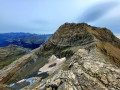
(6) The next two peaks are clearly in view: the Taillon on the left and Pico Royo on the right, further down. The climb up to Pico Royo is steep, covering 115 m of elevation gain! You’ll cross the 3,000-metre mark again. Reach Pico Royo at 3,051 m.

(7) There are several bivouac sites here. It’s worth noting that, although set slightly back from the ridge and lower than its neighbouring peak, the summit offers beautiful, unobstructed views to the east and west (sunrises and sunsets), whilst being less crowded than the latter. Leave Le Royo via a path along the northern ridge and easily cover the 936 m of elevation gain to reach the king of the area, the Pic du Taillon (Punda Negra) at 3,144 m.

(8) The 360° view across France and Spain is exceptional here, taking in the whole of the Central Pyrenees. And in the foreground to the north, there is a magnificent view of the Malh Arrouy (2,967 m), the Soum Blanc des Espécières (2,687 m), the Pic de Saint-André (2,608 m), Port de Boucharo, the Col de Tentes, the Lac des Espécières, the Pic des Tentes (2,322 m), the Pic de la Pahule (2,292 m), the Pic de Lary (2,397 m) and the Vallée des Pouey Aspé...

There are several ways to leave this enchanting stronghold: I choose the ‘normal route’ leading to the Doigt and the ‘paquebot’ of the Pointe Bazillac. Simply leave the ridge to the right and descend the Spanish-side slope. Passing below the 3,000-metre mark...

(9) Arrival at the Doigt, which can easily be bypassed to the north.

(10) Arrival at the “Fausse Brèche” = Pointe Bazillac at 2,906m. The path continues to the right, leaving the “paquebot” – the rocky wall of the Pic de Bazillac – on the left.

(11) Pass the Abri Gaurier on the left, a natural cavity beneath the cliffs suitable for bivouacking and capable of accommodating five to six people. From 1906 onwards, Abbé Gaurier used it regularly for his hikes in the massif (see Gaurier’s story in the ‘Things to see’ section). Continue roughly along the contour line, skirting the cliffs, until you come to the ‘serrure’ of the Brèche de Roland. Reach the Brèche de Roland at 2,807 m.

(12) The return journey follows a well-marked and well-used path towards the Port de Boucharo.

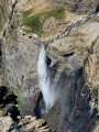
(13) Arrival at the Refuge des Sarradets (or Refuge de la Brèche de Roland), at 2,587 m. Continue on, passing the Col des Sarradets at 2,589 m, then carefully descend the waterfall of the torrent flowing down from the Glacier du Taillon. Take great care on the rock, which can be slippery when wet. Then take the long path that leads to the Port de Boucharo, passing beneath the northern cliffs of the Taillon and the Gabiétous. Reach the Port de Boucharo.

(1) Continue to the Col de Tentes car park (S/E).

Waypoints

  1. S/E : mi 0 - alt. 7,244 ft - Col de Tentes
  2. 1 : mi 1.02 - alt. 7,438 ft - Port de Boucharo (Puerto de Bujaruelo)
  3. 2 : mi 2.3 - alt. 8,146 ft - Hourquette des Gabiétous (2,515 m) - Forqueta de Gabietou (2515m)
  4. 3 : mi 3.14 - alt. 9,206 ft - Unnamed pass on the south-western ridge of the Gabiétous (2,861 m)
  5. 4 : mi 3.37 - alt. 9,544 ft - Western Gabietous (3,034 m) – Gabieto Sur (3,031 m)
  6. 5 : mi 3.62 - alt. 9,846 ft - Eastern Gabiétous (3,033 m) - Gabieto Norte (3031m)
  7. 6 : mi 3.87 - alt. 9,596 ft - Col des Gabiétous (2,938 m)
  8. 7 : mi 4.19 - alt. 9,980 ft - Pico Royo (3051m)
  9. 8 : mi 4.49 - alt. 10,308 ft - Taillon (3144m)
  10. 9 : mi 5.01 - alt. 9,593 ft - The Doigt de la Fausse Brèche
  11. 10 : mi 5.07 - alt. 9,514 ft - Pointe Bazillac (2,906 m)
  12. 11 : mi 5.16 - alt. 9,518 ft - Gaurier Shelter (2,850 m)
  13. 12 : mi 5.52 - alt. 9,163 ft - Brèche de Roland
  14. 13 : mi 6.03 - alt. 8,471 ft - (2587m) - refuge des Sarradets
  15. S/E : mi 9.02 - alt. 7,244 ft - Col de Tentes

Notes

This description relates to a summer hike undertaken by two people in October 2025. There was no snow on the route.

In winter, only attempt this route if you are fully proficient in snowshoeing or ski touring, and in the use of crampons and an ice axe. Please note: the start is at the Station des Espécières, not at the Col de Tentes.

Car park at the start
(S/E) At an altitude of 2,207m, at the Col de Tentes, in a large car park. This is an official car park, marked on road maps. It is free of charge. You are not permitted to camp there, nor even to sleep in your car, van or campervan, as it is situated within the “Heart of the Pyrenees National Park” zone. It is not accessible during the winter season.

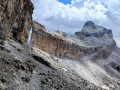
From the car park, even before setting off along the road to the Port de Boucharo, you can see the four peaks in the area that are over 3,000 metres high (though these do not overlook the Cirque de Gavarnie, unlike our seven targets). From right to left: the Western Gabiétous (3,034 m), the Eastern Gabiétous (3,031 m; which appears much higher than the previous one due to the perspective), the Pico Royo (on the slope towards the Taillon, 3,051 m) and finally the lord of the area, the Taillon (3,144 m), an enormous mass of limestone, towering above the former Taillon and Gabiétous glaciers and the Vallon de Pouey Aspé (sloping down towards the village of Gavarnie, via the Cabane des Soldats and the Plateau de Bellevue).

Estimated time
I completed this route in just under 8 hours, including breaks at the various summits and photo stops, having set off from the car park at 7.30 am. Allow between 7.5 and 9.5 hours. You should only attempt the full route during the summer months, due to nightfall.

Difficulty
The route is reserved for seasoned mountaineers. It is classified as Very Difficult for a number of reasons: significant elevation gain; no climbing but sections on exposed ledges between (3) and (5); steep sections (>35%) ; lack of signposting, apart from cairns, which are sometimes unreliable; high-mountain conditions. The IBP Index is 155 HKG, which corresponds to a ‘Difficult’ route for a hiker with a high level of physical fitness.

Alternatives:

  • Depending on your fitness level, it may be worth ascending into the Vallée des Espécières the day before to camp there (outside the ‘Cœur du Parc’ zone) and complete the route the following day or over two days (staying overnight at the Refuge des Sarradets (17)).
  • To vary the route, it is possible to return to the Col des Tentes (S/E) via the Cabane des Soldats (the “Bandera” route). After descending from the Col des Sarradets and crossing the stream, a sign at a junction indicates “Gavarnie 2h”. Take this route and follow the path which crosses the stream again to the right, passing beneath the Pic des Sarradets. The path then winds its way down quite steeply.
    Two options:

    1. Head off-trail near the 1,976 m mark on the IGN map to the hut (shorter route): keep the Cabane des Soldats as your destination so that you can return to it by crossing two streams and cutting straight across rocky outcrops and ridges.
    2. Follow the path to the Gave des Tourettes (longer route): descend along the path to the junction by the stream (elevation 1,873 m on the IGN map), which allows you to climb back up to the hut via the path.

    About 50 metres after passing the hut on the way up, leave the path and turn right onto the steep grassy slope, following a stream, and climb straight up the very steep grassy slope to the Col des Tentes (S/E).
    Allow about 50 minutes from the junction below the Col des Sarradets to the Cabane des Soldats, then 30–40 minutes to climb up to the Col des Tentes from the hut. Total time saved: 15 to 30 minutes, but an additional 340 metres of elevation gain!

  • Alternative route to the summit of the Casque du Marboré: passing through the Brèche, you’re very close to the first summit of the Cirque de Gavarnie, the Casque, at 3,011m. You can ‘pop up there’ in 2 hours 30 minutes maximum (there and back).

Water sources
There is only one source of drinking water on the route, at the Refuge des Sarradets (17), at the rear of the refuge, from a freely accessible tap. In spring and summer, meltwater from snowfields, springs, lakes, rivers or runoff cannot be guaranteed to be safe to drink, even though there are no herds grazing in the summer pastures in this area above the Col des Sarradets. Allow at least 3 litres per person and/or bring a filter or purification tablets.

Shelters
There are several shelters along the route: the Refuge des Sarradets (17), bivouac caves on either side of the Brèche de Roland (12) and the Abri Gaurier (11).

  • (17) Refuge des Sarradets
  • (17) Just below the refuge, there are around ten spots suitable for bivouacking.
  • (12) Brèche de Roland: there are pitches (around 5 or 6) beneath the cliff where you can camp on the Spanish side, to the right as you approach from the French side (make sure to follow the cliff face closely towards the Taillon).

Equipment
In summer, bring the usual high-mountain hiking kit: hiking boots, walking poles, suitable clothing, rainwear, water, food, a survival blanket, a knife, a compass, a map, a whistle, sunglasses, a hat, sun cream, and UV-protective lip balm… A GPS (or a smartphone with the Visorando hiking app) can be very useful.

Visitor numbers
At weekends in spring and summer, the route is very busy as far as the Port de Boucharo ((1)), the Brèche de Roland (12) and the Taillon itself, which is extremely popular ((9)), but much less so on the other sections. Whatever the season, don’t forget to let your friends and family know your exact route and inform them of any changes by text or phone.

Check the weather forecast before setting off

Contributor
If, whilst on your route or whilst using the map, you notice any errors in signposting or place names, you can become a contributor and report them:
- signage errors, safety issues, conflicts of use, environmental concerns: click here.
- mapping errors, place names: click here.

This route passes through a protected area, which may be subject to special regulations:

Worth a visit

(1) at the Hourquette des Gabiétous

Even here, the atmosphere is superb, with numerous rocky spires all around the pass. The view is magnificent over the south-western slope of the Gabiétous and beyond, to Pico de Escuzana (2,766 m) and the Faja de Escuzana. That is where the south-western ridge of the Gabiétous begins. To our right as we reach the Hourquette, Pico Escusaneta (2,609 m) marks the end of the western ridge of the Gabiétous, which we’ll follow eastwards until we join the first ridge at the pass at 2,861 m.

(11) The Gaurier Shelter

Michel Ludovic Gaurier was born on 2 August 1875 in Bayon, Gironde. The son of a sea-going captain, he was descended from a long line of sailors who had settled on the Île d’Oléron since 1677.

At the age of 16, he visited the Pyrenees for the first time to seek treatment for a sore throat in Argelès.

In 1896, aged 21, he entered the priesthood. He was ordained a priest on 4 June 1898. He remained at Pons College as a teacher of natural sciences.

In August 1900, a doctor sent him to Cauterets to treat the early stages of laryngitis.

Captivated by the beauty of the Pyrenees, he went on his first excursions there and began studying the Vignemale glaciers.

He returned to the Pyrenees the following year, and spent all his holidays there thereafter. Back at the secondary school, he studiedRussell’s writings with his pupils.

In 1904, the Ministry of Agriculture asked him to continue his glacial studies and extend them to the major Pyrenean glaciers. The government needed to ascertain the volume of water available for irrigation and for the construction of the first hydroelectric power stations.
In 1905, his first book was published: ‘Glacial Observations Made at the Vignemale’.

Until 1909, he devoted himself to glaciology. He compiled a list of the glaciers and main snowfields of the Pyrenees, and observed their movements and changes.

Source: https://www.pyrenees-passion.info/

Mountain wildlife

We encountered few mammals, but it is worth noting a very large alpine vole between (3) and (4), whilst we were climbing, in a section consisting entirely of rock!

Other walks in the area

For more walks, use our search engine .

The GPS track and description are the property of this route's author. Please do not copy them without permission.