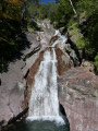
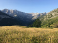
This description relates to a hike undertaken in summer.
In both summer and winter, check the ‘Bulletin montagne’ weather forecast and, in winter in particular, the snow and avalanche bulletin from Météo-France for the Haute-Bigorre massif in the Hautes-Pyrénées. A call to the Haute-Montagne Gendarmerie unit may also reassure you about current conditions.
I do not recommend this hike in severe autumnal conditions (snow, heavy rain or hail), unless you have extensive mountain experience and are suitably equipped. Indeed, the Couloir de Tuquerouye can be particularly dangerous in the rain or when covered in snow.
For your information, another Visorando route, La Hourquette d’Alans, covers part of the route on snowshoes in snowy conditions.
Estimated time
Allow 3½ hours, including breaks and a picnic, when hiking solo; add half an hour when hiking in a group. This is a fairly generous estimate.
Difficulty
The hike is classified as “Very Difficult” (summer) due solely to the Tuquerouye Couloir (S), which is even more difficult on the descent than on the ascent. It is a challenging route, off the beaten track, where you must keep your cool.
Watch out for rockfalls in the couloir. When in a group, remain vigilant and do not line up one behind the other.
Water sources
From the Tuquerouye Refuge, when there is no snow, Lac Glacé is a quarter of an hour’s walk away, but there is no guarantee the water is safe to drink. Further down, except in the depths of winter, there is an outdoor tap with drinking water at the Refuge des Espuguettes (3).
Don’t forget to allow for around 1.5 litres per person in summer from the Tuquerouye Refuge (S) to Gavarnie (E).
Shelters
(3) The Refuge des Espuguettes is open all year round. In winter, it is unstaffed and has 8 beds available.
See the refuge’s website.
The staff are really friendly and the coffee (€1) is the cheapest in the whole of the Pyrenees!
In the event of bad weather between the Hourquette d’Alans (1) and the fork in the path (2), there is a lovely rock shelter that can serve as a temporary refuge for several people.
Equipment
In summer, bring the usual high-mountain hiking kit (hiking boots, walking poles, suitable clothing, rainwear, water, food, survival blanket, knife, compass, map, whistle, etc.).
In autumn and spring, add gloves and a hat. If there is a risk of snow, add an ice axe and crampons.
Traffic
In summer, the route is relatively busy. However, from autumn onwards, once the Espuguettes mountain hut is closed, it is common not to come across anyone, even at weekends. You should therefore inform your friends and family of the route you are taking and your planned times.
Mobile phone or radio communications
There used to be a radio, but there is now no means of radio communication at the Tuquerouye Refuge (S) (as of 2019). There is also no mobile phone coverage.
Mobile phone coverage is non-existent from the Tuquerouye Refuge (S) to the Hourquette d’Alans (1). From there to Les Espuguettes (3), coverage is very poor. You’ll find a signal (though not necessarily from all operators) at Les Espuguettes.



 Country:


 Visorando Member
 Moderate
 Difficult