Tousaus Hut circular route – Gavarnie

The Cabane des Tousaus is a short route designed for beginners to try their hand at snowshoeing. It is an easy destination for those looking to hike in the snow and who need to gain a little altitude.
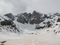
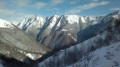
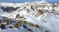
Once you reach your destination, you can stop for a picnic and enjoy an already exceptional panoramic view over part of the Ossoue Valley and the Soum Blanc ridge, stretching from Secugnat to the Soum des Canaus.
The presence of many other snowshoers and skiers in the vicinity makes for a safe, stress-free hike where you can follow the trail by sight.

Details

n°6750778
Creation:
Last update:
Last review:
  • Snowshoeing
    Activity: Snowshoeing
  • ↔
    Distance: 1.76 mi
  • ◔
    Duration according to the author: 5 hrs 
  • ▲
    Difficulty: Easy

  • ⚐
    Back to start: Yes
  • ↗
    Ascent: + 771 ft
  • ↘
    Descent: - 755 ft

  • ▲
    Highest point: 6,319 ft
  • ▼
    Lowest point: 5,659 ft

Photos

Description of the walk

The route starts from the bend in the D921 (1,735 m) on the road leading up from the village of Gavarnie to the Gavarnie-Gèdre-les Espécières resort.
Park in the small car park at the bend. Before 9 am, you may be able to find a proper parking space; after that, you’ll probably have to park on the roadside.

(S/E) At the tip of the bend, head due north across the snow-covered embankment. Depending on the season and snow conditions, you can put on your snowshoes here or continue in your walking boots. Begin the ascent directly towards the north-west. Follow the tracks of skiers or snowshoers heading uphill, almost exactly along the dotted line on the summer trail map.
Depending on snow conditions and the season, the path may be visible, cleared of snow or, conversely, buried under a layer of snow.

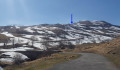
After 100 m, cross the Ruisseau de Peyrenère and continue on to reach the ridge.
Continue along the ridge heading north, then north-west.
Reach the edge of the Serres des Tousaus, at an elevation of 1,783 metres, by joining theGR®10.

(1) Make your way to the viewpoint (1,870 m) along the metal fence. Enjoy the unobstructed view of the Bois de Saint-Savin below, as well as the Ossoue valley and the road leading to the Ossoue Dam.

Follow the existing tracks or make your own way westwards, towards the Cabane des Tousaus (1,835 m).

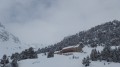
(2) You’ll reach the hut easily, with its metal ‘cuyalas’ (enclosure) clearly visible from a distance.
After a break of varying length, leave the hut heading south, climbing up the slope.

(3) Head for the 1,872-metre mark. From there, just for the fun of a bit of climbing and descending, head straight up the slope towards the summit of the nearby hill at around 1,930 m.
Then head back down and rejoin the track you took on the way up (the one before reaching the hut).
All these undulating mountain pastures of Peyrenère can be explored safely, both on the way up and on the way down – even if that means sliding down on your bum! If you have time, you can make several round trips.

Then head back towards the Ruisseau de Peyrenère and the ridge where the walk began.
Don’t hesitate to take a shortcut from the ridge, without following the path you took on the way up.
This will take you back to the bend by the car park (S/E).

Waypoints

  1. S/E : mi 0 - alt. 5,663 ft - Coume de Peyrenère bend (1,720 m)
  2. 1 : mi 0.42 - alt. 5,758 ft - Tousaus Viewpoint (1,783 m)
  3. 2 : mi 0.78 - alt. 5,994 ft - Cabane de Tousaus (1835m)
  4. 3 : mi 1 - alt. 6,142 ft - Elevation 1872
  5. S/E : mi 1.76 - alt. 5,666 ft - Coume de Peyrenère bend (1,720 m)

Notes

This account relates to a group hike undertaken in winter (March 2021) in substantial snow cover with 25 cm of fresh powder snow.
Depending on snow conditions, there may be no snow immediately after the bend, but rather on the Serre des Tousaus plateau.
Most of the route will follow either tracks left by previous skiers or snowshoers, or a GPS track.
This hike can also be undertaken in summer, following roughly the same route, whilst staying on the paths – which are perfectly visible throughout – from (S) to (2), as far as possible.

- The bend at Coume de Peyrenère at 1,720 m on the D923 is not strictly speaking a car park. However, its width, both on the inside and outside, allows around ten vehicles to park there without any problems. On busy days, when returning from a run in the middle of the afternoon, it is common to find far more than 10 vehicles parked both before and after the bend, sometimes in less than ideal conditions, which may prevent snow-clearing vehicles from passing, for example.
If the car park is full when you arrive, it is wiser to park at the bend below (around 4 spaces) or, if necessary, at the Granges de Holle car park.

- I completed this route as part of a group on snowshoes in 5 hours, including breaks and a picnic, setting off from the car park at 9.30 am. This is a fairly generous estimate. Allow between 2 and 4 hours.

- I’ve rated it as ‘Easy’ in winter. It’s a straightforward route, ideal for beginners, whether in a group or on your own.
Whatever the season, don’t forget to let your friends and family know your exact route and inform them of any changes by text or phone.

- In winter when there is snow, streams can be used as water sources without too much risk. However, make sure you carry at least 0.5 litres of cold water per person and 1 litre of hot water in a thermos flask per person.

- Only the Cabane des Tousaus (2) can truly serve as a permanent shelter along the route.
Nearby is the Chalet La Grange de Holle, run by the FFCAM. Availability and bookings can be found on their website.

- In winter when there is snow, standard mid-mountain hiking kit is required: hiking boots, suitable clothing, rainwear, water, food, a survival blanket, a knife, a compass, a map, a whistle, snowshoes, a pair of poles, gaiters, sun cream, lip balm, a GPS or the Visorando app on your smartphone, gloves, suitable warm clothing, a flask with a hot drink, a hat, and sunglasses suitable for glare off the snow.

Météo-France Mountain Bulletin and Avalanche Risk Assessment Bulletin (BRA or BERA)
Check the weather forecasts, particularly the Météo-France snow and avalanche bulletin for the Haute-Bigorre massif in the Hautes-Pyrénées. Calling the Pierrefite-Nestalas High-Mountain Gendarmerie unit or the Gavarnie High-Mountain CRS may also put your mind at rest.

Worth a visit

Gascon place names
Peyrenère: from peyre/peyra = stone and nère = black, meaning ‘black stones’.

A visit to the village of Gavarnie

Other walks in the area on Visorando: see here. Apply filter criteria if required (weather, difficulty, type of activity).

Always be cautious and plan ahead when you're outdoors. Visorando and the author of this route cannot be held responsible for any accidents occurring on this route.

The GR® and PR® markings are the intellectual property of the Fédération Française de Randonnée Pédestre.

Reviews and comments

5 / 5
Based on 1 review

Reliability of the description
5 / 5
Ease of following the route
5 / 5
Route interest
5 / 5
MCTOUL
MCTOUL

Overall rating : 5 / 5

Date of your route : Feb 23, 2021
Reliability of the description : ★★★★★ Very good
Ease of following the route : ★★★★★ Very good
Route interest : ★★★★★ Very good
Very busy route : Yes

I completed this route on 23 February 2021. A 20cm layer of snow had fallen two days earlier, covering a thick layer of very rutted, waterlogged ‘spring’ snow.
The conditions were, in fact, very good for the season.
It wasn’t possible to continue the route towards the Cabane de Sausse Dessus with the beginners due to a fairly steep slope just past the Cabane des Toussaus.
For beginners, a few laps in the area between the road, the Serre des Tousaus and the hut were more than enough to keep everyone happy.
That is why, around the actual route described here, you can walk safely to extend your time on the snow.
The Cabane is an easy spot to stop for a picnic.

Machine-translated

Other walks in the area

For more walks, use our search engine .

The GPS track and description are the property of this route's author. Please do not copy them without permission.