Country:

 City:


Head towards the Bastan Valley via Luz-Saint-Sauveur. Pass through the village of Barèges and continue for 3 km on the RD918. Reach the car park at the Tournaboup ski resort. Continue along the RD918, heading uphill towards the Col du Tourmalet. The road runs alongside a ski run called ‘Bastan’. Pass the Super Barèges ski lift stations, with their café-restaurant (Cabanes de Stouets), and continue the climb. The start is at the bend with a car park on either side of the road (in the hairpin bend and on the outside), at an altitude of 1,944 metres.
(S/E) On the outside of the bend, to the west, take the path that starts there, and immediately turn left down a long slope leading to the Cabane de Toue.
(1) Pass the 1839 commemorative stele, ignore the various tracks to the left and head west across the grassy area. This brings you onto theGR®®10access route (from Artigue) towards Lac Bleu. The faint red and white markings begin here.
Walk just clear of La Bonida and the Col de la Bonida, gradually heading north-east as you approach the Cabanes d’Aoube.
Continue along the path, which climbs gently. A valley separates you from the Plateau d’Aoube, with its huts and Cuyalàs (enclosures, both old and new, bordered by stones). Once you have almost reached the top of the Ruisseau d’Aoube valley, climb the slope on the left bank, heading roughly due north, to reach the bottom of the Vallon de l’Aouda, leaving the Bonida mountain well to your right. The path passes to the right of the Touigne du Milieu (2,241 m) and goes past the Lac d’Aouda (usually dry in summer), through a lunar landscape of short grass and boulders scattered across the entire plateau.
(2) Leave the western valley of the Col d’Oncet on your right and continue north-west towards the Col d’Aoube.
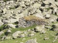
Very close to the largest boulder, visible from a distance, between the Col d’Aoube and the Col d’Oncet, stands a stone hut—now in ruins, with only the roof remaining—nestled amongst the boulders. The ascent to the pass follows the right-hand side of the valley (north), via a series of closely spaced hairpin bends, along a clearly visible path, though without any signposting. Reach the Col d’Aoube (2,369 m).
(3) From here, you can see the Pic Crémat very clearly, which you are about to climb (not quite to its summit, but almost). You can see the Crémat-Merlheu Ridge, with the Pic de Merlheu. At the far end of the Vallon du Laquet (named after the stream that flows there), you can make out the Lac Bleu below, at 1,954 m.
As you ascend, head north-west initially to avoid the first rocky outcrop below the pass, then follow the switchbacks up towards the summit, which is clearly visible on the right. The final stretch of the ascent follows roughly the ridge line between the pass and the summit.
(4) At the summit of Pic Crémat, at 2,630 m, a cairn marks the summit point. Behind the ridge lies a dizzying drop down to Lac de Peyrelade, 700 m below! Further on lies the Lesponne Valley. To the right lies the magnificent Pic du Midi de Bigorre, rising to 2,876 m, with Pène Blanque at 2,743 m situated between it and us.
Leave the pass heading south-south-west, then follow the top of a rocky outcrop as you head westwards.
Go round the south side of a rocky outcrop that is difficult to climb down without equipment and is somewhat exposed, then return to the ridge. Follow this ridge line to the next summit, the Esquio d’Asou at 2,600 m. Continue along the ridge, passing several gaps in the rocky ridge line, including that of the Pénitent (a stone column 5–6 m high). Reach the Pic de Merlheu at 2,636 m.
(5) Its summit is slightly flatter than the ridge line followed from the Crémat. A 360° view across the entire Pyrenees.
To the south, in the foreground, you can make out Lac des Coubous at 2,064 m, with the Néouvielle Massif in the background. Still in the background, further to the right, all the 3,000-metre peaks of Gavarnie are visible, if visibility is good, as well as the Brèche de Roland (2,807 m) and the Doigt de la Fausse Brèche (2,944 m), situated 30 km away! To the south-west lies the Vignemale Massif, with its highest peak, the Pique Longue, at 3,298 m. A little further west, the Balaïtous rises to 3,144 m.
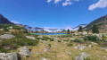
But the ‘highlight of the show’ remains Lac Bleu and Lac Vert, barely 1.5 km away. The setting formed by the Cirque du Lac Bleu is a marvel, with the Pène deth Pouri at 2,587 m to the south, the Aiguillettes at 2,399 m to the west, the Pic de Bizourtère at 2,311 m to the north-west, and the long Vallon du Lhécou, which leads up to Lac Bleu from Le Chiroulet to the north.
Leave the summit heading north, at almost a 90° angle to the ridge line you have already followed. Continue along a less exposed ridge line, with gentler western and southern slopes. Follow the curve of this ridge until you reach an impassable rocky saddle at an elevation of 2,230 m.
(6) Then descend to the left over grassy slopes and rocky outcrops to the path visible at the bottom of the Vallon du Laquet.
(7) Once past the rocky outcrops, head south-west, then south, to reach the bottom of the valley and rejoin the Tourmalet–Lac Bleu summer path. Just before a 90° bend to the north, leave the path and take a small track on the left which climbs the rocky hillock, where an old EDF rain gauge from the mid-20th century stands.
At the summit, there is a view overlooking the nearby Lac Bleu and Lac Vert. Leave the outcrop to the east and descend towards Lac Vert, but without approaching its shores. Reach a junction situated on the stream flowing from the Lac Vert spillway.
(8) Continue westwards, partly along the path and partly across the grassy areas, to reach another promontory overlooking Lac Bleu. Then descend to the eastern shores of Lac Bleu, following the valley floor along a path that circles the lake clockwise. This marks the end of the route.
(9) To return, follow the path back to the shores of Lac Vert, heading roughly due east.
(8) Go round Lac Vert to the right (south) and continue due east along clearly visible tracks, sometimes on paths marked on the map, sometimes across the grassy areas. Leave the two shepherds’ huts at Lac Vert far to your right. Pass close by, or make a detour to, several old stone huts, ‘cuyalas’ and ‘leytès’, which are practically derelict. This will take you to the path running west of the Pic de Bédéra (2,513 m), leading to the pass not marked on the map, the Col de Bédéra.
(10) Head into the valley, climbing up the right-hand bank of the valley floor. Reach the Col de Bédéra (2,404 m).
(11) The descent from the south-facing pass is steep but not exposed and perfectly manageable for ordinary walkers (which is not the case in winter, when there is snow). Head down towards Lac de la Lahude, hidden behind a small promontory, which you go round to the west via its spillway, through an area of interlocking boulders.
Then head south-west into the Ruisseau de la Mousquère ravine, a narrow corridor combining boulders and a stream, but with a clearly visible track on the left bank. Leave the ravine towards the 1,970 m mark by following the visible track on the left-hand side: this is the current marked route; see the warning in the ‘Difficulty’ section of the ‘Practical Information’ section below. Two alternative routes are also possible: continue through the ravine to the plateau at 1,940 m or even further down to around 1,800 m.
Make your way to the Cabanes d’Aoube via paths and descents across the grassy slopes. Head roughly eastwards along one of the many tracks leading to the car park. The marked route will cross the Pla de Monhaillat and Montaquéou.
(12) Pass by the fountain. Continue south-west until you reach the Altisurface path. Cross it, passing by the top of the Toue ski lift at 1,935 m. Return to the junction with the outbound path near the memorial stone.
(1) Take the track leading to the car park (S/E).
 Visorando Member

 Difficult


 Moderate