


 Country:

 City:


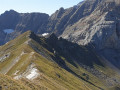

Each day includes detailed practical information.
Day 1: Explore the Cirque de Gavarnie and its remarkable Grande Waterfall. Hike along the little-used ledges.
Overnight stay at the Refuge des Espuguettes for thisfirst day to get into the swing of things!
Day 2: The big day: ascent of the Pimené (2,801 m). Magnificent descending ridge. Ascent of the exceptional Tuquerouye Couloir. Overnight stay at the refuge.
Day 3: Return from Tuquerouye to Gavarnie via the Hourquette d’Alans.
Circular loop of 3 days between Gavarnie, Pimené and Tuquerouye


This route is a 3-day circular route with 2 nights in mountain huts.
Day 1: Explore the Cirque de Gavarnie and its remarkable Grande Waterfall. Hike along the little-used ledges.
Overnight stay at the Refuge des Espuguettes for thisfirst day to get you up to speed!
Day 2: The big day: ascent of the Pimené (2,801 m). Magnificent descending ridge. Ascent of the exceptional Tuquerouye Couloir. Overnight stay at the mountain hut.
Day 3: Return from Tuquerouye to Gavarnie via the Hourquette d’Alans.
Details
Creation:
Last update:
Last review:
-
 Activity: Walking
-
 Distance: 19.68 mi
-
 Average duration: 3 days
-
 Difficulty: Very difficult
-
-
 Back to start: Yes
-
 Ascent: + 8,763 ft
-
 Descent: - 8,783 ft
-
-
 Highest point: 9,098 ft
-
 Lowest point: 4,439 ft
Photos


Stages of the route
This route needs several days, find the details below:
Notes
This route passes through a protected area, which may be subject to special regulations:
Worth a visit
Each day’s itinerary details the sights to see or activities to enjoy during the hike or in the surrounding area.
Reviews and comments
5 / 5
Based on 1 review
Reliability of the description
5 / 5
5 / 5
Ease of following the route
5 / 5
5 / 5
Route interest
5 / 5
5 / 5

Belif
Hello,
I’d like to do this route as a 2.5-day, 2-night camping trip.
For those of you who know the area or have done this hike, do you know if there are any nice spots to pitch a tent?
Thanks in advance 
Machine-translated

MCTOUL
Hello,
Day 1: author’s time = 4 hours, Visorando time = 6 hours 30 minutes
Day 2: author’s time = 4 hours, Visorando time = 6 hours 20 minutes
Day 3: author’s time = 4 hours, Visorando time = 3 hours 50 minutes
The author’s times include breaks for photos, snacks and coffee or beer at the Refuge des Espuguettes! For the first two days, these times are on the short side…
Doing it in 8 hours is certainly possible – if anyone has done it – but that’s not how I approach the mountains.
The Refuge des Espuguettes requires a booking during the season. The Refuge de Tuquerouye does not; you need to arrive there very early.
Day trip option no. 3: descend on the Spanish side and do the Balcon de Pineta
Kind regards
Machine-translated
Odre
Hello,
One user says they completed the circular route in 8 hours – admittedly by running – but could the author specify how many hours it actually takes to walk the route without taking any shortcuts? It’s hard to picture the difference between 3 days and 8 hours.
Thank you
Machine-translated
Clément-34
Overall rating : 5 / 5
Date of your route : Aug 05, 2020
Reliability of the description : ★★★★★ Very good
Ease of following the route : ★★★★★ Very good
Route interest : ★★★★★ Very good
Very busy route : No
I completed all three stages in a single day, jogging downhill and walking at a brisk pace uphill. Spreading the hike over three days is a good idea if you’re not used to long hikes or if you’re in a group.
I followed the GPS track on my watch and it seemed accurate.
As a guide:
- Actual walking time: 6 hours (1 hour 45 mins + 2 hours 45 mins + 1 hour 30 mins)
- Total duration: 8 hours
The first stage of the route can be shortened (this is particularly worth doing if you’ve already done the Brèche de Rolland route).
Stage 2 is superb, taking in the Pic du Piméné and then the couloir leading to the Tuquerouye refuge, which is truly impressive. You need to be very careful, as the author of the guide clearly points out. I think this is the most interesting of the three stages.
Stage 3 is pleasant, but you need to take great care when descending the Tuquerouye couloir.
Many thanks to the author of this guide.
Machine-translated
Other walks in the area
Gavarnie to the Espuguettes Refuge
 Visorando Member
 7.16 mi
+3,868 ft
-1,677 ft
6h 40
 Difficult
 Departure from Gavarnie (Hautes-Pyrénées)
Day 1The Cirque de Gavarnie needs no introduction; it is a monument, a cathedral, a colossus.The route via the Plateau de Bellevue allows you to discover it from this remarkable vantage point.The path running along the slopes of the Bosquet Long adds an element of excitement, allowing you to appreciate it in all its splendour, whilst offering a tranquillity not found on the better-known routes.The return route along the ledge on the right-hand side takes you back to the Refuge des Espuguettes, where you’ll spend the first night.
Cirque Gavarnie par le Plateau de Bellevue et Bosquet Long
 7.53 mi
+2,228 ft
-2,231 ft
5h 25
 Moderate
Departure from Gavarnie (Hautes-Pyrénées)
The Cirque de Gavarnie needs no introduction, it's a monument! The passage through the Plateau de Bellevue offers a wonderful viewpoint. Without snow, the path running along the side of the Bosquet Long heights adds an extra element of excitement, allowing you to appreciate it in all its splendour and tranquillity, which is not possible on the more well-known variants. The more classic return route allows you to cross the very pleasant La Prade plateau, as well as meeting other people.
⚠️ Hiking is prohibited from 1 November to 30 April. Once the quiet zone is in place, using this route between (4) and (5) constitutes a violation of National Park regulations. This is a category 4 offence under: R.331-65 3° — "Deliberate disturbance of the peace in the core area of the National Park" (€750 fine).
⚠️ DOGS PROHIBITED
See other prohibitions in the practical information section.
Please check with the Gavarnie Tourist Office before setting off: +33 (0)5 62 92 49 10.
Gavarnie waterfall with return via the Cirque du Pailla
 7.27 mi
+2,156 ft
-2,142 ft
5h 15
Moderate
Departure from Gavarnie (Hautes-Pyrénées)
Hike in the most famous cirque in the Pyrenees. Return via the path leading to the Cirque du Pailla, which allows you to avoid the crowds and gain height to enjoy this magnificent place from a different perspective.
Cirque de Gavarnie via the Plateau de Bellevue
 6.95 mi
+1,450 ft
-1,470 ft
4h 25
Moderate
Departure from Gavarnie (Hautes-Pyrénées)
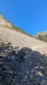
Walk to the Cirque de Gavarnie, staying above the Plateau de Bellevue, aptly named.
⚠️ Hiking is prohibited from 1 November to 30 April. Once the quiet zone is in place, using this route between (4) and (7) constitutes a violation of National Park regulations. This is a category 4 offence under: R.331-65 3° — "Deliberate disturbance of the peace in the core area of the National Park" (€750 fine).
⚠️ DOGS PROHIBITED
See other prohibitions in the practical information section.
Please check with the Gavarnie Tourist Office before setting off: +33 (0)5 62 92 49 10.
The Taillon
12.76 mi
+6,680 ft
-6,706 ft
6 hrs
Very difficult
Departure from Gavarnie (Hautes-Pyrénées)
The summit of the Taillon as seen from Gavarnie, via the Brèche de Roland refuge.
From Gavarnie to the Col de Tentes via the Cabane des Soldats
 6.01 mi
+2,979 ft
-223 ft
5h 20
Moderate
Departure from Gavarnie (Hautes-Pyrénées)
A very beautiful walk that takes in a variety of very different sections of trail. The spectacular view from the Bellevue plateau – which certainly lives up to its name – is particularly memorable: the Marboré, the Pics de la Cascade, the Tour and the Casque, the great waterfall, with the Hôtellerie du Cirque at its base.
Refuge du Pailha circular
 5.94 mi
+1,388 ft
-1,385 ft
3h 55
Moderate
Departure from Gavarnie (Hautes-Pyrénées)
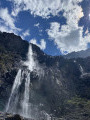
A magnificent circular hike that allows you to climb to a high altitude without too much difficulty and arrive at a refuge guarded by very friendly people. The return journey takes you along a path carved into the rock, offering splendid views.
The Cirque de Gavarnie via the ledges
 7.19 mi
+2,313 ft
-2,306 ft
5h 20
Moderate
Departure from Gavarnie (Hautes-Pyrénées)
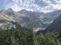
This trail is much less frequented than the main path and offers more views of the cirque along most of its length.
⚠️From 1 November to 30 April, and as soon as the quiet zone is established, using the route between 4 and 5 constitutes an offence under the National Park regulations: a 4th category offence under: R.331-65 3° — "Deliberate disturbance of the peace in the core area of the National Park" (€750 fine)."
⚠️ DOGS ARE NOT ALLOWED between 2-3-4 and 5.
Please check with the Gavarnie Tourist Office before setting off: +33 (0)5 62 92 49 10.
For more walks, use our search engine .
The GPS track and description are the property of this route's author. Please do not copy them without permission.

