Ascent and circuit of Mont Caume

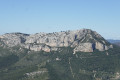
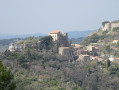
Perched at an altitude of 801 m, Mont Caume is one of the four ‘Toulon brothers’ that frame the city. Above all, it is the highest; its summit is very barren as it is highly exposed to winds and the vagaries of the weather. All these features make climbing it a must and well worth the effort. The suggested walk takes you almost all the way round it.

Details

45824560
Creation:
Last update:
Last review:
  • Walking
    Activity: Walking
  • ↔
    Distance: 7.81 mi
  • ◔
    Average duration: 6h 20 
  • ▲
    Difficulty: Difficult

  • ⚐
    Back to start: Yes
  • ↗
    Ascent: + 3,107 ft
  • ↘
    Descent: - 3,107 ft

  • ▲
    Highest point: 2,621 ft
  • ▼
    Lowest point: 1,289 ft
  • ⚐ Country: France
  • ⚐ City: Évenos (83330)
  • ⚑
    Start/End: N 43.170465° / E 5.888144°
  • ❏
    IGN map(s): Ref. 3346OT
  • Hour-by-hour weather

Description of the walk

The route starts from the Col du Corps de Garde car park in the commune of Évenos.

(S/E) Take the path that winds its way through the undergrowth of kermes oaks and a few pines, behind the green fire tank (see photo 17813). The path, which is quite narrow despite being well-used, climbs steeply. Its signposting is haphazard and outdated: green markings on the ground and blue markings (spray-painted, likely traces of a trek, but not a recent one). However, there is no risk of going astray, as there are no junctions with other paths, except at the 660-metre mark (see below).

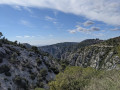
(1) At the 660-metre mark, an optional detour: turn left (see photo 17832) onto a tiny trail that heads west. The aim is to reach the point directly above the Trou des Fées and enjoy a remarkable view stretching as far as the Calanques of Marseille. Quite soon, the path meets the rocky ridge. Behind a rocky outcrop slightly higher up to the right of the path lies the crevice through which you must pass. The path is marked by a cairn – make sure you spot it (otherwise, you can simply scramble up the ridge anywhere; it’s not dangerous).

Once on the rocky ridge, there is no longer a path, just scree and piles of rocks. Walk generally due west.

(2) A pine tree with a large broken branch hanging down to the ground may serve as a landmark to help you return via the same route. At the edge of the cliff, use the map to locate the exact spot directly above the Trou des Fées. However, you cannot see this hole from up here.

(3) Follow the same route back to the main path without any particular difficulty.

(1) You’ve now completed five-sixths of the climb. Turn left. The final section takes you through more varied vegetation, characteristic of the Mediterranean maquis at this altitude.

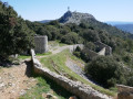
(4) You reach the ridge of Mont Caume via a small road linking the western fortified structure with the main access road. The walk takes you past all the former military and civilian sites over a distance of just over 1 km, as virtually all of them are now freely accessible.

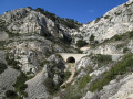
The route therefore first takes you to the end of the Western fortification and to the summit of “Caume Ouest”, listed as 753 m above sea level. Then take the path that starts at the rear of the western fortification, runs alongside the northern fortifications, passes close to a roofless storehouse, crosses a ditch via a metal footbridge, and then heads downhill towards the four reinforced concrete casings.

(5) Pass the junction for the return route. Continue straight on. Then keep going straight along the small road which continues to climb towards the summit of Mont Caume at 801 m.

(6) Look out for the start of the return path on the right and carry on. Walk past the old firing platforms, now concreted over, and a platform with a former underground store completely sealed off by a metal door. The route leads to the eastern fortified structure, on “Caume Est”, at an altitude of approximately 730 m. Old, heavily rusted metal signs mark the former boundaries that were once off-limits to the public. This is no longer the case today.

Walk along the walls of the disused fortified structure, which features a large number of loopholes, some of which are dummy ones. Continue along the road as it climbs.

(7) Take a hairpin bend on the right that heads eastwards and reach a terrace overlooking Le Revest and its dam. Shortly afterwards, on the right, you’ll find the staircase leading up to the heights of the “Caume Est”. Head all the way east to a small, dilapidated former civilian antenna relay building. Then take the track to the north which, within the old fortified enclosure, leads to the summer forest fire watchtower. Climb the steps and go round the building.

(8) On the small ridge, you’ll find the official summit, marked here by a triangular cast-iron marker with sides measuring 11 cm. It bears the inscription in relief: “Institut Géographique National – Point Géodésique – Ne pas détruire”. You are indeed at the summit. However, there is no indication of the altitude. You’ll find the altitude elsewhere, a little further down.

Head back down the ridge towards the ruined and walled-up buildings. Walk alongside them to the south. At the eastern end of the buildings, there is a courtyard walled in on three sides. On the far wall, the following is still inscribed (though for how much longer is anyone’s guess, as the letters are barely legible): “Mont Caume Station – Altitude 800 m”. To get back down to the road, don’t take any risks by jumping off the very high wall; instead, make your way back to the eastern end. Take this opportunity to go down into the completely enclosed courtyard at the entrance to one of the underground ammunition depots.

Then turn right onto the small road leading to the entrance to the compound housing the large metal tower for civilian antennas and relay stations. But there’s no question of going in here. Go round the wire-mesh fence to the south to reach “the other 800-metre summit”, on which the bases and remains of the old radio communication tower still stand.

Then head back down to the road, taking care to avoid the old barbed-wire fences. Once on the road, make your way to the start of the downhill path.

(6) This start point, on the right-hand side of the road (as you head uphill), is marked by a warning sign for paragliders, fixed to the safety barrier. Climb over the barrier. You can see, below, some steps cut into the slope and the path winding its way through the bushes. Just before the first steps, you’ll pass an old vaulted cistern buried beneath the road (you can see the frame of its former small door).

Go down the steps (there is a paragliding launch site here) and begin the descent along the path. In fact, this is a buried France Télécom cable, covered with metal plates or concrete throughout. Be careful, the slope is steep! This ‘path’ bypasses the official route shown on the map and, above all, allows you to avoid the tarmac road.

Once you reach a hairpin bend at elevation 572 (along with a second paragliding launch site), don’t miss the path which takes a 90° turn to the left (towards the east) and heads into fairly low scrub.
As you climb slightly, pass the 616-metre mark, then continue towards the cliffs of the Bau du Midi. The route passes just below a high-voltage power line running up to the summit of Mont Caume.

Caution: the route becomes difficult to follow from here!
Unfortunately, from here on, there is no proper path. Progress becomes difficult through the vegetation for about 10 minutes. Look out for a rocky spur; you’ll pass to the left of it.

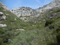
(9) Once past this spur, further difficulties lie ahead! You must now climb up the rocky flank of a ravine (including the eastern ridge of the Bau du Midi, whose dizzying cliffs plunge down into the Revest valley). There is still no properly marked path, even though it is clearly shown on various maps. Use a small pass as your landmark (which, as it has no name on the map, I shall refer to as the Collet du Mont Caume).

The route passes through this small pass, almost on the boundary between the municipalities of Évenos and Le Revest. On this rocky slope, once you have passed the last cairns guiding you over the bare rock, it is better to make fairly rapid progress whilst climbing up the bottom of the ravine (to the left, to the west) beneath Caume Est, rather than over the rocks on the eastern slope – which, although clear and seemingly easier, become more difficult due to overly dense vegetation a little further up.

(10) At the small Mont Caume pass, you’ll easily spot a hunters’ watchtower perched in a tree. Turn right, heading north-east, for a few metres, then you’ll soon find on the left the open path that leads into the undergrowth to go round Mont Caume to the north (whilst further north-east, the path continues towards the cliffs, passing by the karstic cave of Mont Caume).

Our path gradually winds its way into tall, fairly dense scrub. It’s not easy to follow the trail. There are still no signposts. You’ll need to keep your bearings: the map, the sun, the Mont Caume tower and… the Visorando app on your smartphone!

(11) Fortunately, just north of Mont Caume, this path (shown as a dotted line on the IGN map) joins a wider path (shown as a solid line) at elevation 607. To the right, this path continues towards the Fontaine Saint-Martin. Turn left. Continue the descent and the walk round the massif without difficulty.

Shortly after the 517-metre mark, the path joins another path. To the right, the path leads to La Rouge and Robœuf. Continue to the left to reach a junction of several paths at the 453-metre mark.

(12) The wide path is blocked by a gate marked ‘chasse gardée’. Unless you are accompanied by a member of the hunting society, you cannot continue the walk beyond this point.
Head due east along a path skirting the edge of the Siou Blanc Massif, carefully following the cairns and the route marked on the app. Climb up to the summit of Mont Caume via its northern face.

(5) Reach the junction from the outward journey, on the ridge, at the eastern end of Caume Ouest. Continue straight on for about ten metres until you reach the tarmac road. Turn left onto the road as it descends and reach the junction from the outward journey.

(4) Follow the same path as on the way out, without passing the large pine tree (2), and return to the car park at the starting point (S/E).

Waypoints

  1. S/E : mi 0 - alt. 1,289 ft - Car park at the - Col du Corps de Garde (391m)
  2. 1 : mi 0.91 - alt. 2,169 ft - Crossroads
  3. 2 : mi 1.03 - alt. 2,238 ft - Large pine tree with branches lying on the ground
  4. 3 : mi 1.1 - alt. 2,073 ft - Vertical drop at the Trou des Fées
  5. 4 : mi 1.47 - alt. 2,352 ft - West Fort route, on the left
  6. 5 : mi 1.83 - alt. 2,346 ft - Crossroads on the way back
  7. 6 : mi 2.36 - alt. 2,487 ft - Start of the downhill path
  8. 7 : mi 2.52 - alt. 2,543 ft - Bend to the right
  9. 8 : mi 2.73 - alt. 2,618 ft - Mont Caume (804m)
  10. 9 : mi 3.89 - alt. 1,916 ft - Foot of the rocky spur
  11. 10 : mi 4.27 - alt. 2,323 ft - Hunters’ hut - Collet du Mont Caume
  12. 11 : mi 4.74 - alt. 1,991 ft - Junction
  13. 12 : mi 5.9 - alt. 1,486 ft - Crossroads
  14. S/E : mi 7.81 - alt. 1,289 ft - Car park at the - Col du Corps de Garde (391m)

Notes

I’ve rated this hike as ‘difficult’ because in several sections you have to make your way without any landmarks, on very steep slopes, through vegetation that is sometimes very dense (including thorny plants, typical of Mediterranean vegetation). These challenges mean it’s hard to imagine this as a leisurely family outing… That was also the original idea behind making it a challenging hike!

You must bring a map (and, if possible, a GPS or the Visorando app on a smartphone or iPhone).
The time given includes numerous photo breaks, the detour (as described) directly below the Trou des Fées (optional) and a detailed exploration of all the fortified structures.

Make sure you bring plenty of water! Hiking boots are essential. Sturdy clothing (jeans and a top covering your arms – nothing you’d mind getting a bit dirty).
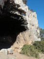
A cave can provide shelter if you head up to the left of the path (around the 560-metre mark, 15 minutes after setting off). There are numerous shelters at the summit of Mont Caume in case of bad weather, but none on the way back.

The exact altitude of Mont Caume varies between 800 and 804 metres depending on the source.

alternative route:
It is not impossible that a shorter alternative route exists between waypoints (8) and (10)... Who will give it a go?

Worth a visit

From the summit, you can see for several tens of kilometres in all directions.
In good weather, you can easily see the coastline from the Calanques of Marseille all the way past the Îles d’Hyères. Inland, at the foot of Mont Caume, you can see the Roboeuf farm and a pond fed by the Destel (which then flows into the Reppe, in the Gorges d’Ollioules). Beyond that lies the Siou Blanc massif. To the west, the entire Sainte-Baume range is clearly visible. To the east, you can see as far as the Alpilles, particularly in winter when they are snow-capped and the weather is perfectly clear.
It is easy to see why its commanding position, close to the naval port of Toulon, served for centuries as a strategic vantage point.
Whether or not you’re interested in military history, one cannot help but be amazed by the efforts that must have been made in the 19th century to build these two small fortified structures and the three gun emplacements – totalling nine platforms – at the summit of Mont Caume (between 1887 and 1890). There are also all these fortifications, barracks, quarters, underground ammunition shelters and dozens of ammunition storage tunnels near the gun carriages. One cannot help but spare a thought for the hundreds of men garrisoned here, in this austere, isolated place, which must have been freezing in winter.
In return for their time spent here, however, they were rewarded with the most remarkable view of the Mediterranean coast.
The military presence remained active throughout the early 20th century but was abandoned shortly after the end of the Second World War.
Whilst the site is now freely accessible, you must remain vigilant as it has not been decontaminated. A great deal of waste – both metal and construction debris – litters the ground and the areas around the defence positions. Please take care when moving around these areas.

The site is of significant ecological interest. Mont Caume features a rocky habitat that supports numerous animal and plant species. There are many publications and websites covering these topics, and I encourage you to have a look at them before your hike!

Furthermore:
On the eastern face, you can reach the Aven du Mont Caume. 116 metres deep and 100 metres long, its entrance is quite wide (2 x 1.5 metres) and leads to a 110-metre-deep shaft. This karstic cave is only accessible to experienced cavers. You emerge quite a distance away via another entrance.

On the north face of Mont Caume, you can see the Trou des Fées. 66 metres deep, its entrance is shaped like a large archway. It features a 51-metre shaft with two entrances. I was unable to reach its entrance in February 2015, as the vegetation had completely overgrown the paths leading to it from the base of the cliff. As the cliff is not very steep, it might be possible to access it from there. If any Visorandonneur knows how to get there, please let us know in the comments section for this hike!

There are a great many other paths for exploring the southern and, above all, the northern faces. The northern flank must be particularly pleasant in summer, as the undergrowth is very damp in winter, receiving little sunlight.

We cannot conclude this chapter without mentioning the particularly large number of wild boars in the massif. With a bit of luck (as I had), you’ll spot several; a hunting association uses its land to build up the population.

At the summit of Mont Caume, you may also spot a fairly large herd of goats, grazing or resting in complete freedom in the wild. Some of the females and the male have remarkable pairs of horns!

So, happy hunting… for interesting sights on this walk!

Reviews and comments

3.7 / 5
Based on 4 reviews

Reliability of the description
4 / 5
Ease of following the route
3.5 / 5
Route interest
3.5 / 5
User 27777600

Overall rating : 5 / 5

Date of your route : Nov 10, 2025
Reliability of the description : ★★★★★ Very good
Ease of following the route : ★★★★★ Very good
Route interest : ★★★★★ Very good
Very busy route : No

Machine-translated

Bernadette13
Bernadette13

Hello Marc,
I don't blame you, not for something so minor. We'll go back. We found the "real" coordinates for the hole on a caving website, and we'll try to reach it from another side if possible. In any case, it's a 60-metre vertical karstic cave, so we can't go down into it. It's just curiosity. And then we'll do your entire hike.
Thank you, best regards.
Bernadette

Machine-translated

MCTOUL
MCTOUL

Hello Bernadette13,
The Trou des Fées is not the destination of this hike, as its title clearly indicates.
The description clearly states that the trail does not lead to this cave, but to the cliff above a rocky outcrop, from where you cannot see the entrance to the cave. Once you have this information, it is up to you to decide whether or not to make the 5-minute detour.
Turning back because you didn't read the description is a shame and disappointing, but I hope you don't hold it against me, the author...
Next time, do the whole hike, you won't be disappointed by the joys of the trail and the view at the top!
Best regards

Machine-translated

Bernadette13
Bernadette13

I would just like to comment on the location of Trou des Fées. It is not where it is marked on the IGN map! So, after following the route described by the author as best we could, navigating unstable stones and sharp limestone pavement rocks (watch your ankles!),... we saw NOTHING! A difficult, pointless and disappointing round trip.
So disappointing that we stopped the hike there and returned to the car.

Machine-translated

MCTOUL
MCTOUL

Hello Vincent,
“A poorly maintained path that’s difficult to follow”,
OK. But haven’t you been a bit too harsh with your rating?
Kind regards

Machine-translated

Vincent.dauphin
Vincent.dauphin

Overall rating : 2.3 / 5

Date of your route : Dec 09, 2024
Reliability of the description : ★★★☆☆ Average
Ease of following the route : ★★☆☆☆ Disappointing
Route interest : ★★☆☆☆ Disappointing
Very busy route : No

A poorly maintained path that is difficult to follow

Machine-translated

MCTOUL
MCTOUL

This route is based on a previous one that formed a circular loop around Mont Caume: after (12), it continued through the hunting grounds until it reached (E) the Col du Corps de Garde. After 10 years of being published on Visorando, I had to remove this final section and find another way to avoid retracing my steps entirely. Of course, any walker who doesn’t want to make this U-turn to the north could simply head back the same way they came!

Thank you, however, for your comments; I have improved the route description
Kind regards

Machine-translated

Yul83
Yul83

Overall rating : 3.7 / 5

Date of your route : Apr 22, 2024
Reliability of the description : ★★★★☆ Good
Ease of following the route : ★★★★☆ Good
Route interest : ★★★☆☆ Average
Very busy route : No

Hello,
As for the climb up Mont Caume, there are no particular problems; this part of the walk is well worth the trip and the effort. However, as for doing the northern loop via the east, this section is of very little interest apart from adding a few extra kilometres.
It would be worth pointing out that the descent from point 6 is very, very steep – bordering on dangerous. We cut across to the bottom of this descent via the road. But from there, as mentioned above, the walk takes us through very dense, thorny scrub, which is of little interest, just like the rest of the walk up to point 12.
I can confirm that the route between points 9 and 10 is difficult to follow...

Machine-translated

MCTOUL
MCTOUL

OK, thanks!
It’s true that between (9) and (10), the trail is a bit tricky to follow… But it doesn’t take very long!
And I’d note that between (12) and (5), you need to stay alert, keeping a close eye on the cairns… and the GPS track.

Kind regards

Machine-translated

oxford7583
oxford7583

No problem.
I’d already done the circuit in the opposite direction to the one indicated.
From the summit, I descended via the very steep track, then headed east to rejoin the track; there’s no vegetation, so wearing long trousers is definitely recommended.
I then came to an area with lots of vegetation and small scree slopes; that’s when I strayed from the track for the first time, between points 9 and 10.
I then got back on track, which took me to the hunters’ camp. From there, I followed the marked path, which was very shaded. No problems.
Between points 10, 11 and 12, there were no problems.
From point 12, I headed up towards the summit to reach point 5.
On this section, I lost the trail once despite the markers. You cross a rocky area, but at one point you have to turn off to the left and it’s not easy to find the trail again.
I hope this helps
Kind regards

Machine-translated

MCTOUL
MCTOUL
• Edited:

Hello oxfort7583,
Thank you for your feedback.
As you are the first visitor to this route since it was republished with modifications, could you tell me a little more about the difficult sections of the route?
Best regards

Machine-translated

oxford7583
oxford7583

Overall rating : 3.7 / 5

Date of your route : Apr 22, 2024
Reliability of the description : ★★★★☆ Good
Ease of following the route : ★★★☆☆ Average
Route interest : ★★★★☆ Good
Very busy route : No

A lovely walk, but be careful not to stray from the track. You absolutely must use the app and the GPS track, as I lost the path twice – there are few markings on the ground, the signposts have been destroyed and there’s a lot of vegetation covering parts of the path.
I couldn’t find the way to the Fairy Cave.
Suitable for experienced walkers.

Machine-translated

Other walks in the area

For more walks, use our search engine .

The GPS track and description are the property of this route's author. Please do not copy them without permission.