Winter ascent of Pic d’Aygues-Cluses from Tournaboup

This winter hike follows the charming Vallon d’Aygues-Cluses, passes close to the hut and refuge of the same name, then climbs up the ridge separating the Massif du Néouvielle, until it reaches the Hourquette Nère.
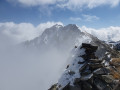
The icing on the cake is the final ascent of the Pic d’Aygues-Cluses, a beautiful but fairly technical peak at an altitude of 2,620 metres (this is optional).
You will be entering the Néouvielle National Nature Reserve, which is protected by regulations. Please respect these regulations (see practical information).

Details

n°20784360
Creation:
Last update:
Last review:
  • Snowshoeing
    Activity: Snowshoeing
  • ↔
    Distance: 11.33 mi
  • ◔
    Duration according to the author: 8 hrs 
  • ▲
    Difficulty: Very difficult

  • ⚐
    Back to start: Yes
  • ↗
    Ascent: + 3,973 ft
  • ↘
    Descent: - 3,963 ft

  • ▲
    Highest point: 8,517 ft
  • ▼
    Lowest point: 4,774 ft

Photos

Description of the walk

Head to the car park at the Tournaboup ski resort via Barèges (65). Arrive early (in both summer and winter) to secure a space.

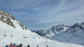
(S/E) From the car park, cross the D918 and make your way through the resort buildings towards the bottom of the slopes, taking care to walk alongside them rather than on them. Early in the morning, this shouldn’t be a problem. Later in the morning, it’s best to go round the ski school’s nursery and follow the stream. Head up towards the south-east, keeping the small wood on your right and staying on its edge.

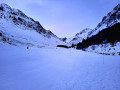
(1) Leave the bend at the Pont de la Gaubie car park (1,528 m) below on your right. Then generally follow the track (closed in winter), which is more or less covered in snow , or theGR®®10. On the other side of the stream, you’ll catch sight of the Cabanes de la Gaubie, a group of dry-stone buildings (see the ‘During the hike: Pastoralism’ section below).

The path is overlooked by the magnificent Soum de la Piquette (2,324 m), which is usually the only peak bathed in sunshine early in the morning. Turning round, you can also admire, on the other side of the car park, the ridge running from left to right from the Pic d’Ourdégon (2,436 m) to the Pic Bédéra (2,513 m), passing via the Soum de Moutarra, the Col des Pêcheurs and the Pic de Barbe.

Head for the 1,640 m mark, where the two paths meet. Continue along the Ruisseau des Coubous until you reach the Pountou footbridge.

(2) Cross the footbridge (1,740 m). You will soon reach the signpost (1,741 m). Turn left, heading due east, towards the Cabane d’Aygues Cluses. High up on the right in the distance, you can clearly see the pass that separates this long valley – which is fairly gentle in its lower reaches but very steep towards the end – from the plateau and the hollow in which Lac dets Coubous is nestled. You will return via this lake and valley at the end of the circular route.
Head up the valley of the Ruisseau d’Aygues Cluses. The path runs very close to the stream, on the left bank.

(3) Still on the left bank, at an altitude of 2,041 m, pass the reservoir and sluice gate which supplies Lac dets Coubous via a 2-kilometre underground penstock; you will pass by the lake on the way back.
Shortly afterwards, the track emerges from the woodland onto a very beautiful and vast, undulating plateau, leading via numerous routes to the Cabane d’Aygues-Cluses.

To the right in the distance, beyond the scattered mountain pines amidst the snow cover, if you look up you’ll be struck by the Pic and Crête de la Touatère (2,530 m), an imposing rocky massif, completely snow-covered in the depths of winter. In the distance ahead, blocking the horizon, lies the ridge stretching from the Pic d’Aygues-Cluses to the Pic de Gourget, with the Col de Barèges, another pass leading to the Néouvielle Nature Reserve.

(4) Stop at the hut, or walk past it, or make use of a rock jutting out of the sea of snow to take a break. It’s been two and a quarter hours since we left Tournaboup. It will take another two hours to climb to the peak.

Most of the tracks left by skiers and a few snowshoers head south-east towards the Col de Barèges. You may find yourself breaking trail from here! Head north-east across the Lac de Couela Gran, reach the Lac d’Agalops (both invisible in good snow conditions), then head east-south-east towards the Hourquette Nère, the first stage of the route. Stay at the bottom of the valley to begin with, then gradually climb up the left-hand slope, making your way up in short, numerous switchbacks… Reach the Hourquette Nère.

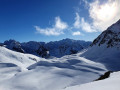
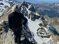
(5) Take in the already magnificent scenery at your feet! The whole of the Néouvielle Massif lies before you!
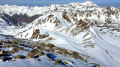
It’s not over yet; the final stretch is gruelling: there’s still a fairly difficult 155 m of elevation gain to cover, across snow-covered rocks and ledges that you’ll need to scale using your hands on numerous occasions.

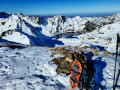
(6) The Pic d’Aygues-Cluses finally reveals itself! From up there, words are no longer enough to describe the beauty all around… A large cairn emerges from the layer of snow (still plentiful enough that day, despite the already spring-like conditions). The return journey follows roughly the same route back to the Refuge d’Aygues-Cluses.

(4) Either follow exactly the same tracks or, as described here, head further to the right, leaving the refuge on your left, then follow the course of the Ruisseau de Coueyla Gran down to just below the reservoir.

(3) Then take the same path as on the way out, but in the opposite direction, to return to the car park (S/E).


Waypoints

  1. S/E : mi 0 - alt. 4,774 ft - Tournaboup
  2. 1 : mi 0.68 - alt. 5,049 ft - Parking Pont de la Gaubie
  3. 2 : mi 1.65 - alt. 5,722 ft - Footbridge at the - Aygues Cluses (ruisseau) - Affluent du Coubous
  4. 3 : mi 3.44 - alt. 6,690 ft - Reservoir
  5. 4 : mi 4.13 - alt. 7,067 ft - Cabane d'Aygues Cluses (2150m)
  6. 5 : mi 5.58 - alt. 8,074 ft - Hourquette Nère
  7. 6 : mi 5.9 - alt. 8,517 ft - Pic d'Aygues-Cluses (2620m)
  8. S/E : mi 11.33 - alt. 4,777 ft - Tournaboup. Near the - Bastan (cours d'eau) - Affluent du Gave de Gavarnie

Notes

Regulations concerning the Néouvielle National Nature Reserve:
• Dogs are not permitted in the core zone of the Pyrenees National Park, even when kept on a lead
• Dog boarding facilities – enquiries at Aragnouet Town Hall – Tel: 05 62 39 62 63
• No open fires, to prevent fires and soil damage
• Please keep quiet to preserve the peace and tranquillity of the area
• Please bring bin bags with you to take your rubbish back down
• No picking or collecting of plants, minerals or fossils is permitted
• Capturing animals is prohibited
• Regulated camping is permitted more than an hour’s walk from a road access point, between 7 pm and 9 am
• No camping or overnight parking of motorhomes to preserve the beauty of the sites and prevent pollution
• Hunting and fishing are prohibited

This description relates to a solo hike undertaken in spring (April 2022) in moderate, old snow. Naturally, there are no visible paths or markings! Most of the route will follow either tracks left by previous skiers or snowshoers, or a GPS track.

Only attempt this route if you are fully proficient in snowshoeing or ski touring.
This hike can also be undertaken in summer, following roughly the same route and staying – as far as possible – on the paths, which are then clearly visible throughout.

Estimated time
I completed this route on snowshoes in 7 hours 30 minutes, including breaks and a picnic. This is a fairly tight estimate. Allow between 8 and 9 hours 30 minutes. In summer, allow 7 hours.

Difficulty
I have rated it as ‘Difficult’ in winter due to the length and elevation gain of the route, the steep sections at the start (5) and the fact that the route is unmarked. It is a fairly challenging hike.
In summer, the rating is ‘Moderate’.
The IBP (Intelligent Benchmark Prediction) index is 130HKG, which corresponds to a ‘Very Difficult’ route for a walker with ‘Average’ fitness.

Water sources
- In winter, when there is snow, streams can be used as water sources without too much risk. However, allow for 1 litre of cold water per person and 1 litre of hot water in a thermos flask per person.
- In summer, there is a known spring at Lake Coueyla Gran (4). The safety of other springs or runoff water cannot be guaranteed, due to grazing livestock. Allow 2.5 litres per person.

Shelters
Only the Aygues Cluses Refuge and Cabin (4) can serve as permanent shelters along the route.
Please note that in summer, these are very busy at night.

Equipment
- In summer, bring standard mid-mountain hiking kit: hiking boots, suitable clothing, rainwear, water, food, a survival blanket, a knife, a compass, a map and a whistle.
- In winter when there is snow, you must also bring snowshoes, a pair of poles, gaiters, sun cream, lip balm, a GPS or the Visorando app on your smartphone, gloves, suitable warm clothing, a flask with a hot drink, a hat, and sunglasses suitable for the glare off the snow. Some will also bring an avalanche transceiver (DVA), a shovel and a probe. On this route, crampons and an ice axe are essential, except on Variant 2 where the ice axe is optional.

Traffic
- In winter, when there is snow, you’ll see plenty of tracks left by ski tourers or snowshoers all the way to the Cabane d’Aygues-Cluses (4) and you’ll come across quite a few people. However, depending on the day you choose and the weather, you may then find yourself on your own all the way to the summit.
- In summer, the route is very busy as far as the Cabane d’Aygues-Cluses (4), but less so beyond that point via the Col de Barèges.
Whatever the season, don’t forget to let your friends and family know your exact route and keep them updated on any changes via text message or phone call.

Snowshoes + poles or crampons + poles or crampons + ice axe
If you’re setting off early in the morning in the middle of winter, it will probably be more comfortable to use crampons as high up as possible (up to 2,000 or 2,100 metres). Walking in crampons is virtually the same as walking in boots, with the added advantage of being able to safely navigate small flat sections or gentle icy slopes, and especially narrow, overhanging sections of hard or icy snow.
When putting on crampons on flat ground or gentle slopes, you keep your poles. As soon as the gradient exceeds 15 to 20 per cent, snowshoes and poles are stowed away and securely fastened to your rucksack, and you use the ice axe. Using an ice axe requires a good level of skill, particularly in the event of a fall or when descending.

Météo-France Mountain Bulletin and Avalanche Risk Assessment Bulletin (BRA or BERA)
Check the weather forecasts, particularly the Météo-France snow and avalanche bulletin for the Haute-Bigorre massif in the Hautes-Pyrénées. A call to the Haute-Montagne Gendarmerie unit may also put your mind at rest.

Avalanche-prone areas
There is little risk on these slopes. The only slope in the north-western sector may present a risk, depending on the BERA risk assessment checked before setting off and the current snow depth. You must keep a watch out for any cracks, which may be precursors to an avalanche or snow slide. If there are several of you, you must maintain safe distances.

TheGR®® andPR®® markings are the intellectual property of the French Hiking Federation.

Worth a visit

Pastoralism
In the summer pastures of the high Béarn-Bigourdan valleys, shepherds built dry-stone huts, known as ‘capane’, with a rectangular layout. Situated in the centre of a dry-stone enclosure where the sheep spent the night – known as ‘cueilas’, ‘cuyalas’ or ‘courtaous’ – these huts are now often in ruins. Source: Wikipedia.
The huts at La Gaubie are in fairly good condition and are still in use.

Place names
Source: ‘La mule et l’intello’ blog. Many thanks to him!
Translations with the help of Pierre Salles, an excellent commentator on France-Bleu Béarn.
Barèges: ßa’RƐdjə The little (?) valley. The (Latin) etymology is rather disputed, but seems nonetheless unavoidable. The root comes from the Latin ‘vallem’ and the suffix most likely comes from the Latin ‘-eticam’,…perhaps a diminutive (?)
‘Barège’ (actually ‘Varètge’) is the name of the valley. The commune bearing this name did not come into being until the 20th century: at the instigation of Urbain Cazaux, a member of the valley’s departmental council and president of the French Ski Federation, the entire eastern section of the land that had previously belonged to the commune of Betpouey was separated from it to create the new commune.
The place had already been given this name due to the great renown of its thermal baths (cf. their imperial clientele): it was originally referred to as ‘the baths of (the valley of) Barège’, then (in Paris!) this was shortened to ‘Barèges’ to refer, in effect, solely to these thermal baths. This name has stuck.
Aygues-Cluses ’aigəs ’clusəs Most certainly ‘closed waters’, ‘hidden waters’ (Latin etymology). The torrent that flows down through the upper part of the valley then disappears into ground composed of piled-up granite boulders, so that the lower part of this valley has no stream. Medieval troubadours referred to ‘trobar clus’ as a genre of poetry whose deeper meaning could only be revealed to those who had been given the keys to understand it, whilst remaining hidden from others. Reconstructed spelling: aigas clusas.
Ets Coubous e(t)s ku’bus. Most likely: sinkholes and resurgences. Etymology probably pre-Latin. We are very close to Aygues-Cluses and in the same type of terrain. Only this time, it is in a place where water disappears in some spots and resurfaces in others. Reconstructed spelling: Eths cobós.
Tournaboup: Other places in the valley bear this name. The only possibility: a compound word made up of ‘torna’ (‘it returns’, ‘it turns’) and ‘vo(l)p’, the fox. Literally, therefore: ‘Turning fox’. But again, why? This (Latin) etymology is, after all, rather uncertain, and distortions may have occurred over the centuries. Reconstructed spelling: Tornavop.
Néouvielle Massif: in Gascon: ‘nèu’ (snow) and ‘vielha’ (old, ancient).

Variants
At the summit of the Pic d’Aygues-Cluses (6), you can choose to descend via a circular route through the Col de Barèges, snow conditions permitting.

Always be cautious and plan ahead when you're outdoors. Visorando and the author of this route cannot be held responsible for any accidents occurring on this route.

The GR® and PR® markings are the intellectual property of the Fédération Française de Randonnée Pédestre.

Reviews and comments

4.7 / 5
Based on 1 review

Reliability of the description
5 / 5
Ease of following the route
4 / 5
Route interest
5 / 5
Nonop
Nonop

Overall rating : 4.7 / 5

Date of your route : Jul 05, 2024
Reliability of the description : ★★★★★ Very good
Ease of following the route : ★★★★☆ Good
Route interest : ★★★★★ Very good
Very busy route : Yes

I’ve had a very good experience with the Visorando app.
I particularly appreciate its user-friendliness

Machine-translated

MCTOUL
MCTOUL
chamois
chamois

IBP = Intelligent Benchmark Prediction?

Machine-translated

Other walks in the area

For more walks, use our search engine .

The GPS track and description are the property of this route's author. Please do not copy them without permission.