The Aiguillettes du Lac Bleu via the Chiroulet and Col de Bareilles

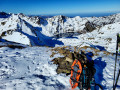
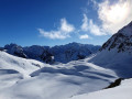
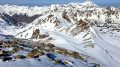
A very beautiful winter round-trip hike, allowing you to discover the splendid Lac Bleu de Lesponne in winter beneath its layer of pristine snow and ice, then the Col de Bareilles and its view of the lake, the Lesponne Valley and the Pène det Pouri, and finally the Aiguillettes septentrionales (2,367 m), which are the most easily accessible peaks for winter alpine hiking. Whilst the total elevation gain is considerable, there is nothing to stop you stopping at each of the notable points along the way.

Please note: this hike requires you to monitor snow conditions before and during the route and therefore demands an excellent knowledge of the mountains in winter.

Details

n°33767945
Creation:
Last update:
Last review:
  • Snowshoeing
    Activity: Snowshoeing
  • ↔
    Distance: 6.86 mi
  • ◔
    Duration according to the author: 10 hrs 
  • ▲
    Difficulty: Extremely difficult

  • ⚐
    Back to start: Yes
  • ↗
    Ascent: + 4,308 ft
  • ↘
    Descent: - 4,318 ft

  • ▲
    Highest point: 7,759 ft
  • ▼
    Lowest point: 3,484 ft

Photos

Description of the walk

Via Bagnères-de-Bigorre, Beaudéan, then the Lesponne Valley, head for the hamlet of Le Chiroulet, where the D29 road ends, on the left bank of the Adour de Lesponne.
Here you’ll find a few houses, a wayside shrine, a small hydroelectric power station, a restaurant called Ô Chiroulet that’s open almost all year round, and a car park for around thirty cars.

(S/E) Walk round the back of the restaurant, taking a wide track.

(1) Cross a small bridge. Just before the hydroelectric power station on the left, take a wide path on the right which passes through a lovely clearing before heading into the woodland. The path is clearly marked in yellow and signposted towards Lac Bleu.

Winding its way up the mountain in numerous hairpin bends, the path leads through the Bois de Pouzac, between the Ruisseau de Lhécou and the penstock coming from the reservoir at an altitude of 1,271 metres. Unless there is snow, do not cut across the hairpin bends!

(2) Pass this reservoir and continue the ascent through the Lhécou valley. Depending on snow conditions, the path may not be visible. In that case, follow previous tracks or use your GPS.

(3) At around 1,520 m, the path and this route take you along the left bank of the Lhécou.

(4) Just before the footbridge at 1,669 m, where the path crosses the Lhécou again to return to the right bank, take the off-trail ascent up the western couloir (rather than the climb via the summer path up the eastern couloir), turning right towards the south-west up the slope. This very steep couloir (700 m at a 46 per cent gradient) is in the sun from daybreak, unlike the other one (and is less prone to snow slides).

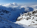
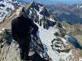
Climb up this long, wide couloir beneath the unnamed summit at 2,105 m, the end of the Crête de Bizourtère. This couloir faces due south and resumes its ascent after a short, level stretch. At around 1,940 m, you reach a short plateau which, turning south-east, leads to the huts and the shores of Lac Bleu de Lesponne (1,977 m). The view of the lake, its basin and the surrounding peaks is worth the trip in itself!

(5) Here, there are two options depending on the condition of the lake.
- If the lake is frozen and in good condition (usually from December to March), continue along the route as marked, crossing the lake’s ice to the west to reach the base of the Couloir de Valma (not shown on the IGN map), a couloir descending to the south-east of the Col de Bareilles.
- If the lake is unfrozen or the ice is unsafe, it is better to climb up the rocks and then, via an ascending traverse, reach the snow, which is firm enough to support your weight, and continue the traverse to reach the valley’s alluvial fan (or take the summer path 60 metres above lake level).

(6) At the bottom of the couloir, at elevation 2008, do not look for the Cabane de Bareilles – nothing remains of it. Start up the slope of this very attractive, fairly steep couloir (27–41 per cent gradient) facing south-east to north-west. Reach the Col de Bareilles at 2238 m.

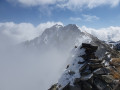
(7) Snow cornices are common; the best route is generally to the north of the pass at around 2,250 m. Then take the south-south-west ridge which climbs up towards the Aiguillettes at 2,367 m (gradient 33 per cent). Reach the summit of the Aiguillettes.

Take care on the final few metres of the ascent! “Depending on the snow conditions reported on weather websites (see § Practical Information) and those assessed on site, the summit may be covered by an unstable layer, consisting of a snowpack visible on the surface and a void beneath it, creating a risk of the snowpack sliding and causing a snow slide or avalanche. Keep an eye out for cracks, ‘whale’s mouths’ and any other signs of an impending slide. The slopes are steep and long all the way to Lac Bleu to the south-east or to the Lesponne Valley and the Cabane d’Ourrec to the west!
In this case, do not venture as far as the summit!''

In winter, the ridge between each of the Aiguillettes peaks is then difficult to traverse without equipment (see section ‘During the hike’).

(8) The return journey follows the same route or an alternative route to this one. Head for the Col de Bareilles.

(7) Then the debris cone of the Couloir de Valma.

(6) Head for Lac Bleu.

(5) Do not follow the tracks from the ascent. Head south-east towards the Pas de Bouc on the left bank of the lake’s spillway, the Ruisseau du Lhécou. Cross the bridge, then take the path with its high retaining wall (walk between the wall and the cliff, where in summer you walk on the wall) and begin the descent into the Lhécou valley. Follow the tracks left by previous skiers and snowshoers, or find your own way intuitively down the snow-covered slopes. Head towards the footbridge at 1,669 m, then the hairpin bends at 1,600 m.

(4) Continue the descent and head for Chiroulet (S/E) via the reverse route of the outward journey.

Waypoints

  1. S/E : mi 0 - alt. 3,517 ft - le chiroulet
  2. 1 : mi 0.06 - alt. 3,494 ft - Small bridge over the - Adour de Lesponne (rivière)
  3. 2 : mi 0.85 - alt. 4,193 ft - Reservoir
  4. 3 : mi 1.66 - alt. 4,954 ft - Lhécou Crossing
  5. 4 : mi 1.89 - alt. 5,269 ft - Junction
  6. 5 : mi 2.43 - alt. 6,401 ft - Lac Bleu de Lesponne
  7. 6 : mi 2.77 - alt. 6,585 ft - Bareilles cone of debris junction
  8. 7 : mi 3.28 - alt. 7,375 ft - col de bareilles
  9. 8 : mi 3.57 - alt. 7,759 ft - Northern peak of the Aiguillettes du Lac Bleu
  10. S/E : mi 6.86 - alt. 3,504 ft - le chiroulet

Notes

This description relates to a hike undertaken as a pair in early February 2023, when snow cover was below the usual average.
Above 1,500 metres (which was the only elevation reached, due to the specific conditions at that time), no tracks, paths or signposting were visible! Most of the route will follow the description accompanied by a GPS track, or even follow in the tracks of previous skiers or snowshoers.
In winter, only attempt this route if you are fully proficient in snowshoeing or ski touring, and in the use of crampons and an ice axe in high-mountain terrain.

Parking at the start
There is a proper free car park, though it is quite busy, even in winter. Parking properly shows respect and consideration for those who will be parking there later in the day.

Estimated time
We completed this route in 10 hours, including breaks and a picnic (3 hours), setting off from the car park at 10.30 am. This is well above average; we took our time… Allow between 7½ and 9 hours.
2 hours 45 minutes to climb from Le Chiroulet to Lac Bleu, almost entirely using crampons, walking poles and an ice axe.
1 hour to climb to the Col de Bareilles.
Three-quarters of an hour to climb to the Aiguillettes.
2 hours 30 minutes to descend.

Difficulty
This hike is classified as Extremely Difficult due to the significant elevation gain, exposed sections between Montagne de Maïloa and Bizourtère, very steep sections between (3) and (5), the lack of signposting, and high-mountain conditions. This is a challenging route, reserved for experienced mountaineers, but anyone can adjust the difficulty by stopping along the way.
In summer, the difficulty rating would be Medium.
The IBP Index is 138 HKG (with or without snow), which corresponds to a route of ‘Medium’ difficulty for a hiker with a high level of fitness, or ‘Very Difficult’ for one with an average level of fitness.
The classification of the entire hike according to the Swiss Alpine Club’s guidelines is T6: Difficult alpine hike.
The mountaineering grade for the ridge is F: Easy (no harness or ropes required), although it is exposed.

Water sources
There are no sources of drinking water along the route.
- In winter, when there is snow, streams can be used as water sources without too much danger. However, allow for 1 litre of cold water per person and 1 litre of hot water in a thermos flask per person.
- In summer, springs, lakes, rivers or runoff water are not guaranteed to be safe to drink. Allow 1.5 litres per person.

Shelters
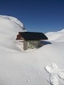
The Cabane du Lac Bleu (5) makes an excellent shelter for both day and night.

Equipment
- In summer, bring standard high-mountain hiking kit: hiking boots, suitable clothing, rainwear, water, food, a survival blanket, a knife, a compass, a map and a whistle.
- In winter when there is snow, you must also bring snowshoes or touring skis, a pair of poles, gaiters, sun cream, lip balm, a GPS or the Visorando app on your smartphone, gloves, suitable warm clothing, a flask with a hot drink, a hat, and sunglasses suitable for glare off the snow. Some people will also take an avalanche transceiver (DVA), a shovel and a probe. Crampons and an ice axe are essential equipment on this route.

Visitor numbers
- In winter, when there is snow, Lac Bleu is not very busy, attracting mainly ski tourers rather than snowshoers, as the ascent to Col Bleu is reputed to be perilous. The ascents to Col de Bareilles and Pic de Bizourtère are even less frequented. The ascent of the Aiguillettes is rarely undertaken, even though it is not technically demanding.
- In summer, the route to Lac Bleu and Col de Bareilles is fairly busy.
Whatever the season, don’t forget to let your friends and family know your exact route and inform them of any changes by text message or phone call.

Snowshoes + poles or crampons + poles or crampons + ice axe
In the depths of winter, in the morning, it may be easier to use crampons than snowshoes or skis. Indeed, walking in crampons is almost identical to walking in ordinary shoes, with the added advantage of being able to safely navigate small flat sections or gentle icy slopes, and above all narrow, overhanging sections of hard or icy snow.
When putting on crampons on flat ground or gentle slopes, you keep your poles. As soon as the gradient exceeds 15 to 20 per cent, the snowshoes and poles are stowed away and securely fastened to your rucksack, and you use the ice axe. Using an ice axe requires a good level of skill, particularly in the event of a fall or when descending.

Check the weather forecast, particularly the snow and avalanche bulletin from Météo-France for the Haute-Bigorre massif in the Hautes-Pyrénées.

Avalanche-prone areas
This section of the route is known to be prone to avalanches, at the end of the Combe du Lhécou, below the Montagne de Maïloa. Only venture there when the risk is low or if avalanches have previously occurred and you know how to interpret the signs.

If, on your route or on the map you are using, you notice any errors in signposting or place names, you can become a contributor and report them:
- marking errors, safety issues, conflicts of use, environmental concerns: click here.
- mapping errors, place names: click here.

Worth a visit

Lac Bleu
Lac Bleu is often referred to as Lac Bleu de Lesponne, named after the valley in which it is situated, to distinguish it from the other Lac Bleu lakes in the Pyrenees.
It is situated in the Hautes-Pyrénées department, south-east of the commune of Beaucens, on the border with the commune of Bagnères-de-Bigorre. Covering an area of 51 ha², it is 120 m deep, making it the deepest lake in the Pyrenees

La Cabane du Lac Bleu WP (5) https://www.pyrenees-refuges.com/fr/affi...

Alternative routes
- In summer, do not take the western corridor on the ascent to Lac Bleu and do not cut across the hairpin bends on either the ascent or the descent; instead, stay on the marked paths.

- At the WP (7) Col de Bareilles, you can easily reach the Pic de Bizourtère (2,311m), with a climb of just 73m

- On the return journey, after the WP (7) at Col de Bareilles, you can choose to descend into the Combe du Lhécou via a path cut through the Crête de la Bizoutère.

- On the return journey, after the waypoint (7) at the Col de Bareilles, you can choose to descend via the hut and Lac d’Ourrec. This is a much longer circular route, very steep at the start, but well worth the detour.

- You can choose to do this route without ascending via the avalanche-prone Combe du Lhécou, but via Lac d’Ourrec instead.

Place names
- Lac Bleu was previously known as Lac de Lhecou ( lyécou), from the Pre-Celtic word ‘lheco’, meaning ‘large stone’ or ‘flat stone’. This name has been retained by the torrent that once served as the lake’s outlet.
However, other interpretations suggest that Lac Bleu was formerly known as Lac d’Ilhéou or Lac de Lhéou, and that it lost this name during the 19th century. In the 1907 Joanne guidebook, it was still listed under its dual name, Lac Bleu or Lhéou. Lac d’Ilhéou or Lac de Lhéou derive from the Gascon words ‘iou’ and ‘héou’, meaning ‘lake’. It is therefore ‘the lake of the lake’, which makes it a tautology, a repetition.

- Lesponne comes from the Latin *sponda*, which in Gascon became *espou* or *espona*, meaning ‘edge’, ‘rim’ or ‘steep slope’. The Lesponne Valley would therefore be the ‘valley of the edge’ or the ‘valley of the steep slope’.

- The Pic de Bizourtère comes from the Gascon word ‘besurt’, which is the Gascon name for the bird-catchers’ rowan. This peak does indeed overlook the Bois de Bizourtère, a forest in the Chiroulet where many bird-catchers’ rowans grow.

Reviews and comments

5 / 5
Based on 1 review

Reliability of the description
5 / 5
Ease of following the route
5 / 5
Route interest
5 / 5
User 9792226

Overall rating : 5 / 5

Date of your route : Jul 27, 2026
Reliability of the description : ★★★★★ Very good
Ease of following the route : ★★★★★ Very good
Route interest : ★★★★★ Very good
Very busy route : Yes

Starting from the Chiroulet car park, heading towards the Blue Lake and then on to the Col de Bareilles circular hike; a lovely hike in summer

Machine-translated

Other walks in the area

For more walks, use our search engine .

The GPS track and description are the property of this route's author. Please do not copy them without permission.