Country:

 City:
City:


Head to the car park at the Tournaboup winter sports resort via Barèges (65). Arrive early (in both summer and winter) to secure a space!
(S/E) From the car park, cross the D918 and make your way through the resort buildings at the bottom of the slopes, taking care to walk alongside the slopes rather than on them. Early in the morning, this isn’t a problem. Later in the morning, it’s best to go round the ski school’s nursery and follow the stream. Head south-east, leaving the small pine copse on your left as you take the road (closed in winter) which is more or less covered in snow; cross the Pont de la Gaubie, pass the building on your right and reach the “Pont de la Gaubie” junction.
(1) Turn right towards the south and then generally follow theGR®®10trail. On the other side of the stream, you’ll catch sight of the Cabanes de la Gaubie, a group of dry-stone buildings (see section ‘Sights : Pastoralism’ below).
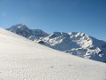
The path is overlooked by the magnificent Soum de la Piquette (2,324 m), which is usually the only peak bathed in sunshine early in the morning. Turning round, you can also admire, on the other side of the car park, the ridge running from left to right from the Pic d’Ourdégon (2,436 m) to the Pic Bédéra (2,513 m), passing via the Soum de Moutarra, the Col des Pêcheurs and the Pic de Barbe.
Continue along the Ruisseau des Coubous until you reach the Pountou footbridge. Cross the footbridge (1,740 m). You will soon come to a signpost (1,741 m).
(2) Turn left, heading due east, towards the Aygues Cluses hut and refuge. To the right, high up in the distance, you can clearly see the pass that separates this long valley – which is fairly gentle in its lower reaches but very steep towards the end – from the plateau and the hollow in which Lac dets Coubous is nestled. You will return via this lake and valley at the end of the circular route. Head up the valley of the Ruisseau d’Aygues Cluses. The track runs very close to the stream, on the left bank.
Stay mainly on the left bank. At the 2041-metre mark, you’ll reach the reservoir and sluice gate, which are connected via a 2-kilometre underground penstock to Lac dets Coubous, which you’ll pass on the way back.
(3) Continue straight on close to the bed of the Ruisseau de Coueyla. Shortly afterwards, the path emerges from the woodland onto a very beautiful and vast, undulating plateau, leading via numerous routes to the Refuge d’Aygues-Cluses.
To the right in the distance, beyond the scattered mountain pines amidst the snow cover, if you look up you’ll be struck by the Pic and Crête de la Touatère (2,530 m), an imposing rocky mass, completely snow-covered in the depths of winter. You can’t see it, but at the end of this ridge lies the Col de Tracens, which you’ll take to enter the Vallée des Coubous (after the Pic de Gourguet).
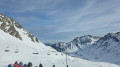
(4) Most of the skiers’ tracks head south-east towards the Col de Barèges. Leave theGR®®10and head south-east. Pass either close to or just past the Cabane d’Aygues-Cluses, the only accommodation available before the Refuge is built in 2023.
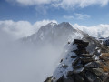
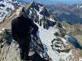
(5) Carry on and then pass the 2,295-metre and 2,368-metre marks (following the summer path to the Col de Barèges) and 2,368-metre mark (leaving the path). Continue the steep ascent that now lies ahead, passing close to a small lake. On the left is a small, unnamed peak at 2,537 m, between the Col de Barèges and the Pic de Gourguet. Head for the saddle to the left of the summit at around 2,570 m. Turn right onto the broad ridge that winds round the cirque below the Gourguet and reach the summit. From there, depending on weather conditions, there is a 360° view of the surrounding peaks and the lakes of the Néouvielle National Nature Reserve.
(6) The return journey follows the same route back to the Aygues-Cluses refuge.
(4) Head south-west as you leave the refuge, following the winter trail (marked blue on the IGN map) and any tracks left by skiers or snowshoers, heading towards the Madaméte Lakes. You will then zigzag along the thalweg of an invisible snow-covered stream flowing down from Lac d’Aygues-Cluses. The slope is quite steep. You’ll have to work your way round rocky outcrops and crooked pines to forge a path without being able to see your destination at all, for about 400 m.
On a flat stretch, head south-west towards Lac d’Aygues Cluses, which can be made out in a hollow. At around 2,200 m, the winter track leading to or from the Col de Tracens branches off to the right. It can be difficult to spot this junction without a GPS.
(7) Leave the track leading to the Col de Madaméte, which passes by the Lacs de Madamète, and turn right, climbing steeply. Reach the northern shore of Lac de Madamète (2,299 m).
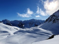
(8) Cross the lake if ice and snow conditions permit. If in doubt, do not attempt it and instead go round it to the west. For the ascent, it is better to stay further south than the winter track (marked blue on the IGN map, which is more suited to the descent). There is a magnificent view of the Pic de Tracens (2,551 m) to the right ahead and, above all, of the Col de Tracens (2,463 m) a little further to the left. To the left, the ever-present Pic d’Estibère and the majestic Pic de Madaméte! Continue roughly due west, through a landscape that looks completely lunar (were it not for the snow...).
The ascent continues through a landscape of small valleys, with numerous steep sections and gentle slopes where you can catch your breath. You’ll reach the final few metres of ascent before the pass with a bit of effort. Climb the final section beneath the impressive peaks of the Pic de Tracens (2,551 m), heading for the beautiful gap.
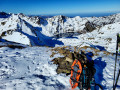
(9) Reach the Col de Tracens (2,463 m), a magnificent vantage point overlooking the Vallon des Coubous and its countless lakes (especially in winter, when everything is blanketed in snow), as well as all the surrounding peaks. This is the final high point before descending to complete the circular route. Even in winter, this pass is a fairly busy thoroughfare at weekends, as it lies on a route well known to ski tourers. But outside weekends and school holidays, even in glorious weather, you may find yourself all alone in the world!
If there are tracks, follow them; otherwise, head slightly further south-west to begin the descent safely, rather than following the winter track (marked ‘Blue’ on the IGN map). Below the pass, join the summer path coming from the Pic de Madaméte, the‘PR®®’ trail. In the distance, ahead and to the left, you can see the Cirque des Sept Lacs, including Lac des Coubous, bordered by the majestic ridges of La Mourèle and Lurtet. Then head west; the slope remains steep, sometimes requiring you to avoid descending straight down the slope.
(10) Shortly after the 2,325 m mark, on a flat section, you can either follow the Blue winter trail via Lac Nère to the west, or roughly follow the“PR®®” trail to the north-west, or – between the two – head a little lower down after the small ridge (the route chosen here) into a new small snow-covered valley. Head towards Lac de Tracens (2,190 m) from the east.
(11) Go round it to the east. At the lake’s spillway, make your way north-east of Lac Blanc (it really is white!) and south of Lac de la Jonquère (or Dera Yunco). Watch out for snow bridges in this marshy area in summer; it is very hilly and the route is not obvious if there are no tracks!
(12) At Lac de la Jonquère, head due north to go round Lac dets Coubous to the east; the lake only comes into view quite late, as it lies in a deep hollow. When you spot it, you’ll also see its dam and, at its north-western end, a hut: the Cabane dets Coubous.
(13) Go round the lake to the east, crossing the dam. Reach the dam pass at 2,045 m.
(14) The final descent takes place down a very steep, north-facing slope, which is likely to be in the shade for much of the day (known as ‘le mur dets Coubous’). Begin the descent from the pass. On the right, pass right by the entrance to the underground tunnel and its SHEM gate (not shown on the map). Adjust your descent route according to snow conditions, possibly avoiding all or part of the hairpin bends on the summer path, which are completely hidden if there is a substantial depth of snow in the depths of winter. Cross the Ruisseau dets Coubous via a footbridge. Head back to the signpost you saw this morning at Pountou, then on to the footbridge over the Ruisseau d’Aygues Cluses (1,740 m).
(2) Return to the morning’s path and head back to the car park (S/E).
 Visorando Member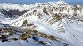
 Difficult
 Moderate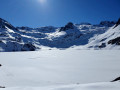
 Extremely difficult