


 Country:

 City:


Head towards the Bastan Valley via Luz-Saint-Sauveur. Pass through the village of Barèges and continue for 3 km on the D918. You’ll reach the car park at the Tournaboup ski resort. If the D918 is open beyond this point, continue uphill towards the Tourmalet. The road runs alongside a ski run called ‘Bastan’. Drive as high up as possible to Super-Barèges or Les Cabanes de Stouets, the departure points for the Tourmalet chairlift and the Toue and Ourdis ski lifts.
Wherever the road is blocked (which varies depending on the season and snow conditions), park on the roadside. Continue along the road and put on your snowshoes (or skis) as soon as possible. The start of the hike is at the resort buildings.
(S/E) Leave the restaurant and resort buildings on your right and cut across the D918 through the snow-covered grass, heading due south. Make your way to a hairpin bend on the D918 with its crash barrier, which is clearly visible from the ski lift departure points. Stay on the snow-covered road for approximately 200 m.
(1) When the road turns sharply to the left (Source de Labach), leave it and head into the valley opening out to the south. The slope becomes steeper, quickly turning south-westerly. Shortly afterwards, head south-east, setting off below the Pic de Campana, towards the Bat de Barrère valley. A high rocky ridge marks the boundary between this valley and the cirque of this route.
(2) To the south of this ridge, 500 m after leaving the road, turn right (south-south-west; do not continue straight on towards the Vallon de Bat de Barrère). Climb, leaving the Pic de Caoubère (2,496 m) and its southern secondary peaks on your right. At around 2,200 m, you’ll reach a fork in the path (not visible on the ground).
(3) From here, there are two options for completing a circular route. The route suggested here ascends on the western side and descends on the eastern side. Head, therefore, south-south-west. Pass over ridges and hollows to reach the western section of the Crête de la Pègue, at around 2,400 m.
(4) Follow the ridge to the left (east) and easily reach an unnamed summit at 2,406 m. Descend east-north-east into a small valley and reach a ledge. Continue along the valley towards the east, reach a small basin and go round it to the north (on the left).
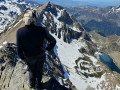
(5) Resume the ascent, heading east then south-east. Reach the eastern end of the Crête de la Pègue, just below the 2,441-metre mark. A gap in the ridge offers a magnificent view of the Vallon d’Aygues-Cluses, the Madamète Lakes, the Col and the Pic de Madamète (2,661 m).
(6) Descend via the same route to the northern edge of the cirque.
(5) Then veer right and descend the cirque heading north or north-north-west. Join the tracks from the ascent at around 2,200 m
(3) Descend roughly along the same route as on the way up, following the dips and ridges to find the best route back to the car park (S/E).
 Visorando Member
 Difficult


 Moderate

