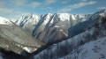
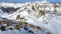
Pic de Pimené in winter from Gavarnie

Whilst the Pimené holds no secrets for any experienced hiker in summer, it is less well-known in winter. It is reserved for experienced walkers, undeterred either by the route’s significant elevation gain, or by the need to cross expanses of pristine snow – which are not always easy to navigate – to reach its base, or by its arduous slopes, and even less so by its final ridge, which is short but tricky. See Practical Information.
But from up there, the winter spectacle makes you forget the summer view: the Cirque de Gavarnie, Mont-Perdu, the Cirque d’Estaubé and much more besides, all cloaked in white!

Details

n°33956777
Creation:
Last update:
–
Last review:
  • Snowshoeing
    Activity: Snowshoeing
  • ↔
    Distance: 7.95 mi
  • ◔
    Duration according to the author: 8 hrs 
  • ▲
    Difficulty: Extremely difficult

  • ⚐
    Back to start: Yes
  • ↗
    Ascent: + 4,665 ft
  • ↘
    Descent: - 4,649 ft

  • ▲
    Highest point: 9,104 ft
  • ▼
    Lowest point: 4,498 ft

Photos

Description of the walk

Part of this description is taken from the summer version of the walk by the same author, described here:
Le Pimené, an exceptional viewpoint over the Cirque de Gavarnie, and part of the winter hiking route by the same author described here: Hourquette d’Alans from Gavarnie and the Espuguettes refuge in winter

Park in the local authority car park on the right on the outskirts of the village, or – before 9.30 am in high season – in the village itself, in one of the private car parks. Both charge €5 per day (in 2019).

(S/E) Finish walking through the village, heading towards the unmissable cirque that rises directly to the south. Cross the Pont Brioule bridge near the gendarmerie and continue along the right bank for about 500 metres. You will reach the junction for the Refuge des Espuguettes, the Hourquette d’Alans and the Barrage des Gloriettes. Yellow signposts indicate all the destinations.

(1) Start the ascent on the left, first alongside the Ruisseau d’Alans, which flows down from the Petit Pimené and the Espuguettes, then through the Bois de Pailla. Although the path is not signposted, it is very clearly marked. On emerging from the Bois de Pailla, at around 1,760 m, just over an hour after setting off from Gavarnie, you can just make out the tip of the roof of the Refuge des Espuguettes, due east. You’ll reach the 1,782 m mark on the vast Pailla Plateau, near a National Park sign (if it’s visible beneath the snow).

(2) Ignore the fork to the right towards the Cabane de Pailla (the ascent towards the Swan Couloir between the two Astazou peaks), and climb the final 250 m up the north-eastern slope, finding the best route to the refuge – for example, via the main summer path, which is usually hidden, or, as shown here, by cutting across the large hairpin bend on the Haute Route Pyrénéenne (HRP) at 1,850 m. Reach the Refuge des Espuguettes at 2,027 m, 1h30–1h45 after setting off from Gavarnie. Part of the refuge remains open all year round.

(3) Continue onto the Plateau des Cardous, where it is rare to find any tracks left by skiers or snowshoers. Follow the Blue winter route on the IGN map roughly due east up to 2,250↓m.

(4) The route then turns north-north-east for about 300 m to reach what will be the junction for the return journey.

(5) Begin a series of hairpin bends below the Col du Pimené and reach the pass.

(6) Follow the ridge, veering slightly to its left at times (i.e. westwards), towards the only peak visible from here, the Petit Pimené.

(7) Reach the summit of the Petit Pimené (2,667 m), already a fine achievement.
Descend due north to the small pass (2,647 m), then resume the ascent of the ridge due north. The slope becomes really steep.

(8) Caution!: after a very gruelling 150 m climb where you’ll need to use your hands and navigate a few exposed sections, you’ll reach the Pimené . On the final metres of the ascent, make sure you stay on the ridge line – that’s where it’s safest!

(8) The descent follows the same route taken on the way up to the Petit Pimené (avoid the passage to the left, east of the Petit Pimené, which is very steep and exposed).

(7) Continue along the ridge almost as far as the Col du Pimené.

(6) Just before the Col du Pimené, head due south to reach the A/R junction.

(5) Then follow the same route as on the way out via the Plateau des Cardous, Les Espuguettes, the Bois de Pailla and the village of Gavarnie (S/E).

Waypoints

  1. S/E : mi 0 - alt. 4,505 ft - Village de Gavarnie
  2. 1 : mi 0.61 - alt. 4,554 ft - Common junction (outward and return) - Gave de Pau
  3. 2 : mi 1.58 - alt. 5,840 ft - Pailha Hut junction
  4. 3 : mi 2.21 - alt. 6,640 ft - Refuge des Espuguettes
  5. 4 : mi 2.91 - alt. 7,441 ft - Leave the summer path – Head up the slope
  6. 5 : mi 3.13 - alt. 7,608 ft - A/R junction – Turn right on the outward journey
  7. 6 : mi 3.37 - alt. 8,146 ft - Col de Pimené (2530m)
  8. 7 : mi 3.8 - alt. 8,707 ft - Petit Piméné
  9. 8 : mi 4.15 - alt. 9,088 ft - Piméné
  10. S/E : mi 7.95 - alt. 4,505 ft - Village de Gavarnie

Notes

This description relates to a hike undertaken as a pair in early January 2023, with snow cover below the usual averages. The altitude at which we put on our crampons was 2,000 m.
Above the altitude of the mountain hut (and only as far as that point, due to the specific conditions at that time), no tracks, paths or markings are visible! Most of the route will follow the description accompanied by a GPS track, or even in conjunction with tracks left by previous skiers or snowshoers.
In winter, only attempt this route if you are fully proficient in snowshoeing or ski touring, and in the use of crampons and an ice axe in high-mountain terrain.

Parking at the start
There are proper car parks, but they all charge a fee; a few free spaces may be available in the village if you arrive early. Parking properly shows consideration and solidarity with those who will be parking later in the day.

Estimated time
We completed this route in 8 hours 30 minutes, including breaks and a picnic (2 hours 30 minutes), setting off from the car park at 10.15 am. This is slightly longer than average; we took our time… Allow between 7 hours 30 minutes and 9 hours.
1 hour 45 minutes to climb up to the refuge (3).
2 hours 30 minutes to Pimené.
2 hours for the descent.

Difficulty
This walk is classified as ‘Very Difficult’ by the author, due to the fairly significant elevation gain, an exposed section on the final ridge, very steep sections between (3) and (7), the lack of signposting, and high-mountain conditions. It is a challenging route, reserved for experienced mountaineers, but anyone can adjust the difficulty by stopping along the way.
In summer, the difficulty rating would be ‘Difficult’ (with the return route being the same).

The IBP Index is 174 HKG (with or without snow), which corresponds to a ‘Difficult’ route for a hiker with a high level of fitness or a ‘Very Difficult’ route for one with an average level of fitness.
The classification of the entire hike according to the Swiss Alpine Club’s guidelines is T6: Difficult alpine hike.
The mountaineering grade for the ridge is F: Easy (no harness or ropes required), although it is exposed.

Visorando’s criteria classify it as Extremely Difficult.

Water sources
There are no sources of drinking water along the route.
- In winter, when there is snow, streams can be used as water sources without too much risk. However, allow for 1 litre of cold water per person and 1 litre of hot water in a thermos flask per person.
- In summer, springs, lakes, rivers or runoff water are not guaranteed to be safe to drink. Allow 1.5 litres per person.

Shelters
The Cabane du Lac Bleu (5) makes an excellent shelter for both day and night.

Equipment
- In summer, bring standard high-mountain hiking kit: hiking boots, suitable clothing, rainwear, water, food, a survival blanket, a knife, a compass, a map and a whistle.
- In winter when there is snow, you must also bring snowshoes or touring skis, a pair of poles, gaiters, sun cream, lip balm, a GPS or the Visorando app on your smartphone, gloves, suitable warm clothing, a flask with a hot drink, a hat, and sunglasses suitable for glare off the snow. Some people will also take an avalanche transceiver (DVA), a shovel and a probe. Crampons and an ice axe are essential equipment on this route.

Visitor numbers
- In winter, when there is snow, Lac Bleu is not very busy, attracting mainly ski tourers rather than snowshoers, as the ascent to Col Bleu is reputed to be perilous. The ascents to Col de Bareilles and Pic de Bizourtère are even less frequented. The ascent of the Aiguillettes is rarely undertaken, even though it is not technically demanding.
- In summer, the route to Lac Bleu and Col de Bareilles is fairly busy.
Whatever the season, don’t forget to let your friends and family know your exact route and inform them of any changes by text message or phone.

Snowshoes + poles or crampons + poles or crampons + ice axe
In the depths of winter, first thing in the morning, it may be easier to use crampons than snowshoes or skis. Indeed, walking in crampons is almost identical to walking in ordinary shoes, with the added advantage of being able to safely navigate small flat sections or gentle icy slopes, and above all narrow, overhanging sections of hard or icy snow.
When putting on crampons on flat ground or gentle slopes, you keep your poles. As soon as the gradient exceeds 15 to 20 per cent, the snowshoes and poles are stowed away and securely fastened to your rucksack, and you use the ice axe. Using an ice axe requires a good level of skill, particularly in the event of a fall or when descending.

Check the weather forecast, particularly the snow and avalanche bulletin from Météo-France for the Haute-Bigorre massif in the Hautes-Pyrénées.

Avalanche-prone areas
This section of the route, at the end of the Combe du Lhécou, below the Montagne de Maïloa, is known to be prone to avalanches . Only venture there when the risk is low or if avalanche runs have occurred previously and you know how to interpret the signs.

Place names
It can be spelled Pimené or Piméné.

If, whilst on your route or whilst using the map, you notice any errors in signposting or place names, you can become a contributor and report them:
- signposting errors, safety issues, conflicts of use, environmental concerns: click here.
- mapping errors, place names: click here.

This route passes through a protected area, which may be subject to special regulations:

Worth a visit

(8) Some useful information about the Pimené:
Less busy than the Brèche route, the Pimené route is a Pyrenean classic that many walkers, skiers and tourists tackle all year round. In summer, you’ll come across children delighted to discover the high mountains in groups or with their families. For some, it’s a revelation. Sourcekorpa.fr/pyreneesecretes

Long known to shepherds, hunters and border guards, the Pimené is the ultimate vantage point for the Gavarnie region and the neighbouring valleys; lookouts could easily spot a lost animal, prey, troop movements or contraband. The first recorded ascent was made by the geographer and mineralogist Henri Reboul and the astronomer and chemist Jacques Vidal in 1787, who had been commissioned to carry out topographical surveys there.
Find out more...

Along the route
Numerous vantage points for taking photos of the surrounding wonders.

Nearby
- The village of Gavarnie and its church,
- The Cirque de Gavarnie, at least as far as the Grande Waterfall, even in winter.
See theGavarnie Tourist Office website.

Alternative route for the descent
Circular route via the Cabane d’Alans, at the end of the Plateau d’Alans (which extends from the Plateau des Cardous). See the Visorando page for the Refuge des Espuguettes and the Plateau d’Alans

Reviews and comments

5 / 5
Based on 1 review

Reliability of the description
5 / 5
Ease of following the route
5 / 5
Route interest
5 / 5
Dcl 31
Dcl 31

Overall rating : 5 / 5

Date of your route : Aug 10, 2026
Reliability of the description : ★★★★★ Very good
Ease of following the route : ★★★★★ Very good
Route interest : ★★★★★ Very good
Very busy route : Yes

A lovely, challenging hike.
360° view

Machine-translated

Other walks in the area

For more walks, use our search engine .

The GPS track and description are the property of this route's author. Please do not copy them without permission.