Pic de Larry and the Ayous Lakes circuit in winter from Gabas

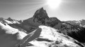
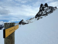
The Pic de Larry is a wonderful winter destination for experienced walkers.
The ascent to the Refuge d’Ayous presents no particular difficulties.
The ascent of the Col de Larry, followed by the peak, is often undertaken off-trail, solo, and over fairly steep slopes. The view is well worth the effort!
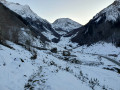
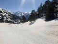
The return route via the Ayous Lakes takes you through an enchanting landscape of forests, vast snow-covered expanses and frozen lakes, all under the constant, imposing watch of the giant of Ossau, the Pic du Midi.

Details

n°12189181
Creation:
Last update:
Last review:
  • Snowshoeing
    Activity: Snowshoeing
  • ↔
    Distance: 15.62 mi
  • ◔
    Duration according to the author: 8 hrs 
  • ▲
    Difficulty: Very difficult

  • ⚐
    Back to start: Yes
  • ↗
    Ascent: + 4,734 ft
  • ↘
    Descent: - 4,728 ft

  • ▲
    Highest point: 7,651 ft
  • ▼
    Lowest point: 3,507 ft

Photos

Description of the walk

Head for the village of Gabas (in the municipality of Laruns) in the Ossau Valley, past Laruns, towards the Col du Pourtalet, the last village before Lake Fabrèges. Park at the bend on the way out of the village or in the car park in the village if there are no spaces available. The start is at the bend just after leaving the village, past the bridge over the Gave de Bious, at 1,036 m.
In winter, the road leading to the Bious Oumette or Bious Artigues car parks is closed to traffic due to the risk of avalanches. It remains closed until late in the winter, even though the risk has virtually disappeared.
(See additional note on parking in the practical information section)

(S/E) Take the path that climbs up after the bridge, clearly marked and signpostedGR®10–GR®108, towards Lac de Bious Artigues and the Tour des Lacs d’Ayous.

(1) The path soon joins the D231, which is closed to traffic in winter. Continue south-south-west along this very pleasant road through the steep-sided gorges of the Gave de Bious.

(2) Carry on along the road. After passing the Bious Oumette car park – which opens in mid-spring – and before reaching a large hairpin bend to the left below the dam, cut across this bend (following the summer trail). Return to the road and follow it to the left.

(3) At the junction, pass the path signposted “SHEM” with an overhead penstock and carry on straight ahead. Go round the eastern tip of Lac de Bious Artigues and reach its car park.

(4) The road ends here; follow the wide track that goes round the lake to the east.

(5) At the junction, at the tip of the Crête de l’Ours, continue along the track (south-west), thus leaving the path that circles the lake to the south. You will then enter a wooded area. Pass by the beautiful Source de Hounrède and continue along the track, which is sometimes earth, sometimes tarmac, and may be snow-covered or even icy. Snowshoes may be required depending on the season. The route climbs steadily. You will reach the Gave de Bious plateau shortly before the Pont de Bious.

(6) Leave the track and turn right (west) onto the path that climbs through the forest. The path climbs steeply and winds its way up in several hairpin bends. You’ll reach the Col Long d’Ayous clearing (there are two shepherds’ huts here). Continue westwards through the clearing. Leave the clearing and head south-west, following theGR®10. At around 1,750 m, with a view of Lac Roumassot (frozen until the end of March), head west.

(7) Pass north of the Roumassot shepherd’s hut and head up alongside the stunning Roumassot Waterfall, which flows down from Lac du Miey.

(8) A steep, challenging climb over boulders and snow—which may be more or less melted or frozen—takes you up to the Lacs d’Ayous plateau (elevation 1,929). Continue westwards, leaving the lakes to the south. In winter, they are completely frozen over and virtually invisible.

(9) North of Lac Gentau, at the junction, a signpost – often invisible in winter – marks the ascent to the Col d’Ayous. Head right (north-west) towards the pass, which cannot be seen (hidden by a false pass signposted further on). It is not uncommon for no track to be visible, as the pass is far less frequented than the Ayous Refuge. The slope quickly becomes steep and it may be necessary to make several switchbacks.

(10) Pass the false pass on the slope and continue westwards.

(11) Reach a flat area and continue westwards. After a short, very steep climb (there may even be a snow cornice below the pass), you’ll reach the Col d’Ayous.
A marker there indicates the summit of the pass, but it is very low and is usually buried under the snow. From this vantage point, there is a magnificent view over both valleys and, in the distance, the Pic du Midi d’Ossau.

(12) Leave the pass and follow the ridge south-west. Reach another ridge at elevation 2241.

(13) Continue southwards. Be careful: after 200 m, the ridge continues due south, with, straight ahead, rocky outcrops that cannot be crossed, either directly or by going round them to the right or left.
Do not wait until you are facing these rock formations. At an altitude of approximately 2,250 m, veer to the right and descend gently into the snow-covered basin along a fairly steep, short, and therefore not very exposed slope that is sometimes stony.

(14) Walk about a hundred metres into the basin, then head back up to the left onto the original ridge via an easy slope. You’ll reach an unnamed summit, which I’ve christened ‘Pic de l’Imposture’ as it gives the false impression that you’ve reached your destination.
Continue south-west and reach the end of the ridge of this Pic de l’Imposture at around 2,250 m. From there, you have a breathtaking view of the Refuge d’Ayous, 400 m below!

(15) Descend easily back into the basin via the same route. Tackle the final section, which isn’t very technical or particularly daunting but is very steep and requires careful attention. Finish heading due south along the ridge line and reach Pic de Larry.

(16) The return route to Lac Gentau follows the same path as the ascent, with a few minor deviations (do not go back via the “Pic de l’Imposture” or the Col d’Ayous). Descend back into the basin.

(14) Return to the ridge to the north.

(13) Descend straight down the slope to the right towards the plateau, without going back over the pass.

(11) At the junction from the ascent, follow your own tracks to the right and reach the false pass

(10) At the steepest part of the slope, leave the ascent track again to descend straight down the slope to the right towards the Ayous Refuge, following the summer path (not visible in winter) shown on the IGN map as soon as possible.

(17) Reach the Ayous Refuge (1,980 m). It is unstaffed during the winter season, but part of it is open, providing accommodation for around fifteen people.

Leave the refuge and take the path to Lac Bersau, 100 metres higher up (2,082 m), heading south-south-west. The start is quite steep!

(18) Reach the shore of Lake Bersau, which may be completely or partially frozen, depending on the season.
Walk along the left bank of the lake, at the foot of the small ridge at 2,103 m.
Reach the small pass between the Pic de Bielle (on the right, 2,314 m) and the magnificent Pic Castérau (on the left, 2,227 m); this is the summer spillway of Lake Bersau. Without following the summer route of the path, head straight down the slope towards Lake Castérau.

(19) Leave Lac Castérau on your left. You will thus skirt round more than a quarter of Pic Castérau. Its southern cliffs are particularly striking. Continue roughly eastwards, following theGR®108more or less closely.

Cross the vast plateau of the Gave de Bious or the Bas des Arazures.

(6) Reach the Pont de Bious, which you passed on the left on the way up.

Then take the same path as on the way there, taking care not to slip on the concrete track, which is often frozen or snow-covered, even late in the afternoon.
Except below Lac de Bious Artigues, where you can take the SHEM penstock path, which saves 10 minutes. During this section, take care not to go the wrong way and be sure to turn off on the descent at the 1385 m mark!
Return to your car in Gabas (S/E).


Waypoints

  1. S/E : mi 0 - alt. 3,507 ft - Gabas
  2. 1 : mi 0.19 - alt. 3,543 ft - D231 road
  3. 2 : mi 1.51 - alt. 4,104 ft - Junction on the circular loop
  4. 3 : mi 2.23 - alt. 4,554 ft - Intersection with a penstock
  5. 4 : mi 2.35 - alt. 4,642 ft - Lac Bious Artigues
  6. 5 : mi 2.85 - alt. 4,701 ft - Junction – Turn left
  7. 6 : mi 3.66 - alt. 5,046 ft - Plateau/Pont de Bious – Turn left on the way there
  8. 7 : mi 5.15 - alt. 6,178 ft - Shepherd’s hut above the - Lac de Roumassot
  9. 8 : mi 5.29 - alt. 6,325 ft - Lac du Miey – Continue westwards
  10. 9 : mi 5.54 - alt. 6,414 ft - Signpost - Lac Gentau
  11. 10 : mi 6.04 - alt. 6,818 ft - Faux-col
  12. 11 : mi 6.34 - alt. 7,100 ft - Flat stretch
  13. 12 : mi 6.39 - alt. 7,162 ft - Col d'Ayous (2188m)
  14. 13 : mi 6.56 - alt. 7,333 ft - Crête du Larry
  15. 14 : mi 6.78 - alt. 7,375 ft - Access to the Pic de l’Imposture
  16. 15 : mi 6.85 - alt. 7,388 ft - Pic de l’Imposture
  17. 16 : mi 7.15 - alt. 7,651 ft - Pic de Larry
  18. 17 : mi 8.28 - alt. 6,457 ft - Refuge d'Ayous (1980m)
  19. 18 : mi 8.9 - alt. 6,841 ft - Lac Bersau
  20. 19 : mi 9.69 - alt. 6,378 ft - Lac Castérau
  21. S/E : mi 15.62 - alt. 3,507 ft - Gabas

Notes

⚠️This route description is based on a solo winter hike (March 2021) undertaken in substantial, long-standing snow cover. From (6) onwards, no path or signposting is visible! For most of the route, you will need to follow the route description accompanied by a GPS track, or even follow in the tracks of previous skiers or snowshoers.
Only attempt this route if you are fully proficient in snowshoeing or ski touring. This is not a route suitable for beginners.
This hike can be undertaken in summer, following roughly the same route and staying – as far as possible – on the tracks and paths, which are clearly visible throughout.

?️Parking at the start
Many winter hikers park their cars in a small car park on the bend of the D934, at an altitude of 1,067 metres, near the Gabas Refuge. They then take the D231 from this car park. However, at this point, the road is closed by a barrier and signs prohibit pedestrian access due to the risk of avalanches. This is why this walk starts from the Pont de Gabas a little further down, even though it then follows the same road; there are no signs there indicating that the route is closed. However, you must remain vigilant in winter regarding the actual risk of avalanches in all the ravines of the torrents that cross the road.

⏰Estimated time
I completed this route on snowshoes in 9 hours, including breaks and a picnic, setting off from the car park at 8 am. This is a fairly tight estimate. Allow between 9 and 10.30 hours. In summer, allow 7–8.30 hours.

?‍♀️Difficulty
I’ve rated it as Difficult due to the length and elevation gain of the route, the steep sections between (9) and (16), and the fact that the route is unmarked. It’s a fairly challenging route where you need to maintain a good sense of direction and keep your cool.
In summer, the rating is Moderate.
The IBP Index (an automated system for assessing the difficulty of a route) is 161 HKG, which corresponds to a ‘Difficult’ route for a hiker with a ‘High’ level of fitness.

?Water sources
- In winter, when there is snow, streams can be used as water sources without too much risk. However, you should allow for 1 litre of cold water per person and 1 litre of hot water in a thermos flask per person.
- In summer, there is drinking water at the Ayous Refuge. The safety of other springs, lakes, rivers or runoff water cannot be guaranteed, due to grazing livestock. Allow 2.5 litres per person.

?Shelters
Only the Ayous Refuge can truly serve as a permanent shelter along the route. However, in an emergency, shelter can be found at any of the huts mentioned.
Please note that in summer, the Ayous Refuge is very busy at night; it is best to book in advance.

?Equipment
- In summer, bring standard mid-mountain hiking kit: hiking boots, suitable clothing, rainwear, water, food, a survival blanket, a knife, a compass, a map and a whistle.
- In winter when there is snow, you must also bring snowshoes, a pair of poles, gaiters, sun cream, lip balm, a GPS or the Visorando app on your smartphone, gloves, suitable warm clothing, a flask with a hot drink, a hat, and sunglasses suitable for glare off the snow. Some people will also add an avalanche transceiver (DVA), a shovel and a probe.

?‍?‍?‍?Trail usage
- In winter, when there is snow, you’ll see plenty of tracks left by ski tourers or snowshoers along virtually the entire route up to the Col de Larry (9). However, depending on the day you choose and the weather, it’s possible to be on your own all day.
- In summer, the route is very busy; it forms part of theGR®10, except for the section from the Col de Larry (12) to the Pic de Larry.
Whatever the season, don’t forget to let your friends and family know your exact route and keep them updated on any changes via text message or phone call.

??Météo-France Mountain Bulletin and Avalanche Risk Assessment Bulletin (BRA or BERA)
Check the weather forecasts, particularly the Météo-France snow and avalanche bulletin for the Haute-Bigorre massif in the Hautes-Pyrénées. A call to the Pierrefite-Nestalas High-Mountain Gendarmerie unit or the Gavarnie High-Mountain CRS may also put your mind at rest.

?Avalanche-prone areas
From (9) to (16), you should start to be vigilant about the risk of snow slides or even avalanches. The slopes face east, north or north-east, and depending on the BERA risk assessment checked before setting off and the depth of snow present, you must keep a watch out for any signs of snow failure, which may precede an avalanche or snow slide. If there are several of you, you must maintain safe distances between each other.

TheGR® andPR® trail markings are the intellectual property of the French Hiking Federation.
If, on your route or on the map you are using, you notice any errors in signposting or place names, or …, you can become a contributor and report them:
- marking errors, safety issues, conflicts of use, environmental concerns, etc.: click here
- mapping errors, place names, etc.: click here

This route passes through a protected area, which may be subject to special regulations:

Worth a visit

At the summit of the Pic de Larry
Take in the exceptional scenery before you. It is slightly obscured to the south-west by the Pic Hourquette, which is 47 metres higher than the Larry...
The view stretches northwards from the Col d’Ayous (2,188 m) and the Pic d’Ayous (2,288 m) in front of us, to the Soum d’Aas (2,427 m) and the Escarpu (2,606 m).
To the east lie the Grand Gabizos (2,692 m) and Pic Lurien (2,826 m). Then there is the Pic du Midi d’Ossau, which towers over the landscape at 2,884 m!
Further south, before us, the magnificent Pic Castérau (2,227 m) overlooks Lake Bersau. In the distance to its left are the Pic Peyreget and the Pic d’Enfer. Then the Pico de Anayet in Spain (2,245 m), and the Pic des Moines (2,349 m) on the border, which seems so close!
To the west, Pic Hourquette (2,384 m) is even closer, whilst in the distance the enormous Visaurin (2,669 m) stands out against the horizon.
On a clear day, even further away to the north-west, one can make out on the horizon the Pic d’Ansabère (2,360 m) on the border and the Pic d’Anie (2,504 m).

Place-name etymology in Gascon
Hounrède: from ‘houn’ or ‘hount’ (spring) and ‘rede’ (rock, hillock); probably meaning ‘spring of the rock’, as a large, beautiful rock faces the humble little spring.
Ayous: reflection, reverberation Source: ‘La mule et l’intello’ blog. Many thanks to him!

Alternative route
On the way there, there is a shortcut through the forest between Lac de Bious Artigues and the Cabane du Col Long d’Ayous, avoiding the section at Pont de Bious and the concrete/icy track.
You must follow this path using GPS, as it has no signposting and, as it is hardly ever used in winter, there are no tracks to follow.

Another walk by the same author covers a round trip to the Pic de Larry; you can find it here.

Always be cautious and plan ahead when you're outdoors. Visorando and the author of this route cannot be held responsible for any accidents occurring on this route.

The GR® and PR® markings are the intellectual property of the Fédération Française de Randonnée Pédestre.

Reviews and comments

5 / 5
Based on 1 review

Reliability of the description
5 / 5
Ease of following the route
5 / 5
Route interest
5 / 5
MCTOUL
MCTOUL

Thanks anyway!

Machine-translated

danielfr40
danielfr40

Thank you
Unfortunately, my tracking software has a bug and I don't have any records
Best regards

Machine-translated

MCTOUL
MCTOUL

Hello danielfr40

Thank you for your comments and your rating.
Excellent, and well done on your off-trail descent to Lake Bersau!
If you’ve got the tracklog, I’d love to have it.
But I’m afraid I won’t be able to do the same in winter, even though it’s tempting!
Kind regards

Machine-translated

danielfr40
danielfr40

Overall rating : 5 / 5

Date of your route : Jul 11, 2025
Reliability of the description : ★★★★★ Very good
Ease of following the route : ★★★★★ Very good
Route interest : ★★★★★ Very good
Very busy route : Yes

i followed your route in the summer.
So I started from the lower car park at Bious Artigues.
That should bring the hike down to 19 km with 1,200 m of elevation gain. It took me 6.5 hours, which was easier in summer.
i really liked the Pic Imposture and the Pic d'Ayous, thank you
From the peak, I descended onto the path below and made my way back down to Lake Bersau without returning to the pass and the refuge. There was no path, and the descent was a bit steep in places in the grass, but there were plenty of flat areas to rest my feet, although I'm not very fast at this kind of thing.
Thanks for the route and the description

Machine-translated

Other walks in the area

For more walks, use our search engine .

The GPS track and description are the property of this route's author. Please do not copy them without permission.