Circuit and ascent of Pic Peyreget from L’Araille (Cirque d’Anéou)

This winter version of the walk takes you through the stunning Cirque d’Anéou and its vast snow-covered expanses.
But its main attraction lies in the approach to the giant of the Béarn, the Pic du Midi d’Ossau (2,884 m), via a circuit around and ascent of its little brother, the Pic Peyreget, which lies just a few hundred metres opposite it. At the summit of the Peyreget, you feel as though you could almost touch the ridges of the ‘Jean-Pierre’, as it is nicknamed by the locals.
Covered in snow, this secluded route is challenging but truly exceptional!

Details

29656743
Creation:
Last update:
Last review:
  • Snowshoeing
    Activity: Snowshoeing
  • ↔
    Distance: 7.16 mi
  • ◔
    Duration according to the author: 6 hrs 
  • ▲
    Difficulty: Difficult

  • ⚐
    Back to start: Yes
  • ↗
    Ascent: + 3,061 ft
  • ↘
    Descent: - 3,071 ft

  • ▲
    Highest point: 8,123 ft
  • ▼
    Lowest point: 5,614 ft

Photos

Description of the walk

Good physical fitness and a GPS (or the Visorando app) are recommended.

In the Ossau Valley, pass through the village of Laruns, then the hamlets of Eaux-Chaudes and Gabas, on the D934. Continue to Lake Fabrèges and carry on towards Pourtalet. Shortly before the pass, park in a staggered parking area alongside and to the left of the D934, at a place known as La Cabane de l’Araille (also called: Parking d’Anéou).

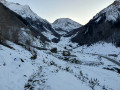
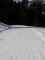
(S/E) The walk starts directly from the centre of the car park, on the opposite verge of the D934, on a track that is usually completely covered in snow from November to March.
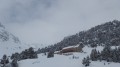
Head towards the imposing U-shaped building complex (pastoral centre) towards which the track leads. Leave the pastoral centre on your left when you reach a fork in the track.

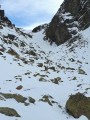
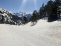
(1) Turn sharply right at the fork in the track towards the north-west. Cross a footbridge over the Lalagüe stream and pass the end of the path leading to the Cabane de Houns de Gabès on your right. Continue north-west, climbing up through the snow-covered mountain pastures of the Cirque d’Anéou, following the blue winter trail marked on the IGN map. The Pic de Peyreget is the imposing rocky massif directly ahead. The Pic du Midi d’Ossau is no longer visible. At 2,050 m, it is better to go round the hillock at the 2,116-metre mark on the left rather than on the right, as the slope is less steep. This will take you to the Col de l’Iou (2,194 m).

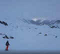
There are usually tracks left by skiers or snowshoers up to this point (at least), provided it hasn’t snowed overnight. The Pic du Midi d’Ossau is revealed here almost entirely along its south-western face. From here, you enter an area of pristine and completely isolated landscapes.

(2) Go round the Pic Peyreget to the west and north-west, keeping it on your right. Do not descend to the level of Lac de Peyreget as the summer path does, but instead head north-north-east towards a rocky ridge to reach it.

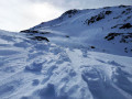
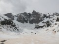
(3) Go round this ridge to the left before heading due east, ascending the gully between the Peyreget and the Pic du Midi d’Ossau. You’ll cross a scree slope, where it is common to find snow bridges over peat bogs (beware of rockfalls near the boulders). Pass the two small snow-covered lakes, preferably in the middle or keeping them close to your right, and the third small lake at 2,159 m, keeping well to the right of it. You then pass at the foot of an imposing rock mass on the left, rising to 2,316 m, with rocks completely shaped by erosion. Via a fairly long, chaotic steep slope, you reach the Col de Peyreget, at an altitude of 2,380 m.

(4) Suddenly, the ridges come into view in the distance. The view is remarkable… but there’s more to come!
The imposing mass of the Pic du Midi d’Ossau is very close by… View of the snow-covered lake and the Pombie Refuge, 350 m below. Head due south along the serrat leading to the summit, which slopes quite gently.

(5) Reach the summit of Pic Peyreget (2,487 m). The landscape is no longer just remarkable, it is exceptional: a 360° view, with the Pic du Midi d’Ossau to the north, the Ayous Lakes and the peaks towering above them to the north-west, the border range to the south, with the Spanish summits, the Balaïtous to the east and – all around – the vast expanse of the snow-covered Pyrenees….. On the descent, head for a secondary summit, very close by to the east,

(6) This offers an unobstructed view of the Pombie Refuge. Follow roughly the same route as on the way up to reach the Col de Peyreget.

(4) Head north along the ridge of the pass as far as possible.

(7) Look down (just glance) towards the descending couloir which branches off to the right towards the Grande Raillère de Pombie and leads to the Couloir de la Fourche du Pic du Midi d’Ossau. Retrace your steps back to the pass.

(4) Head due east down the gently sloping descent. If there are no tracks, keep the Refuge de Pombie in your sights and, navigating the bumps and dips, avoid the lakes and rocky outcrops. The route described here therefore presents no danger. Reach the Refuge de Pombie.

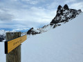
(8) Head due south towards the Col du Soum de Pombie, signposted by a sign. You will need to climb 75 metres in altitude to cross the pass. Reach the Col du Soum de Pombie, which is very poorly marked.

(9) Descend the southern slope of the pass, across the snow-covered slopes, following the summer path if the snow is not too deep. Following a series of hairpin bends, pass close to the Cabane de Sénescau, then return to the Ruisseau Lalagüe near the Cabane de Houns de Gabès; cross the stream and follow the track you took on the way there to reach the car park (S/E).


Waypoints

  1. S/E : mi 0 - alt. 5,650 ft - Parking de la Cabane de l'Arraille
  2. 1 : mi 0.33 - alt. 5,650 ft - Fork in the path
  3. 2 : mi 0.46 - alt. 5,656 ft - Trail fork – Turn right
  4. 3 : mi 2.17 - alt. 7,123 ft - 11.30 am crampons
  5. 4 : mi 2.25 - alt. 7,192 ft - Col de l'Iou
  6. 5 : mi 2.7 - alt. 6,985 ft - Lac de Peyreget
  7. 6 : mi 3.09 - alt. 7,592 ft - Col de Peyreget (2380m)
  8. 7 : mi 3.43 - alt. 8,123 ft - Pic Peyreget (2487m)
  9. 8 : mi 3.46 - alt. 8,084 ft - Peyreget secondary summit
  10. 9 : mi 3.92 - alt. 7,635 ft - Northern end - Col de Peyreget (2380m)
  11. 10 : mi 4.8 - alt. 6,663 ft - Refuge de Pombie
  12. 11 : mi 5.53 - alt. 6,903 ft - Col de Soum de Pombie
  13. S/E : mi 7.16 - alt. 5,650 ft - Parking de la Cabane de l'Arraille

Notes

This description relates to a solo hike undertaken at the start of winter (Dec. 2022) with moderate, long-standing snow cover.
Between (S/E) and , the track, although covered in snow (10 cm), is fairly visible. From there onwards, no track, path or signposting is visible! For most of the route, you’ll need to follow the description along with a GPS track, or even follow in the tracks of previous skiers or snowshoers.

Only attempt this route if you are proficient in snowshoeing or ski touring and know how to use crampons and an ice axe. This hike can be undertaken in summer, following roughly the same route and staying – as far as possible – on the slopes and paths, which are then clearly visible throughout.

Car park at the start
The car park is on the left as you head up towards Le Pourtalet. When there is snow on the road, it can be difficult to distinguish between the dotted line separating the lanes and the kerb. If you arrive very early in the morning, the car park may not yet have been cleared of snow. In that case, make sure you choose a parking space that does not obstruct traffic.

Estimated time
I completed this route on snowshoes in 5 hours 20 minutes, including breaks and a picnic, setting off from the car park at 10.00 am. This is a fairly tight estimate. Allow between 6 and 7 hours. Be aware that it gets dark quickly in winter!
In summer, allow between 4 hours 30 minutes and 6 hours.

Difficulty
I’ve rated it as Difficult due to the steep sections between (2) and (6) and the fact that the route is unmarked. It’s a slightly challenging route where you need to maintain a good sense of direction, but it’s not very complicated. Neither the distance nor the elevation gain is excessive.
In summer, the rating is ‘Medium’.
The IBP Index (an automated system for assessing the difficulty of a route, based on the track and its gradients) is 118 HKG, which corresponds to a route of ‘Medium’ difficulty for a hiker with a ‘High’ level of fitness, or ‘Very Difficult’ for a hiker with an ‘Average’ level of fitness.

Water sources
- in winter when there is snow, streams can be used as water sources without too much risk. However, allow for 1 litre of cold water per person and 1 litre of hot water in a thermos flask per person.
- In summer, allow 2.5 litres per person.

Shelters
In an emergency, shelter is available at all the huts in the vicinity and in the winter section of the Pombie Refuge (8).

Equipment
- In summer, bring standard mid-mountain hiking kit: hiking boots, suitable clothing, rainwear, water, food, a survival blanket, a knife, a compass, a map and a whistle.
- In winter when there is snow, you must also bring snowshoes, a pair of poles, gaiters, sun cream, lip balm, a GPS or the Visorando app on your smartphone, gloves, suitable warm clothing, a flask with a hot drink, a hat, and sunglasses suitable for glare off the snow. Some people will also take an avalanche transceiver (DVA), a shovel and a probe. Crampons and an ice axe are not always essential, but should be taken along.

Visitor numbers
- in winter when there is snow, you can spend the whole day on your own, depending on the day chosen and the weather.
- In summer, routes in the Cirque d’Anéou are quite busy.
Whatever the season, don’t forget to let your friends and family know your exact route and inform them of any changes by text or phone.

Snowshoes + poles or crampons + poles or crampons + ice axe
In the depths of winter in the morning, it may be easier to use crampons than snowshoes or skis. Indeed, walking in crampons is almost identical to walking in ordinary shoes, with the added advantage of being able to safely navigate small flat sections or gentle icy slopes, and above all narrow, overhanging sections of hard or icy snow.
When putting on crampons on flat ground or gentle slopes, you keep your poles. As soon as the gradient exceeds 15 to 20 per cent, the snowshoes and poles are stowed away and securely fastened to your rucksack, and you use the ice axe. Using an ice axe requires a good level of skill, particularly in the event of a fall or when descending.

Météo-France Mountain Bulletin and Avalanche Risk Assessment Bulletin (BRA or BERA)
Check the weather forecasts, particularly the Météo-France snow and avalanche bulletin for the Aspe-Ossau massif in the Pyrénées-Atlantiques.

Avalanche-prone areas
There are no known avalanche-prone areas on this route. However, remain vigilant on the north-west face of the Pic de Peyreget.

TheGR®® andPR®® trail markings are the intellectual property of the French Hiking Federation.
If, whilst on your route or whilst using the map, you notice any errors in signposting or place names, or …, you can become a contributor and report them:
- signposting errors, safety issues, conflicts of use, environmental concerns: click here
- mapping errors, place names: click here

This route passes through a protected area, which may be subject to special regulations:

Worth a visit

Pic du Midi d’Ossau
The Pic du Midi d’Ossau rises to 2,884 metres. The people of Béarn affectionately call it Jean-Pierre, as its ever-present presence in the landscape means one cannot help but grow attached to it as one would to a loved one. Moreover, this double name alludes somewhat to the dual nature of this mountain, characterised by its forked summit, which gives it a profile that cannot be confused with any other. It is also said that this name means ‘stone giant’.
From certain angles, its shape even strikingly resembles the head of a bear gazing up at the sky.

Geologically speaking, the Pic du Midi d’Ossau is a monolith of andesite, a volcanic rock similar to Volvic stone (used, for example, in the construction of Clermont-Ferrand Cathedral), and forms part of a vast volcanic complex dating from the Permian period (around 280 million years ago). It forms the base of a volcanic vent situated at the centre of a caldera surrounded by ring dykes (very large, ring-shaped veins of volcanic rock), deformed by the tectonic movements affecting the Pyrenees mountain range, and the Peyreget ridges are one section of these ring dykes.

Source: stjo and the Société amicale des géologues amateurs (SAGA Paris)

Places to visit nearby
- On the way back, after returning to your car, you can cross into Spain via the Col du Pourtalet.
- The village of Les Eaux-Chaudes with its spa centre and typical old houses.

Always be cautious and plan ahead when you're outdoors. Visorando and the author of this route cannot be held responsible for any accidents occurring on this route.

The GR® and PR® markings are the intellectual property of the Fédération Française de Randonnée Pédestre.

Reviews and comments

MCTOUL
MCTOUL

Hello,
Yes! It's another hike, not yet described on this site.
Best regards

Machine-translated

Labat jean Louis
Labat jean Louis

Hello,
the Peyreget can be climbed via the south-west ridge

Machine-translated

Other walks in the area

For more walks, use our search engine .

The GPS track and description are the property of this route's author. Please do not copy them without permission.