Country:

 City:
City:


The route starts from the Lac des Gloriettes car park.
(S/E) Take the path that crosses the dam’s engineering structure and then goes round the lake on the western side.
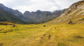
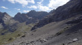
(1) Do not take the footbridge crossing the Gave d’Estaubé. Stay on the path on the left bank. Follow the path for a good part of the way along the upper reaches of the Estaubé Valley, climbing alongside the Gave.
(2) At the junction leading to the bottom of the cirque, take the path that climbs straight up (due south) along the left bank of the Gave d’Estaubé.
(3) Leave the Cabane de Labassa in the distance on your left. The slope becomes steeper. Follow the switchbacks to reach a junction.
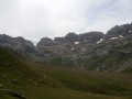
(4) Turn left (south-south-east) towards the Cirque d’Estaubé (leaving the path to the Piméné and the Refuge des Espuguettes on your right). You’ll reach the Y-junction of the paths leading to Turquerouye and Port Neuf de Pinède (elevation 2236).
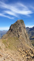
(5) Turn right; a yellow sign on a rock indicates the directions. Leave the Deux Bornes on your right and climb up the scree slope (well-marked with cairns). Continue up to the small pass of the Borne de Tuquerouye (elevation 2431), leaving the Borne (elevation 2471) – a striking cone visible from a great distance – on your left.
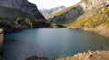
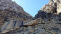
(6) Continue southwards to reach the base of the Couloir de Tuquerouye, a very, very steep scree slope, 45° in places, bordered by the remains of a small glacier, between the Pic de Tuquerouye and the Pic de Pinède. Take particular care in the couloir (approximately 300 m long). The final section of the couloir becomes even steeper. Reach the Brèche and the Tuquerouye Refuge. Exceptional views: the Lac Glacé du Marboré and its turquoise waters stand out against the backdrop of Mont Perdu (Monte Perdito) (3,348 m) and Cylindre du Marboré (Cilindro de Marboré) (3,325 m).
(7) Descend the Spanish slope of Tuquerouye to the lake via a steep, unmarked but well-trodden path. Reach the northern shore of the Lac Glacé du Marboré (an ideal spot for a break).
(8) Find the start of the path on the southern flank of the Tuquerouye–Pinède ridge. It is a shallow gully, ascending diagonally towards the ridge. The OSM Trails map shows its route. During this ascent, depending on the season, you may come across patches of small edelweiss. Reach the ridge and continue along non-exposed terrain. Head for the summit of Pic de Pinède (Pico de Pineta), situated precisely on the Franco-Spanish border ridge. There is a magnificent 360° view of the Cirque d’Estaubé to the north, the Pimené to the west, Mont Perdu to the south and the Rio Cinca valley to the south-east.
The return to Lac des Gloriettes follows essentially the reverse route of the outward journey as far as the footbridge over the Gave d’Estaubé
(1) Turn right and cross the footbridge. Follow a very well-marked path which skirts the lake to the right (Route de Découverte). Return to the Lac des Gloriettes car park (S/E).
 Visorando Member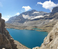
 Very difficult
 Moderate