


 Country:

 City:
City:


The route starts at a place called Agnouède, on the left bank of the Gave de Gavarnie, accessible via a small road branching off the D12a near the Pont Napoléon. There are several parking spaces available for three to four vehicles, just before the road crosses the Ruisseau Mensongé.
(S/E) Take the track that climbs up to the left of the road (the ‘Private Property’ sign is intended for vehicles). Shortly afterwards, turn left onto a narrower track leading to the Agnouède house. Immediately, to the right of the buildings, take a small path that climbs between the fields, heading due south, then briefly due west, and then due south again. The yellow markings begin here, though they are rather sporadic.
(1) About 500 m past the Agnouède buildings, at a small cairn, the route leaves the wide path via three hairpin bends (right, left, right) to avoid heading towards the Moura farm, then continues its ascent north-north-west. At a place called Lahué (IGN map), another hairpin bend directs the path southwards, deep into the undergrowth – an area formerly used for farming, criss-crossed by a network of small dry-stone walls. The path passes beneath the high-voltage power line as it climbs gently southwards, towards the Cabane d’Estarous.
(2) As you approach the Ruisseau de Badet (which flows down from the lake of the same name), the slope becomes steeper and there are more and more hairpin bends. The path crosses the stream via a concrete footbridge. The route continues south-west and leads to the Cabane d’Estarous.
(3) Continue along a path, still signposted, heading roughly south-west. You’ll reach the concrete water collection channel at an altitude of 1,920 m.
(4) NB: here you have the choice of taking the path on the right (easier but slightly longer) or the one on the left, which is more challenging (with handrails and exposed sections, though not particularly difficult), but quicker; this is in fact the service path for the water collection channel’s hydraulic installations. This route opts for the quicker ascent on the left, using the handrails .
So turn left and follow the collector along the contour line for about 400 m, with no signposting whatsoever. At one point, the path skirts a rocky ledge, becoming more exposed. However, sturdy stainless-steel cables allow you to hold on safely. Nevertheless, this section may be daunting for those prone to vertigo. Take care to note the (unnamed) pass on the left, which you should head towards; your destination lies beyond it. Cross the Lassariou Stream and its tributaries several times; their flow varies depending on the season. The route along the culvert ends when it goes underground. The path immediately branches off to the right up the slope.
NB: the concrete culvert enters its underground section via a concrete structure and a watertight door, just after a weir on a tributary of the Lassariou.
Cross the lower reaches of the Culaus d’Aubuste from north to south – a vast, sloping expanse with sparse vegetation consisting of shrubs, thorny bushes and mountain grasses, and occasionally scree – following a route slightly lower down and further east, running almost parallel to the yellow-marked path. At the 2,000-metre mark, our path joins the signposted one, amidst a vast jumble of large boulders, just below the spillway of Lac de Bastampe. In the distance, on the opposite bank of the Gave and therefore on the other side of the valley, a curious and imposing building is always visible. This is a pumping station for the penstock leading to the Pragnères hydroelectric power station, at an altitude of 1,690 metres.
(5) At the fork, carry on straight ahead, heading uphill. Make your way through the scree to reach the spillway, then a first small lake, just before Lac de Bastampe. On the isthmus separating the two lakes, discover this gem of a lake. Walk out to admire the lake in all its splendour and, above all, the verdant islet and its crooked pines, which are the source of its reputation and charm. Take your time as you make your way through the Bastampe glacial cirque, which created this lake, and enjoy a lovely break.
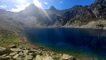
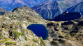
(6) Continue round the lake to its southern end. There are no further signposts from here. Here you’ll find a lovely grassy ridge that climbs southwards, initially at a gentle gradient, then turns south-east and climbs more steeply along a narrow but well-marked path, where you’ll sometimes need to use your hands. This is where the wild part of the walk begins. Make your way onto the ridge separating Lac de Bastampe from Lac de Litouèse. The latter appears majestic and serene, a deep blue, in the tranquillity of its glacial cirque. Here, it’s best not to descend to the lake, so as to then climb up to the Pic de Litouèse.
(7) Leave the path to the right, heading south-west along a fairly visible track. This gradually disappears into theesquià vegetation (gispet, small bushy thorny shrubs), scree slopes, boulders, ledges and rocky outcrops. You cover more than 800 m, generally staying on the contour line, well below the ridge line (which appears inaccessible). You need a good sense of direction, sure-footedness in the mountains and will need to use your hands very frequently (climbing difficulty PD II to III). This section, which includes some fairly exposed passages, is reserved for mountaineers who are not afraid of heights.
Do not attempt to reach the top of the wide chimney leading to the Litouèse-Bastampe Ridge (it is passable, but very exposed); instead, join it at the 2320-metre mark, in the middle, even if this means descending 20 to 30 metres in elevation, then climbing back up through the chimney. Follow it, keeping well to the right at first, where the scree is easier to cross. Then traverse it, whilst continuing the ascent, until you reach the Litouèse-Bastampe Ridge, slightly to the west and below the Pic de Litouèse. A lovely promontory at 2,384 m offers a bird’s-eye view, to the south, of Lac d’Antarrouyes; to the south-west, Lac de Cestrède, at the end of the magnificent suspended valley of the Gave de Cestrède; and due west, the no less magnificent valley leading to Lac Noir, which is invisible from here. Facing south, you can hear the sound of the Soutarra Waterfall, though you cannot see it.
Reach the summit of the Pic de Litouèse at 2,420 m by following the ridge along its western face . There is a fine view of the Pic de Bastampe (2,936 m) and the Pic de Barbe de Bouc (2,964 m) slightly behind it. To the north-east, the peak of the Pic du Midi de Bigorre (2,876 m) can be made out. In the distance, from the east to the south, the summits of the Néouvielle, Troumouse and Gavarnie massifs are clearly visible. Closer to the south-west lies the Soum de Male (2,793 m).
(8) From the summit cairn, retrace your steps for a few dozen metres and descend a narrow, south-facing chimney. At the bottom, do not attempt to continue along the ridge – it’s impassable! Turn west onto a winding path. Join the ridge a little further south. Follow this ridge as far as possible, sometimes to the right, sometimes to the left, but mostly trying to stay on the ridge line. You may need to use your hands, but the difficulty never exceeds grade F II. The final few metres leading to the Soum de Caubarole are a little more challenging. You reach the ridge near the broad summit area. You’ll be rather surprised by the fairly gentle slopes to the east, where numerous sheep graze in season.
(9) Descend via the same routes until you reach stony mountain pastures, 30 or 40 metres below the ridge line. The track takes you along a path running at the foot of a rock shelter.
(10) Make your way through the boulders, the terraced grassy slopes, the herd tracks and the few rocky outcrops—some of which are more or less passable—generally heading north, still without any signposting, with the Litouèse Hut as your destination. You’ll reach it at the north-eastern tip of the lake. Its terrace offers a chance for another break, provided it isn’t occupied by the shepherd and his border collies.
(11) Leave the lake and the hut to the east and, through a large, somewhat difficult-to-navigate scree field, rejoin the path that descends the ravine of the lake’s outlet. The descent, both on the bare sections and through the forest, is particularly challenging, as the slopes are steep and the path, whilst well-maintained, is narrow and prone to rockfalls. You reach the junction leading to Sia at around 1,300 m.
(12) Turn left into the vast Noubasséoube pine forest, staying on the 1,300–1,250 m contour line for 1.7 km, until you reach the Lassariou stream. This path, a variant of the GR®10, runs from the Pont d’Artigot in Trimbareilles to Luz-Saint-Sauveur; it is relatively well-maintained but is not signposted and remains quite narrow. After crossing the stream, continue along the contour line, passing under the high-voltage power line through a wooded area that has been cleared by Enedis’s contractors. Pass the water source, with its associated buildings. In Yer de Prat, you’ll come to a very clear fork in the path.
(13) Turn right as you head downhill and make your way to the pair of buildings at the beautiful Moura farm, with its large dry-stone walls. Take care not to disturb any farmers who may be present, nor the animals grazing in the meadows through which the path passes. Leave the property via its main access track, made of earth and grass, leading to the main path from Agnouède and the fork you passed on the way out.
(1) Turn slightly to the right, staying on the main track. Follow the route in reverse to return to the car park (S/E).
 Visorando Member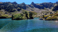
 Moderate
 Easy
Easy 
 Difficult
