Country:

 City:
City:


The route starts at an altitude of 1,058 metres near the Luz-St-Sauveur thermal baths, on the left bank of the Gave de Gavarnie, via a small road leading to the hamlet of Agnouède. There are several parking spaces for 3 to 4 vehicles, just before the road crosses the Ruisseau Mensongé.
(S/E) Take the track that climbs up to the left of the road (don’t be put off by the ‘Private Property’ sign, which only indicates that cars must not enter). 240 m after the start, turn left onto a narrower track leading to the Agnouède house. Immediately, to the right of the buildings, take a small path that climbs between the fields, heading due south, then briefly due west, and then due south again. The yellow markings begin here, though they are rather sporadic.
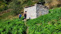
(1) 500 m past the Agnouède buildings, at a small cairn, the route leaves the wide path via three hairpin bends (right, left, right) to avoid heading towards Moura Farm, then continues its ascent north-north-west. In the Lahué area (IGN map), another hairpin bend directs the path southwards, deep into the undergrowth – an area formerly used for farming, criss-crossed by a network of small dry-stone walls. The path passes beneath the high-voltage power line as it climbs gently southwards, towards the Cabane d’Estarous.
(2) As you approach the Ruisseau de Badet (which flows down from the lake of the same name), the slope becomes steeper and there are more and more hairpin bends. The path crosses the stream via a concrete footbridge. The route continues south-west. In 1 hour 15 minutes to 1 hour 30 minutes, you will reach the Cabane d’Estarous.
(3) Continue along a path, which is still signposted, heading roughly south-west. You’ll reach the concrete water collection channel at an altitude of 1,920 m.
(4) NB: here you have the choice of taking the path on the right (easier but slightly longer) or the one on the left, which is more challenging (with handrails and exposed sections, though not particularly difficult), but quicker; this is in fact the service path for the water collection channel’s hydraulic installations. This route opts for the ascent on the right and the return via the handrails.
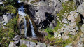
So turn right and follow the collector along the contour line for about 180 m, following the yellow markings. Look for steps that allow you to climb up the collector easily and continue along the path 30 to 50 m above it. The path is not always very well signposted, but it is clearly marked and well cairned. Take note of the unnamed pass on the left, which you should head towards; your destination lies beyond it. You will cross several tributaries of the Ruisseau Lassariou, the flow of which varies depending on the season, including a particularly beautiful little waterfall (flowing in August 2026).
Cross the Culaus d’Aubuste from north to south, a vast, steep expanse with sparse vegetation consisting of shrubs, thorny bushes and mountain grasses, and occasionally scree. Climb to an elevation of approximately 2,080 m before descending to 2,000 m, where the path joins the one you will take later on the descent, just below the spillway of Lac de Bastampe.
On this section, you’ll pass a concrete block bearing the inscription ‘Lac de Bastampe 30 Min’, which is misleading, as there are still a good 40 to 60 minutes of climbing ahead. In the distance, on the opposite bank of the Gave and therefore on the other side of the valley, you never lose sight of a curious and imposing building. This is a pumping station for the penstock leading to the Pragnères hydroelectric power station, at an altitude of 1,690 metres.
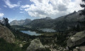
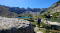
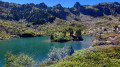
(5) At the fork, continue rightwards uphill; the lake is not far now. Through a jumble of large boulders, reach the spillway, then a first small lake, just before Lac de Bastampe. On the isthmus separating the two lakes, discover this gem of a lake. Walk out onto the isthmus to admire the lake in all its splendour and, above all, the green islet and its crooked pines, which are the source of its reputation and charm. Take your time walking through the Bastampe glacial cirque, which created this lake, and enjoy a lovely break.
(6) Retrace your steps to the fork in the path.
(5) Turn right shortly after the boulder field and follow a well-marked cairn-lined path. Heading roughly due north, reach the water collector just before the Ruisseau de Lassariou at an elevation of 1,860 m, where it emerges from an underground section.
NB: the concrete water collector emerges from its underground section via a concrete structure and a watertight door, just before a weir on a tributary of the Lassariou.
Then take the path that follows the concrete water collector above ground along the contour line, heading north.
On the left bank of the Lassariou, the culvert goes underground again and the path then winds round the rocky outcrop along a ledge, becoming more exposed. However, sturdy stainless-steel cables provide a secure handhold. Nevertheless, this section may be daunting for those prone to vertigo. The path then continues alongside the culvert until it reaches the junction from the outward journey; the circular route is now complete.
(4) Return to the car park by following the route in the opposite direction to the outward journey (S/E).


 Visorando Member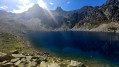
 Very difficult
 Easy
Easy