Country:

 City:


Park in the village square, Place des Écoles, very close to the church.
The route is not signposted. The route begins in the heart of the village, through the streets. Use the street signs to find your way.
(S/E) Cross the square to reach Rue de la Place to the south (you couldn’t make it up!).
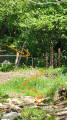
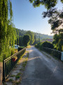
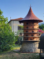
(1) At the first junction, carry on straight ahead along Rue du Pradal. 100 metres further on, take the dirt track on your right to cross the small bridge towards the park. Enter the municipal park. Turn immediately right onto the lawn, through the tree-lined beds, to reach the elegant, renovated arbour. Then continue down towards the River Sios until you reach the gate of a large house. On the right, you’ll see a superb, very well-maintained 18th- or 19th-century dovecote.
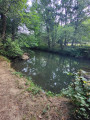
Facing the gate, take the path behind you that runs alongside the river through the park. Continue along this path through the scattered trees and the woodland for about 600 metres in a south-southeasterly direction, until you reach a covered footbridge crossing the river on your right.
(2) Do not cross, but continue along the path on your left until you exit the park to the east and reach the Chemin de Villeneuve road.
Turn right onto the road, which quickly becomes a rural access track. On your left, pass the property in the clearing and, at the fence, turn left onto the track that climbs towards the forest and the slopes of Carsabel for 140 metres.
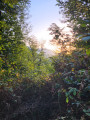
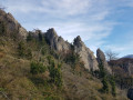
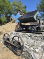
(3) Leave the track and turn left onto a narrow path created by forestry machinery (such as a tracked loader) which cuts deep into the forest, straight up the slope. The path winds twice around this very steep slope. It is marked in the style of a trail (with orange paint marks on the trees from time to time). You will reach a sort of plateau. To the left, a few dozen metres away, you can reach the northern summit of Les Serres, the Cap des Serres. Otherwise, continue south-south-east along this same fairly narrow forest track, which quickly turns into a wider track (shown as a solid black line on the IGN map). You’ll reach a fork.
(4) Turn left onto a new, narrow forest path. The path reaches an old clearing where the forest has reclaimed some ground (scattered trees and scrub), within which there is a sinkhole and a chasm (marked by old barrier tape on the trees).
(5) Continue due east and join a new, wider track which descends generally due south for 100 metres. The track joins a new narrow path that heads due east, through the forest, then quickly through the gigantic thickets of brambles. The path is very easy to follow. Reach the summit of Carsabel (elevation 615). There is no visibility of the surrounding area, as the view is completely obstructed by the surrounding forest. By climbing onto a tree trunk conveniently positioned there, you can see into the distance...
(6) Leave the Carsabel summit plateau to the east and continue along this comfortable but narrow forest path until you reach a wide but poorly maintained track.
(7) The descent begins here. The track heads due south for 100 metres, then south-east for 260 metres, and finally the last 60 metres to the south-west, until it joins a very wide and well-maintained track (shown as a solid black line on the IGN map, but not on OpenStreetMap), at an altitude of 520 m.
(8) Continue the descent, heading south-east, until you reach a completely open meadow, used as a storage area for felled timber, by the roadside, at a place called Saint-Paulet, in the commune of Saint-Paul-de-Jarrat.
(9) Turn back, as entry to the property is prohibited and the exit onto the road is blocked by a gate and a wire-mesh fence. Return to the previous crossroads.
(8) Continue straight on along the main track. First, head up to the 552-metre mark, then return to the junction at 565 metres.
(4) Take the return route along the same path as on the way out until you reach the Passerelle du Sios.
(2) Cross the footbridge tojoin the Lios riverside path on the leftbank towards the centre of Montgailhard; reach the Chemin de l’Oratoire, turn right onto it for 100 metres, before rejoining the riverside path for its final 70 metres. Reach the Rue de la Place in the village centre. Turn right, cross the bridge, then head towards the junction with Rue du Pradal.
(1) Turn left and head back to the car park where you started, Place des Écoles (S/E).
 Visorando Member

 Easy


 Difficult