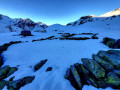
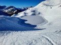
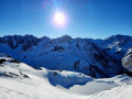
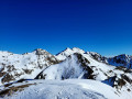
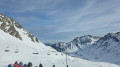
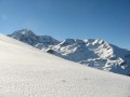
Pic de Barbe from Barèges-Tournaboup in winter

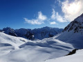
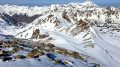
Above Barèges, the Pic de Barbe (2,468 m) remains a rather unassuming peak. Yet it offers one of the most stunning views in the Hautes-Pyrénées: from the summit, the vista stretches from the Pic du Midi to the Néouvielle, from Mont Perdu to the Brèche de Roland, all the way to the Vignemale and the Balaïtous. Five hundred metres below, the Lac Bleu lies dormant beneath the snow.
The route climbs round the Ruisseau de Mousquère, a sun-drenched southern slope, passing through the Plateau d’Aoube, then the Plateau de la Lahude, which offers two opportunities to take a break. Higher up, the mountain becomes tranquil yet rugged: steeper slopes and fewer tracks, just the sound of snowshoes and the silence of the ridges.
A challenging yet accessible winter hike, requiring good snow cover and a high level of fitness. In return: a peaceful summit, a 360-degree view and a beautiful descent through the snow.

Details

n°109491551
Creation:
Last update:
Last review:
–
  • Snowshoeing
    Activity: Snowshoeing
  • ↔
    Distance: 5.90 mi
  • ◔
    Duration according to the author: 7 hrs 
  • ▲
    Difficulty: Difficult

  • ⚐
    Back to start: Yes
  • ↗
    Ascent: + 3,094 ft
  • ↘
    Descent: - 3,084 ft

  • ▲
    Highest point: 8,081 ft
  • ▼
    Lowest point: 5,007 ft

Photos

Description of the walk

Head to Barèges via the D918 and continue on to the Tournaboup winter sports resort (you can also get there by bus).
The ‘info-route 65’ website lists the opening and closing dates for the section leading up to the Col du Tourmalet.
If possible, start the climb towards Super-Barèges. Park as high up as possible between the bend at 1,540 m and the bend at 1,629 m.

(S/E) Put on your snowshoes and continue along the road to the 1,629-metre mark.

(1) Turn left, leave the road and head up onto the wide, flat area (with space to park 2 or 3 vehicles) where a sign (sometimes obscured by snow) points to a path that climbs up the side of a valley, a tributary of the Ruisseau d’Aoube, leading to the ‘cuyalas’ (huts and enclosures) of Aoube.

(2) Then head roughly westwards, cross the Ruisseau de la Mousquère at a point where the stream bed is not eroded, and reach the southern part of the Plateau de la Lahude at an altitude of around 2,030 metres.

(3) Climb straight up the slope towards the north, passing a few dozen metres north of an unnamed lake, and reach the south-western part of the Lahude Plateau, 300 metres west of the lake, near the Turon de la Lahude, leaving the 2,176-metre peak on your right. Then head for the rocky ridge at 2,253 metres.

This section is the wildest (and therefore most isolated), but it offers good climbing conditions on the eastern slope of the rocky ridge, directly to the south, below the Pic de Barbe.

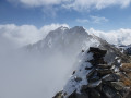
(4) Via a series of switchbacks and traverses, make your way to the summit of the Pic de Barbe at 2,468 m.

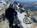
A 360° view stretches from the Pic du Midi de Bigorre and its ridge to the Pic de Merlheu directly ahead to the north, and as far as the Néouvielle to the south, from the Mont Perdu to the Brèche de Roland, and on to the Vignemale and the Balaïtous. Five hundred metres below, Lac Bleu and Lac Vert are not yet pristine white, but the valley linking them to the Col d’Aoube is nonetheless a white wasteland with no apparent signs of life.

It is possible to reach the eastern end of the Pic de Barbe ridge. Here, some skiers descend via the eastern couloir.

(5) For snowshoers, it is best to retrace the outward route to reach the WP (4), via a route similar to the ascent but with fewer hairpin bends. The same applies up to the WP (3).

(3) Next, rather than returning via the Cabane d’Aoube, continue roughly southwards to reach the paths to Coumétou and Beyredo.

Complete the final 150 m of ascent to the GR®10 via the path known as the “Route de Capet”. This will take you to the GR®10 at an altitude of around 1,635 m.

(6) Then descend along the GR®10 until you reach the D918 road and the car park (S/E).

Waypoints

  1. S/E : mi 0 - alt. 5,007 ft - Tourmalet Road D918 - Bastan (cours d'eau) - Affluent du Gave de Gavarnie
  2. 1 : mi 0.76 - alt. 5,361 ft - Turn at elevation 1629 – Turn left up the slope
  3. 2 : mi 1.28 - alt. 6,076 ft - Aoube Hut (1,850 m)
  4. 3 : mi 2.07 - alt. 6,663 ft - Lahude South junction – Turn right
  5. 4 : mi 2.72 - alt. 7,405 ft - Elevation 2,253 m – Head due north
  6. 5 : mi 3.35 - alt. 8,081 ft - Pic de Barbe (2,468 m)
  7. 6 : mi 5.28 - alt. 5,420 ft - GR10 access
  8. S/E : mi 5.9 - alt. 5,007 ft - Tourmalet Road D918 - Bastan (cours d'eau) - Affluent du Gave de Gavarnie

Notes

This description relates to a solo winter hike (December 2025) in moderate snow conditions. Naturally, no paths or markings are visible! Most of the route will follow either the tracks of previous skiers or snowshoers, or a GPS track.

You should only attempt this route if you are fully proficient in snowshoeing or ski touring.
This hike can also be undertaken in summer, following roughly the same route and staying – as far as possible – on the paths, which are clearly visible throughout.

Estimated time
I completed this route on snowshoes in 5 hours 50 minutes, including breaks and a picnic. This is a fairly tight estimate. Allow between 5 hours 30 minutes and 7 hours. In summer, allow 4 hours 30 minutes to 5 hours.
Three-quarters of an hour to climb to the Cabane d’Aoube.
1 hour 30 minutes to reach the unnamed lake at 2,100 metres.
3 hours 10 minutes to reach the Pic de Barbe.

Difficulty
I’ve rated this as ‘Difficult’ in winter due to the length and elevation gain of the route, the steep sections further on (3) and the fact that the entire route is unmarked. It’s a fairly challenging route.
In summer, the difficulty rating is ‘Moderate’.
The IBP (Intelligent Benchmark Prediction) index is 129HKG (hike), which corresponds to a route of ‘Moderate’ difficulty for a hiker with a ‘High’ level of fitness.

Water sources
- In winter, when there is snow, streams can be used as water sources without too much risk. However, allow for 1.5 litres of cold water per person and 1 litre of hot water in a thermos flask per person.
- In summer, there is a spring known as the Cabane d’Aoube, but this may be a resurgence spring; therefore, there is no guarantee that the water is safe to drink due to grazing livestock. Allow 2.5 litres per person.

Shelters
There are no shelters along the route.

Equipment
- In summer, bring standard high-mountain hiking kit: hiking boots, suitable clothing, rainwear, water, food, a survival blanket, a knife, a compass, a map and a whistle.
- In winter when there is snow, bring the usual high-mountain hiking kit: hiking boots, suitable clothing, rainwear, water, food, a survival blanket, a knife, a compass, a map, a whistle, snowshoes, a pair of poles, gaiters, sun cream, lip balm, a GPS or the Visorando app on your smartphone, gloves, suitable warm clothing, a thermos flask with a hot drink, a hat, and sunglasses suitable for glare off the snow. Some will also take an avalanche transceiver (DVA), a shovel and a probe. On this route, crampons and an ice axe are essential.

Traffic
- In winter, when there is snow, you may spot a few tracks left by ski tourers or snowshoers as far as the Plateau de la Lahude between (3) and (4). However, depending on the day you choose and the weather, you may then find yourself on your own all the way to the summit.
Whatever the season, don’t forget to let your friends and family know your exact route and inform them of any changes by text message or phone call.

Météo-France Mountain Bulletin and Avalanche Risk Assessment Bulletin (BRA or BERA)
Check the weather forecasts, particularly the Météo-France snow and avalanche bulletin for the Haute-Bigorre massif in the Hautes-Pyrénées. A call to the Haute-Montagne Gendarmerie unit may also put your mind at rest.

TheGR®® andPR®® trail markings are the intellectual property of the French Hiking Federation.

Worth a visit

Pastoralism
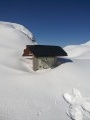
In the summer pastures of the high Béarn-Bigorre valleys, shepherds used to build dry-stone huts, known as ‘capane’, with a rectangular layout. Situated in the centre of a dry-stone enclosure where the sheep spent the night – known as ‘cueilas’, ‘cuyalas’ or ‘courtaous’ – these huts are now often in ruins. Source: Wikipedia.
The huts at Aoube are in fairly good condition and are still in use.

Place names
Source: ‘La mule et l’intello’ blog. Many thanks to him!
Translations with the help of Pierre Salles, an excellent commentator on France-Bleu Béarn.
Barèges: ßa’RƐdjə The little (?) valley. The (Latin) etymology is rather disputed, but seems nonetheless unavoidable. The root comes from the Latin ‘vallem’ and the suffix most likely comes from the Latin ‘-eticam’,…perhaps a diminutive (?)
‘Barège’ (actually ‘Varètge’) is the name of the valley. The commune bearing this name only came into being in the 20th century: at the instigation of Urbain Cazaux, a member of the valley’s departmental council and president of the French Ski Federation, the entire eastern section of the land that had until then belonged to the commune of Betpouey was separated from it to create the new commune.
The place had already been given this name due to the great renown of its thermal baths (cf. their imperial clientele): it was originally referred to as ‘the baths of (the valley of) Barège’, then (in Paris!) this was shortened to ‘Barèges’ to refer, in effect, solely to these thermal baths. This name has stuck.
Tournaboup: Other places in the valley bear this name. The only possibility: a compound word consisting of ‘torna’ (‘he returns’, ‘he turns’) and ‘vo(l)p’, the fox. Literally, therefore: ‘Turning fox’. But again, why? This (Latin) etymology is, after all, rather uncertain, and distortions may have occurred over the centuries. Restored spelling: Tornavop.
Néouvielle Massif: in Gascon: ‘nèu’, meaning ‘snow’, and ‘vielha’, meaning ‘old’ or ‘ancient’.

Always be cautious and plan ahead when you're outdoors. Visorando and the author of this route cannot be held responsible for any accidents occurring on this route.

The GR® and PR® markings are the intellectual property of the Fédération Française de Randonnée Pédestre.

Other walks in the area

For more walks, use our search engine .

The GPS track and description are the property of this route's author. Please do not copy them without permission.