


Refine your search for walks in Demi-Quartier
Demi-Quartier walks


 Jaillet loop from Combloux
 Visorando Member
 5.66 mi
 +1,591 ft
 -1,588 ft
 4h 00
4h 00
 Moderate
 Departure from Combloux (Haute-Savoie)
From the Combloux resort, starting from the Cuchet car park, complete a loop to discover the Jaillet via the Sommet des Salles and the Lac du Jaillet.Hike along a carriage road through pine forests, alpine pastures and ski slopes, with views of the Petit and Grand Croisse Baulet and the Mont Blanc range.
Le Grand Croisse Baulet
 11.25 mi
+3,576 ft
-3,566 ft
8h 15
11.25 mi
+3,576 ft
-3,566 ft
8h 15
 Difficult
Departure from Combloux (Haute-Savoie)
Difficult
Departure from Combloux (Haute-Savoie)
The Petit and Grand Croisse Baulet form part of a forward spur of the Aravis range. They stand out in the valley, from Sallanches to Domancy. Their prominent position on the Aravis massif makes them a remarkable vantage point. The summit offers a breathtaking panorama of the Mont Blanc range, the Aravis to the west, and the Fiz further north. This circular route is challenging but presents no technical difficulties.
 Le Petit Croisse Baulet
 6.51 mi
+1,594 ft
-1,575 ft
4 hrs
Difficult
Departure from Demi-Quartier (Haute-Savoie)
6.51 mi
+1,594 ft
-1,575 ft
4 hrs
Difficult
Departure from Demi-Quartier (Haute-Savoie)
A superb summit sought after by many ski tourers in the region. A 360° panoramic view of the entire Mont Blanc massif, the Aravis range and the Aiguilles Rouges massif.
The Chemin du Calvaire and the Belle au Bois waterfall
 3.11 mi
+738 ft
-732 ft
2h 05
3.11 mi
+738 ft
-732 ft
2h 05
 Easy
Departure from Megève (Haute-Savoie)
Easy
Departure from Megève (Haute-Savoie)
A short, easy route (excluding the optional detour to the waterfall) starting from Megève town centre. Beautiful panoramic views of the resort.
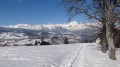
Circular snowshoe loop to the Prapacot mountain pasture in Combloux
 3.08 mi
+965 ft
-965 ft
3 hrs
Easy
Departure from Combloux (Haute-Savoie)
3.08 mi
+965 ft
-965 ft
3 hrs
Easy
Departure from Combloux (Haute-Savoie)
Snowshoe walk starting from Les Intages (municipality of Combloux).
The route is very well marked, fairly easy and can be adapted.
An alternative route allows you to reach the Saint-Gervais Mont Blanc resort (Le Bettex) from Prapacot.
Traverse of Mont Joly and Aiguille Croche
 8.73 mi
+3,058 ft
-2,910 ft
6h 40
Moderate
Departure from Saint-Gervais-les-Bains (Haute-Savoie)
8.73 mi
+3,058 ft
-2,910 ft
6h 40
Moderate
Departure from Saint-Gervais-les-Bains (Haute-Savoie)
A good ridge walk starting from the Bettex telecabin station at Mont d'Arbois and finishing at Le Signal telecabin station above Les-Contamines-Montjoie.
A walk around the Cordon ski area
1.58 mi
+817 ft
-817 ft
1h 25
Moderate
Departure from Cordon (Haute-Savoie)
A short, quick walk around the tiny Cordon ski area and its magnificent views.
Excellent value for effort in terms of the views.
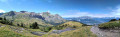
The shepherd's hut at the start of Cordon
 4.54 mi
+2,123 ft
-2,110 ft
3h 55
Moderate
Departure from Cordon (Haute-Savoie)
4.54 mi
+2,123 ft
-2,110 ft
3h 55
Moderate
Departure from Cordon (Haute-Savoie)
Magnificent scenery, particularly over the Aravis mountains. Option to extend the hike to Grand Croise Baulet.
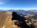
The Mont Joly mountain range
 11.81 mi
+4,715 ft
-4,682 ft
8 hrs
11.81 mi
+4,715 ft
-4,682 ft
8 hrs
 Very difficult
Departure from Megève (Haute-Savoie)
Very difficult
Departure from Megève (Haute-Savoie)
A magnificent, long hike for those who are not afraid of heights, probably one of the best views in the region of the Aravis, Mont Blanc and Beaufortain.
Please note: The second part of the ascent is very exposed and impressive, not recommended for those who are afraid of heights, children or inexperienced hikers.
La Tête de Christomet from Praz-sur-Arly
 6.24 mi
+2,067 ft
-2,070 ft
4h 40
Moderate
Departure from Praz-sur-Arly (Haute-Savoie)
6.24 mi
+2,067 ft
-2,070 ft
4h 40
Moderate
Departure from Praz-sur-Arly (Haute-Savoie)
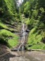
A lovely hike, shaded for most of the route. Beautiful views of the Aravis and Mont Blanc massif. The descent from Plan de l'Aar offers the chance to enjoy several waterfalls.
From Sallanches to Burzier via the chapels
 5.15 mi
+1,722 ft
-1,719 ft
3h 50
Moderate
Departure from Sallanches (Haute-Savoie)
5.15 mi
+1,722 ft
-1,719 ft
3h 50
Moderate
Departure from Sallanches (Haute-Savoie)
This hike can be found on the tourist map of the town of Sallanches. Beautiful views of the Aiguilles de Warens, the Aravis and the Mont Blanc massif, passing by several chapels and magnificent farms and chalets on the hillsides above Sallanches
Les Épines Blanches from Praz-sur-Arly
 4.20 mi
+1,020 ft
-997 ft
2h 50
Moderate
Departure from Praz-sur-Arly (Haute-Savoie)
4.20 mi
+1,020 ft
-997 ft
2h 50
Moderate
Departure from Praz-sur-Arly (Haute-Savoie)
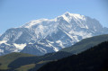
A short hike with views of the Mont Blanc range, the town of Praz and a walk through the woods under the Épines Blanches.
Cross the hamlets of Praz with their chalets and farms.
Fairly easy hike, part of it under the trees, with benches and viewpoints available along the route.
Crêt du Midi via the Chemin des Contrebandiers
 6.84 mi
+2,625 ft
-2,625 ft
5h 25
Moderate
Departure from Praz-sur-Arly (Haute-Savoie)
6.84 mi
+2,625 ft
-2,625 ft
5h 25
Moderate
Departure from Praz-sur-Arly (Haute-Savoie)
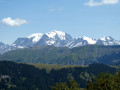
After climbing up a wild trail, the Crêt du Midi offers a magnificent panorama overlooking the Aravis mountains, the Arly Valley, the surrounding massifs and, of course, Mont Blanc.
Rochebrune and Alpette circular from Leutaz
 4.87 mi
+1,906 ft
-1,900 ft
3h 55
Moderate
Departure from Megève (Haute-Savoie)
4.87 mi
+1,906 ft
-1,900 ft
3h 55
Moderate
Departure from Megève (Haute-Savoie)
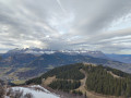
This is a lovely circular in the mountain pastures above Megève with superb forest passages and magnificent views of the Mont Blanc range on arrival at Rochebrune.
Pierre Fendue - Col de Doran - Arêtes des Saix
 10.20 mi
+5,367 ft
-5,381 ft
7 hrs
Very difficult
Departure from Sallanches (Haute-Savoie)
10.20 mi
+5,367 ft
-5,381 ft
7 hrs
Very difficult
Departure from Sallanches (Haute-Savoie)
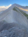
From the hamlet of Lintre, the route passes through Pierre Fendue, Col de Doran and Arêtes des Saix.
For experienced hikers accustomed to steep slopes. You can add a few extra metres if you decide to take the Quatre Têtes alternative route at Col de Doran.
The Cheminées des Fées
 1.85 mi
+955 ft
-945 ft
1h 40
Moderate
Departure from Saint-Gervais-les-Bains (Haute-Savoie)
1.85 mi
+955 ft
-945 ft
1h 40
Moderate
Departure from Saint-Gervais-les-Bains (Haute-Savoie)
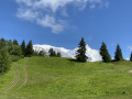
A charming little hike starting from Saint-Gervais-les-Bains. The trail is accessible all year round.
The Arpenaz waterfall at the start of Sallanches
7.01 mi
+338 ft
-328 ft
3h 30
Moderate
Departure from Sallanches (Haute-Savoie)
An easy family walk that can be enjoyed in all seasons.
Porcherey refuge from Plan de la Croix
 3.75 mi
+896 ft
-915 ft
2h 30
Moderate
Departure from Saint-Gervais-les-Bains (Haute-Savoie)
3.75 mi
+896 ft
-915 ft
2h 30
Moderate
Departure from Saint-Gervais-les-Bains (Haute-Savoie)
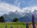
A beautiful hike offering views of numerous mountain ranges along the way: the Aravis range, Tête du Colonney and surrounding area, the Mont Blanc range, Mont d'Arbois and Mont Joly.
The route includes a difficult section where the path disappears from view for a few dozen metres due to a lack of maintenance. An alternative route is available if you wish to avoid this difficulty.
Lachat d'en Haut
 6.11 mi
+2,274 ft
-2,287 ft
4h 45
Moderate
Departure from Passy (Haute-Savoie) (Haute-Savoie)
6.11 mi
+2,274 ft
-2,287 ft
4h 45
Moderate
Departure from Passy (Haute-Savoie) (Haute-Savoie)
This former mountain pasture is located at the foot of the Aiguilles de Warens and offers a beautiful landscape reminiscent of certain panoramas in the Dolomites. A superb circular, where you will pass the Aiguille de Varan from the Zéta. At Lachat d'en Haut and along the route, you will also enjoy superb views of the Mont Blanc Massif, the Aravis Massif and the Fiz Massif.
Prarion loop from Saint-Gervais-les-Bains
 7.11 mi
+2,789 ft
-2,779 ft
5h 40
Difficult
Departure from Saint-Gervais-les-Bains (Haute-Savoie)
7.11 mi
+2,789 ft
-2,779 ft
5h 40
Difficult
Departure from Saint-Gervais-les-Bains (Haute-Savoie)
A pretty, varied loop that starts off rural, then becomes airy, then vertiginous, then wooded. The views from the Prarion ridge are particularly beautiful over the entire Mont Blanc massif. The descent to the Col de la Forclaz is a little vertiginous (with cables in places) but not difficult.
Croisse Baulet loop from Le Plan
 5.90 mi
+3,563 ft
-3,550 ft
5h 50
Difficult
Departure from La Giettaz (Savoie)
5.90 mi
+3,563 ft
-3,550 ft
5h 50
Difficult
Departure from La Giettaz (Savoie)
A beautiful loop to a little-known peak between Aravis and Beaufortain, particularly scenic. The climb is steep but the return loop via the little Croisse Baulet is enchanting, like a balcony with exceptional views of the Mont Blanc massif. It can get a little crowded on the way back as it can be reached in an hour from the Jaillet cable car.
Col de Jaillet
 6.10 mi
+1,801 ft
-1,801 ft
4h 25
Moderate
Departure from La Giettaz (Savoie)
6.10 mi
+1,801 ft
-1,801 ft
4h 25
Moderate
Departure from La Giettaz (Savoie)
The Col de Jaillet offers a magnificent view of Mont Blanc, which appears close by. You can also see a Roman boundary stone that marked the border at the time.
Crêtes du Torraz
 9.44 mi
+2,930 ft
-2,940 ft
6h 55
Difficult
Departure from La Giettaz (Savoie)
9.44 mi
+2,930 ft
-2,940 ft
6h 55
Difficult
Departure from La Giettaz (Savoie)
The route offers magnificent views of the Aravis mountain range with Mont Blanc opposite you. Pure bliss!
Petit Croisse Baulet - Col de Jaillet
 6.14 mi
+2,579 ft
-2,579 ft
5h 05
Moderate
Departure from La Giettaz (Savoie)
6.14 mi
+2,579 ft
-2,579 ft
5h 05
Moderate
Departure from La Giettaz (Savoie)
Le Petit Croisse Baulet is a superb summit offering a 360° view of the entire Mont Blanc massif and the Aravis mountain range.
At the summit and at the Col de Jaillet, you can see a Roman boundary stone that marked the border at the time.
Tête du Torraz
 7.21 mi
+2,411 ft
-2,431 ft
5h 25
Moderate
Departure from La Giettaz (Savoie)
7.21 mi
+2,411 ft
-2,431 ft
5h 25
Moderate
Departure from La Giettaz (Savoie)
A superb summit that is well worth the effort, with breathtaking 360° views: the Aravis mountain range, the Aiguilles Rouges massif, the Mont Blanc massif and Beaufortain.
Petit and Grand Croisse-Baulet
 8.23 mi
+3,780 ft
-3,766 ft
8 hrs
Very difficult
Departure from La Giettaz (Savoie)
8.23 mi
+3,780 ft
-3,766 ft
8 hrs
Very difficult
Departure from La Giettaz (Savoie)
A varied itinerary on fairly gentle slopes, with exceptional views from the ridges. The Croisse Baulet is mainly used by ski tourers, while the Petit Croisse Baulet is accessible from several sides, both on snowshoes and skis: the proposed loop starts at Le Plan, in La Giettaz.
Petit Croisse Baulet via the Col de Niard
 8.26 mi
+3,186 ft
-3,186 ft
6h 35
Difficult
Departure from La Giettaz (Savoie)
8.26 mi
+3,186 ft
-3,186 ft
6h 35
Difficult
Departure from La Giettaz (Savoie)
This loop offers beautiful panoramic views of the Mont Blanc range, the Arve Valley and the Aravis range from a balcony trail.
Le Petétruy
 6.22 mi
+1,404 ft
-1,401 ft
4h 05
Moderate
Departure from La Giettaz (Savoie)
6.22 mi
+1,404 ft
-1,401 ft
4h 05
Moderate
Departure from La Giettaz (Savoie)
This is a pleasant hike that allows you to discover the Pététry mountain pastures and a beautiful panorama of Mont Blanc. At the beginning, you walk along a stream and through the undergrowth. The steepest climb is in the shade of the trees, in the valleys, where you may see cows and, with a little luck, marmots.
The Montivon and Mont Forchet circular loop
3.70 mi
+1,732 ft
-1,732 ft
3h 15
Moderate
Departure from Saint-Gervais-les-Bains (Haute-Savoie)
A circular route mainly through woodland, ideal for hot days, with a few lovely clearings offering views of the Aravis or Mont Joly. The route crosses the TMB (Tramway du Mont-Blanc), providing the opportunity for some picturesque photos.
Circular route from the Tête du Torraz starting from Sciozier
 6.83 mi
+2,116 ft
-2,100 ft
5h 00
Moderate
Departure from Flumet (Savoie)
6.83 mi
+2,116 ft
-2,100 ft
5h 00
Moderate
Departure from Flumet (Savoie)
A lovely, easy circular route – apart from the climb – offering a 360° panorama of the Val d'Arly and the Aravis range.
Gouille des Fours - Col des Annes via Lac de Tardevant
8.45 mi
+3,120 ft
-4,147 ft
6h 35
Difficult
Departure from Sallanches (Haute-Savoie)
From Gouille des Fours, head towards Lac de Tardevant via the Grande Forclaz and Ambrevetta passes, then return via alpine pastures and forests to La Pointe and Col des Annes.
Frioland Circular Loop
4.54 mi
+2,195 ft
-2,201 ft
4h 00
Moderate
Departure from Passy (Haute-Savoie) (Haute-Savoie)
A hike offering magnificent views of the Mont Blanc massif on one side and the Aravis massif on the other.
Aiguille de Varan from Passy
 8.51 mi
+5,961 ft
-5,945 ft
10 hrs
Very difficult
Departure from Passy (Haute-Savoie) (Haute-Savoie)
8.51 mi
+5,961 ft
-5,945 ft
10 hrs
Very difficult
Departure from Passy (Haute-Savoie) (Haute-Savoie)
A beautiful circular hike from Passy in a rugged environment with a remarkable summit overlooking the Arve valley. The wild and vertiginous crossing from the Aiguille de Varan to the Désert de Platé is quite unforgettable. The hike can be split into two by staying overnight at the Refuge de Varan.
This hike should not be attempted in uncertain weather or foggy conditions.
Tour of Mont Vorassay
 6.67 mi
+3,156 ft
-3,136 ft
5h 50
Difficult
Departure from Saint-Gervais-les-Bains (Haute-Savoie)
6.67 mi
+3,156 ft
-3,136 ft
5h 50
Difficult
Departure from Saint-Gervais-les-Bains (Haute-Savoie)
Loop trail around Mont Vorassay, allowing you to get close to the Bionnassay Glacier. The Col du Tricot offers a beautiful view.
Loop via the Arête des Saix
6.18 mi
+2,933 ft
-2,920 ft
5h 25
Difficult
Departure from Sallanches (Haute-Savoie)
A loop in a little-known area at one end of the Aravis. Pretty views of Mont Blanc and the Fayet valley. Totally doable in a day, but you can use the refuges to split the route.
Mayères and Tornieux mountain huts
 4.61 mi
+1,936 ft
-1,936 ft
3h 50
Moderate
Departure from Sallanches (Haute-Savoie)
4.61 mi
+1,936 ft
-1,936 ft
3h 50
Moderate
Departure from Sallanches (Haute-Savoie)
A very pretty route above Sallanches, ideal for warming up when you arrive in the mountains. A wide, easy track for most of the route. In the Aravis range, facing Mont Blanc.
Assy Plateau - Platé Refuge
 2.59 mi
+3,438 ft
-102 ft
4h 10
Difficult
Departure from Passy (Haute-Savoie) (Haute-Savoie)
2.59 mi
+3,438 ft
-102 ft
4h 10
Difficult
Departure from Passy (Haute-Savoie) (Haute-Savoie)
First day of the hike.
A good, varied climb that will take you to the Désert de Platé, a rather exceptional protected site.
Miage and Mont Truc chalets from La Gruvaz
 6.00 mi
+2,464 ft
-2,451 ft
4h 55
Moderate
Departure from Saint-Gervais-les-Bains (Haute-Savoie)
6.00 mi
+2,464 ft
-2,451 ft
4h 55
Moderate
Departure from Saint-Gervais-les-Bains (Haute-Savoie)
Sublime hike to the Chalets de Miage and Mont Truc.
Val Montjoie circular
6.49 mi
+1,519 ft
-1,512 ft
4h 20
Moderate
Departure from Saint-Gervais-les-Bains (Haute-Savoie)
Circular route starting from La Gruvaz, suitable for mountain biking, running, walking or snowshoeing.
Les Chalets de Miage from La Gruvaz
4.86 mi
+1,785 ft
-1,788 ft
3h 45
Moderate
Departure from Saint-Gervais-les-Bains (Haute-Savoie)
A great classic in the area, with particularly bucolic scenery ("and in the middle flows a river"). Ideal for a long break, a picnic or a day in the sun by the stream.
Ban Rouge from Le Lachat
7.00 mi
+2,323 ft
-2,333 ft
5h 15
Moderate
Departure from Notre-Dame-de-Bellecombe (Savoie)
An unusual approach to the summit of Ban Rouge. Magnificent views of the Mont Blanc, Fiz and Aravis ranges. A hike that will delight skiers who frequent the resorts of Praz-sur-Arly and Flumet, revealing sections of the route that are hidden from view in winter.
Lac des Évettes - Refuge du Petit Tétras
 5.45 mi
+1,506 ft
-1,493 ft
3h 50
Moderate
Departure from Notre-Dame-de-Bellecombe (Savoie)
5.45 mi
+1,506 ft
-1,493 ft
3h 50
Moderate
Departure from Notre-Dame-de-Bellecombe (Savoie)
This route passes by the pretty little Lac des Évettes lake in the middle of the pine trees and then joins the Refuge du Petit Tétras near the arrival point of the Crêt du Midi chairlift with its original orientation table. Magnificent view of the Mont Blanc, Fiz and Aravis mountain ranges.
To refuge de Tré la Tete
8.48 mi
+2,690 ft
-2,684 ft
6h 15
Moderate
Departure from Les Contamines-Montjoie (Haute-Savoie)
A circular walk from Les Contamines Montjoie up to the Refuge de tré la Tete and views of the Tré la Tete glacier, then descending to Combe Noire to the waterfalls before returning past the pretty chapel of Notre Dame de la Gorge.
Chalets du Doran via the Sentier du Gypaète trail
 5.11 mi
+2,379 ft
-2,369 ft
4h 25
Difficult
Departure from Sallanches (Haute-Savoie)
5.11 mi
+2,379 ft
-2,369 ft
4h 25
Difficult
Departure from Sallanches (Haute-Savoie)
A wild trail will take you to the vast Doran mountain pasture, offering a beautiful view of the peaks of the Aravis range and its highest point, Pointe Percée.
The Dière footbridge must be used on the route to cross a torrent. Accessible outside the snow season and depending on weather conditions.
Ridge walk via Ban Rouge and Mont de Vorès
10.68 mi
+2,848 ft
-2,848 ft
7h 25
Difficult
Departure from Notre-Dame-de-Bellecombe (Savoie)
A circular walk offering panoramic views of the Mont Blanc, Beaufortain and Aravis massifs. Most of the ascent is on the climb up to Crêt du Midi; the route then follows the ridges with relatively little elevation gain, before descending to Lac du Plan Désert. This climb can be shortened by taking the Crêt du Midi chairlift (fee applies) from Praz-sur-Arly. A day hike with no particular difficulty
Colombaz and return via Les Tappes
6.64 mi
+1,588 ft
-1,608 ft
4h 25
Moderate
Departure from Les Contamines-Montjoie (Haute-Savoie)
Easy hike below Mont Joly and Col du Joly with a beautiful view of Mont Blanc and the Dômes de Miage.
Mont de Vorès starting from Plan Désert
6.38 mi
+2,034 ft
-2,021 ft
4h 40
Moderate
Departure from Notre-Dame-de-Bellecombe (Savoie)
A lovely circular route, with 360° views between the Aravis and Mont Blanc.
Mont de Vorès and Ban Rouge from Plan Désert
7.94 mi
+2,605 ft
-2,605 ft
5h 55
Moderate
Departure from Notre-Dame-de-Bellecombe (Savoie)
A lovely circular route, with 360° views between Aravis and Mont Blanc, allowing you to explore all the peaks in the Praz-sur-Arly area and a historical point in the resort. Extended version (+ 2.5 km, + 200 m elevation gain) of a previously published hike by the same author, adding several viewpoints.
Lac du Gui and Mont Rond
 3.21 mi
+961 ft
-961 ft
2h 20
Easy
Departure from Notre-Dame-de-Bellecombe (Savoie)
3.21 mi
+961 ft
-961 ft
2h 20
Easy
Departure from Notre-Dame-de-Bellecombe (Savoie)
From Lac de Plan Désert, easily access the small Lac du Gui and then Mont Rond via a track. This small summit offers views of the Arly valley and the surrounding mountains.
Ban Rouge
 5.80 mi
+1,650 ft
-1,650 ft
4h 05
Moderate
Departure from Notre-Dame-de-Bellecombe (Savoie)
5.80 mi
+1,650 ft
-1,650 ft
4h 05
Moderate
Departure from Notre-Dame-de-Bellecombe (Savoie)
This hike alternates between forest and pastureland and offers magnificent views of Mont Blanc from the Ban Rouge ridges. An orientation table allows you to better enjoy this magnificent panorama.
Circular walk starting from Baptieu
 3.59 mi
+1,181 ft
-1,178 ft
2h 40
Moderate
Departure from Les Contamines-Montjoie (Haute-Savoie)
3.59 mi
+1,181 ft
-1,178 ft
2h 40
Moderate
Departure from Les Contamines-Montjoie (Haute-Savoie)
An ideal day trip to explore the lush mountain pastures and small high-altitude chalets of Colombaz. A magnificent viewpoint over the Mont Blanc massif, whose summit peeks out between the Dômes de Miage and the Aiguille de Bionnassay.
The Tête du Colonney via the Désert de Platé from Praz Coutant
 9.02 mi
+5,308 ft
-5,295 ft
8h 45
Very difficult
Departure from Passy (Haute-Savoie) (Haute-Savoie)
9.02 mi
+5,308 ft
-5,295 ft
8h 45
Very difficult
Departure from Passy (Haute-Savoie) (Haute-Savoie)
Starting from Praz Coutant (Plateau d’Assy), I suggest a lovely route to reach the Tête de Colonney via the magnificent Désert de Platé. This route is challenging, and part of it takes place in a rather rocky environment, particularly through chaotic sections of sharp limestone pavement.
Please note: there are difficulties on a few tricky sections, where caution is required. See the route description and the ‘Practical Information’ section.
Climb to the Platé Desert
 Tourist office
 4.05 mi
+2,867 ft
-2,867 ft
4 hrs
Very difficult
Departure from Passy (Haute-Savoie) (Haute-Savoie)
4.05 mi
+2,867 ft
-2,867 ft
4 hrs
Very difficult
Departure from Passy (Haute-Savoie) (Haute-Savoie)
With its lunar landscape, peaceful atmosphere and magnificent views, Platé is a site unlike any other. Hike to discover a site with exceptional geological, floral and fauna riches. The size of the site makes it the largest sharp limestone pavement in Europe.
Refuge des Conscrits
 Association / Club / Walk leader
 6.25 mi
+5,472 ft
-804 ft
6 hrs
Very difficult
Departure from Les Contamines-Montjoie (Haute-Savoie)
6.25 mi
+5,472 ft
-804 ft
6 hrs
Very difficult
Departure from Les Contamines-Montjoie (Haute-Savoie)
A magical new route to the heart of the Mont Blanc massif.
High-altitude atmosphere and proximity to the great Alpine glaciers!
Lacs Jovet out and return
 11.20 mi
+3,340 ft
-3,343 ft
8h 05
Moderate
Departure from Les Contamines-Montjoie (Haute-Savoie)
11.20 mi
+3,340 ft
-3,343 ft
8h 05
Moderate
Departure from Les Contamines-Montjoie (Haute-Savoie)
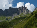
From Les Contamines-Montjoie; an out and return walk to the Lacs Jovet, joining and following the Tour du Mont Blanc trail for most of the way. There are more challenging alternatives to this walk to make it longer, more circular or technically harder; these are described in the useful information section.
From Col du Joly to Col de la Fenêtre
 4.07 mi
+1,010 ft
-988 ft
2h 45
Moderate
Departure from Les Contamines-Montjoie (Haute-Savoie)
4.07 mi
+1,010 ft
-988 ft
2h 45
Moderate
Departure from Les Contamines-Montjoie (Haute-Savoie)
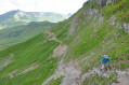
Hike on the trail separating the two passes. This hike offers views of the Mont Blanc massif from both passes. Not particularly difficult, but be careful on the slopes where the trail sometimes climbs quite steeply
Aiguille Croche and Mont Joly from the Col du Joly
 9.21 mi
+2,769 ft
-2,769 ft
6h 40
Difficult
Departure from Hauteluce (Savoie)
9.21 mi
+2,769 ft
-2,769 ft
6h 40
Difficult
Departure from Hauteluce (Savoie)
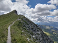
The ascent of Mont Joly, a unique viewpoint facing Mont Blanc, via the Aiguille Croche, which also offers superb panoramic views, with a long ridge walk between the two. A beautiful high mountain atmosphere.
stage 2 of the TMB
6.74 mi
+4,278 ft
-157 ft
6h 50
Difficult
Departure from Les Contamines-Montjoie (Haute-Savoie)
stage2 of the TMB: from Les Contamines-Montjoie to the Refuge de la Croix du Bonhomme.
Les Contamines to Les Chapieux - Tour Mont Blanc
10.10 mi
+4,334 ft
-3,097 ft
8h 25
Difficult
Departure from Les Contamines-Montjoie (Haute-Savoie)
This 2nd stage of the Tour Mont Blanc (TMB) follows the river Le Bonnant upstream to climb over the Col du Bonhomme at 2,329m. Let's do it!
The TMB is a classic long-distance footpath that goes around Mont Blanc, passing from France into Italy and through Switzerland before returning to France.
Tré la Tête mountain refuge and return via Combe Noire and La Sololieu
 7.24 mi
+2,946 ft
-2,949 ft
5h 55
Difficult
Departure from Les Contamines-Montjoie (Haute-Savoie)
7.24 mi
+2,946 ft
-2,949 ft
5h 55
Difficult
Departure from Les Contamines-Montjoie (Haute-Savoie)
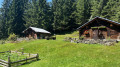
A lovely circular walk combining woodland, panoramic views, a refuge, a waterfall and a remarkable natural area.
Le Réguet
2.64 mi
+886 ft
-886 ft
2h 00
Easy
Departure from Notre-Dame-de-Bellecombe (Savoie)
A family-friendly trail offering the chance to explore the village of Notre-Dame-de-Bellecombe, its church and its bulbous bell tower – the village’s emblem – as well as the old farms of Le Cheloup.
Le Fay from Notre-Dame-de-Bellecombe
2.25 mi
+407 ft
-417 ft
1h 25
Easy
Departure from Notre-Dame-de-Bellecombe (Savoie)
Forest walk starting from the village with a splendid panorama of the Aravis mountain range. For this circular in the woods, park in the car park of the Notre-Dame-de-Bellecombe Tourist Office.
Mont Joly from the Signal gondola lift
9.37 mi
+2,562 ft
-3,875 ft
6h 30
Difficult
Departure from Les Contamines-Montjoie (Haute-Savoie)
This hiking route provides access to Mont Joly via the south face, bypassing the ridge between Les Croches and Le Joly. From the summit of Mont Joly, you can enjoy a magnificent panorama. Please note that the return journey involves a steep descent.
Col de la Fenetre
7.73 mi
+1,296 ft
-3,596 ft
4h 40
Moderate
Departure from Les Contamines-Montjoie (Haute-Savoie)
This walk starts from the top of the gondola at Le Signal. It is an interesting walk, up to and through the Col de la Fenetre. The descent takes you back down through alpine pastures and into the valley leading back to Les Contamines-Montjoie.
⚠️ Please note that you need to park at (A) and not (D) for this walk ⚠️
Circular loop of Pointe de Chombas from Les Troncs
 6.81 mi
+4,206 ft
-4,229 ft
7 hrs
Very difficult
Departure from Le Grand-Bornand (Haute-Savoie)
6.81 mi
+4,206 ft
-4,229 ft
7 hrs
Very difficult
Departure from Le Grand-Bornand (Haute-Savoie)
Pointe de Chombas is beautifully situated between Pointe Percée and Mont Charvet. It is a fairly long and technical circular hike, but one that offers exceptional views. You may spot ibex, chamois, or even a wolf.
Circuit of the Roselette, Prés, Balme and Nant Borrant stream huts
8.65 mi
+2,913 ft
-2,920 ft
6h 30
Difficult
Departure from Les Contamines-Montjoie (Haute-Savoie)
A circular hike or trail run with stunning views over the Val Montjoie, the nature reserve and the Mont Blanc massif. Passing through four refuges on the GR® du Tour du Beaufortain (Roselette and Prés) and the TMB (Balme, Nant Borrant), the sections are short, allowing you to top up your water supplies or take a coffee or lunch break.
The Gorges of Stream Rouge
 1.90 mi
+522 ft
-522 ft
1h 20
Difficult
Departure from Notre-Dame-de-Bellecombe (Savoie)
1.90 mi
+522 ft
-522 ft
1h 20
Difficult
Departure from Notre-Dame-de-Bellecombe (Savoie)
This is a round-trip hike through meadows and woods. The last part descends steeply to the wooden bridge over the Nant Rouge. This section can be quite slippery in wet weather.
⚠️Recommended for experienced hikers due to its dangerous nature (steep and very slippery sections).
Combe Noire waterfall
 3.15 mi
+1,102 ft
-1,086 ft
2h 25
Moderate
Departure from Les Contamines-Montjoie (Haute-Savoie)
3.15 mi
+1,102 ft
-1,086 ft
2h 25
Moderate
Departure from Les Contamines-Montjoie (Haute-Savoie)
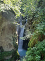
Combe Noire waterfall and its impressive torrential potholes.
Mont Rond via Les Frasses
 4.03 mi
+1,066 ft
-1,056 ft
2h 45
Easy
Departure from Notre-Dame-de-Bellecombe (Savoie)
4.03 mi
+1,066 ft
-1,056 ft
2h 45
Easy
Departure from Notre-Dame-de-Bellecombe (Savoie)
A family-friendly hike that takes you through the typical mountain pastures of the Beaufortin region, with Mont Rond as its highest point. The view from the summit offers a detailed panorama of the various peaks of the Aravis massif. The path to Lac de Gui overlooks the steep-sided valleys of Roche Blanche and the Ruisseau de Douce.
Tour des Fiz via the Passage du Dérochoir and Lac d'Anterne
 16.33 mi
+5,928 ft
-5,912 ft
10 hrs
16.33 mi
+5,928 ft
-5,912 ft
10 hrs
 Extremely difficult
Departure from Passy (Haute-Savoie) (Haute-Savoie)
Extremely difficult
Departure from Passy (Haute-Savoie) (Haute-Savoie)
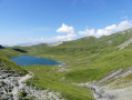
I invite you to tackle the Tour des Fiz, a route of considerable length with a significant elevation gain.Along the way, you’ll be treated to magnificent and varied scenery throughout this hike.Please note, you will encounter a difficult section during the ascent of the Passage du Dérochoir (6): the cliff face is fairly well-equipped but requires a degree of caution, particularly as it is quite exposed.
Plaine Joux - Refuge de Moëde Anterne via Lac de Pormenaz
5.04 mi
+2,484 ft
-371 ft
4h 30
Moderate
Departure from Passy (Haute-Savoie) (Haute-Savoie)
The first stage of a two-day excursion to Lac d'Anterne, this day allows us to reach the Refuge du Col d'Anterne via Les Argentières and Lac de Pormenaz.
Lac and Col d'Anterne in 2 days starting from Plaine Joux
12.33 mi
+4,222 ft
-4,206 ft
2 days
Moderate
Departure from Passy (Haute-Savoie) (Haute-Savoie)
If you spend a night at the Moëde Anterne refuge, you can make a round trip to Lake Anterne, taking a different route on the descent from the refuge.Beautiful view of Mont Blanc. Three lakes on the programme: Lac de Pormenaz on the first day, then a night at the refuge, Lac d'Anterne the next day, which reflects the rocky ridge of Les Fiz, and Lac Vert near Plaine Joux, to be saved for the return trip.
The Lac Vert and Lac de Pormenaz loop from Plaine Joux
 9.60 mi
+2,822 ft
-2,848 ft
6h 50
Difficult
Departure from Passy (Haute-Savoie) (Haute-Savoie)
9.60 mi
+2,822 ft
-2,848 ft
6h 50
Difficult
Departure from Passy (Haute-Savoie) (Haute-Savoie)
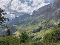
A route through a very wild landscape between two bucolic lakes, with views of Mont Blanc. Very stony trail, ideal after rain. Shaded route in the first and last quarters.
Pointe Noire de Pormenaz from Plaine Joux
 12.18 mi
+3,963 ft
-3,950 ft
8 hrs
Very difficult
Departure from Passy (Haute-Savoie) (Haute-Savoie)
12.18 mi
+3,963 ft
-3,950 ft
8 hrs
Very difficult
Departure from Passy (Haute-Savoie) (Haute-Savoie)
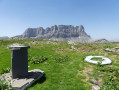
Starting from Plaine Joux (Passy), I suggest a somewhat challenging hike to reach the summit of the Pointe Noire de Pormenaz whilst enjoying magnificent scenery (particularly towards Mont Blanc).
Please note: there is a steep, securedsection (cables, ladders) between (9) and (10).
Refuge de Tré de la Tête from Notre-Dame de la Gorge
 6.43 mi
+2,635 ft
-2,608 ft
5h 15
Difficult
Departure from Les Contamines-Montjoie (Haute-Savoie)
6.43 mi
+2,635 ft
-2,608 ft
5h 15
Difficult
Departure from Les Contamines-Montjoie (Haute-Savoie)
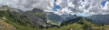
A lovely circular starting from the Notre-Dame de la Gorge car park. The path alternates between refreshing forests, meadows and breathtaking views. Among other things, you will see a natural bridge carved into the rock, a Roman bridge and the Combe Noire waterfall.
The Jovet lakes
 9.43 mi
+3,310 ft
-3,310 ft
7h 15
Moderate
Departure from Les Contamines-Montjoie (Haute-Savoie)
9.43 mi
+3,310 ft
-3,310 ft
7h 15
Moderate
Departure from Les Contamines-Montjoie (Haute-Savoie)
On the border between the Mont Blanc, Beaufortain and Tarentaise massifs, this hike will take you through alpine pastures to discover the Lacs Jovets at an altitude of over 2,100 metres.
Col de la Fenêtre circular from Notre-Dame de la Gorge
 7.99 mi
+3,481 ft
-3,474 ft
6h 40
Difficult
Departure from Les Contamines-Montjoie (Haute-Savoie)
7.99 mi
+3,481 ft
-3,474 ft
6h 40
Difficult
Departure from Les Contamines-Montjoie (Haute-Savoie)
A magnificent circular starting from Notre-Dame de la Gorge. The ascent of the Col de la Fenêtre will take you to a strategic point on the border between the Mont Blanc massif and the Beaufortain. From this narrow pass, you will enjoy a remarkable view of Mont Blanc to the east, Lac de la Girotte and the slopes of Hauteluce to the west.
Chalet de Roselette - Refuge de la Croix du Bonhomme
 6.16 mi
+3,261 ft
-1,358 ft
5h 40
Moderate
Departure from Les Contamines-Montjoie (Haute-Savoie)
6.16 mi
+3,261 ft
-1,358 ft
5h 40
Moderate
Departure from Les Contamines-Montjoie (Haute-Savoie)
From Roselette to the Croix du Bonhomme via a short section of the Tour du Mont Blanc variant.
Col des Annes to the Refuge Gramusset and back via Col de Borne Ronde
 5.53 mi
+2,028 ft
-2,028 ft
4h 20
Moderate
Departure from Le Grand-Bornand (Haute-Savoie)
5.53 mi
+2,028 ft
-2,028 ft
4h 20
Moderate
Departure from Le Grand-Bornand (Haute-Savoie)
A circular walk to the Gramusset Refuge through great limestone scenery.
Gramusset refuge
 4.03 mi
+1,640 ft
-1,640 ft
3h 15
Moderate
Departure from Le Grand-Bornand (Haute-Savoie)
4.03 mi
+1,640 ft
-1,640 ft
3h 15
Moderate
Departure from Le Grand-Bornand (Haute-Savoie)
An easy ridge leads to the Refuge Gramusset, offering magnificent views of the valleys on the Grand Bornand and Reposoir sides, as well as the Aravis mountain range and Pointe Percée with its sharp limestone pavement.
Col des Annes - Gouille des Fours via the Col des Verts
5.47 mi
+3,383 ft
-2,349 ft
5h 30
Difficult
Departure from Le Grand-Bornand (Haute-Savoie)
Depart from the Col des Annes, pass by the Refuge de la Pointe Percée, then by the Col des Verts. Camp at the Gouille des Fours, where ibex have made their home, with a magnificent view of Mont Blanc.
Tour of Mont Charvet with bivouac at Gouille des Fours
13.92 mi
+6,493 ft
-6,463 ft
2 days
Difficult
Departure from Le Grand-Bornand (Haute-Savoie)
Two-day tour in the Aravis mountain range. Departure from the Col des Annes, passing by the Refuge de la Pointe Percée, then the Col des Verts. Bivouac at the Gouille des Fours, where ibex have made their home, with a magnificent view of Mont Blanc. Second day towards Lac de Tardevant via the Grande Forclaz and Ambrevetta, returning via alpine pastures to the Pointe des Annes.
Pointe des Carmélites
 5.76 mi
+2,648 ft
-2,648 ft
4h 55
Very difficult
Departure from Le Grand-Bornand (Haute-Savoie)
5.76 mi
+2,648 ft
-2,648 ft
4h 55
Very difficult
Departure from Le Grand-Bornand (Haute-Savoie)
If you enjoy the karstic atmosphere of sharp limestone pavement, don't hesitate to undertake this fairly short hike, which offers beautiful scenery throughout. The first half follows paths, but the second half is off-trail. Choose your route carefully and don't be afraid of rocks. As a result, it takes longer than the elevation gain would suggest (3 hours of climbing).
This route is strongly discouraged in poor visibility, especially for the off-trail section.
Pointe Percée via the Cheminées de Sallanches
 5.67 mi
+3,563 ft
-3,563 ft
7 hrs
Extremely difficult
Departure from Le Grand-Bornand (Haute-Savoie)
5.67 mi
+3,563 ft
-3,563 ft
7 hrs
Extremely difficult
Departure from Le Grand-Bornand (Haute-Savoie)
The highest point in the Aravis range, Pointe Percée is a very popular summit. The route via the Cheminées de Sallanches proposed here is more technical and less frequented than others. The route and the view are magnificent!
Pointe de Chombas
 5.54 mi
+2,792 ft
-2,795 ft
5h 00
Difficult
Departure from Le Grand-Bornand (Haute-Savoie)
5.54 mi
+2,792 ft
-2,795 ft
5h 00
Difficult
Departure from Le Grand-Bornand (Haute-Savoie)
A neighbouring summit to the Pointe Percée but much less well-trodden, with a very rocky traverse across the sharp limestone pavement, presenting no major difficulty (a short section requiring the use of your hands, just for fun!), for those seeking a bit of peace and quiet, whilst still enjoying a 360° view.
Please take careful note of the route description (4) and the ‘Practical Information’ section.
Pointe Percée via the usual route
 5.74 mi
+3,602 ft
-3,579 ft
5 hrs
Very difficult
Departure from Le Grand-Bornand (Haute-Savoie)
5.74 mi
+3,602 ft
-3,579 ft
5 hrs
Very difficult
Departure from Le Grand-Bornand (Haute-Savoie)
Hike to the summit of the Aravis range. This popular summit, situated on the GRP® Massif de Tournette-Aravis, offers a magnificent 360° panorama of all the surrounding mountain ranges and peaks.
Although it does not require mountaineering equipment, the hike is rated TD as it requires a good sense of direction and features generally steep slopes, exposed sections, scree crossings and numerous sections where you need to use your hands.
Pointe de Bella Cha
 Tourism professional
 5.38 mi
+3,081 ft
-3,081 ft
5h 10
Very difficult
Departure from Le Grand-Bornand (Haute-Savoie)
5.38 mi
+3,081 ft
-3,081 ft
5h 10
Very difficult
Departure from Le Grand-Bornand (Haute-Savoie)
Although overshadowed by the Pointe Percée, the Pointe de Bella Cha is nonetheless an interesting peak with magnificent views, far removed from the crowds at its bigger sister peak. An easy access path, followed by steep grassy slopes, leads to the base of a huge sharp limestone pavement – which is great fun in places – and which takes you up to the final slopes.Please read the route description carefully before setting out on this mountain hike.
Refuge Nant Borrant - Refuge des Mottets
 9.72 mi
+4,452 ft
-3,018 ft
8h 20
Difficult
Departure from Les Contamines-Montjoie (Haute-Savoie)
9.72 mi
+4,452 ft
-3,018 ft
8h 20
Difficult
Departure from Les Contamines-Montjoie (Haute-Savoie)
Stage2 of the Tour du Mont Blanc: from the Nant Borrant mountain hut (Contamines-Montjoie) to the Mottets mountain hut (Bourg-Saint-Maurice) via the Col des Fours route.
Tour of Mont Lachat
 3.83 mi
+1,171 ft
-1,158 ft
2h 45
Easy
Departure from Crest-Voland (Savoie)
3.83 mi
+1,171 ft
-1,158 ft
2h 45
Easy
Departure from Crest-Voland (Savoie)
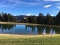
Short, easy hike with beautiful panoramic views of the Aravis and Mont Blanc. Lac du Mont Lachat at the summit, very pleasant with picnic tables.
Circular at Pointe Chombas
 7.80 mi
+3,281 ft
-3,307 ft
6h 25
Very difficult
Departure from Le Grand-Bornand (Haute-Savoie)
7.80 mi
+3,281 ft
-3,307 ft
6h 25
Very difficult
Departure from Le Grand-Bornand (Haute-Savoie)
The Aravis valleys are among the classic hiking destinations in Haute-Savoie. Pointe Chombas is a little less well known. Here is a circular route through pastures, forests and rocky areas. Some sections can be dizzying, others involve a bit of climbing but are not difficult. The reward is a little-visited summit offering panoramic views of the Alps, the Jura and, of course, the Mont Blanc range in the foreground.
(!) Please note: some parts of the route are challenging.