Lac des Évettes - Refuge du Petit Tétras

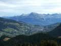
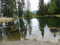
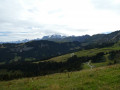
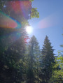
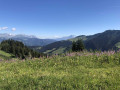
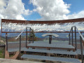
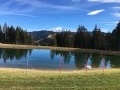
This route passes by the pretty little Lac des Évettes lake in the middle of the pine trees and then joins the Refuge du Petit Tétras near the arrival point of the Crêt du Midi chairlift with its original orientation table. Magnificent view of the Mont Blanc, Fiz and Aravis mountain ranges.

Details

3937238
Creation:
Last update:
Last review:
  • Walking
    Activity: Walking
  • ↔
    Distance: 5.45 mi
  • ◔
    Average duration: 3h 50 
  • ▲
    Difficulty: Moderate

  • ⚐
    Back to start: Yes
  • ↗
    Ascent: + 1,506 ft
  • ↘
    Descent: - 1,493 ft

  • ▲
    Highest point: 5,640 ft
  • ▼
    Lowest point: 4,380 ft

Photos

Description of the walk

To get to the start, from Notre-Dame-de-Bellecombe, follow the D1212 towards Les Saisies. At the top of the hill, turn immediately left towards Le Lachat - Les Béguelins. Follow this small uphill road, Route du Lachat, to the car park at the end (there is a tennis court).

(S/E) With your back to the tennis court, take the track on the right that follows the ridge to the next crossroads.

(1) Turn left onto the downhill track. At the edge of the woods, walk past an alpine chalet on your right, cross a wooded area and then a ski slope with a chairlift. Cross another wooded area and, at the edge, turn right onto a small flat track that enters the forest. You will soon reach Lac des Évettes.

(2) Continue on the path that starts at the top of the lake. Join a track and follow it to the right until you reach a three-way junction. Turn left and continue downhill to the next junction.

(3) Turn right and begin a steady climb. Ignore the secondary paths on the right or left, then cross a wood on a slight incline. At the end of the wood, turn right at the three-way junction and reach the start of a path on the right just after passing under the chairlift and a few metres before a chalet.

(4) Follow this path into the woods. Some sections are equipped with handrails but do not present any major difficulties.

(5) At the edge of the woods, continue climbing through the pastures, passing under the chairlift again and then near the start of a ski lift. Continue along the track that passes under it, making two hairpin bends, and you will reach the Refuge du Petit Tétras.

(6) Turn left towards the Crêt du Midi chairlift arrival point and reach the orientation table located on a wooden terrace.

(7) After enjoying the view, return to the Refuge du Petit Tétras.

(6) Continue along the almost horizontal track to the next junction.

(8) Ignore the turn-off to the left and begin the descent into the forest. After several hairpin bends, you will arrive at the Col du Drayon with its small car park.

(9) Leave the mountain track and take the ridge path on the right that follows the Roc des Évettes. Enjoy the views of the surrounding mountains and the Arly valley. Pass the Télésiège des Évettes chairlift and reach the next junction with the route taken on the way up.

(1) Take the same route back to the car park near the tennis court (S/E).

Waypoints

  1. S/E : mi 0 - alt. 4,833 ft - Car park
  2. 1 : mi 0.4 - alt. 4,888 ft - Crossroads, turn left downhill.
  3. 2 : mi 0.95 - alt. 4,432 ft - Lac des Évettes
  4. 3 : mi 1.57 - alt. 4,380 ft - Crossroads, on the left
  5. 4 : mi 2.31 - alt. 4,974 ft - Path on the right
  6. 5 : mi 2.49 - alt. 5,259 ft - Exit the woods and turn right uphill
  7. 6 : mi 2.78 - alt. 5,574 ft - Petit Tétras refuge
  8. 7 : mi 2.95 - alt. 5,633 ft - Orientation table
  9. 8 : mi 3.22 - alt. 5,617 ft - Crossroads, straight ahead
  10. 9 : mi 4.33 - alt. 4,980 ft - Col de Drayon (1519m)
  11. S/E : mi 5.45 - alt. 4,833 ft - Car park

Notes

The route is not well marked but easy to follow with numerous signposts.
Alternative route:
(8) You can take the track on the left to reach Crêt du Midi in about 30 minutes.

Reviews and comments

4.5 / 5
Based on 23 reviews

Reliability of the description
4.7 / 5
Ease of following the route
4.5 / 5
Route interest
4.4 / 5
pierre huraux
pierre huraux

Overall rating : 4.7 / 5

Date of your route : Aug 29, 2026
Reliability of the description : ★★★★★ Very good
Ease of following the route : ★★★★★ Very good
Route interest : ★★★★☆ Good
Very busy route : No

Follow the directions in “Details” carefully to reach the starting point (and do not follow Google Maps’ “Go to start” option, which would take you along a footpath by car!!!) and follow the signs for Lachat Les Béguelins. Drive to the end of the road to the car park – it’s straightforward.
It’s quite a long descent down to the little lake at Les Evette. Please note that between points 4 and 5, the handrails are in place and come in handy if the ground is damp. However, the sections themselves do not present any difficulties.
After the Petit Tétras refuge, we recommend heading to the Crêt du Midi, where only the final stretch requires a bit of care.
During this walk, there are superb views of Mont Blanc, the Aiguilles de Chamonix and the Aravis.
The descent is pleasant, even enjoyable, between points 9 and 1, on the Roc des Evettes.
According to the GPS: 10 km, elevation gain/loss: 570 m, 4 hours 50 minutes (at a leisurely pace).

Machine-translated

User 30298367
• Edited:

Overall rating : 4.7 / 5

Date of your route : Aug 06, 2026
Reliability of the description : ★★★★★ Very good
Ease of following the route : ★★★★★ Very good
Route interest : ★★★★☆ Good
Very busy route : No

Mainly a forest walk (perfect for sunny days). At the start, you head down to Lac des Evettes and then back up to the Petit Tétras mountain hut (passing under a few ski lifts), with a steeper section featuring a handrail, as indicated, but perfectly manageable for beginners like us with an 8-year-old child. Beautiful panoramic view from the orientation table. The section of the return route along the Roc des Evettes ridge is magnificent. The walk took 4 hours with a child.

Machine-translated

User 13037328

Overall rating : 4.3 / 5

Date of your route : Aug 17, 2026
Reliability of the description : ★★★★☆ Good
Ease of following the route : ★★★★☆ Good
Route interest : ★★★★★ Very good
Very busy route : No

It is highly recommended to continue on to the Crêt du Midi. For experienced walkers only.

Machine-translated

randonnee 2015
randonnee 2015

Overall rating : 4.7 / 5

Date of your route : Aug 07, 2026
Reliability of the description : ★★★★★ Very good
Ease of following the route : ★★★★★ Very good
Route interest : ★★★★☆ Good
Very busy route : No

A lovely outing for a first hike; after the mountain hut, we did a round trip to the Croix du Midi. There’s a beautiful view from the summit – you need to climb a little way past the cross to reach the viewing point.

Machine-translated

User 29807147

Overall rating : 4.7 / 5

Date of your route : Aug 07, 2026
Reliability of the description : ★★★★★ Very good
Ease of following the route : ★★★★★ Very good
Route interest : ★★★★☆ Good
Very busy route : No

A fairly strenuous hike, particularly the steep climb up to the refuge in the sun. The walk is nevertheless interesting overall, with breathtaking views.
The lake is just a small patch of water of little interest.
You can have a drink and lunch at the refuge, but a picnic at the tables overlooking the pass, with views of Mont Blanc, is far more impressive (about a hundred metres from the refuge, further up).

Machine-translated

christophebr
christophebr

Overall rating : 5 / 5

Date of your route : Jul 25, 2026
Reliability of the description : ★★★★★ Very good
Ease of following the route : ★★★★★ Very good
Route interest : ★★★★★ Very good
Very busy route : Yes

A straightforward walk with some challenging sections (a steep slope at the start and sections requiring the use of a rope) but entirely manageable
lovely view from the orientation table, where you can have a bite to eat (see table)
A very pleasant walk along the ridge
Completed in 3 hours (see risk of rain and thunderstorms) plus 40 minutes for a picnic
I recommend it

Machine-translated

Machecourt
Machecourt

Overall rating : 4.3 / 5

Date of your route : Jul 20, 2026
Reliability of the description : ★★★★★ Very good
Ease of following the route : ★★★★☆ Good
Route interest : ★★★★☆ Good
Very busy route : No

Plan B for this scorching hot day, as this relatively short route does indeed run largely through woodland. Shortly after setting off, there’s a surprising descent down to Lac des Evettes, but after that the climb is steady, half in the shade, half in the sun. There’s a lovely unobstructed view beyond the mountain hut. The descent is easy through the woods along a track suitable for vehicles, then along a breezy ridge. So this is a hike best saved for days when it’s really hot.

Machine-translated

Vigi
Vigi
• Edited:

Overall rating : 4.7 / 5

Date of your route : Jul 13, 2026
Reliability of the description : ★★★★★ Very good
Ease of following the route : ★★★★★ Very good
Route interest : ★★★★☆ Good
Very busy route : Yes

A lovely little walk.
A beautiful view of the Mont Blanc massif.

Machine-translated

Gbouv
Gbouv

Overall rating : 4.7 / 5

Date of your route : Jun 02, 2026
Reliability of the description : ★★★★★ Very good
Ease of following the route : ★★★★☆ Good
Route interest : ★★★★★ Very good
Very busy route : No

The route is very varied, with a few steep sections towards the end; it’s partly in the shade and partly in the sun, which is perfect for a walk in early June.
The path leading away from the lake is rather poorly signposted; we had to go back and forth twice to find the right way. You really must head towards Les Grabilles; after that, it’s fine.

Machine-translated

User 8796871

Overall rating : 4.3 / 5

Date of your route : Sep 08, 2025
Reliability of the description : ★★★★☆ Good
Ease of following the route : ★★★★★ Very good
Route interest : ★★★★☆ Good
Very busy route : No

Lovely trail through the woods

Machine-translated

User 26306045

Overall rating : 5 / 5

Date of your route : Jun 27, 2025
Reliability of the description : ★★★★★ Very good
Ease of following the route : ★★★★★ Very good
Route interest : ★★★★★ Very good
Very busy route : No

A variety of paths make this a very pleasant hike.
After Lac des Evettes, follow the gabilles before finding the sign indicating the refuge.
Some nice climbs, but always safe, to reach a magnificent panorama over Megève and the various peaks. (Continue past the refuge to the ski lift to see the orientation table)
It would be a shame to miss the Crêt du Midi (where we spotted marmots)

The return to the car park is pleasant via the Roc des Evettes

Machine-translated

Tiph
Tiph

Overall rating : 4.7 / 5

Date of your route : May 29, 2025
Reliability of the description : ★★★★★ Very good
Ease of following the route : ★★★★★ Very good
Route interest : ★★★★☆ Good
Very busy route : No

A pleasant hike to warm up.
We pushed on to Crest du Midi, as it would be a shame to miss it.
There's a slightly steep hill before you reach the refuge. There were no handrails, but that didn't stop us from getting there with a 6-year-old child.
The path was still very wet two days after the rain, so it was a bit slippery.
Beautiful view of the Mont Blanc massif.

Machine-translated

User 25832918

Overall rating : 4.7 / 5

Date of your route : May 29, 2025
Reliability of the description : ★★★★☆ Good
Ease of following the route : ★★★★★ Very good
Route interest : ★★★★★ Very good
Very busy route : Yes

It was a bit difficult to find the start, which was much further from Notre Dame de Bellecombe than we had thought.
At point 4, there is only one handrail cable, but it is not dangerous.
No problems otherwise, there are plenty of signposts.
A lovely walk.

Machine-translated

Bernard ROUSSEL
Bernard ROUSSEL

Overall rating : 5 / 5

Date of your route : Sep 23, 2024
Reliability of the description : ★★★★★ Very good
Ease of following the route : ★★★★★ Very good
Route interest : ★★★★★ Very good
Very busy route : No

A very beautiful route with just the right amount of difficulty (steep slopes, sections secured with cables for safety), variety in the path and a superb view at the end. Next time I'll go to Crêt du Midi!

Machine-translated

Kfranck
Kfranck

Overall rating : 4 / 5

Date of your route : Jun 29, 2024
Reliability of the description : ★★★★☆ Good
Ease of following the route : ★★★☆☆ Average
Route interest : ★★★★★ Very good
Very busy route : No

Machine-translated

Other walks in the area

For more walks, use our search engine .

The GPS track and description are the property of this route's author. Please do not copy them without permission.