Platé Refuge – Assy Plateau

Day two of the hike.
As you leave the Platé Refuge, you’re almost certain to meet very, very few people on the way to the Varan Refuge. You’ll feel as though you’re the first to discover the path. The long descent between the Col de Barmerousse and the Varan Refuge will remain etched in your memory.

This walk is part of a multi-day hike: Le désert de Platé en boucle depuis le plateau d'Assy

Details

n°675366
Creation:
Last update:
Last review:
  • Walking
    Activity: Walking
  • ↔
    Distance: 4.45 mi
  • ◔
    Average duration: 3h 20 
  • ▲
    Difficulty: Difficult

  • ⚐
    Back to start: No
  • ↗
    Ascent: + 1,463 ft
  • ↘
    Descent: - 4,780 ft

  • ▲
    Highest point: 7,618 ft
  • ▼
    Lowest point: 3,320 ft

Photos

Description of the walk

(S/E) On leaving the refuge, take the path on the right towards the Col de Barmerousse, signposted as a 1 hour 45 minute walk. It is essential to follow the red markers that signpost the route to the Refuge de Varan. You will pass near some ruins, likely former sheepfolds, where, without straying too far from the path, you can take a short break before heading uphill again. You will reach the Col de Barmerousse.

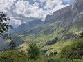
(1) Begin a long descent down the slope, covering 700 metres in elevation, with a view of the hamlet where the Refuge de Varan is situated. At an altitude of around 1,850 metres, ignore a path branching off to the left and continue the descent.

(2) Continue to the left, passing in front of the refuge; the path then joins, from the left below the refuge, a signpost indicating the Plateau d’Assy is 1 hour 25 minutes away. Here, rejoin theGRP® du Pays du Mont-Blanc until the next junction.

(3) Leave theGRP® and head down to the right towards the hamlet of Curalla. Do not head up towards the upper part of the hamlet. Continue downhill until you reach a signpost reading “Pedestrian path – Plateau d’Assy 0h35”.

(4) By leaving the forest track to take this fairly steep path, you’ll save a little distance.
Please note! This path does not appear on the 1:25,000 IGN maps; the signpost is not very visible and is easy to miss. However, you can continue along the forest track.

(5) Join the forest track (near two reservoirs), cross it and immediately take a path heading east.
When the path splits into two branches – one going uphill and one on the right going downhill – take the path down to the right.

(6) At the signpost near a stream, head towards the Jardin des Cimes (0h10).

(7) Just before reaching the Chemin de la Charmette (tarmac road), if you’ve been doing the hike over two days, you’ll have returned to the signpost you passed the day before. Head down to your right to the car park (E).


Waypoints

  1. S : mi 0 - alt. 6,650 ft - Refuge de Platé
  2. 1 : mi 1.78 - alt. 7,618 ft - Col de Barmerousse (2325m)
  3. 2 : mi 2.84 - alt. 5,253 ft - Signpost below the Varan refuge
  4. 3 : mi 3.04 - alt. 5,003 ft - Change of direction
  5. 4 : mi 3.58 - alt. 4,416 ft - Change of direction
  6. 5 : mi 3.8 - alt. 3,780 ft - Return to the forest track, which you cross
  7. 6 : mi 4.04 - alt. 3,589 ft - Change of direction. Signpost
  8. 7 : mi 4.36 - alt. 3,425 ft - Change of direction. Signpost
  9. E : mi 4.45 - alt. 3,320 ft - Car park

Notes

You’ll need suitable footwear and a good supply of water, as there’s nowhere to top up your supplies before the fountain near the Refuge de Varan. There’s no shade along the route to the refuge. An early start is recommended.
This walk should be undertaken in dry weather, given the section through the sharp limestone pavement and the descent to the Refuge de Varan. Do not stray from the red markers that guide your way.
The long descent, where you’ll need to find a firm footing, may put a strain on your knees and/or thighs.
For the average walker, allow 5½ hours to complete this walk, plus or minus a little extra time for eating, drinking and resting.

Worth a visit

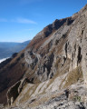
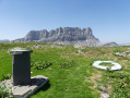
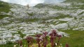
You’ll encounter sharp limestone pavement during the climb towards the Col de Barmerousse. Be sure to take a look towards the Refuge de Platé before it disappears from view.
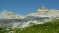
As well as the view of the Mont Blanc massif, to your right and then behind you, you’ll be able to admire peaks such as the Tête du Colonney, the Sautet, the Aiguille Rouge and the Aiguille de Varan.

Reviews and comments

4.2 / 5
Based on 2 reviews

Reliability of the description
4.5 / 5
Ease of following the route
4 / 5
Route interest
4 / 5
Valerie D
Valerie D

Overall rating : 5 / 5

Date of your route : Aug 28, 2023
Reliability of the description : ★★★★★ Very good
Ease of following the route : Not used / Not applicable
Route interest : Not used / Not applicable
Very busy route : No

We extended the walk by going via the Varan chalets – a lovely option that didn’t disappoint us.

Machine-translated

loict31
loict31

Overall rating : 4 / 5

Date of your route : Jul 14, 2020
Reliability of the description : ★★★★☆ Good
Ease of following the route : ★★★★☆ Good
Route interest : ★★★★☆ Good
Very busy route : No

A lovely route – watch out for the elevation gain up to the pass, with a series of ascents and descents.
The route is very well signposted with red markers at regular intervals.
Stunning panoramic views of the Mont Blanc massif and the Aiguilles...
The descent to Varan is steep but not dangerous; walking poles are recommended, however.

Machine-translated

Gilcool 1
Gilcool 1

The climb to the Col de Barmerousse went smoothly. The path was muddy but well-marked; walking poles are recommended for the descent given the steep gradient. The traverse to Platé was not completed on 20 June due to the presence of large snowfields from the Col de Barmerousse onwards. The traverse is not recommended before 14 July without the appropriate equipment (crampons/ice axe). However, the ascent to the Aiguille de Varan is possible for those with sure-footedness.

Machine-translated

Other walks in the area

For more walks, use our search engine .

The GPS track and description are the property of this route's author. Please do not copy them without permission.