The Granges and Montavus circular snowshoe loop

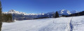
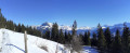
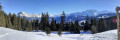
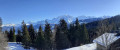
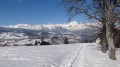
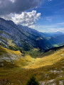
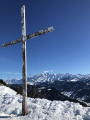
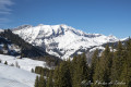
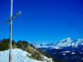
A lovely circular snowshoe route offering magnificent views of the Mont Blanc massif, the Fiz massif and, in particular, the Aiguilles de Warens and the Aravis.

Details

n°18557575
Creation:
Last update:
Last review:
  • Snowshoeing
    Activity: Snowshoeing
  • ↔
    Distance: 6.08 mi
  • ◔
    Duration according to the author: 4 hrs 
  • ▲
    Difficulty: Moderate

  • ⚐
    Back to start: Yes
  • ↗
    Ascent: + 1,332 ft
  • ↘
    Descent: - 1,329 ft

  • ▲
    Highest point: 4,537 ft
  • ▼
    Lowest point: 3,648 ft

Photos

Description of the walk

The start of this hike is at the Cry car park (Combloux ski area).

(S/E) From the car park, head towards the snow play area to the left of the Mabboux sports shop. Make your way to the bottom station of the Beauregard chairlift, passing between the Brons chairlift and the restaurant ‘Chez Albert’.

(1) Follow the footpath/snowshoe trail that runs alongside the Beauregard chairlift. Turn right, heading west, then north; pass under the lower station of the Perthuis chairlift and continue to a Y-junction near a chalet.

(2) Take the path on the left (signposted ‘Le Bâchais’). Head north-west until you reach a signpost marked ‘Raquettes’.

(3) Leave the Le Bâchais path on your left and enter the forest onto the circular snowshoe path (Les Montavus). Follow the signposts carefully as far as Les Lovatières.

(4) At the ‘Raquettes’ signpost, turn sharply westwards and follow the ‘Granges’ circular loop. Pass the Mouilles Fleuries chalets to reach a junction.

(5) Ignore the path on the left which climbs towards the Col du Jaillet and take the path on the right which descends towards Les Granges. Continue to the ‘Les Granges’ signpost just before two chalets.

(6) Do not follow this route; instead, turn right onto the path leading to Les Montavus. Walk through the Bois des Tours. Enjoy the magnificent view of Mont Blanc as you emerge from the woods, just before the Montavus chalet.

(7) At the Montavus junction, carry on straight ahead towards La Grangeat. Head eastwards until you reach a small road at a bend.

(8) Turn right and follow the road for about fifty metres southwards. Turn right, following the sign for Les Seugets.

(9) Head south towards Route du Vernay. At Les Granges, you’ll come to a Fork in the road.

(10) Take the right-hand path, the Chemin des Granges-Est, and you’ll come to a junction where it crosses the path you took on the way there.

(2) From here, return to the Cry car park via the same route (S/E).

Waypoints

  1. S/E : mi 0 - alt. 3,898 ft - La Cry car park
  2. 1 : mi 0.23 - alt. 3,927 ft - Lower station of the Beauregard chairlift
  3. 2 : mi 1.02 - alt. 4,327 ft - Y-junction – turn left
  4. 3 : mi 1.28 - alt. 4,495 ft - Lovatières snowshoe trail
  5. 4 : mi 2.08 - alt. 4,068 ft - Les Lovatières
  6. 5 : mi 2.69 - alt. 3,796 ft - Route des Granges
  7. 6 : mi 2.85 - alt. 3,707 ft - Les Granges
  8. 7 : mi 3.53 - alt. 3,740 ft - Montavus
  9. 8 : mi 3.99 - alt. 3,652 ft - La Grangeat
  10. 9 : mi 4.12 - alt. 3,760 ft - Les Seugets
  11. 10 : mi 4.39 - alt. 3,757 ft - Chemin des Granges Est
  12. S/E : mi 6.08 - alt. 3,898 ft - La Cry car park

Notes

Depending on snow conditions, you may need to take off your snowshoes between point (8) and point (10).

Worth a visit

View of the Mont Blanc massif and the Aravis massif.

Reviews and comments

4.2 / 5
Based on 2 reviews

Reliability of the description
4.5 / 5
Ease of following the route
3.5 / 5
Route interest
4.5 / 5
sylvie84000
sylvie84000

Overall rating : 3.7 / 5

Date of your route : Sep 18, 2025
Reliability of the description : ★★★★☆ Good
Ease of following the route : ★★☆☆☆ Disappointing
Route interest : ★★★★★ Very good
Very busy route : No

A beautiful hike through pastures and forests with stunning views. At the start of the hike, due to construction work on the lower chairlift station, the path is not very well marked... luckily we had our GPS
The hike is really worth doing because it is so varied. I recommend having a picnic after point 7 (Montavus) because the view of the Aravis and Mont Blanc is breathtaking. I recommend this hike with a GPS

Machine-translated

henrigole
henrigole

Hello,
Having read your comment:

A very peaceful but rather uninteresting walk.

and the interest rating you gave the route is ****
I suppose you meant to say:
A very peaceful and very interesting walk.

Machine-translated

seminois
seminois

Overall rating : 4.7 / 5

Date of your route : Feb 08, 2025
Reliability of the description : ★★★★★ Very good
Ease of following the route : ★★★★★ Very good
Route interest : ★★★★☆ Good
Very busy route : No

A lovely hike on hard-packed snow, done with crampons.
Stunning views of the Mont Blanc massif, as well as the Aravis and the Aiguilles de Varan.
We met three couples. A very peaceful but rather uninteresting walk.
I’d highly recommend it – perhaps suitable for children.
Seminois

Machine-translated

Other walks in the area

For more walks, use our search engine .

The GPS track and description are the property of this route's author. Please do not copy them without permission.