Rochebrune and Alpette circular from Leutaz

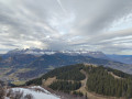
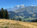
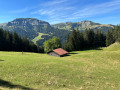
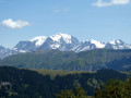
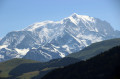
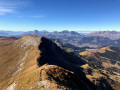
This is a lovely circular in the mountain pastures above Megève with superb forest passages and magnificent views of the Mont Blanc range on arrival at Rochebrune.

Details

39633510
Creation:
Last update:
Last review:
  • Walking
    Activity: Walking
  • ↔
    Distance: 4.87 mi
  • ◔
    Average duration: 3h 55 
  • ▲
    Difficulty: Moderate

  • ⚐
    Back to start: Yes
  • ↗
    Ascent: + 1,906 ft
  • ↘
    Descent: - 1,900 ft

  • ▲
    Highest point: 6,201 ft
  • ▼
    Lowest point: 4,318 ft

Photos

Description of the walk

Park in the car park in the village of Leutaz.

(S/E) Take the track that climbs towards the restaurants and Alpette. Continue to the start of the path towards Rochebrune at the Fontanettes crossroads.

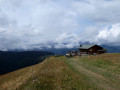
(1) Take the path on the left, passing in front of the Ferme des Fontanettes. You will arrive at the lower station of the Alpette chairlift. Continue along the winding path to reach the Maison Forestière.

(2) Turn left and continue climbing. Shortly afterwards, you will arrive at Rochebrune, a large ski lift site. Take the opportunity to admire the view of Mont Blanc.

(3) Turn right to continue the climb, quickly reaching a crossroads with a path.

(4) Take the path on the right, running parallel to the ski run. Further on, pass under the chairlift and follow a left-hand bend to reach the Alpette restaurant.

(5) Turn right back onto the track, then turn left to reach the upper station of the Jardin chairlift.

(6) Continue to the top station of the Petite Fontaine chairlift, where there is also a picnic area. Continue for a few dozen metres to reach the Sur les Prés chalet crossroads.

(7) Turn right and quickly enter the woods: be careful on this section as there are many roots on the path. Descend and follow a few switchbacks to reach Les Chambrettes.

(8) Take the path that winds down through the woods. When you come out of the woods, you will reach the Parrin chalets.

(9) Turn right and follow the right bank of the Cassioz stream. Continue along a wider track to return to the initial crossroads at Les Fontanettes.

(1) Retrace your steps to return to the Leutaz car park (S/E).

Waypoints

  1. S/E : mi 0 - alt. 4,321 ft - Leutaz car park
  2. 1 : mi 0.23 - alt. 4,462 ft - Fontanettes
  3. 2 : mi 1.14 - alt. 5,354 ft - Forest House
  4. 3 : mi 1.72 - alt. 5,748 ft - Rochebrune
  5. 4 : mi 2 - alt. 5,764 ft - Trail fork
  6. 5 : mi 2.6 - alt. 6,115 ft - L'Alpette
  7. 6 : mi 2.83 - alt. 6,201 ft - Jardin chairlift
  8. 7 : mi 3.22 - alt. 6,093 ft - On the Meadows
  9. 8 : mi 3.88 - alt. 5,282 ft - Les Chambrettes
  10. 9 : mi 4.23 - alt. 4,619 ft - Parrin
  11. S/E : mi 4.87 - alt. 4,324 ft - Leutaz car park

Notes

There are no water points along the route.
The climb to Rochebrune is very interesting. Avoid the tracks as much as possible.
The descent into the forest is quite steep and strewn with roots on the ground. You will need to remain alert.
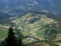
There are lots of cows in the mountain pastures, which are always a pleasure to encounter.

Worth a visit

(S/E) If the restaurants are open, you can enjoy a nice beer or other drink with a crêpe or other snack when you arrive.

Reviews and comments

4.7 / 5
Based on 18 reviews

Reliability of the description
4.8 / 5
Ease of following the route
4.6 / 5
Route interest
4.6 / 5
patrick55
patrick55

Thank you for this very interesting feedback. This year, this walk is on our hiking group’s itinerary (we’ll be staying in Praz next week) and I’ll take your constructive comments on board.

Machine-translated

pierre huraux
pierre huraux

Overall rating : 4.7 / 5

Date of your route : Aug 30, 2026
Reliability of the description : ★★★★★ Very good
Ease of following the route : ★★★★★ Very good
Route interest : ★★★★☆ Good
Very busy route : No

A relatively large car park, easy to find.
Please note: If you look closely at the map, check the contour lines between points 7 and 9: this is why we chose to do the suggested route in reverse: the climb between 9 and 7 is continuous and steep at around 30° all the way up – it’s a tough climb (but watch your knees if you’re going the other way).
Whereas the descent between point 3 (Rochebrune) and point 1 went without a hitch, and is even relatively comfortable.
There were plenty of people between point 7 (on the meadows) and point 3 (Rochebrune), coming from Megève by various means (chairlifts or cable car).
Otherwise, a pleasant walk, with an ascent through the forest and consistently beautiful panoramic views of the Mont Blanc massif, the Aiguilles de Chamonix and the Aravis.
According to the GPS: 8 km, elevation gain/loss: 588 m, 4 hours 50 minutes (walking mode).

Machine-translated

PROM
PROM

Overall rating : 4.3 / 5

Date of your route : Jul 23, 2026
Reliability of the description : ★★★★★ Very good
Ease of following the route : ★★★★☆ Good
Route interest : ★★★★☆ Good
Very busy route : No

It’s worth noting that between 7 and 9, the descent is really very steep

Machine-translated

rabedroc 1
rabedroc 1

Overall rating : 4.3 / 5

Date of your route : Jul 16, 2026
Reliability of the description : ★★★★☆ Good
Ease of following the route : ★★★★☆ Good
Route interest : ★★★★★ Very good
Very busy route : No

The most beautiful route of our week.
Stunning scenery with alternating views of the mountains and meadows.
This route is relatively easy to complete.
Highly recommended

Machine-translated

christophebr
christophebr

Overall rating : 4.7 / 5

Date of your route : Jul 19, 2026
Reliability of the description : ★★★★★ Very good
Ease of following the route : ★★★★★ Very good
Route interest : ★★★★☆ Good
Very busy route : No

A pleasant, unpretentious walk. The start is steep, and the descent is a bit steep, so you need to stay alert.
At the summit, there’s the potential for a beautiful view of Mont Blanc. Note that there are ski lifts at the summit.
Picnic tables with lovely panoramic views, particularly the one we used, which overlooks the Aravis

Machine-translated

Zoltic
Zoltic

Overall rating : 5 / 5

Date of your route : Jul 14, 2026
Reliability of the description : ★★★★★ Very good
Ease of following the route : ★★★★★ Very good
Route interest : ★★★★★ Very good
Very busy route : No

I was delighted to do this route again.
I found that the restaurant at Rochebrune is rather expensive. The one at L’Alpette was closed.
There was only patchy shade on the way up, but much more of it on the way down.

Machine-translated

patrick55
patrick55

I am delighted that you enjoyed this hike so much. Next year, in September 2026, my club will be hiking for a week in this area. Of course, this hike will be part of my programme. Thank you for your comments.

Machine-translated

Zoltic
Zoltic

Overall rating : 5 / 5

Date of your route : Nov 10, 2025
Reliability of the description : ★★★★★ Very good
Ease of following the route : ★★★★★ Very good
Route interest : ★★★★★ Very good
Very busy route : No

This route offers excellent value for effort.

I did it when there was snow on the peaks. Magnificent! Apart from the last 100 metres of elevation gain, the rest was sheltered from the wind (and probably from the sun in summer). Two mountain restaurants are the only places to get water. They are closed at this time of year.

The winter storage of the signs had already begun, and those on the slopes had been removed. The turn at point 7 in particular was difficult to find, especially as the path is very poorly marked at this point.

Machine-translated

User 9320071

Overall rating : 4.3 / 5

Date of your route : Oct 13, 2025
Reliability of the description : ★★★★☆ Good
Ease of following the route : ★★★★☆ Good
Route interest : ★★★★★ Very good
Very busy route : No

Superb hike starting from Megève.
Magnificent panoramic views (especially) at Rochebrune
⭐️⭐️⭐️
Alpine pastures, forests, meadows, beautiful chalets, a river, cows, horses... It's all there.
However, there is quite a climb and it's seriously steep!😬

Machine-translated

Lolo 38
Lolo 38

Overall rating : 4 / 5

Date of your route : Aug 23, 2025
Reliability of the description : ★★★★☆ Good
Ease of following the route : ★★★★☆ Good
Route interest : ★★★★☆ Good
Very busy route : No

The climb up and descent are a little steep and slippery on the way back, so it might be better to do it the other way round. Beautiful arrival at the top with breathtaking views

Machine-translated

codulac
codulac

Overall rating : 4.7 / 5

Date of your route : Aug 17, 2025
Reliability of the description : ★★★★★ Very good
Ease of following the route : ★★★★☆ Good
Route interest : ★★★★★ Very good
Very busy route : No

forests, ridges and peaks, fields, panoramic views, cows, a lake, peace and space: 5 stars, thanks to the contributor. An easy route, but you need to be comfortable with heights
We did it in reverse; we avoided Le Guet (one of us was afraid of heights), which is very easy. The forest provided wonderful protection from the heatwave (90% of the route was covered)
But... 13 km on the clock and not 8 🤪: bring more water!

Machine-translated

philippe basty
philippe basty

Overall rating : 5 / 5

Date of your route : Aug 18, 2025
Reliability of the description : ★★★★★ Very good
Ease of following the route : ★★★★★ Very good
Route interest : ★★★★★ Very good
Very busy route : No

Same comment as last year: a beautiful route, not very busy from the Leutaz car park to Rochebrune.
More people further on, and always surrounded by people who don't say hello
Thanks to the author for this beautiful hike.

Machine-translated

patrick55
patrick55

Hello, the years go by and they are all the same. I am posting exactly the same comment as last year at the same time, with intense heat in Allauch (a village near Marseille).
Glad you enjoyed the hike. It's very hot here in the south at the moment. I'd love to do that hike again for the cool air and mountain scenery.

Machine-translated

Blp69
Blp69

Overall rating : 4.7 / 5

Date of your route : Jul 05, 2025
Reliability of the description : ★★★★★ Very good
Ease of following the route : ★★★★☆ Good
Route interest : ★★★★★ Very good
Very busy route : No

A wonderful little hike in the cool air of the Megeve mountain pastures. The end of the route is a bit steeper and can be slippery.

Machine-translated

Yrabour
Yrabour

Overall rating : 5 / 5

Date of your route : Aug 18, 2024
Reliability of the description : ★★★★★ Very good
Ease of following the route : ★★★★★ Very good
Route interest : ★★★★★ Very good
Very busy route : Yes

Very beautiful hike, superb views of the Mont Blanc range. The descent from Sur les Près is quite steep and can pose some problems in wet conditions.

Machine-translated

Other walks in the area

For more walks, use our search engine .

The GPS track and description are the property of this route's author. Please do not copy them without permission.