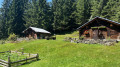
Circuit of the Roselette, Prés, Balme and Nant Borrant stream huts

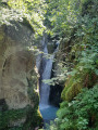
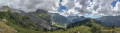
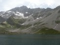
A circular hike or trail run with stunning views over the Val Montjoie, the nature reserve and the Mont Blanc massif. Passing through four refuges on the GR® du Tour du Beaufortain (Roselette and Prés) and the TMB (Balme, Nant Borrant), the sections are short, allowing you to top up your water supplies or take a coffee or lunch break.

Details

102285434
Creation:
Last update:
Last review:
  • Walking
    Activity: Walking
  • ↔
    Distance: 8.65 mi
  • ◔
    Average duration: 6h 30 
  • ▲
    Difficulty: Moderate

  • ⚐
    Back to start: Yes
  • ↗
    Ascent: + 2,913 ft
  • ↘
    Descent: - 2,920 ft

  • ▲
    Highest point: 6,388 ft
  • ▼
    Lowest point: 3,921 ft

Description of the walk

Park in the car park at Notre-Dame de la Gorge.

(S/E) Continue south along the Route de Notre-Dame de la Gorge until you reach the church.

(1) Walk past the church and take the path on the right leading into the woods. A sign here warns that the path is difficult due to a steep gradient. Follow this path and the signposts to reach the hamlet of l’Anery.

(2) Continue along the steep climb until you reach the Chenelattaz crossroads, where you’ll find the ‘Variante du Tour du Pays du Mont-Blanc’ route.

(3) Turn left onto this route and continue to the Bûche Croisée crossroads.

(4) Keep left to reach the Roselette Refuge in short order.

(5) Turn left onto the GRP® Tour du Beaufortain, making an almost 180° turn. Follow the almost level path through the Vallon de Rozières des Prés to reach the Chalets des Prés.

(6) Carry on straight ahead, now on a slight incline, pass under a power line, then reach the Refuge des Prés at the highest point of the walk.

(7) Continue along the GRP® Tour du Beaufortain, heading south, until you reach the junction with the alternative route leading to the GR®5.

(8) Take this branch, to the left, to reach the Refuge de la Balme.

(9) Carry on straight ahead, now on the GR®5, which runs alongside the GRP® du Beaufortain. After a long but easy descent, you’ll find the Refuge de Nant Borrant in the valley.

(10) Continue along this valley, passing the Roman Bridge over the Téna. Carry on to the left and, via the Roman Track, return to the crossroads at Notre-Dame de la Gorge.

(1) Retrace your steps along the same route as on the way there until you reach the car park at Notre-Dame de la Gorge (S/E).

Waypoints

  1. S/E : mi 0 - alt. 3,927 ft - Car park at - Notre Dame de la Gorge
  2. 1 : mi 0.18 - alt. 3,950 ft - Notre Dame de la Gorge
  3. 2 : mi 0.68 - alt. 4,521 ft - l’Anery
  4. 3 : mi 1.14 - alt. 5,108 ft - La Chenelettaz
  5. 4 : mi 1.57 - alt. 5,623 ft - Bûche Croisée
  6. 5 : mi 2.12 - alt. 6,132 ft - Refuge de la Roselette
  7. 6 : mi 3.61 - alt. 5,928 ft - Les Prés
  8. 7 : mi 4.36 - alt. 6,365 ft - Le Refuge des Prés
  9. 8 : mi 5.09 - alt. 6,260 ft - GR junction
  10. 9 : mi 5.81 - alt. 5,584 ft - Refuge de la Balme
  11. 10 : mi 7.3 - alt. 4,800 ft - Refuge de Nant Borrant
  12. S/E : mi 8.65 - alt. 3,924 ft - Car park at - Notre Dame de la Gorge

Notes

Note: the route can be walked in either direction, although the descent via the Anery is less pleasant at the end of the walk than it is on the ascent at the start. There are no major difficulties on the route, but the climb to the Refuge de Roselette via the Anery is steep at the start.
No special equipment is required. The route can be shortened by descending directly from Les Prés to Nant Borrant, thus avoiding the circular route via the Refuge de la Balme.
Water points along the route at the refuges.
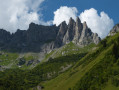
Between (5) and (6): heading towards Les Prés, the path runs along a ledge beneath the Aiguille de Roselette and offers a beautiful panoramic view of the Val Montjoie. You enter the nature reserve and the path follows a natural course to the Refuge des Prés.
(6) It is possible to take a shortcut and descend directly to the stream Borrant by turning left onto the path through the Bois de la Rollaz.

This route passes through a protected area, which may be subject to special regulations:

Worth a visit

Val Montjoie.
Les Contamines-Montjoie Nature Reserve.
Mont Blanc.

Always be cautious and plan ahead when you're outdoors. Visorando and the author of this route cannot be held responsible for any accidents occurring on this route.

The GR® and PR® markings are the intellectual property of the Fédération Française de Randonnée Pédestre.

Other walks in the area

For more walks, use our search engine .

The GPS track and description are the property of this route's author. Please do not copy them without permission.