Pointe de Chombas

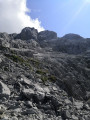
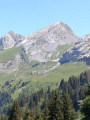
A neighbouring summit to the Pointe Percée but much less well-trodden, with a very rocky traverse across the sharp limestone pavement, presenting no major difficulty (a short section requiring the use of your hands, just for fun!), for those seeking a bit of peace and quiet, whilst still enjoying a 360° view.
Please take careful note of the route description (4) and the ‘Practical Information’ section.

Details

683377
Creation:
Last update:
Last review:
  • Walking
    Activity: Walking
  • ↔
    Distance: 5.54 mi
  • ◔
    Average duration: 5h 00 
  • ▲
    Difficulty: Difficult

  • ⚐
    Back to start: Yes
  • ↗
    Ascent: + 2,792 ft
  • ↘
    Descent: - 2,795 ft

  • ▲
    Highest point: 7,956 ft
  • ▼
    Lowest point: 5,650 ft

Photos

Description of the walk

(S/E) Start from the Col des Annes car park. Take the 4x4 track and you’ll reach the Tête des Annes (the top of the Annes chairlift) fairly quickly.

(1) Continue straight on (the path on your left is a shortcut off the 4x4 track that leads back to the car park) towards the Col de l’Oulettaz. Be careful: at the pass, the path is a bit steep and slippery. A chain makes the passage easier.

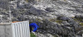
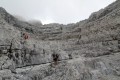
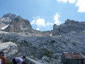
(3) The path, which is not difficult, climbs to the Refuge de Gramusset. Just past the refuge (heading south), a blue-painted arrow points towards ‘Chombas’. The route through the sharp limestone pavement is exceptionally well marked. Follow the arrows and the blue paint markings, often accompanied by cairns, through the sharp limestone pavement (these are sometimes as frequent as every 10 m). You’ll reach the foot of the rocky ridge where the route is marked by a blue arrow (at around 2,350 m). There is currently a snowfield about 10 m above and another a few metres below.

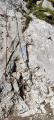
(4) You’ll soon reach a small cliff face about 4 to 5 metres high, equipped with two knotted ropes, which you can cross without much difficulty. After that, apart from one or two sections where you’ll need to use your hands – though these are not at all difficult – it’s a classic mountain path all the way to the summit. Blue markings are present right up to the point where the path emerges onto the dome known as ‘Les Prés aux Chèvres’. From there, the path is clearly marked all the way to the summit.

(5) For the return journey, take the same route back to the Col des Annes (S/E).

Waypoints

  1. S/E : mi 0 - alt. 5,653 ft - Car park - Col des Annes (1721m)
  2. 1 : mi 0.47 - alt. 6,106 ft - Arrival at the chairlift - Tête des Annes
  3. 2 : mi 1.08 - alt. 6,286 ft - Crossing the Col de l’Oulettaz
  4. 3 : mi 1.99 - alt. 7,090 ft - Refuge Gramusset
  5. 4 : mi 2.53 - alt. 7,697 ft - Approximate location of the start of the route
  6. 5 : mi 2.76 - alt. 7,956 ft - Pointe de Chombas
  7. S/E : mi 5.54 - alt. 5,653 ft - Car park – Col des Annes (1,721 m)

Notes

There are no water sources, but the Gramusset Refuge is located roughly two-thirds of the way along the route.

Precautions to take:
- At the Col de l’Oulettaz, the path is a little steep and slippery. A chain makes the passage easier.
- Crossing the sharp limestone pavement is tricky due to the numerous crevasses and their very sharp ridges.

Please note: on the descent, a path branches off towards the Combe de Chombas, situated between the Pointe de Chombas and Mont Charvet (shown as a dotted line on the map), on your left: I’m not familiar with this section, but I saw two mountaineers coming from that direction.

Worth a visit

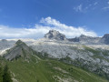
At the summit, a 360° panorama awaits you (Jalouvre, Pointe Blanche, Pointe de Balafrasse, Bargy, Pointe de 2 h, etc.); part of the Aravis range; the Mont Blanc massif; the Arve valley; the Bouchet valley; etc.

The new Gramusset refuge is nearing completion.

Reviews and comments

4.8 / 5
Based on 2 reviews

Reliability of the description
4.5 / 5
Ease of following the route
5 / 5
Route interest
5 / 5
Aluque
Aluque

Overall rating : 4.7 / 5

Date of your route : Sep 08, 2024
Reliability of the description : ★★★★☆ Good
Ease of following the route : ★★★★★ Very good
Route interest : ★★★★★ Very good
Very busy route : Yes

A lovely walk

Machine-translated

maxcaviso
maxcaviso

Overall rating : 5 / 5

Date of your route : Oct 08, 2023
Reliability of the description : ★★★★★ Very good
Ease of following the route : ★★★★★ Very good
Route interest : ★★★★★ Very good
Very busy route : Yes

A lovely summit
You need to be sure-footed to cross the sharp limestone pavement; otherwise, the route is straightforward.
The section described at around 2350 is easily managed. (3m).
The view of the Pointe Percée is magnificent.
The path from the Col des Annes to the Gramusset refuge is very busy.

Machine-translated

Other walks in the area

For more walks, use our search engine .

The GPS track and description are the property of this route's author. Please do not copy them without permission.