Country:

 City:
City:


From Notre-Dame-de-Bellecombe, head towards Les Saisies. Look for the Route du Lachat on the left. Drive as far up as possible, to the car park at the end of the road (next to a tennis court).
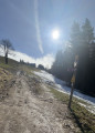
(S/E) Take a wide path heading due east until you reach a crossroads of paths.
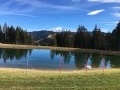
(1) Turn left onto the descending track. You’ll pass a chairlift and then a ski lift in quick succession. The path splits. Take the track straight ahead, which will quickly lead you to Lac des Évettes (a lake much praised in the area but with very brackish water, making swimming impossible). If you choose the path leading down to the La Montagnette mountain hut, you can still rejoin the route a little further on.
(2) Continue along the path on the right, which carries on past the lake, and you’ll soon reach a three-way junction.
(3) Turn left onto a path that descends beneath a power line before crossing it, then continue to the right, heading north-east.
(4) At the fork, turn right towards the Bernards ski lift. Cross the lift and begin a steep climb. This is the “Piste du soir”, well known to skiers at the resort. Continue up the slope through the woodland.
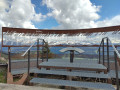
(5) At the fork, leave the woodland and turn right to join a wide ski run. Pass under the Crêt du Midi chairlift, then follow it along a steep path. Some sections are fitted with handrails but do not present any major difficulty. You’ll arrive at the Refuge du Petit Tétras. We recommend taking a detour to the left towards the chairlift’s top station to enjoy the panoramic views, the orientation board and a picnic table.
(6) Head right to cross the Quézet ski lift and join a three-way junction.
(7) Take the path that climbs to the left, running alongside the ski lift, and continue up the slope to the top of the ski lift.
(8) You’ll see the Crêt du Midi cross high up ahead. Leave it on your left (it’s possible to climb up to the cross) and carry on up the slope.
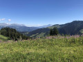
(9) Ignore the descent to the left and carry on climbing to the summit of Ban Rouge. Enjoy the panoramic views, the orientation board and a picnic table.
(10) Head back down to the three-way junction near the Quézet ski lift. A track is shown on the map, running parallel to and below your ascent route. Resist the temptation to take it, as it has completely disappeared and the area is impassable due to very dense vegetation.
(7) This time, turn left onto a wide alpine track that winds its way down. Clearly visible paths allow you to take a shortcut. You’ll arrive at the Col du Drayon.
(11) Leave the alpine track to the right, opposite a small car park. Walk for a long stretch through the woodland along a ridge.
(12) Pass the top station of the Évettes chairlift and continue along the ridge.
(1) Carry on straight ahead at the crossroads and return to the Lachat car park (S/E).
 Visorando Member

 Difficult
  Easy
Easy