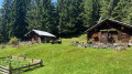
Les Contamines – Roselend

Between heaven and earth on the old N202.

This walk is part of a multi-day hike: Des Contamines au Lac d'Amour

Details

n°12784
Creation:
Last update:
Last review:
  • Walking
    Activity: Walking
  • ↔
    Distance: 13.13 mi
  • ◔
    Duration according to the author: 8 hrs 
  • ▲
    Difficulty: Very difficult

  • ⚐
    Back to start: No
  • ↗
    Ascent: + 4,777 ft
  • ↘
    Descent: - 3,425 ft

  • ▲
    Highest point: 8,287 ft
  • ▼
    Lowest point: 3,921 ft

Description of the walk

Park in the car park at Notre Dame de la Gorge.

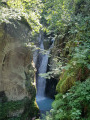
(S) It’s easy to follow theGR®5signposting – shared with theGR® Tour du Mont Blanc route (white and red) – towards the Col du Bonhomme. Enjoy the passage at the ‘Reine des Cieux’ and admire the impressive gorge in rainy weather from the ‘Roman bridge’, which dates from the 18th century, as well as the cows of the Beaufortain.
After an easy walk, you’ll reach the Pont de Nant Borrand.

(1) Stay on theGR® to reach the hamlet of La Balme at an altitude of around 1,700 metres.

(2) Further on, you’ll cross theGRP® ‘Tour du Beaufortain’ trail coming from the Col de la Fenêtre and begin an easy climb to reach the Col du Bonhomme.

(3) Continue along theGR® on an almost flat path to reach the Refuge du Col de la Croix du Bonhomme.

(4) Turn right onto the Crête des Gittes (GR®5) via the Col de la Croix du Bonhomme a little further down. Reach the Col de la Sauce.

(5) Begin a steep descent to rejoin the D925 at the Refuge de Plan de la Lai.

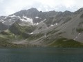
(6) Turn right onto the Rd925, passing the Plan de Lai and Plan Mya lodges, and follow it to the Col de Méraillet above Lake Roselend for the evening’s stop at the Hôtel Chalets de Roselend, with superb views over the lake (E).

Waypoints

  1. S : mi 0 - alt. 3,921 ft - Car park at > - Notre Dame de la Gorge
  2. 1 : mi 1.36 - alt. 4,813 ft - Refuge de Nant Borrant
  3. 2 : mi 2.87 - alt. 5,614 ft - Refuge de la Balme
  4. 3 : mi 5.01 - alt. 7,644 ft - Col du Bonhomme
  5. 4 : mi 6.24 - alt. 8,012 ft - Refuge du Col de la Croix du Bonhomme
  6. 5 : mi 7.96 - alt. 7,566 ft - Col de la Sauce
  7. 6 : mi 9.97 - alt. 5,971 ft - Refuge du Plan de la Lai
  8. E : mi 13.13 - alt. 5,272 ft - Chalet de Roselend - Col de Méraillet (1605m)

Notes

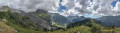
It’s a long day’s walk with no particular danger or difficulty, but the changes in the landscape are striking. The Crête des Gittes is a real highlight – just a touch of vertigo to add to the fun, and what views!

This route passes through a protected area, which may be subject to special regulations:

Always be cautious and plan ahead when you're outdoors. Visorando and the author of this route cannot be held responsible for any accidents occurring on this route.

The GR® and PR® markings are the intellectual property of the Fédération Française de Randonnée Pédestre.

Reviews and comments

5 / 5
Based on 1 review

Reliability of the description
5 / 5
Ease of following the route
5 / 5
Route interest
5 / 5
nana_nere
nana_nere

Overall rating : 5 / 5

Date of your route : Jul 14, 2017
Reliability of the description : ★★★★★ Very good
Ease of following the route : ★★★★★ Very good
Route interest : ★★★★★ Very good

The information provided makes it easy to follow the route.
As for the Gittes ridge walk, I’d add that it’s quite vertiginous (as I’m afraid of heights, I found this section quite a struggle – it can feel long if you’re not keen on it – but I made it all the way to the end!)
As for the Plan de la Lai mountain hut: we were able to pitch our tent there for €3 – good to know!

Machine-translated

Other walks in the area

For more walks, use our search engine .

The GPS track and description are the property of this route's author. Please do not copy them without permission.