Le Petit Croisse Baulet

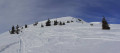
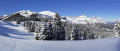
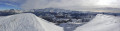
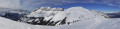
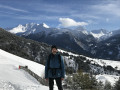
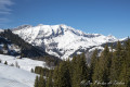
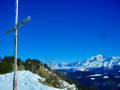
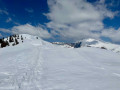
A superb summit sought after by many ski tourers in the region. A 360° panoramic view of the entire Mont Blanc massif, the Aravis range and the Aiguilles Rouges massif.

Details

2907119
Creation:
Last update:
Last review:
  • Snowshoeing
    Activity: Snowshoeing
  • ↔
    Distance: 6.51 mi
  • ◔
    Duration according to the author: 4 hrs 
  • ▲
    Difficulty: Difficult

  • ⚐
    Back to start: Yes
  • ↗
    Ascent: + 1,594 ft
  • ↘
    Descent: - 1,575 ft

  • ▲
    Highest point: 6,591 ft
  • ▼
    Lowest point: 5,043 ft

Photos

Description of the walk

From La Cry (Combloux), take a return pedestrian shuttle to reach the top station of the Beauregard chairlift.

Purple markings (snowshoe symbol)

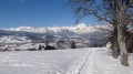
(S/E) From the Beauregard top station, take the south-westerly path and follow the snowshoe trail. You’ll arrive near the Ravine chairlift and continue up to the right, following wide switchbacks until you reach several ski runs.

(1) Cross two ski runs with care to reach the start of the Col du Jaillet path, clearly visible to the west.

(2) Walk along this lovely path lined with fir trees. Pass under the Prés chairlift. Continuing westwards, you’ll reach the junction with the path that branches off to the left towards the Christomet.

(3) Continue straight ahead on the path heading north towards the Col du Jaillet.

(4) At the Col du Jaillet, leave the path coming from La Giettaz on your left and take the one leading into the woodland, heading north-west for about 250 metres, towards another small pass.

No signposting. Follow the ski touring tracks

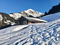
(5) At this point, the ascent to the Croisse Baulet begins. Due to the snow, the summer path is not visible. Follow the tracks left by the many ski tourers heading up to this summit. A winding path is thus formed, heading roughly north-west then west before turning right to reach the Petit Croisse Baulet. The slope is quite steep right up to the summit.

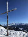
(6) At Petit Croisse Baulet, enjoy a 360° panorama (the Mont Blanc massif, the Aravis range).

Return via the same route to the top station of the Beauregard chairlift (S/E).

Waypoints

  1. S/E : mi 0 - alt. 5,043 ft - Beauregard chairlift top station
  2. 1 : mi 0.83 - alt. 5,571 ft - Ski slopes
  3. 2 : mi 0.92 - alt. 5,548 ft - Col du Jaillet trail
  4. 3 : mi 2.06 - alt. 5,653 ft - Junction with the Christomet trail
  5. 4 : mi 2.19 - alt. 5,650 ft - Col du Jaillet.
  6. 5 : mi 2.35 - alt. 5,712 ft - Start of the ascent towards Croisse Baulet
  7. 6 : mi 3.38 - alt. 6,575 ft - Petit Croisse Baulet
  8. S/E : mi 6.51 - alt. 5,046 ft - Beauregard chairlift top station

Notes

  • Snowshoe equipment (suitable footwear).
  • Wrap up warm: warm clothes, gloves, warm socks and a hat. Temperatures at the summit can reach -15° / -20°
  • Sunglasses.
  • Don’t forget to bring drinks to keep yourself hydrated.

This route passes through a protected area, which may be subject to special regulations:

Worth a visit

  • Combloux resort.
  • Col du Jaillet.
  • Petit Croisse Beaulet.
  • Grand Croisse Beaulet.
  • Le Cristomet.
  • La Tête de Torraz.
  • La Giettaz.

Reviews and comments

4.3 / 5
Based on 2 reviews

Reliability of the description
4.5 / 5
Ease of following the route
4 / 5
Route interest
4.5 / 5
Hermellin  henri
Hermellin henri

not yet realised

Machine-translated

ADNET
ADNET

Overall rating : 4.7 / 5

Date of your route : Jan 26, 2022
Reliability of the description : ★★★★★ Very good
Ease of following the route : ★★★★☆ Good
Route interest : ★★★★★ Very good
Very busy route : No

A superb walk! After the Col de Jaillet, as you emerge from the forest, every walker or skier seems to have chosen their own route, so it’s a good idea to have the Visorando app to hand to help you make your way to the summit, where the view is magnificent.

Machine-translated

Pirene
Pirene

Overall rating : 4 / 5

Date of your route : Mar 23, 2021
Reliability of the description : ★★★★☆ Good
Ease of following the route : ★★★★☆ Good
Route interest : ★★★★☆ Good
Very busy route : Yes

Done on touring skis. A lovely view

Machine-translated

Other walks in the area

For more walks, use our search engine .

The GPS track and description are the property of this route's author. Please do not copy them without permission.