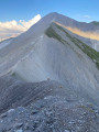
Le Grand Croisse Baulet

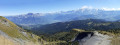
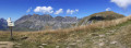
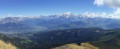
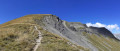
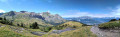
The Petit and Grand Croisse Baulet form part of a forward spur of the Aravis range. They stand out in the valley, from Sallanches to Domancy. Their prominent position on the Aravis massif makes them a remarkable vantage point. The summit offers a breathtaking panorama of the Mont Blanc range, the Aravis to the west, and the Fiz further north. This circular route is challenging but presents no technical difficulties.

Details

4003969
Creation:
Last update:
Last review:
  • Walking
    Activity: Walking
  • ↔
    Distance: 11.25 mi
  • ◔
    Average duration: 8h 15 
  • ▲
    Difficulty: Difficult

  • ⚐
    Back to start: Yes
  • ↗
    Ascent: + 3,576 ft
  • ↘
    Descent: - 3,566 ft

  • ▲
    Highest point: 7,336 ft
  • ▼
    Lowest point: 4,154 ft

Photos

Description of the walk

From Combloux, follow the Route de la Cry, then the Route du Cuchet. Park at the Cuchet car park.

(S/E) From the car park, head towards the path next to the restaurant “Le Petit Cuchet”. Follow this path to the Beauregard chalet.

(1) Head west, leaving the Chemin du Jaillet on your left and taking the path that leads to the top station of the Beauregard chairlift.

(2) Still heading west, continue along the path to the left of the chairlift station. After a fairly steep climb, you’ll reach a fork in the path.

(3) Take the path on the right (signposted for snowshoeing and ski touring). After several hairpin bends, pass beneath the Croix des Salles and reach a crossroads.

(4) Turn right and make your way through the woodland towards another junction where several paths meet.

(5) Follow the sign for “Col du Jaillet” to the left and, on an almost flat path, reach the pass.

(6) Pass the Christomet path on your left and continue north-westwards to the start of the “Croisse Baulet” path.

(7) Take the path on the left. The climb up to the Petit Croisse Baulet begins through woodland, then the slope becomes steeper in open country. Climb one final steep section to reach the summit of the Petit Croisse Baulet.

(8) Head north to descend to the Col de l’Avenaz, following the ridge.

(9) Begin the ascent of the Grand Croisse Baulet, continuing to follow the ridge line. You’ll come to a fork in the path, known as “Sous Croisse Baulet”.

(10) Take the path on the left to complete the climb to the summit, where a 360° panorama awaits you.

(11) Enjoy the view of the Aravis to the west and the Mont Blanc massif to the east, before beginning the descent to the Col de l’Avenaz.

(9) Head left, towards the east, and follow a fairly narrow path towards the Avenaz chalets.

(12) At the chalets, turn right and follow a path that climbs after crossing two small streams. You’ll reach a junction (not shown on the IGN map).

(13) Take the path on the right, which gains altitude quite quickly. After crossing several more streams, rejoin the path heading towards the Col du Jaillet.

(7) Continue to the left to reach the pass.

(6) From the Col du Jaillet, head back to the junction at the foot of the Sommet des Salles.

(5) Unlike on the way up, take the left-hand path towards Le Pertuis.

(14) Turn right and head down to the Chalet de Beauregard.

(1) Follow the same route back as on the way there, returning to the Petit Cuchet and finally to the car park (S/E).

Waypoints

  1. S/E : mi 0 - alt. 4,154 ft - Cuchet car park
  2. 1 : mi 0.75 - alt. 4,711 ft - Chalet de Beauregard
  3. 2 : mi 1.28 - alt. 5,056 ft - Upper station of the Beauregard chairlift
  4. 3 : mi 1.59 - alt. 5,213 ft - Snowshoe/ski touring route
  5. 4 : mi 2.09 - alt. 5,541 ft - Junction with the Col du Jaillet path
  6. 5 : mi 2.63 - alt. 5,531 ft - Junction towards the Col du Jaillet
  7. 6 : mi 3.31 - alt. 5,646 ft - Col du Jaillet
  8. 7 : mi 3.48 - alt. 5,712 ft - Start of the ascent towards the Petit Croisse Baulet
  9. 8 : mi 4.1 - alt. 6,575 ft - Petit Croisse Baulet
  10. 9 : mi 4.64 - alt. 6,335 ft - Col de l'Avenaz (1929m)
  11. 10 : mi 5.03 - alt. 6,883 ft - Sous Croisse Baulet
  12. 11 : mi 5.28 - alt. 7,329 ft - Grand Croisse Baulet
  13. 12 : mi 6.51 - alt. 5,663 ft - Chalets de l’Avenaz
  14. 13 : mi 6.83 - alt. 5,640 ft - Junction, turn right
  15. 14 : mi 9.1 - alt. 5,364 ft - Pertuis, on the right
  16. S/E : mi 11.25 - alt. 4,157 ft - Cuchet car park

Notes

? The IBP statistics for the route give an index of 129 HKG.
? The IBP statistics for the route show an elevation gain of 1,218 m and an elevation loss of 1,217 m, which are closer to reality.

? Mountain kit, particularly good footwear.

? No water available along the entire route.

This route passes through a protected area, which may be subject to special regulations:

Worth a visit

- Combloux
- Le Cuchet
- Le Jaillet
- Le Christomet
- La Croix des Salles
- Le Col du Jaillet
- Le Petit Croisse Baulet
- Le Grand Croisse Baulet
- the Col de Niard
- Tête du Torraz
- La Giettaz

Reviews and comments

4.6 / 5
Based on 3 reviews

Reliability of the description
4.3 / 5
Ease of following the route
4.3 / 5
Route interest
5 / 5
User 26828216

Overall rating : 4.3 / 5

Date of your route : Jul 31, 2025
Reliability of the description : ★★★★☆ Good
Ease of following the route : ★★★★☆ Good
Route interest : ★★★★★ Very good
Very busy route : No

A very beautiful hike! With blueberry picking on the way back

Machine-translated

claire chamot
claire chamot

Overall rating : 4.3 / 5

Date of your route : Aug 26, 2024
Reliability of the description : ★★★★☆ Good
Ease of following the route : ★★★★☆ Good
Route interest : ★★★★★ Very good
Very busy route : No

It’s a lovely walk with stunning views all along the way

Machine-translated

Ju75
Ju75
• Edited:

Hike completed on 19 August 2024.
Contrary to what was stated in the previous comment, there are several sections of the route that are technically not ‘without difficulty’, featuring large, sloping slates that are sometimes slippery and overlook a drop-off before Petit Croisse, and the same applies to the descent before point 12.

Machine-translated

mickou
mickou
• Edited:

Overall rating : 5 / 5

Date of your route : Jun 11, 2022
Reliability of the description : ★★★★★ Very good
Ease of following the route : ★★★★★ Very good
Route interest : ★★★★★ Very good
Very busy route : No

One of the most beautiful views of the south face of the Aravis; there are no technical difficulties, only the distance is a challenge.
This walk was undertaken in mid-June 2022; some sections require waterproof mid- or high-cut boots due to small streams and mud. Given the distance, you should also bring walking poles.
Refreshments are available at the Cuchet car park, depending on the season.

Thanks for sharing!

Machine-translated

Other walks in the area

For more walks, use our search engine .

The GPS track and description are the property of this route's author. Please do not copy them without permission.