Country:

 City:


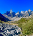

The starting point is the Plan Chevalier car park.
(S/E) Cross the access road to take the path towards Doran via Les Planes, as indicated on the sign. The climb is straightforward, with a few steep sections. You’ll arrive at a place called Les Planes.
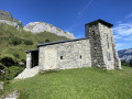
(1) Turn sharply right, cross another small car park and continue straight on along the track reserved for 4x4 vehicles. After a series of hairpin bends, you’ll reach the Doran refuge and chalets.
(2) Carry on straight ahead towards the Arête des Saix, the Col de Doran and the Col de la Forclaz. Cross the Torrent de Dière, keeping slightly to the right. After a short climb, you’ll reach a junction where the direction to the Col de la Forclaz is signposted (3 hrs). Walk a few metres to reach a fork in the track.
(3) Turn left towards the Col de la Forclaz. The grassy ascent poses no problems (go straight on), but higher up, thefirst difficulty is encountered on the scree slope. At this point, you should continue straight on, keeping as close to the centre of the valley as possible, where some tracks are visible, in order to minimise potential exposure to rockfalls as much as possible.
Gradually, the slope becomes very steep, with a few difficult and arduous sections through the scree.
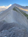
Much higher up, near the pass, head to the right (black ‘K’ marker on a white background), then continue towards the pass; a cable should make it easier to reach the pass over the final few metres.
(4) Once you reach the Col de la Forclaz, continue to the right on a gentle ascent towards the ridge, keeping an eye out for another ‘K’ marker. Head straight ahead towards a small peak visible below.
(5) The Tête du Château is a lovely spot: feel free to take a short detour.
Continue along a path following the ridge northwards.
(6) At Champ Fleuri, carry on straight ahead, leaving the path: about 50 metres further on, head to the right to avoid a small cliff visible opposite and to the left, then continue for a short while along the ridge (a track is visible at the start of this section) until you reach a path (GR® 96).
(7) Follow it to the right. Not far on, you’ll reach the Chalets de Chérente. Watch out for herds (and dogs).
Carry on along the moderately visible path (including the signposting) heading south.
(8) Turn left, following the red-and-white markings towards the bottom of the valley, heading towards a rather impressive cliff.
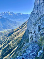
(9) A warning sign indicates that you are about to reach a tricky section: this is the Passage du Saix, which winds its way along the cliff face, aided by a cable.
Be extremely careful on this long stretch – there’s no room for a misstep. Take your time.
The route then becomes much easier as you descend towards the chalets at Mont Ferron.
(10) Turn right onto the path towards Doron, heading uphill. Not far on, the path turns into a track which crosses a wider path twice before eventually rejoining it, climbing to an altitude of around 1,500 metres: take care to stay on course at times.
(11) The path now continues with little change in elevation and reaches the Saix Noir, which involves crossing a ravine secured by a few cables. Continue to the junction with the path you took on the way there.
(3) Keep left to reach the Doran mountain hut.
(2) Ignore the path leading uphill and head straight on along the path towards Outredière and Plan Chevalier (via the Gypaète path). When you reach another path, turn left towards the stream.
(12) Cross the footbridge and head down to the meadows of Outredière, where you’ll join a good path.
(13) Continue down to the hamlet of Outredière.
(14) Follow the small road leading to the Plan Chevalier car park (S/E).
NB: it is also possible to return to the car park by following a path which starts just past Outredière, as indicated by a sign.


 Visorando Member
 Difficult

 Moderate