Tré la Tête mountain refuge and return via Combe Noire and La Sololieu

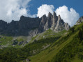
A lovely circular walk combining woodland, panoramic views, a refuge, a waterfall and a remarkable natural area.

Details

60214505
Creation:
Last update:
Last review:
  • Walking
    Activity: Walking
  • ↔
    Distance: 7.24 mi
  • ◔
    Average duration: 5h 55 
  • ▲
    Difficulty: Difficult

  • ⚐
    Back to start: Yes
  • ↗
    Ascent: + 2,946 ft
  • ↘
    Descent: - 2,949 ft

  • ▲
    Highest point: 6,460 ft
  • ▼
    Lowest point: 3,862 ft

Photos

Description of the walk

Park at the Pontet leisure park car park.

(S/E) Head towards Les Contamines, cross the bridge over the Bon Nant, then turn right onto Chemin du Praz. Follow this path, turning right.

(1) At the Oratoire Saint-Antoine, take the track on the left towards La Sololieu. You’ll come to a junction.

(2) Take the track on the right for about a hundred metres, then turn off onto the path on the left, which winds its way up through the woods to a junction.

(3) Take the hairpin bend to the left towards Le Cugnon. The path continues along the mountainside until it meets the path leading down to Le Cugnon.

(4) Turn right onto the climb towards Tré la Tête; a gentle, well-marked ascent with hairpin bends. Further up, on the left, pass the Chemin des Plans and continue to the junction just before the Ruisseau de la Grande Combe.

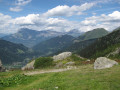
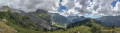
(5) Turn left to join the Chemin Claudius Bernard, which offers a stunning panoramic view across the entire valley. Follow it, turning right as you go, to gradually reach the Refuge de Tré la Tête: food and drink available on site.

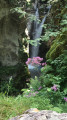
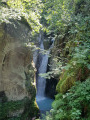
(6) Keep heading in the same direction to begin the descent towards the Combe Noire Waterfall. It takes an hour or so over the rocky ground. Cross the bridge for a good view of the waterfall and the gorge.

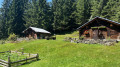
(7) Retrace your steps to take the path back towards Le Cugnon. Pass the two lovely chalets at Combe Noire and reach a three-way junction: signposted ‘Le Cugnon’.

(8) Take the unmarked path on the left and head down into the woods.

(9) Carry on straight ahead, ignoring the path on the left leading to Nant Borrant. You will then reach the wet meadow; cross it and climb slightly up to the hamlet known as La Sololieu. The descent then follows the mountainside.

(3) Continue the descent to the left and follow the ascent route in the opposite direction to return to the car park (S/E).

Waypoints

  1. S/E : mi 0 - alt. 3,871 ft - Leisure Park car park
  2. 1 : mi 0.22 - alt. 3,878 ft - Saint-Antoine Oratory
  3. 2 : mi 0.41 - alt. 4,016 ft - Track on the right
  4. 3 : mi 0.87 - alt. 4,521 ft - Junction
  5. 4 : mi 1.41 - alt. 4,701 ft - Junction
  6. 5 : mi 2.37 - alt. 5,669 ft - Junction
  7. 6 : mi 3.62 - alt. 6,444 ft - Refuge de Tré la Tête
  8. 7 : mi 4.81 - alt. 4,826 ft - Cascades de Combe Noire
  9. 8 : mi 5.29 - alt. 5,115 ft - Sign for Le Cugnon
  10. 9 : mi 5.68 - alt. 4,757 ft - Path junction
  11. S/E : mi 7.24 - alt. 3,868 ft - Car park

Notes

Food and drink available at the Refuge de Trè-la-Tête.

This route passes through multiple protected areas, which may be subject to special regulations:

Reviews and comments

5 / 5
Based on 2 reviews

Reliability of the description
5 / 5
Ease of following the route
5 / 5
Route interest
5 / 5
User 30724388

Overall rating : 5 / 5

Date of your route : Aug 22, 2026
Reliability of the description : ★★★★★ Very good
Ease of following the route : ★★★★★ Very good
Route interest : ★★★★★ Very good
Very busy route : No

Probably one of the prettiest circular walks in the area. But it’s best to park at the Tré la Tête car park, then walk up past the chalets and find the well-signposted path at the top that leads to the mountain hut. The rest of the route is fine; from Sololieu back to the Tré la Tête car park. That said, I wouldn’t classify it as ‘difficult’ – I completed the route in 3 hours 41 minutes of non-stop walking, despite suffering from Achilles tendonitis. There are a few steep sections on the descent, but nothing too serious. It’s worth noting that at point 5, you can climb up behind the mountain hut to see the moraines of the Tré la Tête glacier and spot a few marmots. A very lovely walk.

Machine-translated

User 11094487

Overall rating : 5 / 5

Date of your route : Sep 19, 2025
Reliability of the description : ★★★★★ Very good
Ease of following the route : ★★★★★ Very good
Route interest : ★★★★★ Very good
Very busy route : No

A great hike and an almost deserted refuge (only four people!!);

From the Roman bridge onwards, a little more traffic!

Machine-translated

Other walks in the area

For more walks, use our search engine .

The GPS track and description are the property of this route's author. Please do not copy them without permission.