Country:

 City:
City:


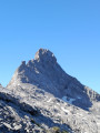
Access from Le Grand Bornand towards Vallon du Bouchet. At a place called Les Plans, take the narrow road to the Col des Annes on the left to reach its small car park.
(S/E) From the car park, head towards the Col de l’Oulettaz and the Refuge de la Pointe Percée. After 200 metres, a grassy path branches off to the left.
(1) Follow this path. After a short descent, take a path into a wood of alders and ferns which remains easy to follow (although you cannot always see your feet), then emerge onto the mountain pasture below the Col de l’Oulettaz. The path more or less follows the contour line. After a long traverse, it passes near a drinking trough and reaches a ravine.
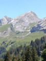
(2) After the ravine, head for one of the fir trees standing on the large grassy slope leading down from the Pointe de Bella Cha.
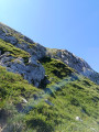
(3) Then all that remains is to climb up the very steep mountain pasture to the base of the rocks, keeping to the right-hand side; the slope narrows, allowing you to spot a double yellow arrow on the lowest rock. Make your way to this rock.
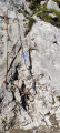
(4) From here, look out for the return couloir on the right. Climb up to the left along a small, steep ledge and some grassy and rocky steps, heading left towards the base of a couloir at the foot of a distinctive escarpment. There are several possible routes: climb the entire couloir or just part of it and exit via an easy slab (II). A few cairns – not all of them very visible – mark the route for the rest of the ascent. Reach the vicinity of the north-east face. Then look for further cairns leading back to the centre of the face and on towards the south face, where you’ll find a path.
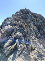
(5) Follow the path through the scree. The face narrows until it becomes a slender, exposed ridge leading to the summit – or rather its secondary summit, as the Pointe de Bella Cha is inaccessible.
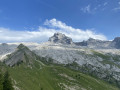
(6) At the summit, there is a magnificent view of Pointe Percée, Mont Blanc and all the surrounding peaks. After a snack, head back to the start of the path.
(5) Continue the descent by following the ascent route in the opposite direction, then veer off it by turning westwards, avoiding the slabs and choosing the best grassy or rocky passages, as on the ascent. This will take you above the couloir spotted on the way up; descend it carefully to rejoin the path taken on the way up.
(4) Choose the best slopes for the descent to reach a point above the line of fir trees. Cut across to rejoin the animal tracks taken on the way up, pass through the ravine area and reach the Col des Annes after a long traverse (S/E).
 Visorando Member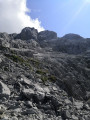

 Difficult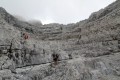
 Extremely difficult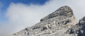
 Moderate