


Refine your search for walks in Charols
Charols walks

 Montagne de Sainte-Euphémie
 Local authority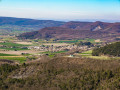
 4.19 mi
 +1,319 ft
 -1,296 ft
 3h 05
3h 05
 Moderate
 Departure from Manas (Drôme)
Starting from Manas, this short but intense hike takes you to the charming village of Pont-de-Barret before climbing to the summit of Sainte-Euphémie mountain. A 380° panorama is guaranteed from the summit and throughout the descent.
Around the Charivari starting from Puy-Saint-Martin
 4.37 mi
+837 ft
-837 ft
2h 45
4.37 mi
+837 ft
-837 ft
2h 45
 Easy
Departure from Puy-Saint-Martin (Drôme)
Easy
Departure from Puy-Saint-Martin (Drôme)
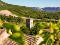
This short route is easily accessible in the hills above Puy-Saint-Martin. It offers new views of the old village and the Valdaine plain.
The Chevrière - La Pigne viewpoints
 7.01 mi
+1,142 ft
-1,161 ft
4h 15
Moderate
Departure from Puy-Saint-Martin (Drôme)
7.01 mi
+1,142 ft
-1,161 ft
4h 15
Moderate
Departure from Puy-Saint-Martin (Drôme)
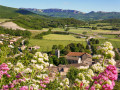
In addition to panoramic views of the Valdaine plain, Couspeau mountain and Saoû forest, this route will allow you to discover the natural and cultural heritage of Puy-Saint-Martin.
Crête de Chevrière - La Pigne
 Visorando Member
 7.46 mi
+1,181 ft
-1,178 ft
4h 30
Moderate
Departure from Puy-Saint-Martin (Drôme)
7.46 mi
+1,181 ft
-1,178 ft
4h 30
Moderate
Departure from Puy-Saint-Martin (Drôme)
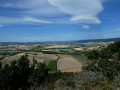
Alternating between small roads, narrow lanes and paths through the woods, this route offers beautiful views of the Marsanne plain, the foothills of the Vercors and the village of Puy-Saint-Martin.
From Moutette to Les Ramières from Saint-Gervais-sur-Roubion
 6.02 mi
+180 ft
-200 ft
2h 55
Easy
Departure from Saint-Gervais-sur-Roubion (Drôme)
6.02 mi
+180 ft
-200 ft
2h 55
Easy
Departure from Saint-Gervais-sur-Roubion (Drôme)
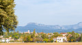
Before exploring the narrow streets of the fortified village of Saint-Gervais-sur-Roubion, discover the rich Valdaine plain. You will cross the Ramières du Roubion, a preserved, shaded natural area where biodiversity reigns supreme.
Tour of the Montagne d'Éson plateau
 4.43 mi
+1,207 ft
-1,207 ft
3h 05
Moderate
Departure from Pont-de-Barret (Drôme)
4.43 mi
+1,207 ft
-1,207 ft
3h 05
Moderate
Departure from Pont-de-Barret (Drôme)
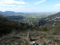
The first part of the route is wild and offers beautiful views of the village of Pont-de-Barret and the meanders of the Roubion, as well as the Montagne de Sainte-Euphémie and the Marsanne plain. On the western side of the plateau, there is access to a viewpoint over Roche Colombe, the Trois Becs and the Montagne de Couspeau, then on the southern side, Saint-Maurice and the Eysahut rocks as you descend the track. Finish with a wild trail in a small valley.
Montagne d'Éson
 2.74 mi
+1,152 ft
-1,152 ft
2h 15
Moderate
Departure from Pont-de-Barret (Drôme)
2.74 mi
+1,152 ft
-1,152 ft
2h 15
Moderate
Departure from Pont-de-Barret (Drôme)
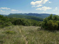
This wild route offers beautiful views of the village of Pont-de-Barret, the meanders of the Roubion, the Montagne de Sainte-Euphémie, the Marsanne plain, Miélandre, Saint-Maurice and the Eysahut rocks.
Montagne de Sainte Euphémie - Pont de Barret
 2.72 mi
+1,286 ft
-1,286 ft
2h 20
Moderate
Departure from Pont-de-Barret (Drôme)
2.72 mi
+1,286 ft
-1,286 ft
2h 20
Moderate
Departure from Pont-de-Barret (Drôme)
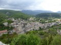
A short hike in a magnificent setting. The undergrowth alternates with open views of the landscape and beautiful panoramas.
Taking the loop in an anti-clockwise direction allows for a more gradual climb and a descent with a beautiful view overlooking Pont-de-Barret in front of you.
The Briesse Plateau - Dieulefit-Bourdeaux region
3.83 mi
+1,066 ft
-1,073 ft
2h 40
Moderate
Departure from Pont-de-Barret (Drôme)
Pleasant circular path, mostly shaded. The ascent and descent are steady and present no technical difficulty. After rain, the path is easier to walk in the opposite direction.
Le Châtelard - The Hermit’s Cave
 0.76 mi
+331 ft
-331 ft
0h 40
Moderate
Departure from Eyzahut (Drôme)
0.76 mi
+331 ft
-331 ft
0h 40
Moderate
Departure from Eyzahut (Drôme)
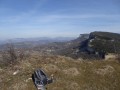
A short hike along a path that once led to the Grotte de l’Ermite and a castle destroyed during the Wars of Religion.
Perched on a narrow ridge, this viewpoint offers a lovely 360° view of the village of Eyzahut and the cliffs, with the forest of Saoû, the Trois Becs to Roche Colombe, the Grand Delmas and the Couspeau mountain as a backdrop.
Châteauneuf de Mazenc - Souspierre circular
 4.07 mi
+272 ft
-262 ft
2h 05
Easy
Departure from La Bégude-de-Mazenc (Drôme)
4.07 mi
+272 ft
-262 ft
2h 05
Easy
Departure from La Bégude-de-Mazenc (Drôme)
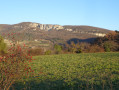
Between the undergrowth and agricultural land, a short, easy hike allows you to enjoy the landscapes at the edge of the Valdaine plain.
From La Bégude-de-Mazenc to La Roche-Saint-Secret-Béconne
 12.40 mi
+1,988 ft
-1,552 ft
7h 25
12.40 mi
+1,988 ft
-1,552 ft
7h 25
 Difficult
Departure from La Bégude-de-Mazenc (Drôme)
Difficult
Departure from La Bégude-de-Mazenc (Drôme)
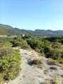
The first stage is a day to get your legs going, with much of the route taking place in the forest.
 Châteauneuf-de-Mazenc - Dieulefit-Bourdeaux region
7.71 mi
+443 ft
-443 ft
1.5 hrs
Moderate
Departure from La Bégude-de-Mazenc (Drôme)
This route takes you through the woods and hills that begin to the east of La Bégude. It also leads you to the hilltop medieval village of Châteauneuf-de-Mazenc, where the breathtaking views will allow you to discover the fields and buildings of the Valdaine plain.
Les Châtelards - Dieulefit-Bourdeaux region
12.23 mi
+1,985 ft
-2,005 ft
7h 20
Difficult
Departure from La Bégude-de-Mazenc (Drôme)
A circular route offering a chance to discover the varied landscapes around La Bégude-de-Mazenc as well as the old village of Châteauneuf-de-Mazenc. With a route mainly through woodland, this long but technically easy hike will be very pleasant on hot summer days.
Le Baron and the Chevrière Balcony
 5.82 mi
+981 ft
-974 ft
3h 30
Moderate
Departure from Roynac (Drôme)
5.82 mi
+981 ft
-974 ft
3h 30
Moderate
Departure from Roynac (Drôme)
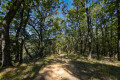
Discover the panoramic view from the east of Roynac: the Chevrière area is home to a remarkable natural site and offers a magnificent view of the Ardèche!
The Baron and the old village of Roynac
 6.57 mi
+1,138 ft
-1,119 ft
4h 00
Moderate
Departure from Roynac (Drôme)
6.57 mi
+1,138 ft
-1,119 ft
4h 00
Moderate
Departure from Roynac (Drôme)
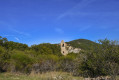
This very shady forest walk offers a new perspective on the Valdaine plain with a few glimpses of the Saoû massif, not to mention the discovery of the old ruined village of Roynac and its belvedere.
Around Souspierre
 9.80 mi
+2,638 ft
-2,638 ft
6h 50
Difficult
Departure from Souspierre (Drôme)
9.80 mi
+2,638 ft
-2,638 ft
6h 50
Difficult
Departure from Souspierre (Drôme)
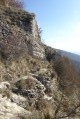
For experienced hikers, this is a beautiful hike, partly through the woods on unmarked trails. After a very beautiful passage along the ridge, they lead to cliffs followed by a dizzying descent into a rocky ridge to the Grotte de l'Ermite, a natural excavation in the rocks. Above, stand the summit of Châtelard and the ruins of an ancient watchtower dating from the Middle Ages, destroyed during the Wars of Religion. The panoramic view over the valley is superb.
Trou du Furet
 2.41 mi
+892 ft
-892 ft
1h 55
Difficult
Departure from Eyzahut (Drôme)
2.41 mi
+892 ft
-892 ft
1h 55
Difficult
Departure from Eyzahut (Drôme)
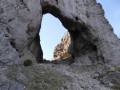
On the border between the Baronnies and the Diois, this route takes you to the cliffs of Eyzahut with the large arch carved into the cliff, the famous "Trou du Furet".
Caution: tricky sections. Route reserved for experienced hikers.
The church and castle ruins in the Old Village of Soyans
 1.58 mi
+531 ft
-518 ft
1h 10
Easy
Departure from Soyans (Drôme)
1.58 mi
+531 ft
-518 ft
1h 10
Easy
Departure from Soyans (Drôme)
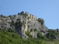
A family walk, starting from the Roubion valley, to discover the old village of Soyans, dominated by the Romanesque church of Saint-Marcel and the castle ruins.
Perched on the edge of the cliff, you can enjoy a magnificent panorama of the Roubion Valley, the Saoû Forest to the north and the Couspeau Mountain to the east.
Bisquerle trail starting from Rochebaudin
 3.85 mi
+1,201 ft
-1,201 ft
2h 50
Moderate
Departure from Rochebaudin (Drôme)
3.85 mi
+1,201 ft
-1,201 ft
2h 50
Moderate
Departure from Rochebaudin (Drôme)
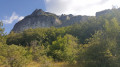
Starting from Rochebaudin, this hike crosses Les Blanchons to reach the foot of Rocher de la Tournelle. It then follows the Bisquerle trail, passes Pied Berthon (possible route to Eyzahut), and joins the DieulefitGRP® (long-distance footpath), allowing you to return to the village via a forest path along the Viarrand ravine.
Tour of the Poët and Saint-Maurice Mountains
 20.32 mi
+2,717 ft
-2,717 ft
4 hrs
Moderate
Departure from Rochebaudin (Drôme)
20.32 mi
+2,717 ft
-2,717 ft
4 hrs
Moderate
Departure from Rochebaudin (Drôme)
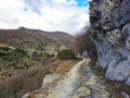
This route takes you along small roads, forest tracks and footpaths, allowing you to discover different landscapes and villages. Starting from Rochebaudin, the route passes through the Col du Perthuis, the Col de Ventebrun, Dieulefit, Poët-Laval, the Grand Pas quarry and Eyzahut.
The Three Crosses at the start of Soyans (Talon)
 6.38 mi
+938 ft
-938 ft
3h 45
Moderate
Departure from Soyans (Drôme)
6.38 mi
+938 ft
-938 ft
3h 45
Moderate
Departure from Soyans (Drôme)
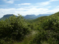
Following paths and small tracks, mostly through woodland, this walk offers some beautiful views and the remains of an ancient hilltop fortified village.
The top of the village, where three crosses stand, offers a magnificent viewpoint with an orientation table.
There is a 270° panorama of the foothills of the Vercors and Diois, Roche Colombe, the Trois Becs, the Montagne de Couspeau, the northern Rhône valley and the Ardèche mountains.
The Portoise plain
 4.44 mi
+197 ft
-171 ft
2h 15
Easy
Departure from Portes-en-Valdaine (Drôme)
4.44 mi
+197 ft
-171 ft
2h 15
Easy
Departure from Portes-en-Valdaine (Drôme)
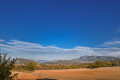
This route, with very little elevation gain, winds along the narrow roads of Portes-en-Valdaine, offering a 360° panoramic view of the village: its characteristic bell tower, its old village centre and the Serre de Mirabel in the background.
Around Mastaize between La Bâtie-Rolland and La Touche
 4.52 mi
+469 ft
-492 ft
2h 30
Easy
Departure from La Touche (Drôme)
4.52 mi
+469 ft
-492 ft
2h 30
Easy
Departure from La Touche (Drôme)
Through wooded and agricultural areas in the Drôme Provençale between Montélimar and Dieulefit.
Above Le Poët-Laval
 4.96 mi
+1,660 ft
-1,667 ft
3h 45
Moderate
Departure from Le Poët-Laval (Drôme)
4.96 mi
+1,660 ft
-1,667 ft
3h 45
Moderate
Departure from Le Poët-Laval (Drôme)
Hike starting from Poët-Laval, offering sweeping views of the Vercors, the Rhône Valley and northern Vaucluse.
Les Trois Croix from Les Lombards
 2.07 mi
+469 ft
-469 ft
1h 20
Easy
Departure from La Répara-Auriples (Drôme)
2.07 mi
+469 ft
-469 ft
1h 20
Easy
Departure from La Répara-Auriples (Drôme)
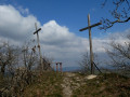
This walk allows you to discover the remains of an ancient fortified village on a hilltop, at the top of which are three crosses and a magnificent viewpoint with an orientation table.
270° panorama of the foothills of the Vercors and Diois, Roche Colombe, the Trois Becs, the Montagne de Couspeau, the northern Rhône valley and the Ardèche mountains.
Les Balcons de Marsanne
 16.75 mi
+866 ft
-876 ft
2 hrs
Easy
Departure from Marsanne (Drôme)
16.75 mi
+866 ft
-876 ft
2 hrs
Easy
Departure from Marsanne (Drôme)
Climb up to the heights of Marsanne via the Chapelle Saint-Félix for a panoramic view over the whole plain.
This route quickly gains altitude as it climbs to the heights of Marsanne, near the ruins of the Saint-Félix Chapel. It continues along a forest track running alongside the mountain. The return journey across the plain is gentler and flatter.
Discover the heritage of Marsanne
 Association / Club / Walk leader2.50 mi
+594 ft
-581 ft
1h 40
Easy
Departure from Marsanne (Drôme)
Association / Club / Walk leader2.50 mi
+594 ft
-581 ft
1h 40
Easy
Departure from Marsanne (Drôme)
Short walk to discover the Sanctuary of Notre-Dame de Fresneau and the old village of Marsanne.
The Fileuses de Marsanne Route
6.39 mi
+1,280 ft
-1,280 ft
4h 05
Moderate
Departure from Marsanne (Drôme)
A heritage trail exploring Marsanne’s history via the historic paths, the old village and the viewpoints overlooking the Valdaine, Vercors, Dévoluy and Mont Ventoux mountain ranges. It is possible to walk the route in the opposite direction if the north wind is moderate.
Col de la Grande Limite
5.96 mi
+1,099 ft
-1,099 ft
3h 40
Moderate
Departure from Marsanne (Drôme)
False duplicate.
A hike to discover the heritage of Marsanne, passing through the southern part of the forest. Discover the Sanctuary of Notre-Dame de Fresneau and the old village. Enjoy panoramic views of the Valdaine plain, the Rhône valley and the surrounding mountains.
Discovering Marsanne
 6.40 mi
+1,217 ft
-1,198 ft
4h 00
Moderate
Departure from Marsanne (Drôme)
6.40 mi
+1,217 ft
-1,198 ft
4h 00
Moderate
Departure from Marsanne (Drôme)
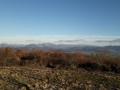
A walk to discover Marsanne’s heritage. The old village, the Sanctuary of Notre-Dame de Fresneau, and panoramic views over the Valdaine plain and the surrounding mountains.
From Poët-Laval to Les Vitrouillères in the Pays de Dieulefit
 6.14 mi
+745 ft
-755 ft
3h 30
Easy
Departure from Le Poët-Laval (Drôme)
6.14 mi
+745 ft
-755 ft
3h 30
Easy
Departure from Le Poët-Laval (Drôme)
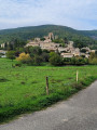
A very pleasant, varied loop with no particular difficulties. From woodland to meadows, it will take you to the remarkable site of Les Vitrouillères, where the potters of Dieulefit extracted clay until 1964. At the end of the route, the old village of Le Poët-Laval, listed as one of the most beautiful villages in France, is of course a must-see.
In the Forest of Marsanne
 7.19 mi
+1,276 ft
-1,273 ft
4h 25
Moderate
Departure from Marsanne (Drôme)
7.19 mi
+1,276 ft
-1,273 ft
4h 25
Moderate
Departure from Marsanne (Drôme)
From the beautiful village of Marsanne, take a walk along wide paths in the forest of the same name.
Serre de Paruel
 2.76 mi
+787 ft
-784 ft
1h 55
Easy
Departure from Marsanne (Drôme)
2.76 mi
+787 ft
-784 ft
1h 55
Easy
Departure from Marsanne (Drôme)
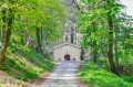
A short walk through the Marsanne Forest, taking in Notre-Dame-de-Bon-Secours and the famous miraculous fountain of Fresneau.
Le Chemin des Fileuses in Marsanne
 5.85 mi
+997 ft
-978 ft
3h 35
Easy
Departure from Marsanne (Drôme)
5.85 mi
+997 ft
-978 ft
3h 35
Easy
Departure from Marsanne (Drôme)
This long hike high up in the heart of the Marsanne forest follows the paths that young silk spinners took to work in the 19th century. At that time, there were many spinning mills in the surrounding area, located along the rivers needed for the activity, particularly near Mirmande.
Undergrowth - Dieulefit-Bourdeaux area
5.94 mi
+240 ft
-266 ft
1 hr
Easy
Departure from Le Poët-Laval (Drôme)
Along the river, along a wide track, through the pinewoods and up a steep incline: these are just some of the variations that will give you your first taste of mountain biking in an always pleasant setting. Ideal for beginners and families!
Serre de Paruel
 2.33 mi
+768 ft
-768 ft
1h 45
Easy
Departure from Marsanne (Drôme)
2.33 mi
+768 ft
-768 ft
1h 45
Easy
Departure from Marsanne (Drôme)
An easy family walk in the vast Marsanne Forest. Beautiful views of the Vercors.
 The foothills of the Valdaine
 21.22 mi
+541 ft
-571 ft
2 hrs
Moderate
Departure from Marsanne (Drôme)
21.22 mi
+541 ft
-571 ft
2 hrs
Moderate
Departure from Marsanne (Drôme)
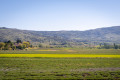
A short route offering magnificent panoramic views over the Valdaine plain and its hilltop villages.Starting from Marsanne, this circular route offers sweeping views across the Valdaine plain and its many hilltop villages, which you’ll pass through as you go: Roynac, Manas, Saint-Gervais and Bonlieu-sur-Roubion, followed by La Laupie.
Mont Rachas via the track
 11.22 mi
+1,975 ft
-1,978 ft
2 hrs
Moderate
Departure from Le Poët-Laval (Drôme)
11.22 mi
+1,975 ft
-1,978 ft
2 hrs
Moderate
Departure from Le Poët-Laval (Drôme)
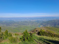
Situated between the Rhône Valley, the Diois and the gateway to Provence, Mont Rachas, thanks to its central location, offers a superb 360° view, from the Trois Becs to Mont Ventoux in the east and over the Tricastin, the Rhône Valley and the foothills of the Ardèche in the west. This route follows a small road, a tarmac track (in poor condition) and finally a narrow path.
Mont Rachas via Les Plaines
 11.24 mi
+2,005 ft
-2,014 ft
2 hrs
Moderate
Departure from Le Poët-Laval (Drôme)
11.24 mi
+2,005 ft
-2,014 ft
2 hrs
Moderate
Departure from Le Poët-Laval (Drôme)
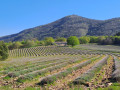
Situated between the Rhône Valley, the Diois and the gateway to Provence, Mont Rachas, thanks to its central location, offers a superb 360° view, from the Trois Becs to Mont Ventoux in the east and over the Tricastin, the Rhône Valley and the foothills of the Ardèche in the west. This route follows a small road, a tarmac track (in poor condition) and forest paths.
De Marsanne à Mirmande par la Sente des Fileuses et retour par Haut-Fayard
 13.58 mi
+2,743 ft
-2,730 ft
2.5 hrs
Difficult
Departure from Marsanne (Drôme)
13.58 mi
+2,743 ft
-2,730 ft
2.5 hrs
Difficult
Departure from Marsanne (Drôme)
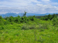
Parcours sportif par les crêtes avec de très belles vues à l'Est (Grand Veymont, Saoû) à l'aller puis sur le Rhône et l'Ardèche au retour. Quelques passages assez pentus.
Old village of La Laupie
 1.88 mi
+207 ft
-207 ft
1h 05
Easy
Departure from La Laupie (Drôme)
1.88 mi
+207 ft
-207 ft
1h 05
Easy
Departure from La Laupie (Drôme)
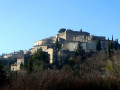
A short walk offering the chance to discover a magnificent, restored site with its narrow streets and paved slanting streets on its promontory.
Further on, the small, secluded Chapel of Saint-Jacques is also full of charm.
On the Borne Rousse path
4.48 mi
+945 ft
-945 ft
2h 55
Easy
Departure from La Laupie (Drôme)
Set between La Laupie, Condillac and Marsanne, this forest walk promises splendid panoramic views over the Valdaine plain and its hilltop villages.
La Pierre Sanglante from Marsanne
 6.97 mi
+873 ft
-873 ft
4h 00
Moderate
Departure from Marsanne (Drôme)
6.97 mi
+873 ft
-873 ft
4h 00
Moderate
Departure from Marsanne (Drôme)
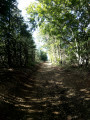
Reaching the "Pierre Sanglante" (a curious rock associated with a legend) from the heights of Marsanne is an easy walk with beautiful views. A return route through the forest is available via the higher ground.
From Marsanne to the Col du Devès via the wind farm and the Pierre Sanglante
 16.71 mi
+1,824 ft
-1,818 ft
3 hrs
Moderate
Departure from Marsanne (Drôme)
16.71 mi
+1,824 ft
-1,818 ft
3 hrs
Moderate
Departure from Marsanne (Drôme)
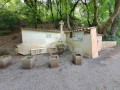
A route mainly following idyllic forest tracks and paths that offer lovely views over the Andrans plain. Starting from Marsanne, the route follows the Sentier des Fileuses to the Col de la Grande Limite, then heads towards the wind farm and passes by the Pierre Sanglante. It continues along the ridge to the Col du Devès and a magnificent viewpoint located at the paragliding launch site. A short loop around this plateau through wild woodland, then back to Marsanne via a balcony trail.
Coste Chaude from the village of Puygiron
 4.29 mi
+367 ft
-371 ft
2h 20
Easy
Departure from Puygiron (Drôme)
4.29 mi
+367 ft
-371 ft
2h 20
Easy
Departure from Puygiron (Drôme)
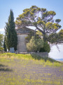
This walk goes around Coste Chaude, the dominant peak of Puygiron, before skirting the lavender fields and the Saint-Bonnet Chapel.
From Puygiron to the Pont de la Cabanne
 3.25 mi
+180 ft
-190 ft
1h 40
Easy
Departure from Puygiron (Drôme)
3.25 mi
+180 ft
-190 ft
1h 40
Easy
Departure from Puygiron (Drôme)
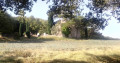
A family walk along quiet country lanes through the Provençal countryside: farmland, lavender fields and wooded hillsides. Not recommended for those with tar allergies or for keen hikers.
Short circular loop around Puygiron and the Chapelle Saint-Bonnet
 2.34 mi
+200 ft
-187 ft
1h 15
Easy
Departure from Puygiron (Drôme)
2.34 mi
+200 ft
-187 ft
1h 15
Easy
Departure from Puygiron (Drôme)
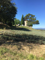
A short country walk surrounded by beautiful scenery near Montélimar.
The ridges of Rochefort-en-Valdaine
 6.96 mi
+1,020 ft
-1,004 ft
4h 05
Moderate
Departure from La Touche (Drôme)
6.96 mi
+1,020 ft
-1,004 ft
4h 05
Moderate
Departure from La Touche (Drôme)
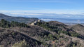
This lovely loop along the ridges of L'Izard and Mont Laroche offers magnificent views of the Roubion valley as far as the foothills of the Vercors and the 3 Becs.
Starting from the pretty village of La Touche, the route passes the castles of Rochefort-en-Valdaine, then the truffle fields of Janeston.
The hike also crosses the pretty little hamlet of Moulin de Bay on the riverbank, via a succession of varied paths and trails, which are sometimes steep but only for short distances.
Around Mastaize
 5.27 mi
+407 ft
-436 ft
2h 45
Easy
Departure from La Touche (Drôme)
5.27 mi
+407 ft
-436 ft
2h 45
Easy
Departure from La Touche (Drôme)
With its mix of small country lanes, paths lined with fields and forest trails, this peaceful route offers a lovely escape into the countryside with views of the surrounding hills.
The Citelle and Serre Pointu streams
 7.27 mi
+1,076 ft
-1,066 ft
4h 15
Moderate
Departure from La Touche (Drôme)
7.27 mi
+1,076 ft
-1,066 ft
4h 15
Moderate
Departure from La Touche (Drôme)
Let yourself be carried away by the diversity of the landscapes along this hike! The route takes you along the Ruisseau de Citelles stream and follows in the footsteps of its past, with old hamlets and mills, before climbing up to the plateau covered with lavender fields.
From Aleyrac to Serre de Forillon
 4.99 mi
+561 ft
-551 ft
2h 45
Easy
Departure from Aleyrac (Drôme)
4.99 mi
+561 ft
-551 ft
2h 45
Easy
Departure from Aleyrac (Drôme)
This walk follows wide forest tracks, leading to a viewpoint offering a 180° panorama of the Valdaine plain below, which is partly agricultural and partly wooded. A short circular route adds variety to the round trip.
Saint-Maurice via the Combe
 8.33 mi
+1,785 ft
-1,791 ft
5h 25
Moderate
Departure from Dieulefit (Drôme)
8.33 mi
+1,785 ft
-1,791 ft
5h 25
Moderate
Departure from Dieulefit (Drôme)
On the border between the Baronnies and the Diois, Saint-Maurice is famous for its chapel and ridges. There is a beautiful view to the north with the forest of Saoû, the Trois Becs at Roche Colombe, the Grand Delmas and the Montagne de Couspeau in the background, and to the south, the Montagne de la Lance and, on a clear day, Mont Ventoux.
Saint-Maurice via the ridges
 7.23 mi
+1,693 ft
-1,699 ft
4h 50
Moderate
Departure from Dieulefit (Drôme)
7.23 mi
+1,693 ft
-1,699 ft
4h 50
Moderate
Departure from Dieulefit (Drôme)
The Montagne de Saint-Maurice is famous for its chapel and ridges. This route offers beautiful views of the Trois Becs, the Grand Delmas and the Montagne de Couspeau to the north, and the Montagne de la Lance to the south. On clear days, you can even see Mont Ventoux.
Montagne de Saint-Maurice via the track and the valley
 9.64 mi
+1,749 ft
-1,755 ft
2 hrs
Moderate
Departure from Dieulefit (Drôme)
9.64 mi
+1,749 ft
-1,755 ft
2 hrs
Moderate
Departure from Dieulefit (Drôme)
Montagne de Saint-Maurice is famous for its chapel and ridges. This route takes you there via a track suitable for vehicles and offers a lovely view with a magnificent 360° panorama, with the Trois Becs, Grand Delmas and Montagne de Couspeau to the north, Montagne de la Lance to the south and, on a clear day, Mont Ventoux. The return journey follows a path through a beech forest, at the bottom of a wild valley.
Montagne de Saint-Maurice via the track
 11.80 mi
+1,752 ft
-1,759 ft
2 hrs
Moderate
Departure from Dieulefit (Drôme)
11.80 mi
+1,752 ft
-1,759 ft
2 hrs
Moderate
Departure from Dieulefit (Drôme)
Montagne de Saint-Maurice is famous for its chapel and ridges. This route takes you there via a track suitable for vehicles, allowing you to enjoy a lovely viewpoint with a magnificent 360° panorama: to the north, the Trois Becs, the Grand Delmas and Montagne de Couspeau; to the south, Montagne de la Lance; and on a clear day, Mont Ventoux.
The Marsanne plateau tour
 4.03 mi
+489 ft
-495 ft
2h 15
Easy
Departure from Marsanne (Drôme)
4.03 mi
+489 ft
-495 ft
2h 15
Easy
Departure from Marsanne (Drôme)
Route in the Marsanne forest with beautiful views of the valleys, along wide paths with gentle slopes.
The cliffs of Roche Colombe
 5.82 mi
+1,988 ft
-1,969 ft
4h 25
Moderate
Departure from Saou (Drôme)
5.82 mi
+1,988 ft
-1,969 ft
4h 25
Moderate
Departure from Saou (Drôme)
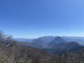
The west summit of Saou forest, which marks the beginning (or end) of this forest.
Roche Colombe in the Saoû Forest region
5.65 mi
+1,962 ft
-1,942 ft
4h 20
Difficult
Departure from Saou (Drôme)
Roche Colombe is the stern of the great ship formed by the Saoû Forest, offering a remarkable view of the Vercors, the Drôme and the interior of the forest.
⚠️ Between 1 July and 15 September, Prefectural Order DDT-SEF-2026-0176 of 4 June 2026 concerning temporary restrictions on access to the Saoû Forest and the Ambel plateau in the event of a fire risk , assessed on a daily basis. A map is published every evening (around 5.30 pm) for the following day.
A short walk above La Touche
3.21 mi
+476 ft
-479 ft
1h 55
Easy
Departure from La Touche (Drôme)
In Valdaine, amongst the wooded hills, there are plenty of paths. Armed with a good IGN map and a GPS, walkers can, so to speak, take their pick from all these possible routes. This short walk is a good example, taking in varied landscapes and attractive woodland.
Between Roc and Estang - Saoû Forest
 3.32 mi
+469 ft
-456 ft
1h 55
Easy
Departure from Saou (Drôme)
3.32 mi
+469 ft
-456 ft
1h 55
Easy
Departure from Saou (Drôme)
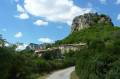
At the foot of the Aiguilles, you will pass through a wide variety of environments. Wetlands and arid areas alternate between the Vèbre and the Mediterranean slopes of the Pas de l'Estang and the Palloir.
Le Muletier in the Saou Forest
11.22 mi
+1,867 ft
-1,864 ft
2 hrs
Moderate
Departure from Saou (Drôme)
A route in the Saou forest, where you’ll follow the tourist trail before heading down the Sentier Muletier. Please note that this descent is technical; some stony sections require caution!
Rochecolombe in the Saou Forest
10.95 mi
+1,706 ft
-1,696 ft
2 hrs
Difficult
Departure from Saou (Drôme)
A beautiful route that will take you through the Saou Forest, then to the foot of Rochecolombe Mountain. The route follows fun and varied paths through the woods.
⚠️ Between 1 July and 15 September, Prefectural Order DDT-SEF-2026-0176 of 4 June 2026 concerning temporary restrictions on access to the Saou Forest and the Ambel Plateau in the event of a fire risk, assessed on a daily basis. A map is published every evening (around 5.30 pm) for the following day.
L'Échelette in the Saou Forest
13.55 mi
+1,745 ft
-1,742 ft
2.5 hrs
Difficult
Departure from Saou (Drôme)
A challenging route, with a short section where you’ll need to carry your bike on the climb up to the Pas de l’Échelette. Enjoy the panoramic views of Crest, the Drôme valley and the Trois Becs!
⚠️ Between 1 July and 15 September, Prefectural Order DDT-SEF-2026-0176 of 4 June 2026 concerning temporary restrictions on access to the Saoû Forest and the Ambel Plateau in the event of a fire risk, assessed on a daily basis. A map is published every evening (around 5.30 pm) for the following day.
Exploring the Saou Forest
9.15 mi
+791 ft
-787 ft
1.5 hrs
Easy
Departure from Saou (Drôme)
A discovery trail in the heart of the Saou Forest, along easy paths and tracks suitable for the whole family. In the heart of the forest, don’t miss the Auberge des Dauphins and its remarkable architecture.The Saou Forest, acquired as part of the Sensitive Natural Areas policy, is the Department’s largest property (2,500 ha). Listed as a protected site since 1942, it is now managed in accordance with the principles of sustainable development, in consultation with local stakeholders.
⚠️ Between 1 July and 15 September, Prefectural Order DDT-SEF-2026-0176 of 4 June 2026 concerning the temporary restriction of access to the Saou Forest and the Ambel Plateau in the event of a fire risk, assessed on a daily basis. A map is published every evening (around 5.30 pm) for the following day.
Grand tour of the Saou Forest
20.17 mi
+3,366 ft
-3,366 ft
4 hrs
Difficult
Departure from Saou (Drôme)
Head east to explore the tourist trail created by Maurice Burrus in 1930. The route passes at the foot of the Trois-Becs. To round off this walk, a descent along forest paths and tracks will make you forget the long climb.
The Saou Forest, acquired as part of the Sensitive Natural Areas policy, is the Department’s largest property. Listed as a protected site since 1942, it is managed in accordance with the principles of sustainable development, in consultation with local stakeholders.
⚠️ Between 1 July and 15 September, Prefectural Order DDT-SEF-2026-0176 of 4 June 2026 concerning the temporary restriction of access to the Saou Forest and the Ambel Plateau in the event of a fire risk, assessed on a daily basis. A map is published every evening (around 5.30 pm) for the following day.
Aleyrac - Citelles
 6.17 mi
+568 ft
-587 ft
3h 20
Easy
Departure from Aleyrac (Drôme)
6.17 mi
+568 ft
-587 ft
3h 20
Easy
Departure from Aleyrac (Drôme)
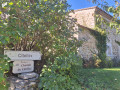
A peaceful hike along wide hillside paths, close to the picturesque, tiny, hidden village of Citelles.
The Cîtelles Stream
 5.92 mi
+682 ft
-686 ft
3h 20
Moderate
Departure from La Touche (Drôme)
5.92 mi
+682 ft
-686 ft
3h 20
Moderate
Departure from La Touche (Drôme)
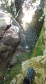
This is an easy hike that alternates between cool woodland and wide open trails on the plateau. You will pass through the hamlet of CÎtelles with its small chapel and waterfall, which is only accessible from above. The return journey follows the stream, where you can take a dip in places.
The route crosses the river four times via small bridges or large stones.
This is a very pleasant walk in summer, and the breaks by the water are very welcome.
Comps Church and Col de la Pousterle
 6.91 mi
+2,205 ft
-2,201 ft
5h 05
Moderate
Departure from Dieulefit (Drôme)
6.91 mi
+2,205 ft
-2,201 ft
5h 05
Moderate
Departure from Dieulefit (Drôme)
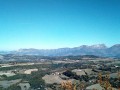
A lovely walk along the hills of the Dieulefit region.
Amidst lavender and chestnut trees – The Dieulefit-Bourdeaux region
6.39 mi
+702 ft
-702 ft
1.5 hrs
Moderate
Departure from Dieulefit (Drôme)
Lavender fields, pine forests, chestnut trees, a stone hamlet and breathtaking views of La Lance mountain… You can enjoy all these landscapes and panoramic views to the full on this easy ride.
From Rochefort-en-Valdaine Castle to the ruins of Notre-Dame la Brune
 17.45 mi
+1,352 ft
-1,355 ft
3 hrs
Moderate
Departure from Rochefort-en-Valdaine (Drôme)
17.45 mi
+1,352 ft
-1,355 ft
3 hrs
Moderate
Departure from Rochefort-en-Valdaine (Drôme)
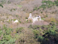
Route mainly following tracks and forest paths offering beautiful 360° views, from the Rhône Valley to Mont Ventoux. Circular route that circles the catchment area of the Citelles stream, from the Château de Rochefort-en-Valdaine to the ruins of Notre-Dame la Brune, passing through the wind farm and its numerous wind turbines.
The two villages – Dieulefit-Bourdeaux region
7.74 mi
+620 ft
-643 ft
1.5 hrs
Moderate
Departure from Dieulefit (Drôme)
This route will take you from Dieulefit to Le Poët-Laval, two sites steeped in history. Take the time to discover the legacy of the Hospitallers, the lives and exile of 16th-century Protestants, or simply admire the narrow streets and buildings. Along the way, you’ll also enjoy a pine forest with a pleasant, scenic trail.
Le Janeston
 4.22 mi
+653 ft
-673 ft
2h 30
Easy
Departure from Rochefort-en-Valdaine (Drôme)
4.22 mi
+653 ft
-673 ft
2h 30
Easy
Departure from Rochefort-en-Valdaine (Drôme)
From the medieval site of Rochefort-en-Valdaine, discover the slopes of the Citelles valley and climb up to the Janeston plateau. The prefix "jan" (broom wood, juniper heath) is characteristic of Mediterranean vegetation.
Citelles valley and its hamlet, via the wind farm
 11.33 mi
+1,047 ft
-1,050 ft
2 hrs
Easy
Departure from Rochefort-en-Valdaine (Drôme)
11.33 mi
+1,047 ft
-1,050 ft
2 hrs
Easy
Departure from Rochefort-en-Valdaine (Drôme)
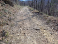
A route mainly following tracks and forest paths offering lovely 360° views, passing through the wind farm and its numerous wind turbines, from the Rhône Valley to Mont Ventoux, as well as a chance to discover the pretty little hamlet of Cîtelles and its valley.
Mont Rachas
 7.62 mi
+2,165 ft
-2,175 ft
5h 25
Difficult
Departure from Roche-Saint-Secret-Béconne (Drôme)
7.62 mi
+2,165 ft
-2,175 ft
5h 25
Difficult
Departure from Roche-Saint-Secret-Béconne (Drôme)
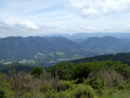
Located between the Rhône Valley, the Diois and the gateway to Provence, Mont Rachas offers superb 360° views thanks to its central location.
Trails and small paths, alternating between climbs and flat sections, make for a relatively easy ascent. The return journey is enhanced by a short detour to the Tour d'Alençon, a 12th-century ruin.
Saracen Caves - Ruins of Béconne
 4.31 mi
+1,302 ft
-1,302 ft
3h 05
Moderate
Departure from Roche-Saint-Secret-Béconne (Drôme)
4.31 mi
+1,302 ft
-1,302 ft
3h 05
Moderate
Departure from Roche-Saint-Secret-Béconne (Drôme)
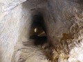
The Saracen Caves at the ruins of the old village of Béconne provide a short walk through the woods and fields of lavender and lead you on an enjoyable route among the vestiges of the past and let you indulge your imagination.