From Puygiron to the Pont de la Cabanne

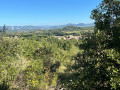
A family walk along quiet country lanes through the Provençal countryside: farmland, lavender fields and wooded hillsides.
Not recommended for those with tar allergies or for keen hikers.

Details

n°87561423
Creation:
Last update:
Last review:
–
  • Walking
    Activity: Walking
  • ↔
    Distance: 3.25 mi
  • ◔
    Average duration: 1h 40 
  • ▲
    Difficulty: Easy

  • ⚐
    Back to start: Yes
  • ↗
    Ascent: + 180 ft
  • ↘
    Descent: - 190 ft

  • ▲
    Highest point: 653 ft
  • ▼
    Lowest point: 515 ft

Photos

Description of the walk

Park in the car park at the bottom of the village.

(S/E) Walk uphill towards the village until you come to a small iron cross set on a carved stone plinth on your right, and the Chemin de la Petite Croix, just after it.

(1) Head down to the right onto the Chemin de la Petite Croix. At the road, continue to the right (Chemin du Pontillard) then, after a right-hand bend, carry on along the Chemin des Saules until you reach a crossroads.

(2) Carry on to the right along the Chemin du Bois des Pins, uphill, until you reach a four-way crossroads.

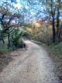
(3) Turn left onto Chemin de Grangeneuve, which is tarmac-surfaced at first but becomes a wide, motorable dirt track after a right-hand bend. You’ll reach the Pont de la Cabanne bridge over the Ruisseau de Gourn ravine.

(4) Turn round and head back to the four-way junction.

(3) Continue straight ahead along Chemin du Grand Bois until you reach the path leading to the chapel.

(5) Walk to the Chapelle Saint-Bonnet and back, then continue left until you reach the junction at the end of the Chemin de Saint-Bonnet.

(6) Keep left onto Chemin des Grands Chênes and follow it to the end. Turn right and head for the car park (S/E).

Waypoints

  1. S/E : mi 0 - alt. 548 ft - Car park at the bottom of the village - Village perché de Puygiron
  2. 1 : mi 0.12 - alt. 597 ft - Chemin de la Petite Croix
  3. 2 : mi 1.07 - alt. 561 ft - Route
  4. 3 : mi 1.39 - alt. 643 ft - Four-way junction (out and back)
  5. 4 : mi 1.69 - alt. 594 ft - Pont de la Cabanne
  6. 5 : mi 2.72 - alt. 604 ft - Access to the chapel - Chapelle Saint-Bonnet
  7. 6 : mi 2.85 - alt. 564 ft - Chemin des Grands Chênes
  8. S/E : mi 3.25 - alt. 548 ft - Car park at the bottom of the village - Village perché de Puygiron

Worth a visit

Visit the old village of Puygiron if you haven’t been there before.

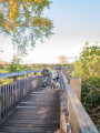
At the Pont de la Cabane, the Gourn stream may be dry or nearly so, or flowing strongly following recent heavy rain. The depth of the ravine is impressive. Before the bridge, a faintly marked path leads down to the stream on the downstream side. After the bridge, the Sentier des Durands leads upstream to even more impressive viewpoints. Take care at all times.

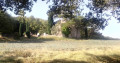
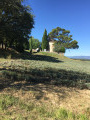
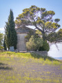
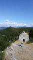
It is worth spending some time around the Saint-Bonnet Chapel, which dates from around the 12th century and is surrounded by a cemetery, like several other Romanesque chapels in the region (Maltaize, Saint-Andéol, etc.). Below it is the ideal spot for admiring the lavender when it is in bloom.

Other walks in the area

For more walks, use our search engine .

The GPS track and description are the property of this route's author. Please do not copy them without permission.