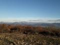
On the Borne Rousse path

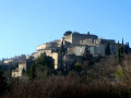
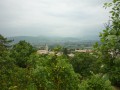
Set between La Laupie, Condillac and Marsanne, this forest walk promises splendid panoramic views over the Valdaine plain and its hilltop villages.

Details

6742002
Creation:
Last update:
Last review:
  • Walking
    Activity: Walking
  • ↔
    Distance: 4.48 mi
  • ◔
    Average duration: 2h 55 
  • ▲
    Difficulty: Easy

  • ⚐
    Back to start: Yes
  • ↗
    Ascent: + 945 ft
  • ↘
    Descent: - 945 ft

  • ▲
    Highest point: 1,654 ft
  • ▼
    Lowest point: 725 ft

Description of the walk

To reach the starting car park, follow the directions in the practical information section. 

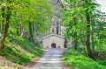
(S/E) From the car park at the start of the forest track, begin walking along the forest track, heading north, until you reach the Vallat Blanc signpost.

(1) Continue straight on along a slightly narrower track until you reach the Ravin de Romésine.

(2) When the track veers slightly to the right, on the edge of the clearing, continue to the right. Shortly afterwards, ignore the small path leading uphill to the left. Carry on until you reach a second hairpin bend, at the “Peupliers” signpost.

(3) Carry on to the left along the track which climbs towards the “Kazakh” signpost.

(4) At the ‘Kazakh’ signpost, carry on to the left towards ‘Borne Rousse’, just above you.

(5) At Borne Rousse, take in the view, then continue along the ridge, heading south towards the “La Crête” marker.

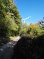
(6) When you reach the marker, continue along the ridge path which descends towards the “La Montagne” signpost.

(7) At the “Montagne” signpost, continue the descent to the left, towards “Vallat Blanc”, and return to a junction you passed on the way out.

(1) Turn right. Follow the forest track you took on the way there in the opposite direction to return to the starting point (S/E).

Waypoints

  1. S/E : mi 0 - alt. 725 ft - Car park on the Route de Condillac
  2. 1 : mi 0.5 - alt. 866 ft - Vallat Blanc. Junction of the circular loop
  3. 2 : mi 0.87 - alt. 1,020 ft - Romésine Ravine
  4. 3 : mi 1.27 - alt. 1,207 ft - Poplars
  5. 4 : mi 2.03 - alt. 1,654 ft - Kazakh
  6. 5 : mi 2.07 - alt. 1,611 ft - Red boundary stone
  7. 6 : mi 2.25 - alt. 1,585 ft - The ridge
  8. 7 : mi 3.4 - alt. 1,188 ft - La Montagne
  9. S/E : mi 4.48 - alt. 725 ft - Car park on the Route de Condillac

Notes

Start on the D219 towards Marsanne; after 2 km, turn right (D105) towards Sauzet, then take the first right onto the D107 towards Condillac. Turn immediately right onto the forest track; the car park is 200 metres away.

Worth a visit

- Signposts.

- The village of La Laupie.

Reviews and comments

4 / 5
Based on 3 reviews

Reliability of the description
4.7 / 5
Ease of following the route
4 / 5
Route interest
3.3 / 5
Sandrine.B
Sandrine.B

Overall rating : 3.7 / 5

Date of your route : Jan 12, 2026
Reliability of the description : ★★★★★ Very good
Ease of following the route : ★★★★☆ Good
Route interest : ★★☆☆☆ Disappointing
Very busy route : No

Very wide, easy-to-follow trail. Fortunately, there is a short section along the ridge, with a single viewpoint towards the Rhône. Nothing spectacular, but it takes 1 hour and 50 minutes at a normal walking pace. But thank you anyway, I didn't know this area and it's a good place to stretch your legs.

Machine-translated

fuji26
fuji26

Hike completed today, 25/12/2025. Thank you, Visorando, for warning me about the snow on the hills. The first part of the climb was in the sun, so it was fine, but once we reached Borne Rousse, there was too much snow to stay on the path, so we stayed on the track in the shade, which was pleasant.

Machine-translated

User 4133759
• Edited:

Overall rating : 4.7 / 5

Date of your route : Sep 15, 2025
Reliability of the description : ★★★★★ Very good
Ease of following the route : ★★★★★ Very good
Route interest : ★★★★☆ Good
Very busy route : No

Perfect half-day walk.
Takes about 2 hours and 20 minutes at a leisurely pace.
Beautiful view from the Borne Rousse ridge and pleasant ridge trail through the woods.

Machine-translated

Maison Aaa
Maison Aaa

Overall rating : 3.7 / 5

Date of your route : Apr 12, 2025
Reliability of the description : ★★★★☆ Good
Ease of following the route : ★★★☆☆ Average
Route interest : ★★★★☆ Good
Very busy route : Yes

The first part of the walk is very pleasant.
Then, the ridge path – which isn’t signposted but which you manage to find anyway – is pleasant.
The final section, a descent along a stony path, isn’t much fun, and you start to wonder whether you’re on the cycle route.
When we came back onto the signposted circular route, we concluded that this must be the right route!

Machine-translated

Other walks in the area

For more walks, use our search engine .

The GPS track and description are the property of this route's author. Please do not copy them without permission.