The foothills of the Valdaine

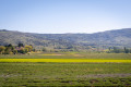
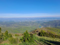
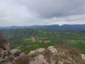
A short route offering magnificent panoramic views over the Valdaine plain and its hilltop villages.
Starting from Marsanne, this circular route offers sweeping views across the Valdaine plain and its many hilltop villages, which you’ll pass through as you go: Roynac, Manas, Saint-Gervais and Bonlieu-sur-Roubion, followed by La Laupie.

Details

42509208
Creation:
Last update:
Last review:
  • Touring/Gravel
    Activity: Touring/Gravel
  • ↔
    Distance: 21.22 mi
  • ◔
    Duration according to the author: 2 hrs 
  • ▲
    Difficulty: Moderate

  • ⚐
    Back to start: Yes
  • ↗
    Ascent: + 541 ft
  • ↘
    Descent: - 571 ft

  • ▲
    Highest point: 860 ft
  • ▼
    Lowest point: 430 ft
  • ⚐ Country: France
  • ⚐
    Area: Dauphiné
  • ⚐ City: Marsanne (26740)
  • ⚑
    Start/End: N 44.64396° / E 4.87316°
  • ❏
    IGN map(s): Ref. 3037SB, 3038SB

  • ◶
    Type of surface:
  •  
     100% Road
  • Hour-by-hour weather

Photos

Description of the route

The route starts in Marsanne, at Place Émile Loubet, in front of the tourist information office.

(S/E) At the junction, with the town hall opposite, take the D105 on the left towards Grâne, which runs alongside the castle. Continue until you reach the three-way junction.

(1) Turn right towards the hamlet of Les Bastets onto the small road that gradually descends. Ride straight through the hamlet and stay on the main road. Pass under the railway line and continue straight ahead until you reach the third stream, arriving at a junction just after a bend to the right.

(2) Turn left as you come out of the bend and cross a bridge straight away. Carry on along the small road, passing the Roynac cemetery, and continue to the end of the road.

(3) Continue left onto the main road towards the village of Roynac. Cross the village by cutting across the roundabout and keep heading along the D107 to Puy-Saint-Martin. As you approach the village, after the football pitches and the pumping station, carry on straight ahead along Rue de Fangerac.

(4) At number 120, leave the main road to wind your way through the narrow streets of the old village until you reach the Grande Rue.

(5) Cross it and carry on straight ahead until you reach the roundabout.

(6) Carry on straight ahead, taking care as it can sometimes be busy, until you reach the first Y-junction with the Route de Manas.

(7) Turn left onto the D107 and continue to the village of Manas.

(8) At the end of the road, turn left onto the D310, towards Pont de Barret. Cycle through the charming village, then cross the Roubion river to reach a Fork in the road near a fire station.

(9) Turn right onto the D128, towards Charols. Make sure you stay on the right-hand side of the road as there is no cycle lane. You’ll reach a roundabout in Charols.

(10) Continue straight on and stay on the D128 until you join the D74 at Saint-Gervais-sur-Roubion.

(11) Turn right onto the D74 and continue until you reach a roundabout in Bonlieu-sur-Roubion.

(12) Go straight ahead and continue on the D74 towards Sauzet. Cross the bridge over the TGV line and arrive at a fork at the bottom of the descent.

(13) Turn left onto the small Chemin du Moulin and follow it to where it ends at the foot of the old village of La Laupie.

(14) Turn right and you’ll reach a roundabout in La Laupie.

(15) Carry on straight ahead on the D219 until you reach the junction with the D105.

(16) Turn right to return to Place Émile Loubet (S/E)

Waypoints

  1. S/E : mi 0 - alt. 860 ft - Marsanne Tourist Information Office - Chapelle Notre-Dame de Fresneau (Marsanne)
  2. 1 : mi 0.88 - alt. 745 ft - Les Bastets - Béal (ruisseau) - Affluent de l'Ancelle
  3. 2 : mi 3.4 - alt. 676 ft - Le Freyssinet
  4. 3 : mi 3.81 - alt. 633 ft - Roynac
  5. 4 : mi 6.16 - alt. 653 ft - Puy-Saint-Martin
  6. 5 : mi 6.31 - alt. 682 ft - Grande Rue
  7. 6 : mi 6.62 - alt. 650 ft - Puy-Saint-Martin roundabout
  8. 7 : mi 6.77 - alt. 656 ft - Route de Manas
  9. 8 : mi 8.43 - alt. 722 ft - Manas - Roubion (rivière)
  10. 9 : mi 9.13 - alt. 755 ft - Junction by the fire station
  11. 10 : mi 11.34 - alt. 719 ft - Charols - Église Saint-Jean-Baptiste (Charols)
  12. 11 : mi 14.61 - alt. 561 ft - Saint-Gervais-sur-Roubion
  13. 12 : mi 15.81 - alt. 502 ft - Bonlieu-sur-Roubion
  14. 13 : mi 16.78 - alt. 466 ft - TGV Bridge
  15. 14 : mi 17.95 - alt. 446 ft - La Laupie
  16. 15 : mi 18.34 - alt. 469 ft - La Laupie town centre
  17. 16 : mi 19.62 - alt. 715 ft - Route de Marsanne
  18. S/E : mi 21.22 - alt. 860 ft - Marsanne Tourist Information Office - Prieuré Saint-Félix (Marsanne)

Worth a visit

Reviews and comments

5 / 5
Based on 1 review

Reliability of the description
5 / 5
Ease of following the route
5 / 5
Route interest
5 / 5
christiang8
christiang8

Overall rating : 5 / 5

Date of your route : Sep 23, 2024
Reliability of the description : ★★★★★ Very good
Ease of following the route : ★★★★★ Very good
Route interest : ★★★★★ Very good
Very busy route : No


A very well-explained cycle route that’s very easy to follow.
The warnings (dangerous junctions, traffic) are spot on.
In short, a very enjoyable ride.

Machine-translated

Other walks in the area

For more walks, use our search engine .

The GPS track and description are the property of this route's author. Please do not copy them without permission.