Montagne de Saint-Maurice via the track

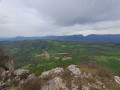
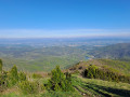
Montagne de Saint-Maurice is famous for its chapel and ridges. This route takes you there via a track suitable for vehicles, allowing you to enjoy a lovely viewpoint with a magnificent 360° panorama: to the north, the Trois Becs, the Grand Delmas and Montagne de Couspeau; to the south, Montagne de la Lance; and on a clear day, Mont Ventoux.

Details

94778045
Creation:
Last update:
Last review:
  • Touring/Gravel
    Activity: Touring/Gravel
  • ↔
    Distance: 11.38 mi
  • ◔
    Duration according to the author: 2 hrs 
  • ▲
    Difficulty: Moderate

  • ⚐
    Back to start: Yes
  • ↗
    Ascent: + 1,732 ft
  • ↘
    Descent: - 1,713 ft

  • ▲
    Highest point: 3,022 ft
  • ▼
    Lowest point: 1,526 ft
  • ⚐ Country: France
  • ⚐
    Areas: Alps, Dauphiné
  • ⚐ City: Dieulefit (26220)
  • ⚑
    Start/End: N 44.537409° / E 5.056175°
  • ❏
    IGN map(s): Ref. 3138OT

  • ◶
    Type of surface:
  •  
     
     
     12% Road  82% Byway  6% Path
  • Hour-by-hour weather

Photos

Description of the route

Start from the entrance to the “Hutopia” campsite, Chalaval district, Dieulefit. Coming from Nyons or Montélimar, head towards Bourdeaux on the D538 and turn left towards Les Vitrouillères, just after and opposite the fire station and police station. Park before the campsite entrance, along the road.

(S/E) Continue along the road, go round the barrier and carry on along the track overlooking the campsite until you reach a fork.

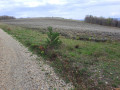
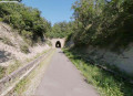
(1) Turn right and follow the track, which climbs gradually for 6 km, until you reach a field of lavender.

(2) The slope levels out and then becomes almost flat. Continue until you reach the start of a small path on the right, after a short climb.

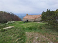
(3) Turn right and you’ll soon reach the chapel.

(4) After taking in the view, return to the track.

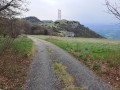
(3) Continue to the right until you reach the telecommunications pylons.

(5) Don’t hesitate to climb to the top of the ridge, behind the pylons, to enjoy a magnificent view. Then return to the campsite entrance via the track, following the route in reverse (S/E).

Waypoints

  1. S/E : mi 0 - alt. 1,526 ft - Entrance to the Hutopia campsite
  2. 1 : mi 0.68 - alt. 1,670 ft - Junction
  3. 2 : mi 3.68 - alt. 2,815 ft - Field of lavender
  4. 3 : mi 4.78 - alt. 2,959 ft - Path on the right
  5. 4 : mi 4.9 - alt. 2,989 ft - Chapel
  6. 5 : mi 5.82 - alt. 3,018 ft - Pylons
  7. S/E : mi 11.38 - alt. 1,526 ft - Entrance to the Hutopia campsite

Notes

Make sure you bring something to drink; the climb is sheltered from the wind but quite exposed to the sun.

Hike completed on 11 April 2026.

Worth a visit

For more walks, use our search engine .

The GPS track and description are the property of this route's author. Please do not copy them without permission.