Country:

 City:


From Montélimar station, you can take the bus to the start point at “La Bégude Village”. You can also park nearby, particularly in the village hall car park.
GR® or PR® signposting
(S) Head to the roundabout in the centre of the village, then turn right onto the D9 towards Aleyrac. Pass the fountain on your left, then cross the Jabron. Just after the bridge, at the corner by the fire station, take the Route de Combemont on the left. Follow this road until you reach the letterboxes at numbers 440 and 450 on the outskirts of the village.
(1) At the left-hand bend, carry on straight ahead along the Chemin de Forillon heading south. Ignore the Chemin Marin on your right and continue until you reach a three-way junction.
(2) Keep to the right and follow the path as it enters the forest, where the gradient begins to increase. Walk until you reach a large junction of forest tracks.
(3) Ignore the first track on the right and take the second one. Follow it until you reach the tarmac road at the first houses.
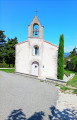
(4) Continue straight on along the tarmac road until you reach the county road. Take the path on the left which runs alongside the departmental road on your right for 300 m; then, at the right-hand bend, walk carefully alongside the road and, 150 m further on, take the sharp left-hand bend onto Chemin des Voltes, heading towards the Town Hall. You’ll reach the hamlet with the chapel and the Town Hall.
(5) At the town hall, continue along the signposted path which climbs and then levels out. Carry on straight ahead until you reach a road (D809).
(6) Turn left and follow the road to the next junction.
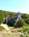
(7) Turn right onto Chemin du Prieuré, leaving the cemetery on your right, and head down to the ruins of the priory.
(8) After taking in the sights, head back to the junction near the cemetery.
(7) Carry on to the right for about 150 m, between the truffle fields, until you reach the wide bend to the right of the road.
(9) Take the path leading uphill to the left. At the three-way junction, keep to the right, walking alongside the farm buildings on your right. Cross a small road and carry on straight ahead until you reach another three-way junction.
(10) Turn left between the grassy areas. The path climbs to an altitude of around 640 m, then descends after passing the Col du Coulant du Pommier (unmarked). Carry on straight ahead until you reach the edge of the woodland and a building with a field planted with lavender (September 2026).
(11) Carry on to the left, skirting the fields on your right, and head straight on until you reach the Col de la Croix.
(12) Begin the descent towards the Tour d’Alençon. After about 2 km, you’ll reach a very pretty property (l’Adret).
(13) Just past the property, take the path on the left. On this section, there are no signposts and a GPS is almost essential. Walk for about 100 m until you come to a cairn on your left. Here, take the small path that descends to the left. Continue on to the Tour d’Alençon.
(14) Carry on a little further to the small road (Chemin d’Alençon) and follow it to the church at La Roche-Saint-Secret (E).
 Visorando Member
 Easy
 Local authority



 Moderate