Country:

 City:
City:


Start from the village hall car park.
Blue signposting, route no. 19
(S/E) Walk up the street to the village centre and head towards Mirmande.
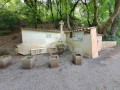
(1) Turn right at the bridge opposite the school to enter the old stone village. Continue straight on past the belfry and follow the narrow lane leading to the washhouse. Magnificent view over the whole of the Valdaine plain and the Saoû mountains. Stay on the main path.
(2) At the junction, take the Chemin du Prieuré opposite, then turn right onto the departmental road. Stay on the road until you reach the viewpoint.
(3) Enjoy the view over Saint-Félix and the old village of Marsanne. Take the hiking trail towards La Pierre Sanglante at the signpost. Stay on this wide forest track until you reach the pass.
(4) Once at the pass, continue straight ahead and follow the path as it winds down to the Crest road towards the Col de Tartaiguille. Cross the road and continue straight ahead along the Chemin du Paradis until you reach the first junction.
(5) Turn right onto the Chemin du Pérou. At the next junction, turn left to reach the hamlet of Les Bastets.
(6) Carry on straight ahead through the hamlet of Les Bastets along the Chemin de la Prairie, then immediately turn right onto the Chemin Neuf.
(7) In the small hamlet of Saunier, turn left onto Chemin Mistral to rejoin Route de Roynac. Turn right, then left at the next junction to take the Grand Chemin.
(8) At the first junction, turn left onto Chemin des Meuniers, which runs alongside the Béal stream. Carry on straight ahead until the end of the road and turn left.
(9) At the junction by the Fourret farm, turn left to follow the Route des Sablons. Turn right at the next junction and follow the Route de Roynac for a few kilometres.
(10) Turn right onto Chemin des Rabibois just before the small bridge over the Ruisseau de Chabotte.
(11) Turn left at the first junction and cross the stream. At the large crossroads, turn right onto Chemin des Prés Nouveaux.
(12) At the junction with Route Les Roubines, continue straight ahead.
(13) Keep to the right to join Chemin les Sauges. The path then changes its name to Tourmentine. Stay on this path until the end, then turn right.
(14) At the Lebras farm, carry on straight ahead along Chemin des Bois. Stay on this path at the junction with Route des Bosquets. Ignore the turn-offs to the right.
(15) At the end of the track, join the Route de Saint-Gervais-sur-Roubion. Turn right and pass under the high-speed rail line.
(16) A few hundred metres after the bridge, turn left at a pylon onto the Chemin de Rousse Gorge and keep to the left. Walk down along the road until you reach the Chemin de Traverse on the right.
(17) Take this path, cross the ford and continue along a dirt track.
(18) At the end of the track, take the Chemin de l’Épeautre on the right. Follow the road uphill, ignoring the turnings on the right, then take the Chemin des Costes Chaudes on the left.
(19) Just before the stream known as Des Bobines, turn right onto the Impasse des Bobines. Stay on this track and carry on straight ahead past the house. The road turns into a dirt track and then joins the Route de Montélimar.
(20) Turn right onto the road and follow it for just under a kilometre. Take the first small road on the right called Grand Chemin, then carry on straight ahead at the next junction.
(21) At the second junction, head up to the left along the Chemin du Clos for a good kilometre. You’ll reach the housing estates.
(22) Just before Impasse Ronsard, take a small dirt track onto Allée d’Oberaula. This joins the road towards Cléon d’Andran. Turn left and ride past the police station.
(23) At the corner of the gendarmerie, turn right and you’ll soon reach the village hall (S/E).

 Visorando Member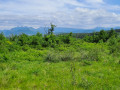
 Difficult
 Moderate
  Local authority