Country:

 City:
City:


Park in the car park at the Marsannevillage hall .
(S/E) On leaving the car park, turn right onto Rue Jean Moulin towards the village centre. Walk past the town hall, then at the junction, continue straight on towards Fresneau.
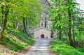
(1) 200 metres past the crossroads, turn right onto Chemin de la Bourelle. At the end of the path, turn left and carry on straight ahead under the belfry towards the Priory of Saint-Félix to explore the pottery and glassware workshops. At the junction at the top, on Rue du Prieuré, turn right.
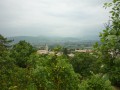
(2) Stop off at Saint-Félix to take a breather and admire the village and the Valdaine plain. Continue uphill.
(3) 150 metres past Saint-Félix, take the path on the left to join the Sentier des Fileuses. Cross the Route de Loriol (take care as visibility is limited) and climb up to the Col de la Grande Limite via the Sentier des Fileuses. Analternative route is available via the road to join the Sentier des Fileuses. At the Col de la Grande Limite, cross the car park towards “Gros Fayard”.
(4) Turn left onto the path marking the boundary between the communes of Marsanne and Mirmande to avoid the rocky section of the track. Follow signs for “Gros Fayard”. At the top of the climb, turn left to rejoin the track on the right or stay on the path to reach Gros Fayard.
(5) Turn left towards “Les Fileuses bas”.
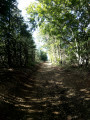
(6) 300 metres past Gros Fayard, turn left and follow the path through the pine forest; then, after passing under the power line, continue along the path through the old quarries.
(7) Pass by a former tripoli (diatomite) quarry.
(8) On leaving the forest, stay on the track for 300 metres, then turn right onto the path through a Lebanese cedar nursery.
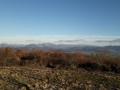
(9) At the end of the path, you’ll reach a viewpoint. Take the path on the right, then turn left after about a hundred metres.
(10) Cross an old firewood cutting area (used for domestic purposes by local residents).
(11) At the end of the track leading to the firewood cutting area, turn left and head back down towards the main track.
(12) Once you reach the main track, turn right and head towards Les Gravillons.
(13) Continue down the DFCI track towards Fresneau. During the descent, enjoy the view over the Valdaine and the old village.
(14) At the bottom of the descent, take the path on the left and leave the DFCI track. At the Fork in the road, continue to the left.
(15) Stop off at Fresneau to visit the sanctuary and taste the water from the miraculous fountain. Then keep to the right and head down to the village (S/E).
 Association / Club / Walk leader
 Easy
Easy  Visorando Member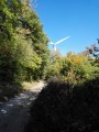
 Local authority