Between Roc and Estang - Saoû Forest

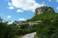
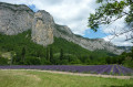
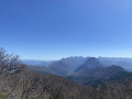
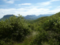
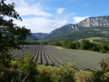
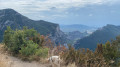
At the foot of the Aiguilles, you will pass through a wide variety of environments. Wetlands and arid areas alternate between the Vèbre and the Mediterranean slopes of the Pas de l'Estang and the Palloir.

Details

2308899
Creation:
Last update:
Last review:
  • Walking
    Activity: Walking
  • ↔
    Distance: 3.32 mi
  • ◔
    Average duration: 1h 55 
  • ▲
    Difficulty: Easy

  • ⚐
    Back to start: Yes
  • ↗
    Ascent: + 469 ft
  • ↘
    Descent: - 456 ft

  • ▲
    Highest point: 1,457 ft
  • ▼
    Lowest point: 1,073 ft

Photos

Description of the walk

Departure from the centre of the village of Saoû.

(S/E) From the car park, head towards the schools and cross the bridge opposite. Go up Rue de l'Houme and turn left, then further on to the right.

(1) The road arrives at the Chantebise intersection. Continue along the road opposite towards Pas de l'Estang, then take the flat, stony path on the left.

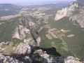
(2) At the fork, take the path on the right (blue sign for "l'Estang"). It passes at the foot of the cliffs and leads to Pas de l'Estang.

(3) Take the track on the right towards Pointe des Estangs. It winds its way through the rocky gorge.

(4) At the Pointe des Estangs fork, take the path on the right.

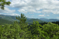
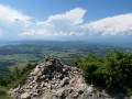
(5) Climb up to the right into the forest for 150 metres and continue straight ahead after the crossroads. Beautiful views of the plain.

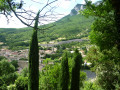
(6) Continue straight ahead along the road. It leads to the Château district. Take the road opposite. It passes at the foot of the hamlet, goes around the hillock, then descends to the Chantebise intersection.

(1) Turn left and follow the same route you took on the way there to return to the village and the car park (S/E).


Waypoints

  1. S/E : mi 0 - alt. 1,073 ft - Car park in the centre of the village of Saoû. Towards the bridge - Vèbre (rivière) - Affluent du Roubion
  2. 1 : mi 0.36 - alt. 1,158 ft - Chantebise intersection
  3. 2 : mi 0.69 - alt. 1,138 ft - Turn right towards the Estang
  4. 3 : mi 1.33 - alt. 1,217 ft - Pas de l'Estang
  5. 4 : mi 1.47 - alt. 1,207 ft - Pointe des Estangs
  6. 5 : mi 1.75 - alt. 1,253 ft - Turn right into the forest
  7. 6 : mi 2.4 - alt. 1,312 ft - Turn right onto the road
  8. S/E : mi 3.32 - alt. 1,073 ft - Car park in the centre of the village of Saoû

Notes

We strongly recommend that you take IGN map no. 3138OT with you. Bring sufficient food and water and wear suitable clothing for walking. Hikers must be self-sufficient, but professional guides are available if required. Emergency number: 18 or 112.

Information from the Val de Drôme Tourist Office: +44 75 63 10 88 / valleedeladrome-tourisme.com

Worth a visit

HERITAGE - Encounter with a wall of art.
Dry stone walls dot our landscape. Used for agricultural purposes, to separate land and isolate stones unsuitable for cultivation, they once lined the paths that connected villages, used by villagers, mule drivers, peddlers, charcoal burners, exiles... and hikers today. Then one day, an idea, some materials, a group of men and women, and a low wall covered with vegetation became a work of art. Combining different artistic techniques and using time and nature as tools, this low wall, visible at the end of the hike, is part of a trail that will eventually link the forest of Saoû to the village of Sierra de Guara in Spain.

Reviews and comments

4.8 / 5
Based on 37 reviews

Reliability of the description
4.8 / 5
Ease of following the route
4.9 / 5
Route interest
4.6 / 5
DidierRando26
DidierRando26

Overall rating : 5 / 5

Date of your route : Mar 08, 2026
Reliability of the description : ★★★★★ Very good
Ease of following the route : ★★★★★ Very good
Route interest : ★★★★★ Very good
Very busy route : Yes

Hello,
I'm not going to be original. A nice little hike for a Sunday morning. No difficulty. Magnificent scenery, and the village of Saoû is worth a visit. The yellow markings are very clear.
I recommend it!
Thanks to the author.

Machine-translated

glaciers
glaciers

Overall rating : 4.7 / 5

Date of your route : Oct 15, 2025
Reliability of the description : ★★★★★ Very good
Ease of following the route : ★★★★★ Very good
Route interest : ★★★★☆ Good
Very busy route : No

A pleasant hike starting from the charming village of Saoû.
A fairly long climb (for 10 seniors) but no difficulty along the route.
Varied landscapes.
Thank you to the author for sharing.

Machine-translated

Famille herbert
Famille herbert

Overall rating : 4 / 5

Date of your route : Sep 15, 2025
Reliability of the description : ★★★★☆ Good
Ease of following the route : ★★★★☆ Good
Route interest : ★★★★☆ Good
Very busy route : No

A pleasant hike with the beautiful village of Saoû.

Machine-translated

Sd
Sd

Overall rating : 4.3 / 5

Date of your route : Jul 15, 2025
Reliability of the description : ★★★★☆ Good
Ease of following the route : ★★★★★ Very good
Route interest : ★★★★☆ Good
Very busy route : Yes

Did it early in the morning with few people on the circuit, no major difficulties and beautiful scenery + the magnificent village of Saou!

Machine-translated

User 23809601

Overall rating : 4.7 / 5

Date of your route : Jun 23, 2025
Reliability of the description : ★★★★★ Very good
Ease of following the route : ★★★★★ Very good
Route interest : ★★★★☆ Good
Very busy route : No

A pleasant hike with a few rocky sections. Not to be attempted in flip-flops!
We did it in the late afternoon, staying in the shade almost the whole way, and it was quite nice.

Machine-translated

Mag-38
Mag-38

Overall rating : 4.7 / 5

Date of your route : Jun 04, 2025
Reliability of the description : ★★★★★ Very good
Ease of following the route : ★★★★★ Very good
Route interest : ★★★★☆ Good
Very busy route : No

An easy, shaded and uncrowded route.
Attractive forest trails and beautiful views of the peaks.

Machine-translated

websissou
websissou

Overall rating : 5 / 5

Date of your route : Feb 28, 2025
Reliability of the description : ★★★★★ Very good
Ease of following the route : ★★★★★ Very good
Route interest : ★★★★★ Very good
Very busy route : No

A lovely, easy loop trail. In February, there was hardly anyone around, just us and nature awakening after winter. The directions are clear and the trail is pleasant, with beautiful views of the surrounding mountains and lovely buildings. We had a picnic in the sun halfway along the trail.
Thank you for this walk.

Machine-translated

DenisV26740
DenisV26740

Overall rating : 5 / 5

Date of your route : Feb 05, 2025
Reliability of the description : ★★★★★ Very good
Ease of following the route : ★★★★★ Very good
Route interest : ★★★★★ Very good
Very busy route : No

A very pleasant route for families, with good signposting.

Machine-translated

Andre Romeuf
Andre Romeuf

Overall rating : 5 / 5

Date of your route : Feb 03, 2025
Reliability of the description : ★★★★★ Very good
Ease of following the route : ★★★★★ Very good
Route interest : ★★★★★ Very good
Very busy route : Yes

A great route for a family outing, very easy with no difficulties

Machine-translated

l'ancônais
l'ancônais

Overall rating : 4.7 / 5

Date of your route : Dec 21, 2024
Reliability of the description : ★★★★★ Very good
Ease of following the route : ★★★★★ Very good
Route interest : ★★★★☆ Good
Very busy route : No

An easy and enjoyable hike

Machine-translated

JuliaM
JuliaM

Overall rating : 5 / 5

Date of your route : Nov 23, 2024
Reliability of the description : ★★★★★ Very good
Ease of following the route : ★★★★★ Very good
Route interest : ★★★★★ Very good
Very busy route : No

A beautiful hike with varied landscapes (cliffs, scree, forests, villages) without any difficulty and beautiful views.
On the southern slope, at the fork, a sign indicating "hunting in progress 4 km ahead" made us uneasy. We turned back and asked some people we met. A young cyclist who was hunting reassured us and we were able to finish the loop. Thank you for sharing.

Machine-translated

VIVI61
VIVI61

Overall rating : 5 / 5

Date of your route : Oct 28, 2024
Reliability of the description : ★★★★★ Very good
Ease of following the route : ★★★★★ Very good
Route interest : ★★★★★ Very good
Very busy route : No

A beautiful, easy hike through forests and mountains.

Machine-translated

christobald
christobald

Overall rating : 5 / 5

Date of your route : Aug 12, 2024
Reliability of the description : ★★★★★ Very good
Ease of following the route : ★★★★★ Very good
Route interest : ★★★★★ Very good
Very busy route : No

A pleasant short hike. The region is very charming and this easy walk is a good representation of it.

Machine-translated

Ouh là là
Ouh là là

Overall rating : 5 / 5

Date of your route : Apr 16, 2024
Reliability of the description : ★★★★★ Very good
Ease of following the route : ★★★★★ Very good
Route interest : ★★★★★ Very good
Very busy route : Yes

A lovely, very easy hike, which is rare in the Saoû forest! Varied landscapes with the last houses and crops of the village of Saoû on one side of the Roc and the hill, which is wilder, on the other. With a bit of luck, you may see a bardot, an animal whose father is a horse and mother is a donkey, in a meadow!

Machine-translated

brigitte26120
brigitte26120

Overall rating : 5 / 5

Date of your route : Jan 01, 2024
Reliability of the description : ★★★★★ Very good
Ease of following the route : ★★★★★ Very good
Route interest : ★★★★★ Very good
Very busy route : Yes

Nice walk
A new view of this village 👍

Machine-translated

Other walks in the area

For more walks, use our search engine .

The GPS track and description are the property of this route's author. Please do not copy them without permission.